Golden Glades, Miami Gardens
Updated · 1,734 residents
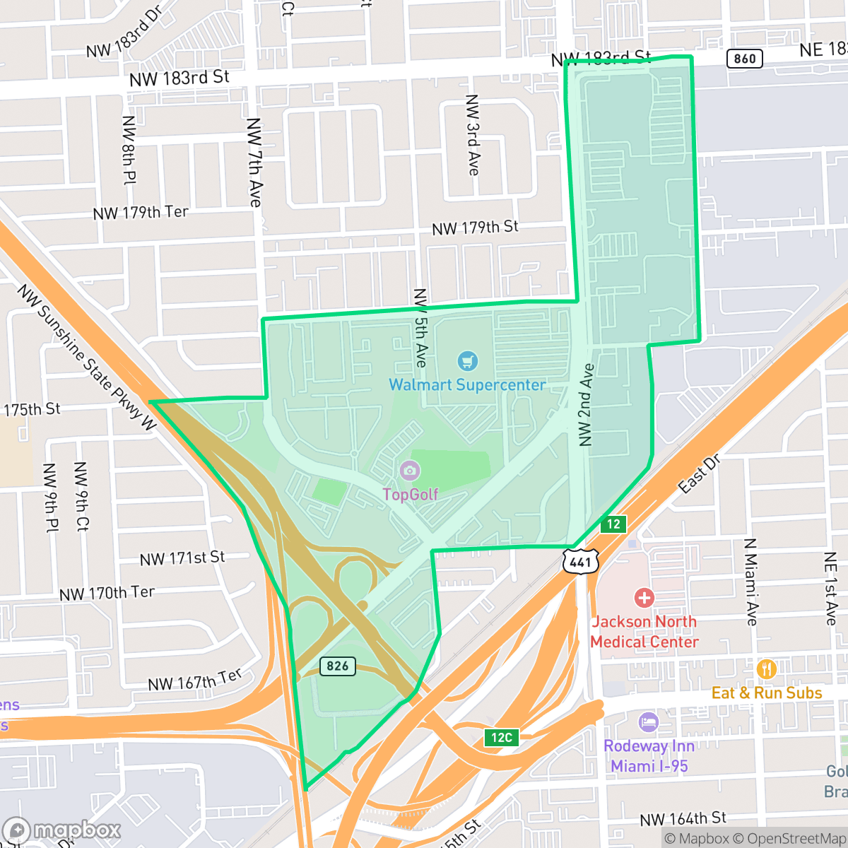
Golden Glades serves as a primary transit gateway for North Miami-Dade County, defined by its position at the intersection of major regional highways. The neighborhood features a diverse residential community with a strong cultural identity and a mix of suburban housing, though residents should expect significant background noise from nearby transit corridors.
Key Highlights
About Golden Glades
Originally a farming community in the late 1920s, Golden Glades transformed significantly during the 1960s when the construction of the Golden Glades Expressway uprooted local agriculture to establish a critical transportation junction. This interchange, connecting Interstate 95, the Florida Turnpike, and the Palmetto Expressway, remains the neighborhood's defining feature. Incorporated into the City of Miami Gardens in 2003, the area evolved into a suburban residential hub. It is culturally distinct for its high concentration of residents with Haitian ancestry, which reached over 40% by 2010. The neighborhood's character is shaped by its status as a vital transit gateway for North Miami-Dade County, balancing its role as a major highway crossroads with a diverse, multi-ethnic residential population.
This area functions as a vital crossroads, where the convergence of the Florida Turnpike, I-95, and the Palmetto Expressway shapes the daily rhythm of the community. Beyond its role as a transportation hub, the neighborhood offers a steady local energy supported by a variety of accessible eateries and educational institutions. The landscape is characterized by uniform tract housing and apartment complexes, creating a consistent suburban aesthetic that reflects the broader development patterns of Miami Gardens.
Prospective residents should weigh the benefits of this central location against specific livability trade-offs. The proximity to major highways and industrial zones results in higher noise levels and occasional air quality fluctuations. While the residential streets themselves are generally quiet, large-scale infrastructure creates barriers that limit pedestrian connectivity. The area is well-suited for those who prioritize regional accessibility and a vibrant, politically liberal community, provided they are comfortable with the acoustic environment typical of a major transit junction.
Neighborhood Scores Across 15 Qualities
Residential structures feature mixed spacing with some neighbors situated close to one another. This level of density remains largely consistent with the average found throughout Miami Gardens.
Residential streets are generally quiet and safe for walking, but large highways and industrial blocks create significant barriers to movement. This neighborhood offers less connectivity for pedestrians compared to the Miami Gardens average.
Uniform tract housing and apartment complexes define the landscape, featuring boxy roof geometries and small yards. This visual character is consistent with the broader Miami Gardens area.
Private fenced backyards are common, but narrow sidewalk verges and a lack of large public parks make dog walking more difficult than in other parts of Miami Gardens. According to iHuus data, the area features primarily private greenery rather than accessible public green space.
A varied landscape of single-family homes, apartment complexes, and large-scale industrial warehouses defines the area. This level of development is consistent with the broader city average.
Active pockets of dining, transit hubs, and educational institutions provide a more vibrant rhythm than the typical Miami Gardens area. According to iHuus data, this mix of suburban residential streets and diverse eateries creates a noticeably more lively atmosphere than the city average.
Persistent sounds from nearby transit corridors and flight paths characterize this area. According to iHuus data, acoustic comfort in Golden Glades is lower than the Miami average.
Air quality in Golden Glades fluctuates between acceptable and unhealthy levels, matching the typical conditions found throughout Miami Gardens. Sensitive groups should monitor local air reports for occasional periods of concern.
Residential areas are interspersed with light industrial uses, such as storage facilities and printing services, which contribute to more active transit traffic than the city average. Residents should be aware of proximity to an EPA Superfund site and potential environmental impacts from nearby utility activity.
Health insurance access remains relatively average for the area, mirroring the broader Miami Gardens trends. According to iHuus data, fewer than half of the local residents are covered by a health insurance plan.
Voting patterns and census indicators reflect a predominantly liberal political leaning, which is more pronounced than the average found across Miami Gardens according to iHuus data.
A diverse range of age groups, including young adults and families, resides in this area. This demographic distribution is largely consistent with the city average according to iHuus data.
Residual flood risk exists within this area as it sits inside a 500-year floodplain. According to iHuus data, the level of safety from flooding is higher than the average for the city of Miami Gardens.
Address-Level Insights for Golden Glades


iHuus Neighborhood Intelligence Insights
Get address-level neighborhood insights for Golden Glades
- Street-level scores — see how individual blocks compare, not just neighborhood averages
- Micro-zone boundaries — identify quiet pockets, flood boundaries, and walkable clusters before you visit
- 15 dimensions in full — walkability, noise, air quality, school quality, insurance coverage, population age profile, urban/rural index, and more
- Boundary risk alerts — know if your address sits near a block boundary where scores drop, the kind of detail no listing will ever mention
- School insights — individual school ratings and insights, not just district-level data
- Compare before you commit — side-by-side data across neighborhoods, down to block precision
No credit card required
Compare with Any Neighborhood
| Dimension | Golden Glades | Andover |
|---|---|---|
| 🚶 Walkabilityavg 6.78 | ||
| 🔊 Acoustic Comfortavg 2.97 | ||
| 🤫 Privacy Indexavg 5.39 | ||
| 🎨 Visual Appealavg 6 | ||
| 🐕 Dog Friendlinessavg 5 | ||
| 🗺️ Urban-Rural Indexavg 6.55 | ||
| ✨ Neighborhood Vibeavg 3.42 | ||
| 🏥 Health Insurance Coverageavg 4.78 | ||
| 🌿 Air Qualityavg 6 | ||
| 🏭 Industrial Proximityavg 6.05 | ||
| 🌊 Flood Safetyavg 4.36 | ||
| 🗳️ Ideological Leanavg 8.79 | ||
| 👥 Population Age Profileavg 4.81 | ||
| 🔥 Fire Safety | ||
| 🏫 School Quality |
Golden Glades Rankings
School Districts Serving Golden Glades
School Insights for Golden Glades
Below average outcomes; significant attendance and academic challenges.
School Insights
See what's really behind every school rating near Golden Glades
- Individual school ratings — each school's own score with outcome context, not just a district average
- Enrollment & class size data — student-to-teacher ratio and how it compares to the state average
- Full demographics breakdown — ethnicity and gender composition for every school in the enrollment zone
- Every school in the district — all schools within the enrollment boundary ranked by rating, not just the closest one
- Grade levels & benchmarks — elementary through high school, with below/above state-average flags
No credit card required