Iron Triangle, Richmond
Updated June 22, 2026 · 9,540 residents
The Iron Triangle is a densely populated, highly walkable neighborhood defined by its consistent street grid and proximity to industrial corridors. Residents benefit from a central location with easy access to transit, though the area is characterized by tightly packed housing and notable noise levels from nearby road traffic.
Key Highlights
About Iron Triangle
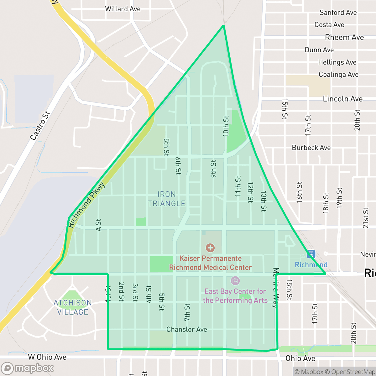
The Iron Triangle in Richmond, California, is a historic neighborhood named for the three railroad lines that define its borders. It emerged in the early 20th century as Richmond's commercial and residential center, anchored by the bustling Macdonald Avenue corridor. In the 1920s, the Atchison, Topeka and Santa Fe Railway drew Mexican workers to the area, establishing a vibrant community with businesses like La Perla grocery. During World War II, the neighborhood underwent a dramatic transformation as thousands of African American and Mexican American workers arrived to work at the nearby Kaiser Shipyards, making the Iron Triangle the historic heart of Richmond's Black community. Today, local landmarks include the East Bay Center for the Performing Arts and the Richmond Greenway, a pedestrian trail converted from former Santa Fe tracks championed by local activist Lillie May Jones.
The neighborhood functions as a dense, low-rise urban environment where a consistent street grid facilitates high walkability to local amenities. While the area benefits from a central location that connects residents to various parts of Richmond, the physical landscape is shaped by its proximity to freight corridors and light industrial zones. According to iHuus data, the area maintains a balanced urban-suburban feel, though the visual landscape is dominated by uniform, compact housing on small lots that prioritize density over expansive private yards.
Prospective residents should consider several livability trade-offs, including high noise levels primarily driven by road traffic and significant environmental considerations related to nearby industrial sites. The local school district, West Contra Costa Unified, faces ongoing challenges with academic performance and fiscal stability, which is a factor for families to weigh. Furthermore, the area faces significant risks regarding flood and fire safety, necessitating careful consideration for long-term residency. This neighborhood is best suited for individuals who prioritize central, walkable access to transit and community services over quiet, low-density suburban living.
Neighborhood Scores Across 15 Qualities
Residential structures are positioned in close quarters with minimal separation between property lines. According to iHuus data, this level of density and lack of buffering is notably higher than the Richmond average.
Pedestrian access is excellent due to a dense grid of sidewalks and well-marked crosswalks that are more consistent than the Richmond average. According to iHuus data, the presence of dedicated sidewalks on both sides of most streets ensures a high level of safety for those traveling on foot.
Standard tract housing with small yards and uniform rooflines characterizes the area. According to iHuus data, the visual variety in this neighborhood is slightly lower than the Richmond average.
Public parks and sidewalk verges are relatively sparse, providing fewer opportunities for outdoor exercise compared to the Richmond average. Most available greenery consists of private backyards rather than accessible communal spaces.
Large-scale industrial warehouses, rail yards, and dense residential grids create a landscape of heavy infrastructure. This mix of paved areas and low-rise housing is largely consistent with the broader Richmond area.
Primarily car-oriented, this area features a quiet atmosphere dominated by industrial units, warehouses, and railway corridors. Local social activity is sparse compared to the Richmond average, with very few walkable businesses or dining destinations available.
Frequent sound from nearby railroad tracks and major freeway corridors creates a loud environment. This level of acoustic disturbance is slightly higher than the average for Richmond.
Air quality in this area is generally good with infrequent periods of elevated readings. This level of air quality is slightly below the Richmond average according to iHuus data.
Extensive rail yards, logistics hubs, and heavy freight traffic characterize this area, making industrial activity much more prevalent here than in the rest of Richmond. Residents should be aware of proximity to an EPA Superfund site and potential environmental impacts on local soil and water according to iHuus data.
Health insurance coverage among residents is relatively high, though it remains slightly below the Richmond city average according to iHuus data.
Voting patterns and census indicators in Iron Triangle align closely with the broader Richmond political landscape. This area shares the same predominant liberal leaning as the rest of the city, according to iHuus data.
A balanced mix of young adults, families, and older residents characterizes the area. According to iHuus data, the age distribution is slightly more concentrated in specific age groups than the Richmond average.
Flood vulnerability is significantly higher in this area than the Richmond average. According to iHuus data, the neighborhood faces substantial environmental risks regarding rising water levels.
Block-Level Insights for Iron Triangle

iHuus Neighborhood Intelligence Insights
Get block-level neighborhood insights for Iron Triangle
- Street-level scores — see how individual blocks compare, not just neighborhood averages
- Micro-zone boundaries — identify quiet pockets, flood boundaries, and walkable clusters before you visit
- 15 dimensions in full — walkability, noise, air quality, school quality, insurance coverage, population age profile, urban/rural index, and more
- Boundary risk alerts — know if your address sits near a block boundary where scores drop, the kind of detail no listing will ever mention
- School insights — individual school ratings and insights, not just district-level data
- Compare before you commit — side-by-side data across neighborhoods, down to block precision
No credit card required
Compare with Any Neighborhood
| Dimension | Iron Triangle | Atchison Village |
|---|---|---|
| 🚶 Walkabilityavg 8.38 | ||
| 🔊 Acoustic Comfortavg 2.96 | ||
| 🤫 Privacy Indexavg 4.19 | ||
| 🎨 Visual Appealavg 5.97 | ||
| 🐕 Dog Friendlinessavg 6.4 | ||
| 🗺️ Urban-Rural Indexavg 6.62 | ||
| ✨ Neighborhood Vibeavg 4.2 | ||
| 🏥 Health Insurance Coverageavg 7.31 | ||
| 🌿 Air Qualityavg 8.35 | ||
| 🏭 Industrial Proximityavg 7.37 | ||
| 🌊 Flood Safetyavg 2.2 | ||
| 🗳️ Ideological Leanavg 9.87 | ||
| 👥 Population Age Profileavg 4.89 | ||
| 🔥 Fire Safetyavg 0.24 | ||
| 🏫 School Quality |
Iron Triangle Rankings
School Districts Serving Iron Triangle
West Contra Costa Unified is currently a distressed district characterized by a severe academic divide and significant financial instability. While a few schools in affluent areas maintain 10/10 ratings and high community engagement, the district's overall portfolio is dominated by underperforming schools, with a substantial portion of elementary and middle schools scoring 1/10 or 2/10. Recent reports of a multi-million dollar structural deficit, teacher strikes, and safety incidents at secondary campuses highlight a system under intense pressure. Despite strong career technical education pathways and a commitment to diversity, the district’s struggle to maintain fiscal solvency and close persistent achievement gaps suggests a fragile operational environment.
Schools
School Insights for Iron Triangle
Below average outcomes; significant attendance and academic challenges.
School Insights
See what's really behind every school rating near Iron Triangle
- Individual school ratings — each school's own score with outcome context, not just a district average
- Enrollment & class size data — student-to-teacher ratio and how it compares to the state average
- Full demographics breakdown — ethnicity and gender composition for every school in the enrollment zone
- Every school in the district — all schools within the enrollment boundary ranked by rating, not just the closest one
- Grade levels & benchmarks — elementary through high school, with below/above state-average flags
No credit card required