Franklin Park, Austin
Updated June 22, 2026 · 18,424 residents
Franklin Park is a quiet, Southeast Austin neighborhood defined by its proximity to natural greenbelts and a mix of mid-century residential styles. While residents enjoy access to local trails, the area is largely car-dependent and situated near significant industrial and logistics corridors.
Key Highlights
About Franklin Park
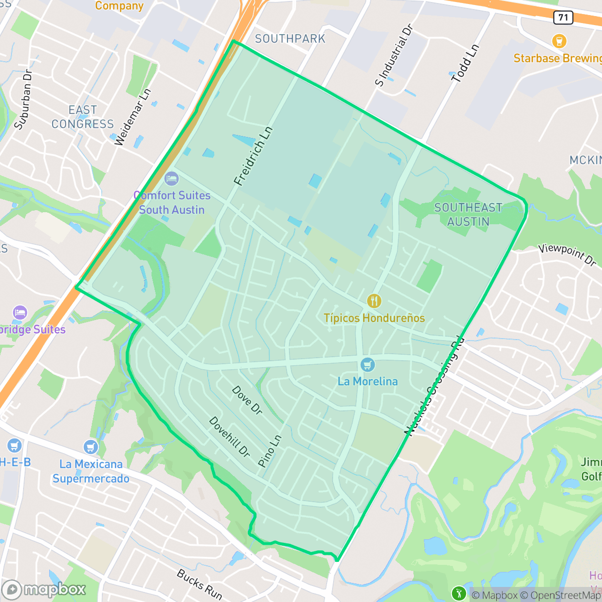
Located in Southeast Austin, the Franklin Park neighborhood was officially established as a subdivision in 1976. Bordered by Interstate 35, East Stassney Lane, and Nuckols Crossing Road, this residential area features a mix of single-family homes, duplexes, and townhomes built primarily throughout the late 20th century. The neighborhood is defined by its proximity to natural spaces, including the Williamson Creek Greenbelt and McKinney Falls State Park. At the heart of the community is its namesake 5.3-acre park, originally named Franklin Neighborhood Park in 1983. In 2017, the Austin City Council officially renamed it Pastor Edward Clarence Craig, Jr. Park to honor a beloved local advocate and pastor who dedicated years of volunteer work to transforming the underutilized park into a safe, vibrant community asset.
The neighborhood serves as a residential hub in Southeast Austin, characterized by its standard suburban layout of single-family homes and apartment complexes. It offers a calm atmosphere with direct access to natural amenities like the Williamson Creek Greenbelt. According to iHuus data, the area maintains a balanced suburban feel, though it is punctuated by nearby industrial warehouses and logistics centers that contribute to its unique urban-industrial landscape. Prospective residents should consider the trade-offs between the neighborhood's natural appeal and its proximity to major transit arteries. While the area provides excellent space for dog owners and outdoor enthusiasts, the noise levels from road traffic and proximity to industrial activity are notable factors. It is best suited for those seeking an affordable, established community that values proximity to recreational trails over high-density walkability or central city nightlife.
Neighborhood Scores Across 15 Qualities
Housing density varies across the area, ranging from closely packed interior homes to more isolated structures near the forest edge. This level of privacy is roughly in line with the Austin average, providing moderate spacing between neighbors.
Residential loops and cul-de-sacs offer safe walking paths, but large highways and high-traffic arterials create notable barriers for pedestrians. This level of connectivity is slightly below the Austin average due to inconsistent sidewalk coverage on main roads.
Uniform tract housing and modest lot sizes characterize the area, which offers less visual variety than the Austin average. According to iHuus data, the landscape consists primarily of standard rooflines and shared amenities rather than luxury estates or lush private landscapes.
Extensive wooded trails and greenbelts provide ample space for dog walking and exercise. This accessibility to natural green space is roughly in line with the Austin average.
Residential neighborhoods blend with industrial warehouses and significant woodland patches, offering a slightly less urban landscape than the Austin average. According to iHuus data, the area features a mix of single-family homes and large-scale commercial zones interspersed with greenery.
A calm, low-density atmosphere prevails with a steady but subdued presence of essential services and local dining. This level of activity is slightly below the Austin average, as many residential blocks remain primarily suburban and car-dependent.
Steady noise from nearby busy streets is a common feature here; however, acoustic levels are noticeably higher than the Austin average according to iHuus data.
Frequent unhealthy air quality levels pose a significant risk to sensitive groups. According to iHuus data, these conditions are notably worse than the Austin average.
Residential and light commercial uses dominate the area, with very little heavy industry or warehouse activity. This lack of industrial density is slightly lower than the Austin average, as some nearby commercial corridors contribute to moderate traffic and noise.
Health insurance enrollment among residents is lower than the Austin average, according to iHuus data.
Voting patterns and census indicators reflect a predominantly liberal political leaning that is even more pronounced than the Austin city average, according to iHuus data.
Residents live alongside a balanced mix of young adults, families, and older populations. This demographic distribution is slightly lower than the Austin average, according to iHuus data.
Flood risk in this area is slightly higher than the Austin average, though a lack of detailed FEMA studies means the precise level of danger remains undetermined. According to iHuus data, the area falls into a category of moderate or undetermined risk.
Block-Level Insights for Franklin Park

iHuus Neighborhood Intelligence Insights
Get block-level neighborhood insights for Franklin Park
- Street-level scores — see how individual blocks compare, not just neighborhood averages
- Micro-zone boundaries — identify quiet pockets, flood boundaries, and walkable clusters before you visit
- 15 dimensions in full — walkability, noise, air quality, school quality, insurance coverage, population age profile, urban/rural index, and more
- Boundary risk alerts — know if your address sits near a block boundary where scores drop, the kind of detail no listing will ever mention
- School insights — individual school ratings and insights, not just district-level data
- Compare before you commit — side-by-side data across neighborhoods, down to block precision
No credit card required
Compare with Any Neighborhood
| Dimension | Franklin Park | Allandale |
|---|---|---|
| 🚶 Walkabilityavg 6.73 | ||
| 🔊 Acoustic Comfortavg 3.73 | ||
| 🤫 Privacy Indexavg 5.87 | ||
| 🎨 Visual Appealavg 6.95 | ||
| 🐕 Dog Friendlinessavg 6.92 | ||
| 🗺️ Urban-Rural Indexavg 7.09 | ||
| ✨ Neighborhood Vibeavg 4.91 | ||
| 🏥 Health Insurance Coverageavg 7.56 | ||
| 🌿 Air Qualityavg 5.17 | ||
| 🏭 Industrial Proximityavg 8.86 | ||
| 🌊 Flood Safetyavg 4.83 | ||
| 🗳️ Ideological Leanavg 9.13 | ||
| 👥 Population Age Profileavg 4.52 | ||
| 🔥 Fire Safety | ||
| 🏫 School Quality |
Franklin Park Rankings
School Districts Serving Franklin Park
Austin ISD is a district in transition, characterized by a sharp divide between its elite, high-performing magnet schools and a significant number of underperforming neighborhood campuses. While academic highlights like LASA and successful bond-funded modernizations demonstrate the district's potential, these are overshadowed by a $60 million budget deficit, declining enrollment, and ongoing state monitoring of its special education department. The district remains a prestigious destination for specific programs, but systemic financial instability and teacher retention challenges in a high-cost environment place it in a mixed category of operational health.
Schools
Del Valle ISD is a district characterized by a sharp divide between its robust financial health and its struggling academic outcomes. While the district maintains a 'Superior A' financial rating and is aggressively expanding its footprint with new high school facilities to meet regional growth, it remains hampered by an overall TEA 'D' accountability rating and significantly low math and reading proficiency levels. High-performing elementary 'bright spots' are offset by severely underperforming middle schools, and recent $13 million budget deficits resulting in staff cuts signal operational pressures despite a commitment to high teacher starting salaries. The district currently serves as a stable corporate entity with modern facilities, but it has yet to demonstrate the academic consistency required to move beyond its status as a transitioning system.
Schools
School Insights for Franklin Park
Below average outcomes; significant attendance and academic challenges.
School Insights
See what's really behind every school rating near Franklin Park
- Individual school ratings — each school's own score with outcome context, not just a district average
- Enrollment & class size data — student-to-teacher ratio and how it compares to the state average
- Full demographics breakdown — ethnicity and gender composition for every school in the enrollment zone
- Every school in the district — all schools within the enrollment boundary ranked by rating, not just the closest one
- Grade levels & benchmarks — elementary through high school, with below/above state-average flags
No credit card required