Pompano Airpark, Pompano Beach
Updated · 2,111 residents
Pompano Airpark is a functional, aviation-focused neighborhood characterized by its mid-century residential pockets and proximity to municipal transit and industrial corridors. While the area offers a quiet, politically balanced environment for a younger demographic, residents should expect frequent aircraft noise and limited pedestrian infrastructure.
Key Highlights
About Pompano Airpark
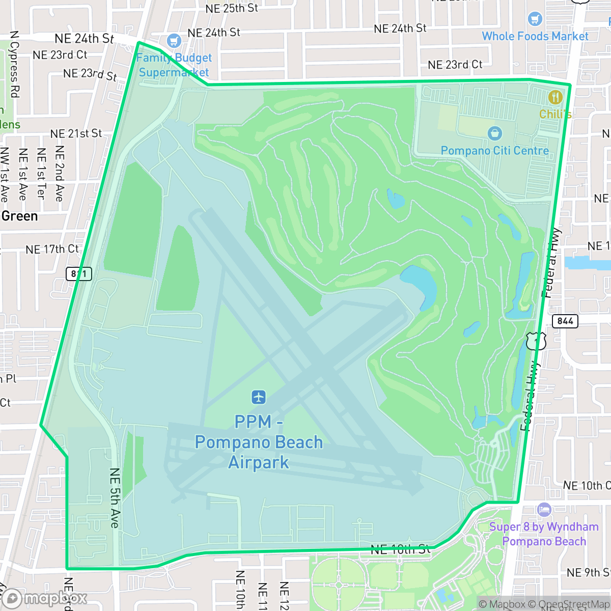
The Pompano Airpark neighborhood centers on the Pompano Beach Airpark, which originated during World War II as a Naval auxiliary landing field. Following the war, the City of Pompano Beach acquired the site in 1947 under the federal Surplus Property Act, transitioning it into a municipal general aviation facility. The surrounding residential area, featuring mid-20th-century single-family homes, developed alongside the airfield. The neighborhood is defined by its aviation-centric character, notably serving as a long-term base for the Goodyear Blimp beginning in 1964. The area has evolved to include significant recreational amenities on former airport land, such as the Pompano Citi Centre, the Emma Lou Olsen Community Center, and a 4.4-mile perimeter trail that remains a signature feature for local residents.
The neighborhood maintains a functional, suburban atmosphere defined by its standard tract housing and close proximity to major utility and transport hubs. It serves as a balanced community where residents benefit from a neutral political climate and a younger, working-age population. The presence of nearby industrial zones and railway corridors contributes to a landscape that prioritizes utility over aesthetic variety, resulting in a quiet, subdued daily experience for those who call the area home.
Prospective residents should consider the trade-offs associated with this location, including the notable noise levels from the adjacent airport and transit routes. Pedestrian access is generally safe on residential side streets, though the lack of continuous sidewalks on major thoroughfares can limit mobility. While the area provides access to community amenities, individuals should be aware of fluctuating air quality and the need to navigate a school district currently undergoing significant structural and budgetary transitions.
Neighborhood Scores Across 15 Qualities
Residential structures feature mixed spacing with some buffers between neighbors, though overall privacy levels are slightly lower than the Pompano Beach average. According to iHuus data, house distances vary from closely packed clusters to moderate yards with some fencing.
Low traffic volumes on residential streets provide opportunities for safe walking, although the lack of continuous sidewalk infrastructure makes navigating major thoroughfares difficult. This level of walkability is slightly below the Pompano Beach city average.
Standard tract housing with small yards and boxy rooflines characterizes this area, which offers less visual variety than the Pompano Beach average. While some properties feature private pools or proximity to the marina, much of the landscape consists of uniform, closely spaced residential units.
Public green space and wide street verges are scarce in this area. According to iHuus data, the lack of accessible public parks and narrow sidewalks makes it less dog-friendly than the Pompano Beach average.
A balance of residential streets and green space exists alongside industrial and utility complexes. This area feels less densely urban than the Pompano Beach average according to iHuus data.
Activity levels are relatively low and the area maintains a quiet, utilitarian atmosphere that is slightly less energetic than the Pompano Beach average. According to iHuus data, most of the neighborhood consists of industrial zones and residential pockets with limited commercial density.
Frequent aircraft activity and proximity to transit corridors result in significant acoustic disturbance. According to iHuus data, noise levels here are notably higher than the Pompano Beach average.
Air quality fluctuates between acceptable and unhealthy levels, appearing lower than the Pompano Beach average according to iHuus data. Sensitive groups may experience occasional concerns on certain days.
Frequent airport traffic, railway corridors, and nearby warehouses create more industrial presence than the typical Pompano Beach neighborhood. Residents should be aware of intermittent heavy freight activity and the proximity to a localized Superfund site.
Health insurance coverage among residents is slightly below the Pompano Beach average, according to iHuus data. This indicates that a significant portion of the local population lacks employer-sponsored or private medical coverage.
Political leanings within the area are evenly split between conservative and liberal perspectives. This represents a more neutral ideological landscape than seen in other parts of Pompano Beach, according to iHuus data.
A higher proportion of young adults and working-age residents live here compared to the Pompano Beach average. According to iHuus data, the population lacks the broad age diversity found in other parts of the city.
Flood risk levels in this area are slightly below the Pompano Beach average due to a lack of detailed federal flood studies. Residents should note that FEMA has not yet completed a comprehensive assessment for this specific location.
Address-Level Insights for Pompano Airpark


iHuus Neighborhood Intelligence Insights
Get address-level neighborhood insights for Pompano Airpark
- Street-level scores — see how individual blocks compare, not just neighborhood averages
- Micro-zone boundaries — identify quiet pockets, flood boundaries, and walkable clusters before you visit
- 15 dimensions in full — walkability, noise, air quality, school quality, insurance coverage, population age profile, urban/rural index, and more
- Boundary risk alerts — know if your address sits near a block boundary where scores drop, the kind of detail no listing will ever mention
- School insights — individual school ratings and insights, not just district-level data
- Compare before you commit — side-by-side data across neighborhoods, down to block precision
No credit card required
Compare with Any Neighborhood
| Dimension | Pompano Airpark | Andrews Industrial District |
|---|---|---|
| 🚶 Walkabilityavg 6.05 | ||
| 🔊 Acoustic Comfortavg 3.33 | ||
| 🤫 Privacy Indexavg 5.28 | ||
| 🎨 Visual Appealavg 6.23 | ||
| 🐕 Dog Friendlinessavg 4.87 | ||
| 🗺️ Urban-Rural Indexavg 6.07 | ||
| ✨ Neighborhood Vibeavg 3.88 | ||
| 🏥 Health Insurance Coverageavg 4.55 | ||
| 🌿 Air Qualityavg 5.68 | ||
| 🏭 Industrial Proximityavg 5.66 | ||
| 🌊 Flood Safetyavg 4.23 | ||
| 🗳️ Ideological Leanavg 5.55 | ||
| 👥 Population Age Profileavg 4.99 | ||
| 🔥 Fire Safety | ||
| 🏫 School Quality |
Pompano Airpark Rankings
School Districts Serving Pompano Airpark
School Insights for Pompano Airpark
Below average outcomes; significant attendance and academic challenges.
School Insights
See what's really behind every school rating near Pompano Airpark
- Individual school ratings — each school's own score with outcome context, not just a district average
- Enrollment & class size data — student-to-teacher ratio and how it compares to the state average
- Full demographics breakdown — ethnicity and gender composition for every school in the enrollment zone
- Every school in the district — all schools within the enrollment boundary ranked by rating, not just the closest one
- Grade levels & benchmarks — elementary through high school, with below/above state-average flags
No credit card required