Jacksonville Naval Air Station, Jacksonville
Updated · 2,873 residents
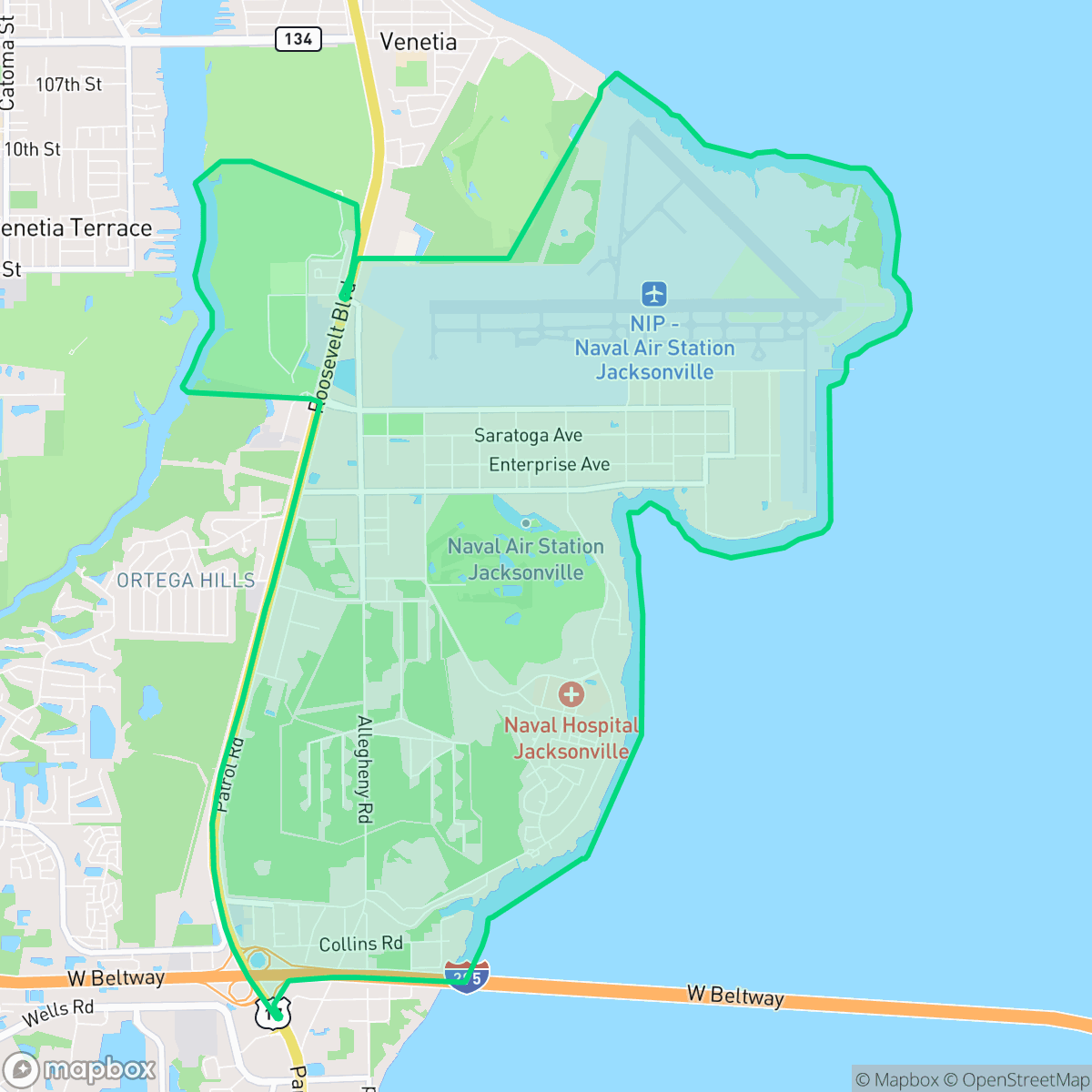
Jacksonville Naval Air Station is a quiet, institutional neighborhood defined by its military presence and suburban landscape. Residents experience limited walkability and few commercial amenities, resulting in a low-key environment primarily populated by young adults.
Key Highlights
About Jacksonville Naval Air Station
Naval Air Station (NAS) Jacksonville, located on the west bank of the St. Johns River at a site historically known as Black Point, was commissioned on October 15, 1940. The land has a rich military lineage, previously serving as the U.S. Army's Camp Joseph E. Johnston during World War I and later as the Florida National Guard's Camp J. Clifford R. Foster. During World War II, the base expanded rapidly into one of the world's largest naval air stations, training thousands of aviators and hosting a German prisoner-of-war compound. The station is famously the birthplace of the Blue Angels, established there in 1946. Today, the 3,400-acre installation functions as a major military hub and industrial base, featuring historic World War II-era structures, Heritage Park’s static aircraft displays, and a self-contained community supporting thousands of service members and their families.
The neighborhood functions as a self-contained, suburban-style community with a layout dominated by institutional architecture and large-scale infrastructure. It is a quiet, residential setting with minimal commercial activity, creating a landscape that is functional rather than aesthetic. The population is notably younger than the Jacksonville average, reflecting its role as a hub for service members and their families. According to iHuus data, the area maintains a strong conservative majority, contributing to a distinct social character within the broader region.
Daily life in the area involves specific trade-offs, including limited pedestrian infrastructure and a consistent hum from local traffic. Potential residents should note that the neighborhood has limited access to pet-friendly spaces and lower rates of health insurance coverage. Environmental considerations include substandard air quality and the proximity of an EPA Superfund site, which warrants caution regarding soil and groundwater. Educational options are split between the Clay and Duval County school districts, both of which are currently navigating significant budgetary and operational challenges that may impact long-term stability for families.
Neighborhood Scores Across 15 Qualities
Building separation is limited, with some office clusters and residential structures positioned in close proximity to one another. According to iHuus data, this level of density indicates less visual privacy than the Jacksonville average.
Navigating the area on foot is difficult due to large blocks and limited pedestrian infrastructure. Traffic patterns and proximity to the airfield make walking less comfortable than in other parts of Jacksonville.
Residential scenery is primarily defined by institutional architecture and high density housing with limited green space. This area offers fewer aesthetic amenities and smaller yards than the Jacksonville average, according to iHuus data.
Sparse greenery and high-traffic airport infrastructure make finding open, unfenced areas for pets difficult. According to iHuus data, the availability of pet-friendly spaces is below the Jacksonville average.
Low-density office blocks and large hangar structures create a more suburban landscape than the Jacksonville average. This area features an even balance of paved streets and open green space, according to iHuus data.
Activity levels are notably low, as this area consists primarily of quiet residential and semi-rural landscapes with very little commercial presence. According to iHuus data, the neighborhood lacks a central commercial pulse or significant points of interest.
Local traffic from nearby busy streets creates a consistent level of sound. This acoustic environment is slightly more active than the average found across Jacksonville.
Frequent unhealthy air quality levels pose a significant risk to sensitive groups. According to iHuus data, the air quality in this area is slightly worse than the Jacksonville average.
Industrial presence is significantly lower than the Jacksonville average, characterized primarily by airport-related freight activity and certain service facilities. However, residents should be aware of a nearby EPA Superfund site that presents potential environmental concerns regarding soil and groundwater.
Health insurance coverage among residents is lower than the Jacksonville average, according to iHuus data. This indicates a higher proportion of uninsured individuals living in the area.
Political leanings in this area are notably more conservative than the Jacksonville average. According to iHuus data, the community maintains a strong conservative majority with a small presence of opposing viewpoints.
A significant majority of the population consists of young adults, which is notably lower in age than the Jacksonville average. According to iHuus data, there is a minimal presence of older residents or established families within this area.
Flood safety levels in this area are roughly comparable to the Jacksonville average. Because FEMA has not yet completed a detailed study for this specific location, residents should exercise caution regarding potential water risks.
Address-Level Insights for Jacksonville Naval Air Station


iHuus Neighborhood Intelligence Insights
Get address-level neighborhood insights for Jacksonville Naval Air Station
- Street-level scores — see how individual blocks compare, not just neighborhood averages
- Micro-zone boundaries — identify quiet pockets, flood boundaries, and walkable clusters before you visit
- 15 dimensions in full — walkability, noise, air quality, school quality, insurance coverage, population age profile, urban/rural index, and more
- Boundary risk alerts — know if your address sits near a block boundary where scores drop, the kind of detail no listing will ever mention
- School insights — individual school ratings and insights, not just district-level data
- Compare before you commit — side-by-side data across neighborhoods, down to block precision
No credit card required
Compare with Any Neighborhood
| Dimension | Jacksonville Naval Air Station | 29th and Chase |
|---|---|---|
| 🚶 Walkabilityavg 3.96 | ||
| 🔊 Acoustic Comfortavg 4.37 | ||
| 🤫 Privacy Indexavg 4.3 | ||
| 🎨 Visual Appealavg 4.24 | ||
| 🐕 Dog Friendlinessavg 4.28 | ||
| 🗺️ Urban-Rural Indexavg 5.22 | ||
| ✨ Neighborhood Vibeavg 1.5 | ||
| 🏥 Health Insurance Coverageavg 4.35 | ||
| 🌿 Air Qualityavg 3.84 | ||
| 🏭 Industrial Proximityavg 5.11 | ||
| 🌊 Flood Safetyavg 4.01 | ||
| 🗳️ Ideological Leanavg 2.75 | ||
| 👥 Population Age Profileavg 3.26 | ||
| 🔥 Fire Safety | ||
| 🏫 School Quality |
Jacksonville Naval Air Station Rankings
School Districts Serving Jacksonville Naval Air Station
School Insights for Jacksonville Naval Air Station
Below average outcomes; significant attendance and academic challenges.
School Insights
See what's really behind every school rating near Jacksonville Naval Air Station
- Individual school ratings — each school's own score with outcome context, not just a district average
- Enrollment & class size data — student-to-teacher ratio and how it compares to the state average
- Full demographics breakdown — ethnicity and gender composition for every school in the enrollment zone
- Every school in the district — all schools within the enrollment boundary ranked by rating, not just the closest one
- Grade levels & benchmarks — elementary through high school, with below/above state-average flags
No credit card required