San Roque, Santa Barbara
Updated June 22, 2026 · 1,943 residents
San Roque is a quiet, visually appealing residential enclave in Santa Barbara, characterized by its diverse historic architecture and mature, tree-lined streets. While the area offers high walkability and excellent air quality, residents should be aware of significant noise levels stemming from local road traffic.
Key Highlights
About San Roque
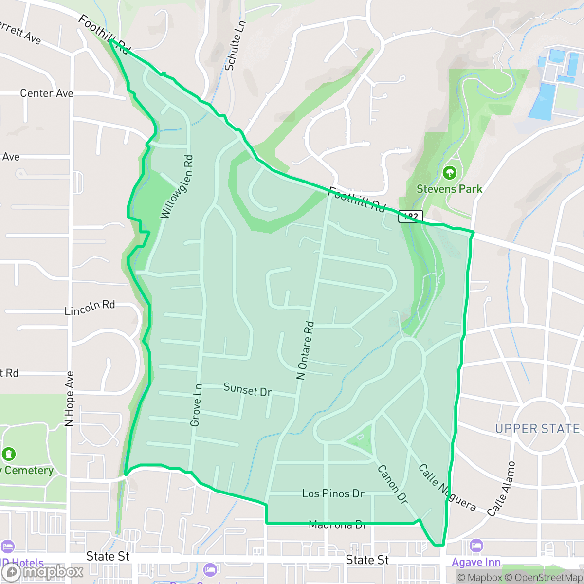
San Roque in Santa Barbara, California, originated as a rural farming area before its first residential subdivision, Rutherford Park, was developed in 1917 by Stephen Rutherford. The neighborhood's unique street layout radiates from Argonne Circle, a central roundabout named in memory of Rutherford's son, who died in the Meuse-Argonne offensive of World War I. In 1926, plans for a grand country club and golf course stalled due to the Great Depression, leading to the creation of the local San Roque and Stevens Parks in 1939. Mostly built out between 1925 and 1970, the neighborhood is celebrated for its eclectic architectural character, featuring a mix of Spanish Colonial Revival, English Tudor, French Normandy, and Craftsman homes. Key neighborhood landmarks include the historic Peabody Elementary School, constructed in 1928, and the San Roque Catholic Church.
The neighborhood functions as a primarily residential community that balances suburban tranquility with proximity to essential services. It features a high degree of visual appeal, supported by well-maintained green spaces like Stevens Park that cater to both dog owners and outdoor enthusiasts. According to iHuus data, the area maintains a high level of health insurance coverage, reflecting a stable and established population base. Residents enjoy a walkable environment, though the proximity to major transit corridors contributes to a noticeable acoustic impact that is higher than the city average.
This area is well-suited for families and professionals who prioritize access to quality education, as it falls within the highly regarded Hope Elementary School District. While the neighborhood provides a strong sense of community and stability, prospective residents should consider the trade-offs between its central location and the acoustic challenges posed by road traffic. Additionally, the area faces specific risks related to flood safety, which is a factor to consider when evaluating property in this part of the city.
Neighborhood Scores Across 15 Qualities
Detached homes typically feature private yards with moderate spacing between neighbors. According to iHuus data, this level of separation is slightly higher than the city average.
Pedestrian connectivity is strong throughout the area, with a dense sidewalk network and safe crossings linking residential streets to commercial strips. This level of walkability is slightly below the Santa Barbara average.
Manicured landscapes, large custom homes, and numerous private pools create a visual environment that is more aesthetically pleasing than the Santa Barbara average. According to iHuus data, the presence of complex architectural features and well-maintained greenery defines the area's premium appearance.
Tree-lined streets and proximity to large parklands provide ample space for walking dogs. According to iHuus data, the availability of connected green spaces is slightly below the Santa Barbara average.
Low-rise multi-family complexes and single-family homes create a dense suburban landscape. According to iHuus data, this area features slightly more open land and greenery than the typical Santa Barbara urban profile.
Social activity is notably higher than the Santa Barbara average, driven by a concentration of local dining and community landmarks. Residents have access to diverse amenities ranging from neighborhood bistros to established parks and social centers.
Frequent noise from nearby railroad tracks and heavy freeway traffic persists in this area. According to iHuus data, acoustic comfort levels are slightly lower than the Santa Barbara average.
Air quality is consistently excellent, matching the high standard found throughout Santa Barbara. Residents can expect minimal pollutants and very low health concerns related to air-borne particulates.
No warehouses, heavy industrial facilities, or hazard sites are present in this area. According to iHuus data, the neighborhood consists entirely of residential, light commercial, and recreational green spaces, which is slightly more residential than the Santa Barbara average.
Health insurance enrollment among residents is notably higher than the Santa Barbara city average, according to iHuus data.
Voting patterns and census indicators show a predominantly liberal community, which is consistent with the broader political landscape of Santa Barbara.
Residents live alongside a diverse range of age groups, including young professionals, families, and seniors. This demographic spread is slightly more varied than the average seen across Santa Barbara, according to iHuus data.
Flood risk in this area remains undetermined because a detailed study has not yet been completed for this specific zone. According to iHuus data, the potential for flooding is higher than the Santa Barbara city average.
Fire hazard levels in San Roque are considerably higher than the Santa Barbara city average. According to iHuus data, this area requires enhanced mitigation measures due to the significant presence of combustible vegetation.
Block-Level Insights for San Roque

iHuus Neighborhood Intelligence Insights
Get block-level neighborhood insights for San Roque
- Street-level scores — see how individual blocks compare, not just neighborhood averages
- Micro-zone boundaries — identify quiet pockets, flood boundaries, and walkable clusters before you visit
- 15 dimensions in full — walkability, noise, air quality, school quality, insurance coverage, population age profile, urban/rural index, and more
- Boundary risk alerts — know if your address sits near a block boundary where scores drop, the kind of detail no listing will ever mention
- School insights — individual school ratings and insights, not just district-level data
- Compare before you commit — side-by-side data across neighborhoods, down to block precision
No credit card required
Compare with Any Neighborhood
| Dimension | San Roque | Alta Mesa |
|---|---|---|
| 🚶 Walkabilityavg 8.12 | ||
| 🔊 Acoustic Comfortavg 3.7 | ||
| 🤫 Privacy Indexavg 5.66 | ||
| 🎨 Visual Appealavg 7.77 | ||
| 🐕 Dog Friendlinessavg 7.45 | ||
| 🗺️ Urban-Rural Indexavg 7.13 | ||
| ✨ Neighborhood Vibeavg 5.46 | ||
| 🏥 Health Insurance Coverageavg 6.92 | ||
| 🌿 Air Qualityavg 10 | ||
| 🏭 Industrial Proximityavg 9.73 | ||
| 🌊 Flood Safetyavg 3.72 | ||
| 🗳️ Ideological Leanavg 9.64 | ||
| 👥 Population Age Profileavg 5.23 | ||
| 🔥 Fire Safetyavg 0.32 | ||
| 🏫 School Quality |
San Roque Rankings
School Districts Serving San Roque
Hope Elementary School District is a high-performing, financially resilient 'basic aid' district characterized by top-tier academic outcomes and deep community integration. With CAASPP scores significantly outperforming state averages and a portfolio of highly-rated neighborhood schools, the district maintains a 'Blue Chip' reputation despite aging infrastructure. Current leadership is proactive in addressing facility needs through a proposed 2026 bond and has successfully implemented sustainability initiatives that reduce long-term overhead. While the small scale of the district limits programmatic variety, its stability, strong teacher retention, and robust parental fundraising make it a premier elementary-level destination in the Santa Barbara region.
Schools
Santa Barbara Unified is a high-achieving district currently facing a period of operational and demographic transition. While its high schools are premier academic institutions with robust specialized programs like the Dos Pueblos Engineering Academy, the district is struggling with a widening achievement gap and stark performance disparities between individual school sites. Operationally, the district is managing the challenges of a high cost-of-living area, including teacher retention issues and a steady 2% annual enrollment decline. Despite these fiscal headwinds and looming budget cuts, the successful implementation of 'Science of Reading' reforms and positive labor negotiations suggest a stable management team that is proactively addressing its structural and academic weaknesses.
Schools
School Insights for San Roque
Below average outcomes; significant attendance and academic challenges.
School Insights
See what's really behind every school rating near San Roque
- Individual school ratings — each school's own score with outcome context, not just a district average
- Enrollment & class size data — student-to-teacher ratio and how it compares to the state average
- Full demographics breakdown — ethnicity and gender composition for every school in the enrollment zone
- Every school in the district — all schools within the enrollment boundary ranked by rating, not just the closest one
- Grade levels & benchmarks — elementary through high school, with below/above state-average flags
No credit card required