Lower State, Santa Barbara
Updated June 22, 2026 · 1,140 residents
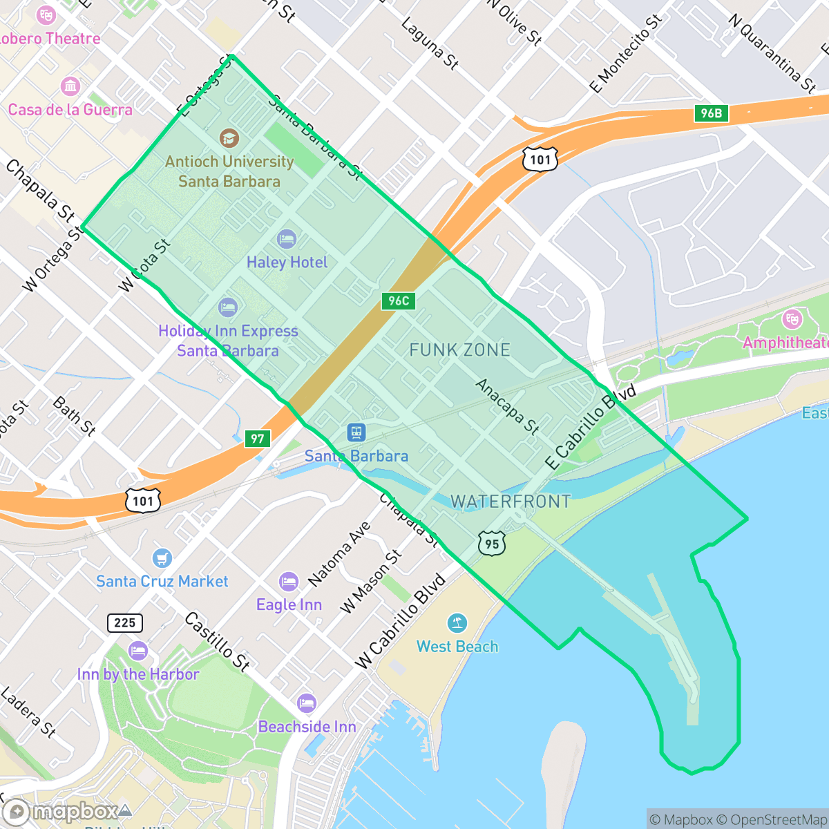
Lower State is a highly walkable urban hub defined by its pedestrian-only promenade and proximity to the Santa Barbara coastline. While the area offers exceptional access to local dining and cultural attractions, residents should expect significant noise levels due to consistent road traffic.
Key Highlights
About Lower State
Lower State, historically the commercial and transit spine of Santa Barbara, evolved from a Chumash pathway into a bustling corridor following American statehood and the 1851 Salisbury Haley street survey. The area's maritime connection was cemented in 1872 with the construction of Stearns Wharf at the foot of State Street, allowing passengers and cargo to unload directly into the district. In 1916, the neighborhood served as the birthplace of the Loughead Aircraft Company (later Lockheed), which tested seaplanes off nearby East Beach. Following the devastating 1925 earthquake, Lower State was rebuilt in its signature Spanish Colonial Revival style. Anchored by historic landmarks like the 1905 Spanish Mission Revival Southern Pacific Railroad Station and Joe's Cafe (the city's oldest restaurant), the neighborhood transitioned in 2020 into a pedestrian-only promenade.
The neighborhood serves as a vibrant commercial and social center, characterized by its high density of restaurants, cafes, and proximity to the Moxi Museum. The area maintains a lively atmosphere that benefits from its seamless integration with the surrounding coastal districts, making it a primary destination for both residents and visitors seeking an active, urban lifestyle.
Prospective residents should weigh the benefits of extreme walkability and dog-friendly amenities against the trade-offs of lower privacy and elevated noise from nearby traffic. The area is best suited for those who prioritize immediate access to city life over a quiet, secluded environment, as the bustling nature of the promenade and the proximity to major transit corridors create a consistently energetic urban experience.
Neighborhood Scores Across 15 Qualities
Residential buildings are situated in close proximity with frequent shared walls or minimal separation between neighbors. This level of density provides less personal buffer than the Santa Barbara average, according to iHuus data.
Pedestrian-priority zones, wide sidewalks, and frequent crosswalks make navigating this area on foot very easy. This level of walkability is notably higher than the Santa Barbara city average, according to iHuus data.
Large, well-maintained homes and frequent private pools define the local landscape. This area offers a visual environment that is slightly below the city average for aesthetic appeal.
Dense urban layouts and fenced greenery provide fewer open grass verges for public use. According to iHuus data, the availability of accessible walking space for dogs is below the city average.
Open land and scattered homes amidst woodland provide a more semi-rural atmosphere than the typical Santa Barbara urban density. According to iHuus data, the area features a blend of low-rise urban cores and industrial structures that is slightly less developed than the city average.
Social activity is notably higher than the Santa Barbara average, driven by a diverse mix of coastal eateries, local coffee shops, and cultural landmarks. According to iHuus data, the area offers a vibrant atmosphere where suburban streets and green spaces meet active dining and industrial-coastal hubs.
Frequent noise from nearby freeway and railroad activity characterizes this area. According to iHuus data, acoustic comfort levels are lower than the Santa Barbara average.
Air quality is consistently excellent with no significant health concerns. This level of air purity is consistent with the city average according to iHuus data.
Residential and light commercial structures dominate the area with no visible warehouses or industrial facilities. While a wastewater treatment plant is present, the neighborhood lacks the heavy industrial activity found in other parts of the city according to iHuus data.
Health insurance access is notably higher in this area than in the rest of Santa Barbara. According to iHuus data, a large majority of the local population is covered.
Voting patterns and census indicators reflect a predominantly liberal political leaning that is slightly more pronounced than the Santa Barbara city average.
Residents live alongside a balanced distribution of young adults, families, and older populations. This demographic spread is roughly in line with the average seen across Santa Barbara.
Located in a coastal high-hazard zone prone to wave action, this area carries a significantly higher flood risk than the Santa Barbara average. Residents should anticipate elevated or potentially prohibitive flood insurance costs according to iHuus data.
Block-Level Insights for Lower State

iHuus Neighborhood Intelligence Insights
Get block-level neighborhood insights for Lower State
- Street-level scores — see how individual blocks compare, not just neighborhood averages
- Micro-zone boundaries — identify quiet pockets, flood boundaries, and walkable clusters before you visit
- 15 dimensions in full — walkability, noise, air quality, school quality, insurance coverage, population age profile, urban/rural index, and more
- Boundary risk alerts — know if your address sits near a block boundary where scores drop, the kind of detail no listing will ever mention
- School insights — individual school ratings and insights, not just district-level data
- Compare before you commit — side-by-side data across neighborhoods, down to block precision
No credit card required
Compare with Any Neighborhood
| Dimension | Lower State | Alta Mesa |
|---|---|---|
| 🚶 Walkabilityavg 8.12 | ||
| 🔊 Acoustic Comfortavg 3.7 | ||
| 🤫 Privacy Indexavg 5.66 | ||
| 🎨 Visual Appealavg 7.77 | ||
| 🐕 Dog Friendlinessavg 7.45 | ||
| 🗺️ Urban-Rural Indexavg 7.13 | ||
| ✨ Neighborhood Vibeavg 5.46 | ||
| 🏥 Health Insurance Coverageavg 6.92 | ||
| 🌿 Air Qualityavg 10 | ||
| 🏭 Industrial Proximityavg 9.73 | ||
| 🌊 Flood Safetyavg 3.72 | ||
| 🗳️ Ideological Leanavg 9.64 | ||
| 👥 Population Age Profileavg 5.23 | ||
| 🔥 Fire Safetyavg 0.32 | ||
| 🏫 School Quality |
Lower State Rankings
School Districts Serving Lower State
Santa Barbara Unified is a high-achieving district currently facing a period of operational and demographic transition. While its high schools are premier academic institutions with robust specialized programs like the Dos Pueblos Engineering Academy, the district is struggling with a widening achievement gap and stark performance disparities between individual school sites. Operationally, the district is managing the challenges of a high cost-of-living area, including teacher retention issues and a steady 2% annual enrollment decline. Despite these fiscal headwinds and looming budget cuts, the successful implementation of 'Science of Reading' reforms and positive labor negotiations suggest a stable management team that is proactively addressing its structural and academic weaknesses.
Schools
School Insights for Lower State
Below average outcomes; significant attendance and academic challenges.
School Insights
See what's really behind every school rating near Lower State
- Individual school ratings — each school's own score with outcome context, not just a district average
- Enrollment & class size data — student-to-teacher ratio and how it compares to the state average
- Full demographics breakdown — ethnicity and gender composition for every school in the enrollment zone
- Every school in the district — all schools within the enrollment boundary ranked by rating, not just the closest one
- Grade levels & benchmarks — elementary through high school, with below/above state-average flags
No credit card required