Bel Air, Santa Barbara
Updated · 2,416 residents
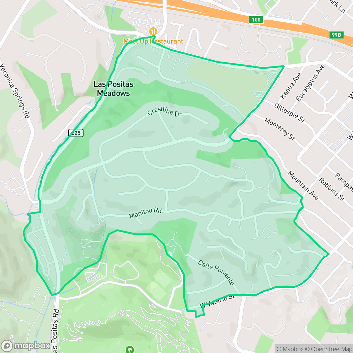
Bel Air is a semi-rural neighborhood in Santa Barbara characterized by its scenic hillsides, manicured landscaping, and quiet suburban atmosphere. The area offers a blend of expansive, tree-lined residential streets and accessible local parks, making it a popular choice for pet owners and those seeking a tranquil, upscale living environment.
Key Highlights
About Bel Air
This neighborhood is defined by its sprawling hillside topography and a significant tree canopy that provides a more open, natural feel compared to the typical Santa Barbara landscape. Residents enjoy a visually polished environment filled with custom homes and private amenities, creating a serene, upscale character that remains largely removed from industrial activity. While the area is primarily car-dependent, its grid-patterned streets and consistent sidewalk access make it a pleasant, quiet environment for walking and outdoor recreation.
Prospective residents should note the trade-offs associated with the area's natural beauty, specifically the extreme wildfire risk and high susceptibility to flooding. The neighborhood serves a diverse demographic, from families attracted to the high-performing Hope Elementary School District to those seeking the privacy of hillside living. While the community maintains a strong liberal identity and clean air quality, potential buyers should account for the necessity of flood insurance and proactive wildfire safety measures when considering this location.
Neighborhood Scores Across 15 Qualities
Residential spacing varies between more secluded hillside properties and denser eastern blocks where homes are closer together. This level of privacy is slightly higher than the Santa Barbara city average according to iHuus data.
Residential streets feature a grid pattern with sidewalks on one side and safe crossings for pedestrians. While sidewalk access is consistent for local parks and schools, walkability is slightly lower than the Santa Barbara average.
Manicured landscaping, large custom homes, and frequent private pools create a visually polished environment that is more aesthetically pleasing than the Santa Barbara average. According to iHuus data, the prevalence of high-end amenities and extensive greenery defines the area's premium character.
Wide residential verges and a large central park provide excellent areas for pets, making this neighborhood more dog friendly than the Santa Barbara average. Tree-lined streets and connected green spaces offer safe, low-traffic routes for exercise.
Sprawling hillsides and a significant tree canopy provide a more open, natural feel than most of Santa Barbara. This area features a mix of low-density residential lots and frequent greenspace, according to iHuus data.
Low-density residential pockets and expansive green spaces create a serene atmosphere that is largely consistent with the city average. While a few local amenities and leisure spots provide convenience, the area remains primarily car-dependent and quiet.
Steady sounds from nearby busy streets are present, though the acoustic environment is notably quieter than the Santa Barbara average according to iHuus data.
Air quality remains consistently high with minimal health concerns. This level of air purity is on par with the rest of Santa Barbara.
No warehouses, industrial facilities, or hazard sites are present within the area. This neighborhood maintains a higher degree of separation from industrial activity than the Santa Barbara average, consisting entirely of residential, institutional, and green spaces.
Health insurance access among residents is slightly below the Santa Barbara city average, according to iHuus data.
Voting patterns and census indicators reflect a very strong liberal leaning, which is slightly more pronounced than the average seen across Santa Barbara.
Residents live alongside a varied mix of young adults, families, and older individuals. This demographic spread is slightly more diverse than the average found across Santa Barbara, according to iHuus data.
Flood risk in this area is significantly higher than the Santa Barbara average, as portions of the neighborhood fall within the designated 100-year floodplain. According to iHuus data, residents may find that flood insurance is typically required for properties here.
High fire hazards exist throughout the area, which is consistent with the broader Santa Barbara city average according to iHuus data. Residents must prioritize maximum protection measures and strict adherence to wildfire safety protocols.
Address-Level Insights for Bel Air


iHuus Neighborhood Intelligence Insights
Get address-level neighborhood insights for Bel Air
- Street-level scores — see how individual blocks compare, not just neighborhood averages
- Micro-zone boundaries — identify quiet pockets, flood boundaries, and walkable clusters before you visit
- 15 dimensions in full — walkability, noise, air quality, school quality, insurance coverage, population age profile, urban/rural index, and more
- Boundary risk alerts — know if your address sits near a block boundary where scores drop, the kind of detail no listing will ever mention
- School insights — individual school ratings and insights, not just district-level data
- Compare before you commit — side-by-side data across neighborhoods, down to block precision
No credit card required
Compare with Any Neighborhood
| Dimension | Bel Air | Alta Mesa |
|---|---|---|
| 🚶 Walkabilityavg 8.12 | ||
| 🔊 Acoustic Comfortavg 3.7 | ||
| 🤫 Privacy Indexavg 5.66 | ||
| 🎨 Visual Appealavg 7.77 | ||
| 🐕 Dog Friendlinessavg 7.45 | ||
| 🗺️ Urban-Rural Indexavg 7.13 | ||
| ✨ Neighborhood Vibeavg 5.46 | ||
| 🏥 Health Insurance Coverageavg 6.92 | ||
| 🌿 Air Qualityavg 10 | ||
| 🏭 Industrial Proximityavg 9.73 | ||
| 🌊 Flood Safetyavg 3.72 | ||
| 🗳️ Ideological Leanavg 9.64 | ||
| 👥 Population Age Profileavg 5.23 | ||
| 🔥 Fire Safetyavg 0.32 | ||
| 🏫 School Quality |
Bel Air Rankings
School Districts Serving Bel Air
School Insights for Bel Air
Below average outcomes; significant attendance and academic challenges.
School Insights
See what's really behind every school rating near Bel Air
- Individual school ratings — each school's own score with outcome context, not just a district average
- Enrollment & class size data — student-to-teacher ratio and how it compares to the state average
- Full demographics breakdown — ethnicity and gender composition for every school in the enrollment zone
- Every school in the district — all schools within the enrollment boundary ranked by rating, not just the closest one
- Grade levels & benchmarks — elementary through high school, with below/above state-average flags
No credit card required