Olivas, San Buenaventura (Ventura)
Updated June 22, 2026 · 1,050 residents
Olivas is defined by its upscale waterfront properties and semi-rural character, offering a blend of open green spaces and pedestrian-friendly paths. While the area provides a quiet, community-focused environment with diverse age demographics, residents should be aware of significant noise from nearby transit corridors and the necessity of proactive fire safety measures.
Key Highlights
About Olivas
The Olivas neighborhood in Ventura, California, is historically rooted in the Rancho era, centered on the landmark Olivas Adobe. Built in 1837 by Don Raymundo Olivas on the 4,700-acre Rancho San Miguel land grant, the site served as a social hub for the Santa Clara River Valley. The original structure was expanded in 1849 into one of the few two-story Monterey-style haciendas in Southern California. After the Olivas family residency ended in 1899, the property was eventually acquired by Max Fleischmann, who restored the building before it was donated to the City of Ventura. Today, the site functions as the Olivas Adobe Historical Park, preserving the region's Latino and Rancho heritage through its historic architecture, period gardens, and educational exhibits, anchoring the identity of the surrounding residential community.
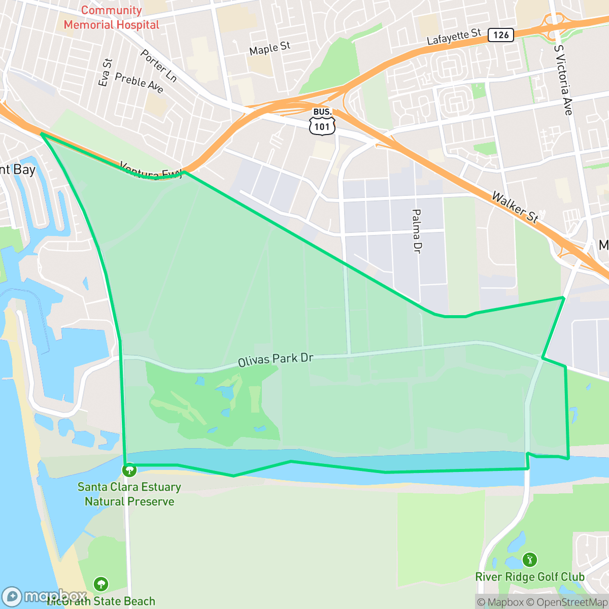
The Olivas neighborhood is a visually polished community known for its high-end homes and private boat docks. The landscape leans semi-rural, characterized by expansive agricultural tracts and greenery that provide a distinct contrast to the denser parts of the city. Pedestrians benefit from continuous sidewalks and canal-side paths, making the neighborhood relatively easy to navigate on foot despite its generally quiet and remote atmosphere. According to iHuus data, the area maintains a clean environment with minimal industrial activity, further enhancing its appeal as a residential enclave.
Living in this area involves several trade-offs for prospective residents. While the neighborhood offers clean air and high rates of health insurance coverage, it experiences high noise levels due to its proximity to the freeway and railroad tracks. Privacy is also a consideration, as many homes are situated in close proximity to one another, resulting in limited separation between dwellings. Furthermore, the region faces extreme wildfire risk, requiring residents to prioritize fire protection. The local school landscape is currently in a state of transition, with families served by a mix of districts that are navigating enrollment shifts and academic challenges.
Neighborhood Scores Across 15 Qualities
Close proximity between dwellings and minimal separation between detached homes result in a lower privacy level than the Ventura average. According to iHuus data, some areas feature high density where structures are nearly touching or share walls.
Continuous sidewalks and canal-side paths provide safe routes for pedestrians, though the area is slightly less walkable than the broader Ventura average.
Large homes and premium amenities, including private boat docks in certain waterfront sections, make the area more visually polished than the San Buenaventura average. According to iHuus data, the neighborhood features notable architectural variety and spacious properties.
Direct access to large public beaches and community parks provides ample space for pets. According to iHuus data, the area offers a level of dog friendliness that is consistent with the city average.
Expansive agricultural fields, golf courses, and large industrial zones create a landscape that is more open and less densely developed than the Ventura city average. According to iHuus data, residents will find a notable presence of greenery and undeveloped tracts interspersed with light industrial and greenhouse structures.
Low density and large industrial or rural landscapes create a very subdued atmosphere. This area lacks the activity found in most of Ventura, as most residents will find very few destinations or social hubs within walking distance.
Frequent acoustic disturbances from nearby freeway and railroad traffic characterize this area. According to iHuus data, noise levels in Olivas are notably higher than the city average.
Air quality remains consistently high with minimal health concerns. This level of cleanliness is on par with the rest of San Buenaventura.
Industrial activity is virtually non-existent in this area, offering a cleaner environment than the city average. Residents can expect a landscape free from warehouses, logistics hubs, or heavy industrial facilities according to iHuus data.
Health insurance accessibility is high in this area, remaining slightly above the San Buenaventura average according to iHuus data.
Political leanings in Olivas align closely with the broader San Buenaventura area, featuring a liberal majority and a modest opposing presence according to iHuus data.
Residents live alongside a balanced demographic of young adults, families, and seniors. According to iHuus data, this age distribution is slightly more varied than the average found across San Buenaventura.
Flood risk in this area remains difficult to assess because FEMA has not completed a detailed study for the neighborhood. According to iHuus data, the level of risk is slightly lower than the Ventura city average.
Wildfire hazards in this area are severe and significantly higher than the Ventura city average. According to iHuus data, residents must prioritize maximum fire protection measures due to the extreme level of risk present.
Block-Level Insights for Olivas

iHuus Neighborhood Intelligence Insights
Get block-level neighborhood insights for Olivas
- Street-level scores — see how individual blocks compare, not just neighborhood averages
- Micro-zone boundaries — identify quiet pockets, flood boundaries, and walkable clusters before you visit
- 15 dimensions in full — walkability, noise, air quality, school quality, insurance coverage, population age profile, urban/rural index, and more
- Boundary risk alerts — know if your address sits near a block boundary where scores drop, the kind of detail no listing will ever mention
- School insights — individual school ratings and insights, not just district-level data
- Compare before you commit — side-by-side data across neighborhoods, down to block precision
No credit card required
Compare with Any Neighborhood
| Dimension | Olivas | Arundell |
|---|---|---|
| 🚶 Walkabilityavg 8.94 | ||
| 🔊 Acoustic Comfortavg 2.96 | ||
| 🤫 Privacy Indexavg 4.99 | ||
| 🎨 Visual Appealavg 6.55 | ||
| 🐕 Dog Friendlinessavg 6.7 | ||
| 🗺️ Urban-Rural Indexavg 6.9 | ||
| ✨ Neighborhood Vibeavg 4.55 | ||
| 🏥 Health Insurance Coverageavg 8.28 | ||
| 🌿 Air Qualityavg 9.98 | ||
| 🏭 Industrial Proximityavg 8.77 | ||
| 🌊 Flood Safetyavg 5.24 | ||
| 🗳️ Ideological Leanavg 8.09 | ||
| 👥 Population Age Profileavg 5.15 | ||
| 🔥 Fire Safetyavg 0.58 | ||
| 🏫 School Quality |
Olivas Rankings
School Districts Serving Olivas
Oxnard Elementary School District is a stable but academically challenged organization characterized by a sharp divide between its high-quality leadership and low-performing academic portfolio. While the district enjoys success in securing facility bonds, maintaining competitive staff pay, and receiving regional accolades for its Superintendent, standardized testing scores remain in the bottom 50% of the state. With a school portfolio where nearly half of the institutions are rated 3/10 or below, the district relies on specialized programs like Dual Language Immersion and strong community engagement to maintain its standing. It currently functions as a middle-of-the-road district in a period of transition, leveraging infrastructure upgrades and modernization to address persistent achievement gaps.
Schools
Oxnard Union High School District is a stable but bifurcated organization, exhibiting a 'Mixed/Transition' profile due to the stark contrast between its high-performing specialized academies and its struggling traditional high schools. While the district maintains strong community trust through successful bond measures and facility modernizations, its academic core is pressured by critically low math proficiency and a projected enrollment decline. Strong Career Technical Education programs and high graduation rates provide a floor for the district's quality, but significant achievement gaps across geographic lines and aging infrastructure on specific campuses remain primary obstacles to overall excellence.
Schools
Ventura Unified is a district in fiscal and structural transition, balancing high-performing flagship campuses with a portfolio of struggling elementary schools facing potential closure. Despite academic strengths—including an A-minus Niche rating and state recognition for attendance—the district is grappling with a persistent enrollment decline of 300 students per year and significant budget deficits that have necessitated staff cuts and surplus property sales. While terminal high schools like Foothill Technology and Ventura High remain stable 'destination' sites, the operational health is currently strained by labor negotiations and the socio-economic pressures of the California coast, placing the district in a state of high-stakes reorganization.
Schools
School Insights for Olivas
Below average outcomes; significant attendance and academic challenges.
School Insights
See what's really behind every school rating near Olivas
- Individual school ratings — each school's own score with outcome context, not just a district average
- Enrollment & class size data — student-to-teacher ratio and how it compares to the state average
- Full demographics breakdown — ethnicity and gender composition for every school in the enrollment zone
- Every school in the district — all schools within the enrollment boundary ranked by rating, not just the closest one
- Grade levels & benchmarks — elementary through high school, with below/above state-average flags
No credit card required