St. Paul Square, San Antonio
Updated June 22, 2026 · 3 residents
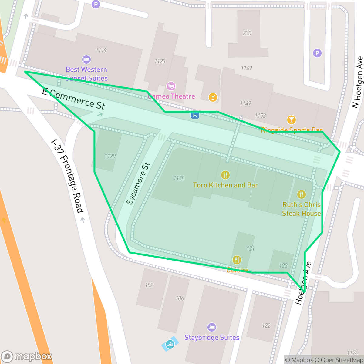
St. Paul Square is a highly walkable, high-energy urban district located on the east side of downtown San Antonio. While the area offers immediate access to diverse dining and dense city living, residents experience significant noise from nearby highway traffic and industrial activity.
Key Highlights
About St. Paul Square
St. Paul Square, also known as the Southern Pacific Depot Historic District, is a historic multi-acre area on the east side of downtown San Antonio. The neighborhood's name derives from the Old St. Paul Methodist Episcopal Church (now known as "The Spire"), a Gothic Revival structure built in the late 1800s that became a vital institutional anchor for San Antonio’s African American community. The area's commercial growth exploded following the arrival of the railroad in 1877 and the 1903 opening of the Southern Pacific Railroad Station (Sunset Station), an architectural masterpiece designed in the Mission Revival style. Despite segregation, St. Paul Square flourished as a vibrant, mixed-race commercial hub and the center of Black business, culture, and civil rights organizing, hosting legendary performers like Louis Armstrong and B.B. King.
The neighborhood serves as a dense, concrete-heavy urban environment characterized by its proximity to major transit corridors and high-rise structures. It functions as a vibrant hub for nightlife and dining, offering residents immediate access to a variety of culinary options ranging from casual eateries to specialized sushi spots. The layout prioritizes pedestrian movement, making it one of the most walkable sections of the city.
Living in this area involves distinct trade-offs, particularly regarding environmental factors. The high volume of road traffic creates a consistently loud acoustic environment, and the location faces challenges with air quality and flood risk. Because of the limited residential infrastructure and the intensity of the urban landscape, it is better suited for those who prioritize proximity to downtown activity over quiet suburban amenities or green space. Prospective residents should also be aware that the local San Antonio Independent School District is currently undergoing significant restructuring to address long-term academic and infrastructure challenges.
Neighborhood Scores Across 15 Qualities
Residential spacing offers a moderate level of separation between neighbors, which is slightly higher than the San Antonio average. According to iHuus data, the area features a mix of building densities that provide some buffer between adjacent properties.
Pedestrians can navigate the area easily via sidewalks and safe crossings, providing a much higher level of walkability than the San Antonio average. According to iHuus data, the infrastructure supports efficient movement on foot throughout the neighborhood.
Residential views consist of uniform tract housing with small, well-maintained yards. This visual profile is roughly consistent with the broader San Antonio area.
Limited access to public parks and a lack of wide green verges make this area less ideal for dog owners. According to iHuus data, pet-friendly infrastructure in this neighborhood is below the San Antonio average.
Highly developed with significant pavement and dense buildings, this area lacks the greenery and open space found throughout much of San Antonio. According to iHuus data, the landscape is characterized by a high concentration of structures and minimal natural vegetation.
Dense high-rises and a diverse range of dining options create an active atmosphere that is significantly more energetic than the San Antonio average. According to iHuus data, the presence of varied culinary destinations and industrial-to-residential transitions contributes to a high-energy landscape.
Frequent noise from nearby railroad tracks and busy freeway traffic is common in this area. According to iHuus data, acoustic comfort is significantly lower than the San Antonio average.
Frequent unhealthy air quality levels pose significant risks to sensitive groups; according to iHuus data, conditions in this area are worse than the San Antonio average.
Light industrial and commercial activities, such as a local printing service, are present alongside residential areas. This concentration of commercial use is lower than the San Antonio average, resulting in less industrial activity than most parts of the city.
Voting patterns and census indicators show a significantly more liberal leaning than the San Antonio average, according to iHuus data.
Residents live alongside a balanced mix of young adults, families, and older individuals. This demographic spread is consistent with the broader San Antonio area.
Block-Level Insights for St. Paul Square

iHuus Neighborhood Intelligence Insights
Get block-level neighborhood insights for St. Paul Square
- Street-level scores — see how individual blocks compare, not just neighborhood averages
- Micro-zone boundaries — identify quiet pockets, flood boundaries, and walkable clusters before you visit
- 15 dimensions in full — walkability, noise, air quality, school quality, insurance coverage, population age profile, urban/rural index, and more
- Boundary risk alerts — know if your address sits near a block boundary where scores drop, the kind of detail no listing will ever mention
- School insights — individual school ratings and insights, not just district-level data
- Compare before you commit — side-by-side data across neighborhoods, down to block precision
No credit card required
Compare with Any Neighborhood
| Dimension | St. Paul Square | 145 Association |
|---|---|---|
| 🚶 Walkabilityavg 6.44 | ||
| 🔊 Acoustic Comfortavg 4.07 | ||
| 🤫 Privacy Indexavg 5.75 | ||
| 🎨 Visual Appealavg 6.11 | ||
| 🐕 Dog Friendlinessavg 5.91 | ||
| 🗺️ Urban-Rural Indexavg 6.87 | ||
| ✨ Neighborhood Vibeavg 4.35 | ||
| 🏥 Health Insurance Coverageavg 5.94 | ||
| 🌿 Air Qualityavg 2.27 | ||
| 🏭 Industrial Proximityavg 8.31 | ||
| 🌊 Flood Safetyavg 4.2 | ||
| 🗳️ Ideological Leanavg 7.37 | ||
| 👥 Population Age Profileavg 4.68 | ||
| 🔥 Fire Safety | ||
| 🏫 School Quality |
St. Paul Square Rankings
School Districts Serving St. Paul Square
San Antonio ISD is currently a distressed district undergoing a high-stakes 'rightsizing' transformation to combat declining enrollment and a legacy of underfunded, aging facilities. While the district maintains prestigious, top-tier magnets like the Young Women's Leadership Academy, the broader portfolio is plagued by academic inconsistency, with nearly 40% of its schools rated 4/10 or lower. Despite a recent upgrade to a state 'C' rating and significant bond investment in infrastructure, the combination of a TEA corrective action plan for graduation rates, widespread literacy gaps, and the closure of 15 campuses reflects a system in a state of survival rather than stability.
Schools
School Insights for St. Paul Square
Below average outcomes; significant attendance and academic challenges.
School Insights
See what's really behind every school rating near St. Paul Square
- Individual school ratings — each school's own score with outcome context, not just a district average
- Enrollment & class size data — student-to-teacher ratio and how it compares to the state average
- Full demographics breakdown — ethnicity and gender composition for every school in the enrollment zone
- Every school in the district — all schools within the enrollment boundary ranked by rating, not just the closest one
- Grade levels & benchmarks — elementary through high school, with below/above state-average flags
No credit card required