Culebra Park-Third World, San Antonio
Updated · 1,207 residents
Culebra Park-Third World is a dense, residential West Side neighborhood characterized by its grid street layout and modest, single-story homes. While the area offers a quiet, suburban atmosphere, residents should expect higher noise levels from nearby road traffic and limited private green space.
Key Highlights
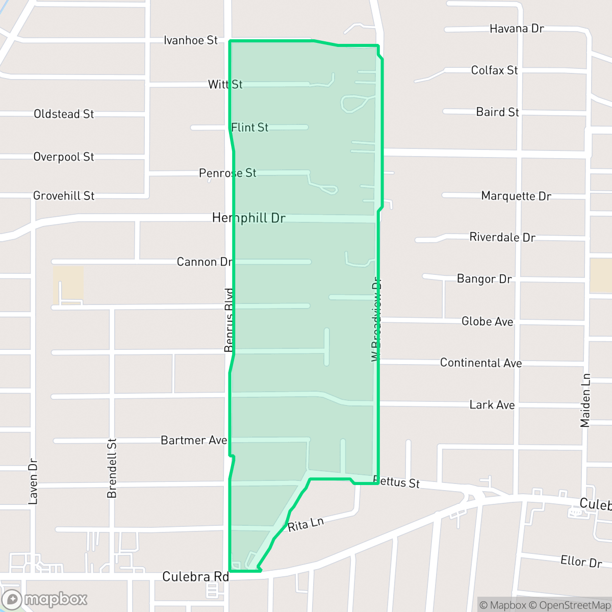
About Culebra Park-Third World
Culebra Park-Third World is a historic West Side area in San Antonio, Texas, traditionally anchored by St. Mary’s University, which established its campus here in 1894. Historically, the community surrounding the university was colloquially and on maps referred to as "Third World S.A." In 2010, a major neighborhood revitalization project spearheaded by the university and the city officially rebranded the area as the "St. Mary's Gateway District" to spur local investment, introducing pocket parks, bike lanes, and pedestrian safety features. The adjacent Culebra Park section features housing stock dating primarily from the mid-to-late 20th century. Historically, the Culebra Road corridor served as a prominent ethnic and racial boundary in San Antonio, transitioning over the decades into a culturally rich, predominantly Hispanic neighborhood.
The neighborhood maintains a consistent, dense residential character defined by mid-to-late 20th-century single-story homes and a traditional grid street pattern. It functions as a quiet enclave within the West Side, offering a modest aesthetic with limited private luxury amenities. According to iHuus data, the area is primarily residential with some commercial activity concentrated along the southern arterial roads, providing a sparse but functional landscape for daily needs. Local spots like Barrio Barista serve as social anchors within this compact, walkable grid.
Prospective residents should consider several livability factors, including a baseline noise level of 62 decibels primarily driven by road traffic. The area presents a mix of educational options, as it sits near the boundaries of the Northside, Edgewood, and San Antonio Independent School Districts. While the community benefits from a strong sense of cultural identity, it is important to note that the neighborhood faces challenges regarding flood safety and limited public green space, making it better suited for those prioritizing a central location over expansive outdoor amenities.
Neighborhood Scores Across 15 Qualities
Housing density is slightly above the San Antonio average, with homes arranged in a typical suburban grid that offers some separation between neighbors. According to iHuus data, residential spacing varies from closely packed lots to standard suburban setbacks.
Low traffic volumes and wide residential streets allow for safe walking, though the lack of consistent sidewalks makes the area slightly less walkable than the San Antonio average.
Dense, utilitarian housing dominates the area, featuring small yards and limited private greenery. This landscape lacks the lushness and architectural variety found in many other parts of San Antonio.
Limited sidewalk verges and a lack of accessible public parks make it difficult to find open areas for walking pets. According to iHuus data, greenery in this area is primarily contained within private fenced yards, making the neighborhood less dog friendly than the San Antonio average.
Frequent open land and scattered homes amid woodland or fields create a landscape that is slightly less urbanized than the San Antonio average. Some pockets feature dense suburban grids with significant tree canopy and single-family homes.
Suburban landscapes and limited local business density result in a lower level of activity than the San Antonio average. While some dining and social spots are accessible, the area remains largely car-oriented with significant green space and residential quietude.
Local traffic from nearby busy streets creates a steady hum. This level of acoustic activity is notably higher than the average for San Antonio.
Frequent unhealthy air quality levels pose a significant risk to sensitive groups. This area experiences worse air quality than the San Antonio average, according to iHuus data.
Industrial facilities, warehouses, and hazardous sites are entirely absent from this area, making it more residential than the San Antonio average. According to iHuus data, the landscape consists of residential streets and open green spaces with no visible heavy industrial activity.
Health insurance accessibility is slightly above the San Antonio average, though a significant portion of the population remains uninsured. According to iHuus data, residents may encounter more frequent challenges accessing subsidized care than in other parts of the city.
Voting patterns and census indicators reflect a significantly more liberal political leaning than the San Antonio average. According to iHuus data, this area is characterized by predominantly liberal ideological preferences.
Residents live alongside a diverse mix of young adults, families, and older individuals. This age distribution is consistent with the overall San Antonio average.
Address-Level Insights for Culebra Park-Third World


iHuus Neighborhood Intelligence Insights
Get address-level neighborhood insights for Culebra Park-Third World
- Street-level scores — see how individual blocks compare, not just neighborhood averages
- Micro-zone boundaries — identify quiet pockets, flood boundaries, and walkable clusters before you visit
- 15 dimensions in full — walkability, noise, air quality, school quality, insurance coverage, population age profile, urban/rural index, and more
- Boundary risk alerts — know if your address sits near a block boundary where scores drop, the kind of detail no listing will ever mention
- School insights — individual school ratings and insights, not just district-level data
- Compare before you commit — side-by-side data across neighborhoods, down to block precision
No credit card required
Compare with Any Neighborhood
| Dimension | Culebra Park-Third World | 145 Association |
|---|---|---|
| 🚶 Walkabilityavg 6.44 | ||
| 🔊 Acoustic Comfortavg 4.07 | ||
| 🤫 Privacy Indexavg 5.75 | ||
| 🎨 Visual Appealavg 6.11 | ||
| 🐕 Dog Friendlinessavg 5.91 | ||
| 🗺️ Urban-Rural Indexavg 6.87 | ||
| ✨ Neighborhood Vibeavg 4.35 | ||
| 🏥 Health Insurance Coverageavg 5.94 | ||
| 🌿 Air Qualityavg 2.27 | ||
| 🏭 Industrial Proximityavg 8.31 | ||
| 🌊 Flood Safetyavg 4.2 | ||
| 🗳️ Ideological Leanavg 7.37 | ||
| 👥 Population Age Profileavg 4.68 | ||
| 🔥 Fire Safety | ||
| 🏫 School Quality |
Culebra Park-Third World Rankings
School Districts Serving Culebra Park-Third World
School Insights for Culebra Park-Third World
Below average outcomes; significant attendance and academic challenges.
School Insights
See what's really behind every school rating near Culebra Park-Third World
- Individual school ratings — each school's own score with outcome context, not just a district average
- Enrollment & class size data — student-to-teacher ratio and how it compares to the state average
- Full demographics breakdown — ethnicity and gender composition for every school in the enrollment zone
- Every school in the district — all schools within the enrollment boundary ranked by rating, not just the closest one
- Grade levels & benchmarks — elementary through high school, with below/above state-average flags
No credit card required