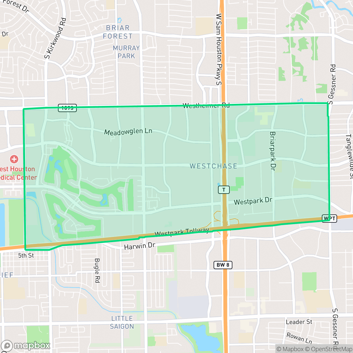
Westchase, Houston
Updated June 22, 2026 · 32,254 residents
Westchase is a dense, car-dependent suburban district defined by its mix of corporate headquarters, multi-family apartment complexes, and diverse international dining options. While the area offers convenient access to major thoroughfares like Beltway 8, residents experience limited privacy due to high housing density and significant traffic noise from surrounding arterials.
Key Highlights
About Westchase
The Westchase neighborhood and business district in western Houston originated in the 1950s when prominent oilman and Houston Colt .45s founder Robert E. Smith purchased vast tracts of local ranch land. Following Smith's death, the Westchase Corporation acquired 760 acres in 1973 to develop a master-planned corporate district. Early development was accelerated by the 1970s energy crisis, drawing major petroleum and technology firms like Chevron and Western Geophysical. The completion of Beltway 8 (the Sam Houston Tollway) in 1988 further fueled the area's rapid commercial growth. Officially designated as a management district by the Texas Legislature in 1995, Westchase has evolved into a major economic hub, hosting the headquarters of major corporations like BMC Software and Phillips 66 alongside residential subdivisions like Woodlake.
The area functions as a major commercial hub, blending high-density apartment living with sprawling office parks. The landscape is characterized by a dense suburban layout where large-scale commercial developments and multi-family housing complexes dominate the terrain. Residents benefit from a wide variety of international culinary options, particularly along major corridors, which provide a lively, albeit car-dependent, social environment. Green space is primarily found in the form of canal corridors and landscaped buffers along major roads, offering necessary relief from the surrounding concrete.
Prospective residents should consider the trade-offs regarding acoustic comfort and environmental factors. The neighborhood experiences consistent noise from high-traffic roads, and residents should be aware of the presence of nearby industrial sites, including a designated EPA Superfund location. While the area provides a central location in western Houston, walkability remains limited by large parking lots and high-speed intersections. The local school landscape is varied, as the area is served by districts experiencing significant operational and academic shifts. It is best suited for professionals and commuters who prioritize proximity to major employment centers over quiet, low-density residential living.
Neighborhood Scores Across 15 Qualities
Residential spacing ranges from dense, shared-wall apartment complexes to larger, detached homes with more significant buffers. This level of privacy is lower than the Houston city average due to the high concentration of closely packed multi-unit structures.
Sidewalks are widely available along residential streets and apartment complexes, though navigating the neighborhood can be difficult due to large parking lots and high-traffic arterial roads. This level of pedestrian connectivity is slightly below the Houston average.
Manicured estates and golf course frontage provide pockets of high-end scenery that sit slightly above the Houston average. This aesthetic contrast is paired with standard multi-family apartment complexes and industrial warehouses throughout the area.
Central canal corridors and manicured golf course fringes provide reliable walking routes for pets. Overall accessibility for dog owners is slightly below the Houston average due to frequent reliance on private yards or narrow roadside verges.
Predominantly suburban in character, this area features a mix of office parks, multi-family complexes, and residential tracts that feel slightly more open than the typical Houston landscape. Extensive commercial zones and large-scale developments create a landscape that is notably less dense than the city average.
Diverse dining and social hubs provide a lively atmosphere that is slightly more active than the Houston average. While certain pockets offer a mix of greenery and amenities, much of the area remains car-dependent due to the presence of industrial corridors and major highways.
A persistent hum from nearby busy thoroughfares defines the local soundscape. According to iHuus data, acoustic comfort in this area is slightly higher than the Houston average.
Air quality levels fluctuate between acceptable and unhealthy, posing occasional concerns for sensitive groups. According to iHuus data, the air quality in Westchase is slightly better than the Houston average.
Residential areas blend with active commercial zones and light industrial units, though proximity to a nearby EPA Superfund site may present environmental concerns regarding soil and groundwater. This level of industrial density is notably lower than the Houston average, according to iHuus data.
Health insurance accessibility is lower than the Houston average, according to iHuus data. Residents may find fewer options for local coverage compared to other parts of the city.
Political leanings in Westchase trend more liberal than the Houston average, according to iHuus data. Residents will find a moderate presence of opposing viewpoints within the community.
A balanced mix of young professionals, families, and older adults resides here, mirroring the broader age distribution found across Houston. According to iHuus data, no single age group dominates the local demographic.
Flood risk in this area is slightly higher than the Houston average. According to iHuus data, the lack of a detailed FEMA study means the specific level of risk for certain properties remains undetermined.
Block-Level Insights for Westchase

iHuus Neighborhood Intelligence Insights
Get block-level neighborhood insights for Westchase
- Street-level scores — see how individual blocks compare, not just neighborhood averages
- Micro-zone boundaries — identify quiet pockets, flood boundaries, and walkable clusters before you visit
- 15 dimensions in full — walkability, noise, air quality, school quality, insurance coverage, population age profile, urban/rural index, and more
- Boundary risk alerts — know if your address sits near a block boundary where scores drop, the kind of detail no listing will ever mention
- School insights — individual school ratings and insights, not just district-level data
- Compare before you commit — side-by-side data across neighborhoods, down to block precision
No credit card required
Compare with Any Neighborhood
| Dimension | Westchase | Acres Home |
|---|---|---|
| 🚶 Walkabilityavg 7.08 | ||
| 🔊 Acoustic Comfortavg 4.14 | ||
| 🤫 Privacy Indexavg 5.34 | ||
| 🎨 Visual Appealavg 6.42 | ||
| 🐕 Dog Friendlinessavg 6.33 | ||
| 🗺️ Urban-Rural Indexavg 6.64 | ||
| ✨ Neighborhood Vibeavg 4.4 | ||
| 🏥 Health Insurance Coverageavg 5.46 | ||
| 🌿 Air Qualityavg 3.58 | ||
| 🏭 Industrial Proximityavg 6.9 | ||
| 🌊 Flood Safetyavg 6.27 | ||
| 🗳️ Ideological Leanavg 6.39 | ||
| 👥 Population Age Profileavg 4.6 | ||
| 🔥 Fire Safety | ||
| 🏫 School Quality |
Westchase Rankings
School Districts Serving Westchase
Alief ISD is a district characterized by academic extremes and proactive financial management. It successfully maintains prestigious flagship high schools that rank among the best in Texas, yet struggles with a significant tail of low-performing elementary and middle schools that drag down the overall portfolio health. Strong leadership stability is evidenced by the successful passage of tax rate measures (VATRE) and a robust teacher incentive program that rewards over 550 high-performing educators. While the district's aggressive approach to teacher compensation and safety protocols demonstrates operational competence, the internal disparity in school quality and ongoing concerns regarding student discipline keep the district firmly in the stable but mixed category.
Schools
Houston ISD is a district in a state of extreme operational and political volatility, currently categorized by a state takeover and the loss of local community control. While the district maintains a collection of world-class magnet and high-performing schools that anchor its academic reputation, these are overshadowed by a 'Toxic' institutional environment characterized by a 33% teacher turnover rate, significant reliance on uncertified staff, and a steady 3.5% annual enrollment loss. Despite reports of rapid academic growth under the state-appointed leadership, the district's stability is undermined by intense community friction, school closures in underserved areas, and an organizational culture increasingly managed through high-stress compliance models, making it a high-risk entity for long-term consistency.
Schools
School Insights for Westchase
Below average outcomes; significant attendance and academic challenges.
School Insights
See what's really behind every school rating near Westchase
- Individual school ratings — each school's own score with outcome context, not just a district average
- Enrollment & class size data — student-to-teacher ratio and how it compares to the state average
- Full demographics breakdown — ethnicity and gender composition for every school in the enrollment zone
- Every school in the district — all schools within the enrollment boundary ranked by rating, not just the closest one
- Grade levels & benchmarks — elementary through high school, with below/above state-average flags
No credit card required