Northside-Northline, Houston
Updated June 22, 2026 · 67,215 residents
Northside-Northline is a dense, established Houston community defined by a grid of single-family homes and proximity to major logistics hubs. While the area offers access to several high-performing schools, it is characterized by limited walkability, significant industrial activity, and closely spaced housing that prioritizes density over privacy.
Key Highlights
About Northside-Northline
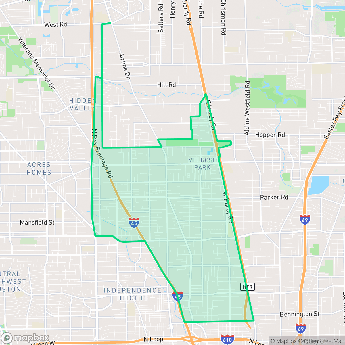
The Northside-Northline neighborhood in north-central Houston (designated as Super Neighborhood #45) developed rapidly following the construction of Interstate 45 (North Freeway) in the early 1960s, which spurred light industrial, retail, and residential growth. A central landmark of the community was the Northline Mall (originally Northline Shopping City), which opened in 1963 as one of Houston's first weather-controlled enclosed shopping centers. For decades, the mall served as a vital commercial and social hub for the area's predominantly working-class and Hispanic residents until its demolition in 2007 to make way for the open-air Northline Commons. The neighborhood's residential character is defined by established single-family homes built between 1940 and 1969, alongside local institutions like the METRO Northline Transit Center and the Houston Community College Northline Campus.
The area functions as a dense suburban-industrial hybrid, where residential grids intersect with significant commercial warehouses and logistics corridors. The landscape is dominated by modest, closely packed single-family homes and apartment complexes, creating a high-density environment with limited private outdoor space. Residents benefit from proximity to key transit infrastructure, including the METRO Northline Transit Center, which helps mitigate the challenges of a car-dependent layout. The neighborhood maintains a distinct local identity through its diverse dining scene and established community institutions, though the presence of large-scale industrial storage and heavy truck traffic remains a central feature of the local environment.
Prospective residents should consider the trade-offs of living in an area where industrial proximity and noise levels are higher than the city average. While the neighborhood features several top-rated public schools, such as Burbank Middle and North Houston Early College High School, the overall walkability remains low due to fragmented sidewalks and busy arterial roads. The area is best suited for those who prioritize proximity to major transit arteries and value the established, tight-knit residential character over expansive green space or quiet, low-density living.
Neighborhood Scores Across 15 Qualities
Residential spacing varies from closely packed apartment clusters to detached homes on narrow lots. According to iHuus data, this level of density provides slightly more separation between structures than the Houston average.
Walking through the area is challenging due to a disconnected sidewalk network and major highway barriers. While residential streets are generally quiet, many paths are interrupted by drainage ditches or lack dedicated pavement, making the area significantly less walkable than the Houston average.
Uniform tract housing and dense apartment complexes define the landscape, which lacks the lush greenery and luxury amenities found in much of Houston. The area features small yards, simple rooflines, and minimal private outdoor features according to iHuus data.
Most greenery in this area is enclosed within private fenced yards, which offers fewer opportunities for off-leash activity compared to the Houston average. Publicly accessible parks and wide grassy verges for walking are sparse throughout the neighborhood.
A landscape of low-rise residential streets sits alongside significant industrial warehouses and major highway corridors. This mix of suburban housing and heavy infrastructure is consistent with the typical urban-rural balance found across Houston.
Low-density industrial and suburban blocks define the area, offering a calm atmosphere with scattered dining and services. Most daily needs require a vehicle, as the layout is largely car-dependent with limited walkable amenities compared to the city average.
Local traffic from nearby busy streets creates a consistent level of noise that is slightly higher than the Houston average, according to iHuus data.
Frequent unhealthy air quality levels pose a significant risk to sensitive groups. According to iHuus data, air quality in this area is consistent with the city average.
Frequent truck traffic and noise from nearby logistics hubs, warehouses, and salvage yards are more prevalent here than in the city average. Residents may encounter significant heavy vehicle activity and industrial dust due to the proximity of distribution centers and large-scale storage facilities.
Health insurance access is significantly lower than the Houston average. Residents may face greater challenges accessing employer-sponsored or private medical coverage according to iHuus data.
Political leanings in this area are more liberal than the Houston average, characterized by a liberal majority with a modest opposing presence according to iHuus data.
Residents live alongside a balanced mix of young adults, families, and seniors. This demographic distribution is roughly in line with the broader Houston area according to iHuus data.
Residual flood risk exists within this area as it sits within a 500-year floodplain. According to iHuus data, the safety level is roughly comparable to the Houston average.
Block-Level Insights for Northside-Northline

iHuus Neighborhood Intelligence Insights
Get block-level neighborhood insights for Northside-Northline
- Street-level scores — see how individual blocks compare, not just neighborhood averages
- Micro-zone boundaries — identify quiet pockets, flood boundaries, and walkable clusters before you visit
- 15 dimensions in full — walkability, noise, air quality, school quality, insurance coverage, population age profile, urban/rural index, and more
- Boundary risk alerts — know if your address sits near a block boundary where scores drop, the kind of detail no listing will ever mention
- School insights — individual school ratings and insights, not just district-level data
- Compare before you commit — side-by-side data across neighborhoods, down to block precision
No credit card required
Compare with Any Neighborhood
| Dimension | Northside-Northline | Acres Home |
|---|---|---|
| 🚶 Walkabilityavg 7.08 | ||
| 🔊 Acoustic Comfortavg 4.14 | ||
| 🤫 Privacy Indexavg 5.34 | ||
| 🎨 Visual Appealavg 6.42 | ||
| 🐕 Dog Friendlinessavg 6.33 | ||
| 🗺️ Urban-Rural Indexavg 6.64 | ||
| ✨ Neighborhood Vibeavg 4.4 | ||
| 🏥 Health Insurance Coverageavg 5.46 | ||
| 🌿 Air Qualityavg 3.58 | ||
| 🏭 Industrial Proximityavg 6.9 | ||
| 🌊 Flood Safetyavg 6.27 | ||
| 🗳️ Ideological Leanavg 6.39 | ||
| 👥 Population Age Profileavg 4.6 | ||
| 🔥 Fire Safety | ||
| 🏫 School Quality |
Northside-Northline Rankings
School Districts Serving Northside-Northline
Aldine ISD is a district in transition, characterized by a high-performing portfolio of specialized choice schools and high schools contrasted with deep academic struggles in its traditional middle school feeders. While ground truth data shows several campuses at 2/10 and 4/10 proficiency levels, the district's operational health is stabilized by proactive teacher retention strategies, successful bond-funded modernization, and expanding dual-enrollment partnerships. Leadership is effectively leveraging 'Choice Schools' as a driver for excellence, though the gap between these elite programs and neighborhood schools remains the primary barrier to 'Blue Chip' status.
Schools
Houston ISD is a district in a state of extreme operational and political volatility, currently categorized by a state takeover and the loss of local community control. While the district maintains a collection of world-class magnet and high-performing schools that anchor its academic reputation, these are overshadowed by a 'Toxic' institutional environment characterized by a 33% teacher turnover rate, significant reliance on uncertified staff, and a steady 3.5% annual enrollment loss. Despite reports of rapid academic growth under the state-appointed leadership, the district's stability is undermined by intense community friction, school closures in underserved areas, and an organizational culture increasingly managed through high-stress compliance models, making it a high-risk entity for long-term consistency.
Schools
School Insights for Northside-Northline
Below average outcomes; significant attendance and academic challenges.
School Insights
See what's really behind every school rating near Northside-Northline
- Individual school ratings — each school's own score with outcome context, not just a district average
- Enrollment & class size data — student-to-teacher ratio and how it compares to the state average
- Full demographics breakdown — ethnicity and gender composition for every school in the enrollment zone
- Every school in the district — all schools within the enrollment boundary ranked by rating, not just the closest one
- Grade levels & benchmarks — elementary through high school, with below/above state-average flags
No credit card required