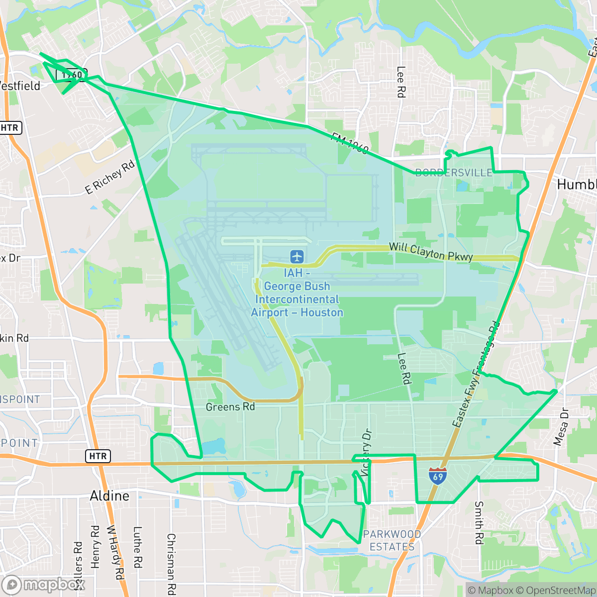
Iah - Airport Area, Houston
Updated June 22, 2026 · 15,843 residents
The IAH Airport Area is a sprawling industrial and transportation hub defined by its proximity to George Bush Intercontinental Airport and extensive logistics operations. While the landscape offers significant open space and wooded tracts, residents face high noise levels from aviation and road traffic, alongside limited walkability.
Key Highlights
About Iah - Airport Area
The Iah - Airport Area neighborhood in north Houston, designated as Super Neighborhood 42, developed around George Bush Intercontinental Airport. In the late 1950s, a group of local businessmen operating as the Jetero Ranch Company quietly acquired the heavily wooded land to preserve it for future aviation use, selling it to the city at cost. The airport officially opened in 1969. Historically, the surrounding residential areas began as rural homesites. This includes Bordersville, a historic African American community that was eventually annexed by Houston. Today, the neighborhood is defined by a mix of these historic residential pockets, undeveloped land, and major commercial employment hubs like the World Houston and Interwood business parks.
This neighborhood functions primarily as a critical logistics and transit corridor for the Houston region, characterized by massive warehouse footprints, expansive paved surfaces, and the constant activity of a major international airport. The area maintains a low-density, industrial-rural fringe feel, where large-scale aviation infrastructure and freight corridors sit adjacent to isolated residential pockets and dense forest buffers. While the environment is dominated by grey infrastructure and heavy machinery, it provides essential access to major highways, making it a functional, albeit car-dependent, base for those working within the regional supply chain or aviation sectors.
Living in this area requires navigating significant trade-offs, particularly regarding acoustic comfort and air quality due to the heavy presence of jet traffic and semi-truck logistics. The neighborhood lacks the traditional amenities and pedestrian-friendly streets found in more central urban districts, offering a quiet, remote atmosphere with minimal local commercial activity. It is best suited for individuals who prioritize proximity to major employment hubs and industrial facilities over traditional suburban walkability or a vibrant nightlife scene.
Neighborhood Scores Across 15 Qualities
Residential spacing varies from dense apartment blocks to suburban layouts with moderate buffers between neighbors. According to iHuus data, the level of separation between homes is slightly higher than the Houston average.
Low traffic on residential streets provides opportunities for walking, though some areas feature disconnected paths and heavy highway infrastructure. According to iHuus data, the ability to navigate the area on foot is below the Houston average.
Standard tract housing and high-density apartment complexes characterize the landscape, which offers less visual variety than the Houston average. According to iHuus data, the area features repetitive roof geometries and small, tidy yards.
Walking options for dogs vary significantly, with some areas featuring expansive forest trails and green buffers while other parts are dominated by high-traffic highways and large asphalt lots. According to iHuus data, the availability of accessible green space for pets is below the Houston average.
A mix of expansive airfield infrastructure, dense woodland, and large-scale industrial warehouses creates a landscape that is slightly more open and less dense than the Houston average. Residents will find significant patches of forest and undeveloped land interspersed with heavy logistics and aviation hubs.
Limited social activity and a heavy industrial presence create a subdued atmosphere. Most daily needs require a vehicle, as local dining and services are sparse compared to the Houston average.
Frequent noise from nearby busy streets creates a consistent background hum. This level of acoustic activity is roughly comparable to the city average.
Frequent unhealthy air quality levels present significant risks to sensitive groups. According to iHuus data, the air quality in this area is notably worse than the Houston average.
Frequent noise and heavy traffic from airport operations, large-scale warehouses, and semi-truck docking are prevalent throughout the area. This level of industrial presence is notably higher than the Houston average.
Health insurance accessibility is slightly below the Houston average. According to iHuus data, fewer residents in this area have coverage compared to the rest of the city.
Political leanings in this area trend significantly more liberal than the Houston average, according to iHuus data.
Residents encounter a varied demographic mix of young professionals, families, and seniors. This age distribution is slightly more concentrated in specific age brackets compared to the broader Houston area, according to iHuus data.
Flood risk in this area remains difficult to determine because a detailed federal study has not yet been completed. According to iHuus data, the potential for flooding is slightly higher than the Houston average.
Block-Level Insights for Iah - Airport Area

iHuus Neighborhood Intelligence Insights
Get block-level neighborhood insights for Iah - Airport Area
- Street-level scores — see how individual blocks compare, not just neighborhood averages
- Micro-zone boundaries — identify quiet pockets, flood boundaries, and walkable clusters before you visit
- 15 dimensions in full — walkability, noise, air quality, school quality, insurance coverage, population age profile, urban/rural index, and more
- Boundary risk alerts — know if your address sits near a block boundary where scores drop, the kind of detail no listing will ever mention
- School insights — individual school ratings and insights, not just district-level data
- Compare before you commit — side-by-side data across neighborhoods, down to block precision
No credit card required
Compare with Any Neighborhood
| Dimension | Iah - Airport Area | Acres Home |
|---|---|---|
| 🚶 Walkabilityavg 7.08 | ||
| 🔊 Acoustic Comfortavg 4.14 | ||
| 🤫 Privacy Indexavg 5.34 | ||
| 🎨 Visual Appealavg 6.42 | ||
| 🐕 Dog Friendlinessavg 6.33 | ||
| 🗺️ Urban-Rural Indexavg 6.64 | ||
| ✨ Neighborhood Vibeavg 4.4 | ||
| 🏥 Health Insurance Coverageavg 5.46 | ||
| 🌿 Air Qualityavg 3.58 | ||
| 🏭 Industrial Proximityavg 6.9 | ||
| 🌊 Flood Safetyavg 6.27 | ||
| 🗳️ Ideological Leanavg 6.39 | ||
| 👥 Population Age Profileavg 4.6 | ||
| 🔥 Fire Safety | ||
| 🏫 School Quality |
Iah - Airport Area Rankings
School Districts Serving Iah - Airport Area
Aldine ISD is a district in transition, characterized by a high-performing portfolio of specialized choice schools and high schools contrasted with deep academic struggles in its traditional middle school feeders. While ground truth data shows several campuses at 2/10 and 4/10 proficiency levels, the district's operational health is stabilized by proactive teacher retention strategies, successful bond-funded modernization, and expanding dual-enrollment partnerships. Leadership is effectively leveraging 'Choice Schools' as a driver for excellence, though the gap between these elite programs and neighborhood schools remains the primary barrier to 'Blue Chip' status.
Schools
Humble Independent School District is a high-performing but increasingly polarized district, currently characterized by a sharp divide between its elite Kingwood-area campuses and its lower-performing facilities in the Humble proper area. While the district maintains prestigious academic markers, including National Merit finalists and top-tier CTE programs, it is currently grappling with significant governance challenges, including board-level drama, skyrocketing legal fees, and teacher burnout due to stagnant wages. Although community support for extracurriculars and individual educators remains high, the administrative instability and emerging financial constraints place the district in a state of transition that offsets its historical academic strength.
Schools
School Insights for Iah - Airport Area
Below average outcomes; significant attendance and academic challenges.
School Insights
See what's really behind every school rating near Iah - Airport Area
- Individual school ratings — each school's own score with outcome context, not just a district average
- Enrollment & class size data — student-to-teacher ratio and how it compares to the state average
- Full demographics breakdown — ethnicity and gender composition for every school in the enrollment zone
- Every school in the district — all schools within the enrollment boundary ranked by rating, not just the closest one
- Grade levels & benchmarks — elementary through high school, with below/above state-average flags
No credit card required