Eastex - Jensen Area, Houston
Updated June 22, 2026 · 35,793 residents
The Eastex - Jensen Area is a working-class community defined by its proximity to major industrial corridors and transport infrastructure. While residents benefit from a quiet, suburban atmosphere and accessible green spaces, the area is largely car-dependent and features a mix of residential blocks and active commercial warehouses.
Key Highlights
About Eastex - Jensen Area
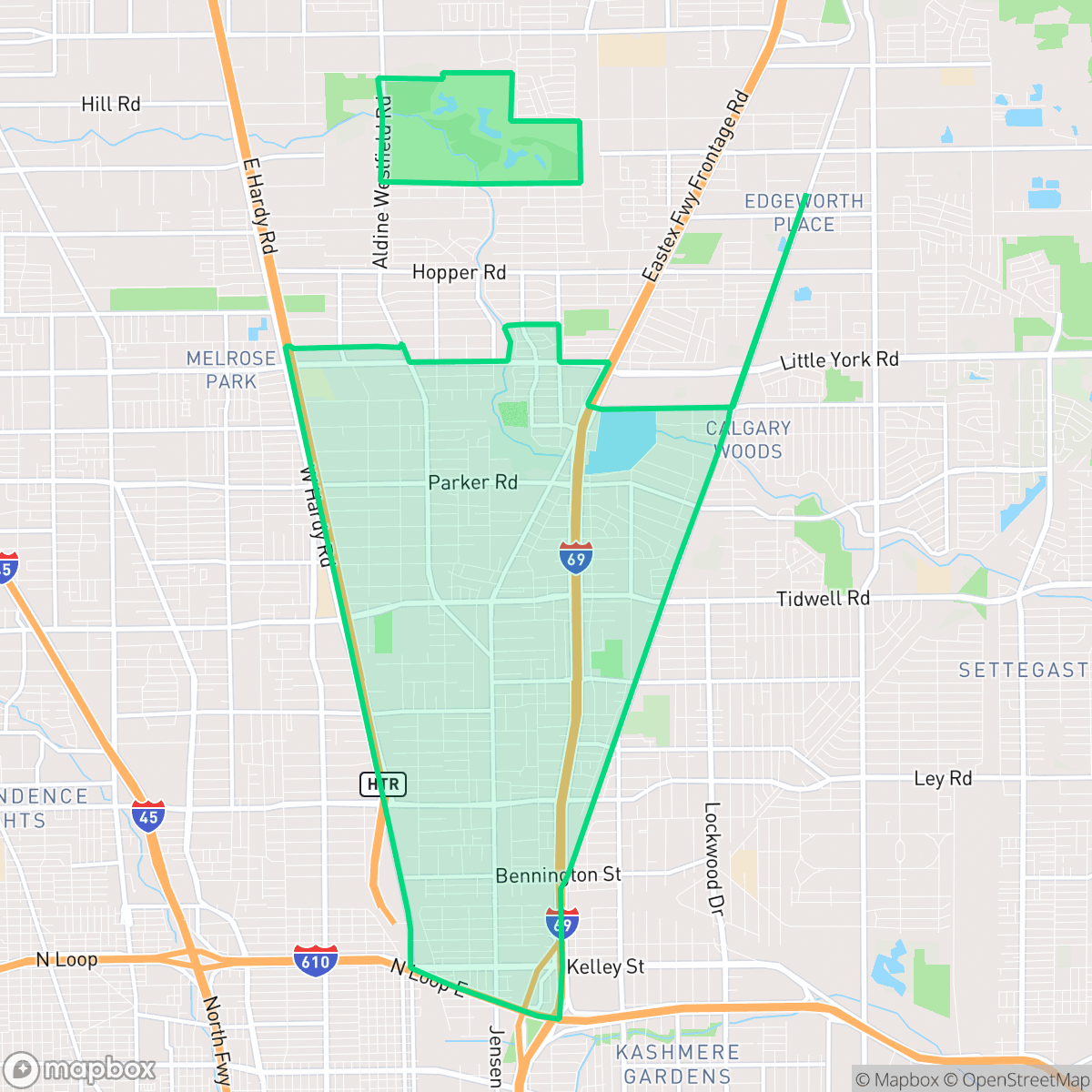
Located in northeast Houston outside the North Loop, the Eastex - Jensen Area is defined by its historic transportation corridors and natural pine forests. Originally, Jensen Drive served as the primary highway connecting Houston to East Texas until it was superseded by the construction of the Eastex Freeway (U.S. Route 59). The neighborhood is characterized by a residential landscape of modest frame homes, many of which were built between 1940 and 1969. Subdivisions within the area include Huntington Place, Croyden Gardens, and Epsom Downs—the latter of which holds local historical significance as the site of a popular horse racing track during the 1930s. Today, the neighborhood maintains a strong working-class identity, with a large portion of its residents employed in manufacturing and labor sectors.
The neighborhood functions as a dense suburban grid that blends residential life with significant industrial and logistical operations. It is characterized by a quiet, low-density environment where modest homes sit alongside warehouses and transport routes. While the area offers functional green spaces for outdoor activity, the streetscape remains primarily utilitarian, with limited walkable retail options beyond local eateries and community services.
Prospective residents should note that the area is heavily car-oriented, as daily errands often require navigating the surrounding industrial zones. While the community provides a stable, quiet setting, the proximity to freight corridors and industrial facilities impacts air quality and noise levels. The neighborhood is best suited for those prioritizing affordability and proximity to employment centers over high-density urban amenities or walkability.
Neighborhood Scores Across 15 Qualities
Residential structures are generally detached with some buffer between neighbors, providing slightly more privacy than the Houston average. According to iHuus data, lot sizes vary between closely packed houses and more standard spacing.
Predictable, low-traffic streets allow for some movement on foot, but a lack of consistent sidewalks makes walking less accessible than in many other parts of Houston. According to iHuus data, the network of pedestrian paths is highly irregular and often absent on major local roads.
Simple, high-density housing and small yards characterize the area. The visual environment appears less manicured than the Houston average, with many properties featuring unpaved patches and basic rooflines.
Large forested parks and drainage greenbelts offer substantial walking space, though many residential streets lack wide grassy verges. Overall pet accessibility is lower than the Houston average due to fragmented greenery along neighborhood sidewalks.
A blend of residential pockets and open land characterizes this area, offering more natural space and woodland than the typical Houston urban landscape. According to iHuus data, the neighborhood features a higher degree of open land and scattered greenery compared to the city average.
Limited social activity and a prevalence of light industrial units create a subdued atmosphere. Most daily errands and dining options require a vehicle, as the area lacks the concentrated foot traffic found in more active parts of the city.
Local traffic from nearby busy streets creates a consistent level of ambient noise. This level of acoustic activity is slightly higher than the Houston average, according to iHuus data.
Frequent unhealthy air quality levels pose a significant risk to sensitive groups. According to iHuus data, air quality in this area is notably worse than the Houston average.
Active warehouse hubs, rail lines, and utility facilities create a landscape of mixed-use development that contains more industrial activity than the Houston average. Residents should be aware of the presence of a nearby EPA Superfund site and the potential for increased truck traffic and noise from logistics centers.
Health insurance accessibility is significantly lower than the Houston average, according to iHuus data. Residents may face greater challenges accessing medical services due to this lack of coverage.
Political leanings in this area trend significantly more liberal than the Houston average. According to iHuus data, the community maintains a liberal majority with a modest opposing presence.
Residents live alongside a diverse range of age groups, including young adults, families, and older individuals. This demographic distribution is slightly below the Houston average, according to iHuus data.
Flood risk levels are currently difficult to determine because a detailed federal study has not yet been completed for this area. According to iHuus data, the level of safety from flooding is lower than the Houston average.
Block-Level Insights for Eastex - Jensen Area

iHuus Neighborhood Intelligence Insights
Get block-level neighborhood insights for Eastex - Jensen Area
- Street-level scores — see how individual blocks compare, not just neighborhood averages
- Micro-zone boundaries — identify quiet pockets, flood boundaries, and walkable clusters before you visit
- 15 dimensions in full — walkability, noise, air quality, school quality, insurance coverage, population age profile, urban/rural index, and more
- Boundary risk alerts — know if your address sits near a block boundary where scores drop, the kind of detail no listing will ever mention
- School insights — individual school ratings and insights, not just district-level data
- Compare before you commit — side-by-side data across neighborhoods, down to block precision
No credit card required
Compare with Any Neighborhood
| Dimension | Eastex - Jensen Area | Acres Home |
|---|---|---|
| 🚶 Walkabilityavg 7.08 | ||
| 🔊 Acoustic Comfortavg 4.14 | ||
| 🤫 Privacy Indexavg 5.34 | ||
| 🎨 Visual Appealavg 6.42 | ||
| 🐕 Dog Friendlinessavg 6.33 | ||
| 🗺️ Urban-Rural Indexavg 6.64 | ||
| ✨ Neighborhood Vibeavg 4.4 | ||
| 🏥 Health Insurance Coverageavg 5.46 | ||
| 🌿 Air Qualityavg 3.58 | ||
| 🏭 Industrial Proximityavg 6.9 | ||
| 🌊 Flood Safetyavg 6.27 | ||
| 🗳️ Ideological Leanavg 6.39 | ||
| 👥 Population Age Profileavg 4.6 | ||
| 🔥 Fire Safety | ||
| 🏫 School Quality |
Eastex - Jensen Area Rankings
School Districts Serving Eastex - Jensen Area
Aldine ISD is a district in transition, characterized by a high-performing portfolio of specialized choice schools and high schools contrasted with deep academic struggles in its traditional middle school feeders. While ground truth data shows several campuses at 2/10 and 4/10 proficiency levels, the district's operational health is stabilized by proactive teacher retention strategies, successful bond-funded modernization, and expanding dual-enrollment partnerships. Leadership is effectively leveraging 'Choice Schools' as a driver for excellence, though the gap between these elite programs and neighborhood schools remains the primary barrier to 'Blue Chip' status.
Schools
Houston ISD is a district in a state of extreme operational and political volatility, currently categorized by a state takeover and the loss of local community control. While the district maintains a collection of world-class magnet and high-performing schools that anchor its academic reputation, these are overshadowed by a 'Toxic' institutional environment characterized by a 33% teacher turnover rate, significant reliance on uncertified staff, and a steady 3.5% annual enrollment loss. Despite reports of rapid academic growth under the state-appointed leadership, the district's stability is undermined by intense community friction, school closures in underserved areas, and an organizational culture increasingly managed through high-stress compliance models, making it a high-risk entity for long-term consistency.
Schools
School Insights for Eastex - Jensen Area
Below average outcomes; significant attendance and academic challenges.
School Insights
See what's really behind every school rating near Eastex - Jensen Area
- Individual school ratings — each school's own score with outcome context, not just a district average
- Enrollment & class size data — student-to-teacher ratio and how it compares to the state average
- Full demographics breakdown — ethnicity and gender composition for every school in the enrollment zone
- Every school in the district — all schools within the enrollment boundary ranked by rating, not just the closest one
- Grade levels & benchmarks — elementary through high school, with below/above state-average flags
No credit card required