Central Business District, Oakland Park
Updated · 1,568 residents
The Central Business District serves as a vibrant hub for Oakland Park, blending historic roots with a growing Culinary Arts District. While the area offers an energetic atmosphere and diverse local amenities, residents should expect consistent traffic noise and a landscape that mixes residential blocks with light industrial activity.
Key Highlights
About Central Business District
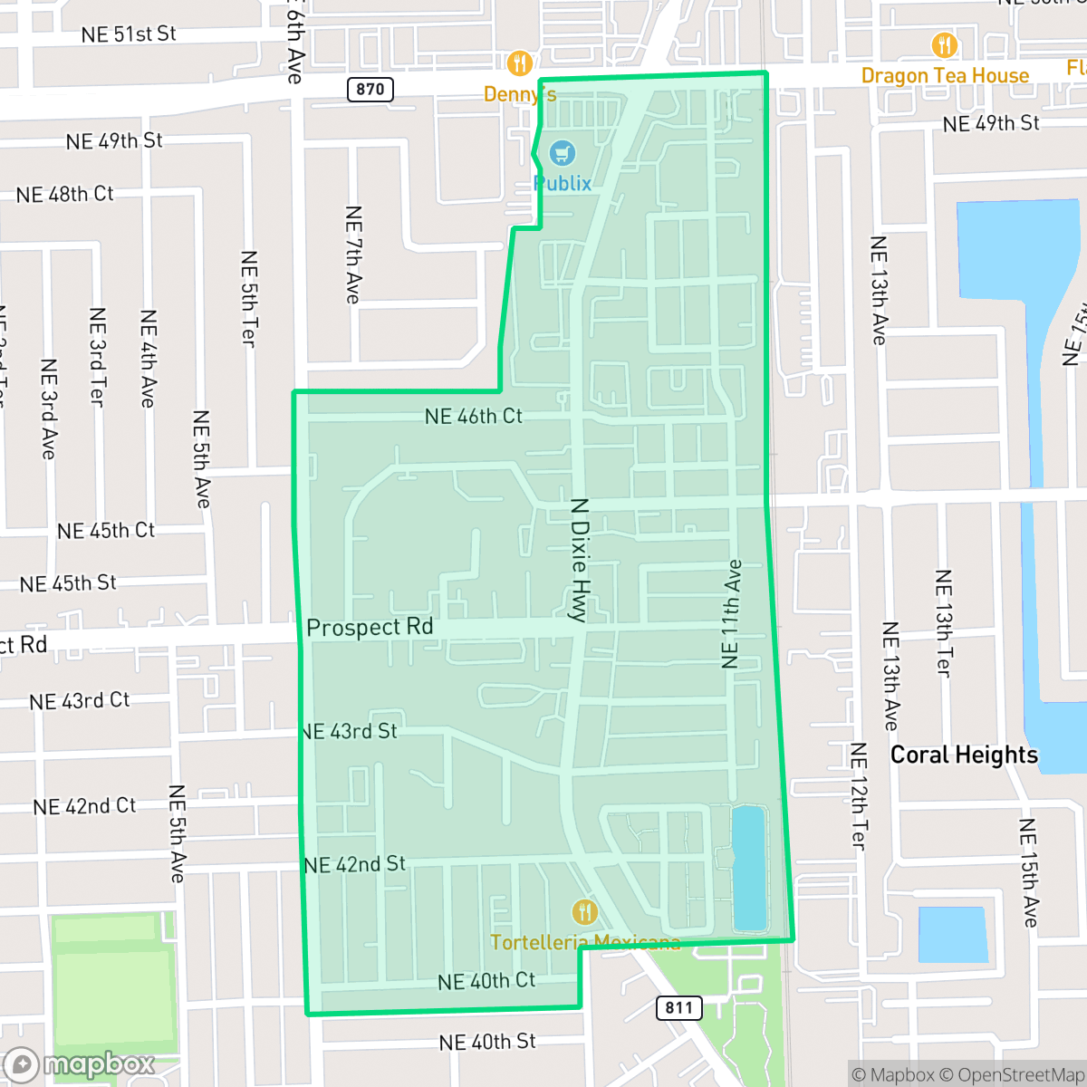
The Central Business District of Oakland Park, historically centered around the intersection of NE 12th Avenue and Oakland Park Boulevard, serves as the city's original commercial core. Established following the city’s incorporation in 1929, the area was once the primary hub for the region’s agricultural economy, facilitating the shipping of local produce via the Florida East Coast Railway. While much of the original architectural fabric has evolved through modern redevelopment, the district remains defined by its role as the city’s civic and commercial center. Recent urban revitalization efforts, including the development of the Culinary Arts District, have sought to transform this historic corridor into a contemporary destination while preserving its identity as the traditional heart of the Oakland Park community.
This neighborhood functions as the primary commercial center of the city, characterized by a dense suburban environment that supports a wide range of dining and wellness businesses. The area attracts a diverse demographic, ranging from young professionals to long-term residents, who benefit from the proximity to local services and the evolving culinary scene. Its central location provides an accessible, high-energy environment that serves as a focal point for community life.
Living in this district involves specific trade-offs, particularly regarding environmental and infrastructure factors. The neighborhood is situated within a designated floodplain, necessitating awareness of flood risks for prospective residents. Additionally, the presence of light industrial warehouses contributes to a steady hum of traffic noise and occasional heavy vehicle activity. While the area offers moderate walkability, the pedestrian experience is sometimes constrained by industrial zones and limited sidewalk infrastructure. The local schools fall under the Broward County School District, which is currently navigating a period of significant structural and budgetary transition.
Neighborhood Scores Across 15 Qualities
Residential spacing varies between closely packed townhomes with shared walls and single-family homes with small yards. According to iHuus data, privacy levels are roughly in line with the city average.
Quiet residential streets allow for walking, though many roads lack dedicated sidewalks. According to iHuus data, the overall pedestrian accessibility is slightly lower than the city average due to industrial zones and traffic friction from warehouse districts.
Visual variety in this area consists of typical tract housing, multi-family complexes, and light industrial buildings. According to iHuus data, the aesthetic landscape is slightly less lush than the Oakland Park city average.
Public park access and central green spaces provide reliable walking areas, even though narrow sidewalk verges are common in industrial zones. According to iHuus data, opportunities for pet activity in this area are consistent with the city average.
This area features a dense suburban environment with a mix of single-family homes, multi-story apartments, and light industrial blocks. The landscape aligns with the city average for semi-rural development, characterized by a blend of residential pockets and commercial strips.
High business density and a diverse range of dining and wellness amenities create a more energetic atmosphere than the Oakland Park average. According to iHuus data, this area functions as a local hotspot where suburban residential blocks blend with active commercial corridors.
Steady hum from nearby busy streets characterizes the area, though acoustic levels remain notably higher than the city average. Residents can expect consistent ambient sound from local transit patterns.
Air quality levels in this area are consistent with the city average, presenting a mix of acceptable and unhealthy days that may cause occasional concern for sensitive groups.
Light industrial warehouses and logistics sites on the western side contribute to notable truck traffic and noise. According to iHuus data, this level of industrial activity is roughly in line with the city average.
Health insurance enrollment levels in this area are lower than the Oakland Park average, according to iHuus data.
Political leanings in this area align closely with the broader Oakland Park community, featuring a liberal majority with a small conservative presence. According to iHuus data, the ideological landscape here is very similar to the city average.
Residents experience a relatively even distribution of age groups, ranging from young professionals to older adults. This demographic spread is slightly less varied than the average across Oakland Park.
Frequent flooding risks exist due to the area being located within a designated floodplain; this represents a higher vulnerability than most parts of Oakland Park according to iHuus data.
Address-Level Insights for Central Business District


iHuus Neighborhood Intelligence Insights
Get address-level neighborhood insights for Central Business District
- Street-level scores — see how individual blocks compare, not just neighborhood averages
- Micro-zone boundaries — identify quiet pockets, flood boundaries, and walkable clusters before you visit
- 15 dimensions in full — walkability, noise, air quality, school quality, insurance coverage, population age profile, urban/rural index, and more
- Boundary risk alerts — know if your address sits near a block boundary where scores drop, the kind of detail no listing will ever mention
- School insights — individual school ratings and insights, not just district-level data
- Compare before you commit — side-by-side data across neighborhoods, down to block precision
No credit card required
Compare with Any Neighborhood
| Dimension | Central Business District | Andrews Gardens |
|---|---|---|
| 🚶 Walkabilityavg 6.86 | ||
| 🔊 Acoustic Comfortavg 3.24 | ||
| 🤫 Privacy Indexavg 5.54 | ||
| 🎨 Visual Appealavg 6.36 | ||
| 🐕 Dog Friendlinessavg 5.18 | ||
| 🗺️ Urban-Rural Indexavg 6.55 | ||
| ✨ Neighborhood Vibeavg 4.88 | ||
| 🏥 Health Insurance Coverageavg 5.61 | ||
| 🌿 Air Qualityavg 6.04 | ||
| 🏭 Industrial Proximityavg 6.08 | ||
| 🌊 Flood Safetyavg 3.7 | ||
| 🗳️ Ideological Leanavg 8.11 | ||
| 👥 Population Age Profileavg 5.13 | ||
| 🔥 Fire Safety | ||
| 🏫 School Quality |
Central Business District Rankings
School Districts Serving Central Business District
School Insights for Central Business District
Below average outcomes; significant attendance and academic challenges.
School Insights
See what's really behind every school rating near Central Business District
- Individual school ratings — each school's own score with outcome context, not just a district average
- Enrollment & class size data — student-to-teacher ratio and how it compares to the state average
- Full demographics breakdown — ethnicity and gender composition for every school in the enrollment zone
- Every school in the district — all schools within the enrollment boundary ranked by rating, not just the closest one
- Grade levels & benchmarks — elementary through high school, with below/above state-average flags
No credit card required