Port of Miami - Dodge Island, Miami
Updated · 239 residents
Dodge Island serves as the primary hub for global cruise and cargo operations, defined by its dense, high-rise residential landscape and polished waterfront views. While the area offers a unique maritime aesthetic, it functions primarily as a transit-oriented industrial zone with limited pedestrian infrastructure and constant traffic activity.
Key Highlights
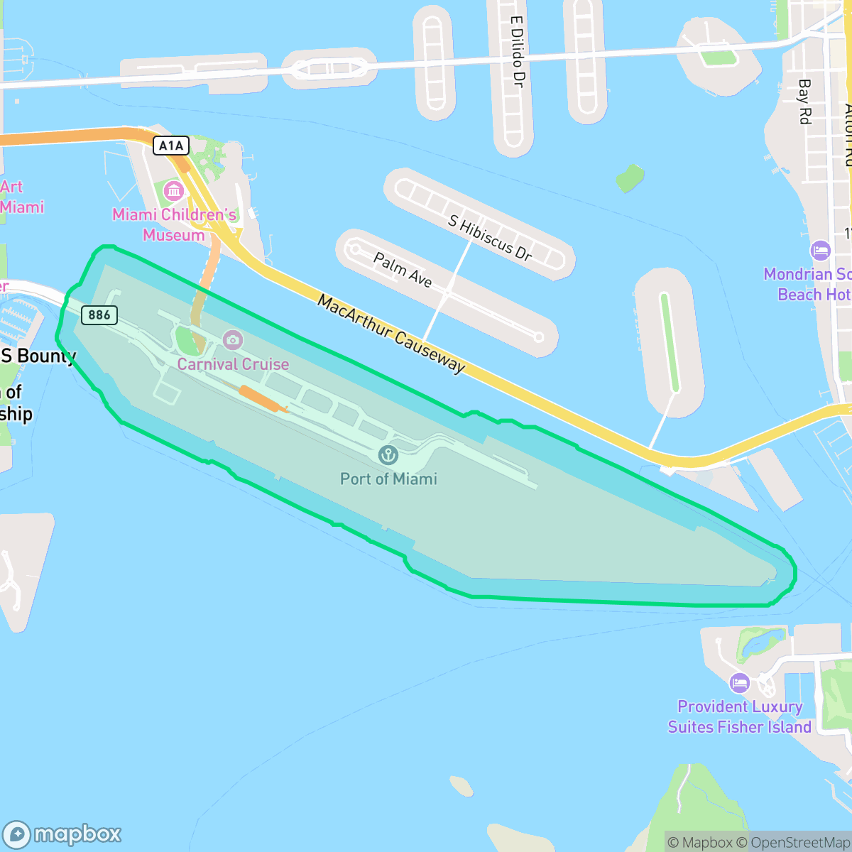
About Port of Miami - Dodge Island
Dodge Island is an artificial island in Biscayne Bay that serves as the primary landmass for PortMiami. Originally formed from spoil disposal during the early 20th-century dredging of Government Cut, the island was largely undeveloped until the 1960s. In 1960, Dade County and the City of Miami approved plans to relocate port operations from the Miami River to a modern facility on Dodge Island. This project involved connecting Dodge, Lummus, and Sam’s Islands into a unified 520-acre site. The new port officially began freight operations in 1964 and expanded significantly in 1979 to establish a major container terminal. Today, it is globally recognized as the 'Cruise Capital of the World' and the 'Cargo Gateway of the Americas,' connected to the mainland via Port Boulevard and the PortMiami Tunnel.
The area functions as a specialized maritime enclave, characterized by its high-density residential towers and proximity to large-scale logistics operations. The visual environment is defined by luxury high-rises and expansive views of Biscayne Bay, creating a distinct aesthetic that contrasts with the surrounding industrial activity. According to iHuus data, the neighborhood maintains a conservative political leaning and is primarily populated by young adults, reflecting a transient and functional demographic rather than a traditional residential community. Residents face significant trade-offs, including poor air quality and a high risk of flooding due to the island's location. The neighborhood is highly car-dependent, as limited sidewalk infrastructure restricts walkability, and the presence of heavy port logistics contributes to persistent traffic noise. While the waterfront setting is visually appealing, the lack of open green space and pet-friendly areas, combined with lower rates of health insurance coverage, makes this location better suited for those prioritizing proximity to the port or maritime work over traditional suburban amenities.
Neighborhood Scores Across 15 Qualities
Buildings and residential towers are situated in very close proximity with shared walls or narrow gaps. This level of density is notably higher than the average seen across Miami.
Pedestrian movement is restricted by a lack of sidewalks in many areas, making it significantly less walkable than the Miami average. While some waterfront promenades offer pleasant paths, most streets are not designed for foot traffic.
Luxury high-rises and expensive yachts create a polished waterfront aesthetic that sits slightly above the city average. According to iHuus data, the visual landscape is defined by upscale amenities and premium maritime views.
Dense urban infrastructure and extensive paved surfaces limit opportunities for off-leash exercise. While waterfront paths provide some access to greenery, the area offers fewer open grassy areas than most of Miami.
Densely packed high-rise structures and significant building density characterize this area, making it much more urban than the Miami average. According to iHuus data, the landscape consists primarily of tall towers with very little open land or greenery.
Activity levels in this area are notably lower than the city average, as much of the landscape is characterized by subdued suburban stretches and car-dependent enclaves. While some coastal pockets near transit hubs offer dining and nightlife, the neighborhood generally lacks dense commercial activity.
Steady traffic sounds from adjacent busy streets are common in this area. This level of acoustic activity is higher than the average found throughout Miami.
Frequent unhealthy air quality levels pose significant risks to sensitive groups. According to iHuus data, the atmosphere in this area is notably worse than the Miami average.
A blend of commercial services and port-related logistics creates a landscape with more industrial activity than the Miami average. Residents may experience intermittent noise from warehouses and large-scale maritime operations alongside local businesses.
Health insurance access is significantly lower than the Miami average. According to iHuus data, a small majority of the local population lacks medical coverage.
Political trends in this area lean more conservative than the broader Miami average. According to iHuus data, the neighborhood maintains a conservative majority with a small opposing presence.
A small majority of the population consists of young adults, with a noticeably lower presence of families and seniors compared to the city average. According to iHuus data, this area lacks the demographic diversity of older age groups found elsewhere in Miami.
Significant flood risk exists due to the area's location within a designated floodplain. According to iHuus data, this level of vulnerability is notably higher than the average for Miami.
Address-Level Insights for Port of Miami - Dodge Island


iHuus Neighborhood Intelligence Insights
Get address-level neighborhood insights for Port of Miami - Dodge Island
- Street-level scores — see how individual blocks compare, not just neighborhood averages
- Micro-zone boundaries — identify quiet pockets, flood boundaries, and walkable clusters before you visit
- 15 dimensions in full — walkability, noise, air quality, school quality, insurance coverage, population age profile, urban/rural index, and more
- Boundary risk alerts — know if your address sits near a block boundary where scores drop, the kind of detail no listing will ever mention
- School insights — individual school ratings and insights, not just district-level data
- Compare before you commit — side-by-side data across neighborhoods, down to block precision
No credit card required
Compare with Any Neighborhood
| Dimension | Port of Miami - Dodge Island | Alameda - West Flagler |
|---|---|---|
| 🚶 Walkabilityavg 6.81 | ||
| 🔊 Acoustic Comfortavg 3.72 | ||
| 🤫 Privacy Indexavg 4.25 | ||
| 🎨 Visual Appealavg 6.05 | ||
| 🐕 Dog Friendlinessavg 4.71 | ||
| 🗺️ Urban-Rural Indexavg 5.07 | ||
| ✨ Neighborhood Vibeavg 4.83 | ||
| 🏥 Health Insurance Coverageavg 4.76 | ||
| 🌿 Air Qualityavg 3.78 | ||
| 🏭 Industrial Proximityavg 6.31 | ||
| 🌊 Flood Safetyavg 3.97 | ||
| 🗳️ Ideological Leanavg 4.66 | ||
| 👥 Population Age Profileavg 4.38 | ||
| 🔥 Fire Safety | ||
| 🏫 School Quality |
Port of Miami - Dodge Island Rankings
School Districts Serving Port of Miami - Dodge Island
School Insights for Port of Miami - Dodge Island
Below average outcomes; significant attendance and academic challenges.
School Insights
See what's really behind every school rating near Port of Miami - Dodge Island
- Individual school ratings — each school's own score with outcome context, not just a district average
- Enrollment & class size data — student-to-teacher ratio and how it compares to the state average
- Full demographics breakdown — ethnicity and gender composition for every school in the enrollment zone
- Every school in the district — all schools within the enrollment boundary ranked by rating, not just the closest one
- Grade levels & benchmarks — elementary through high school, with below/above state-average flags
No credit card required