Weston Ranch, Stockton
Updated June 22, 2026 · 19,703 residents
Weston Ranch is a master-planned suburban community in southwestern Stockton known for its extensive levee trail system and uniform tract housing. While the area offers high walkability and abundant green space for residents, it remains a quiet commuter enclave with limited local commercial amenities. Residents experience a dense residential environment where homes are closely spaced, and the proximity to major roads contributes to elevated noise levels.
Key Highlights
About Weston Ranch
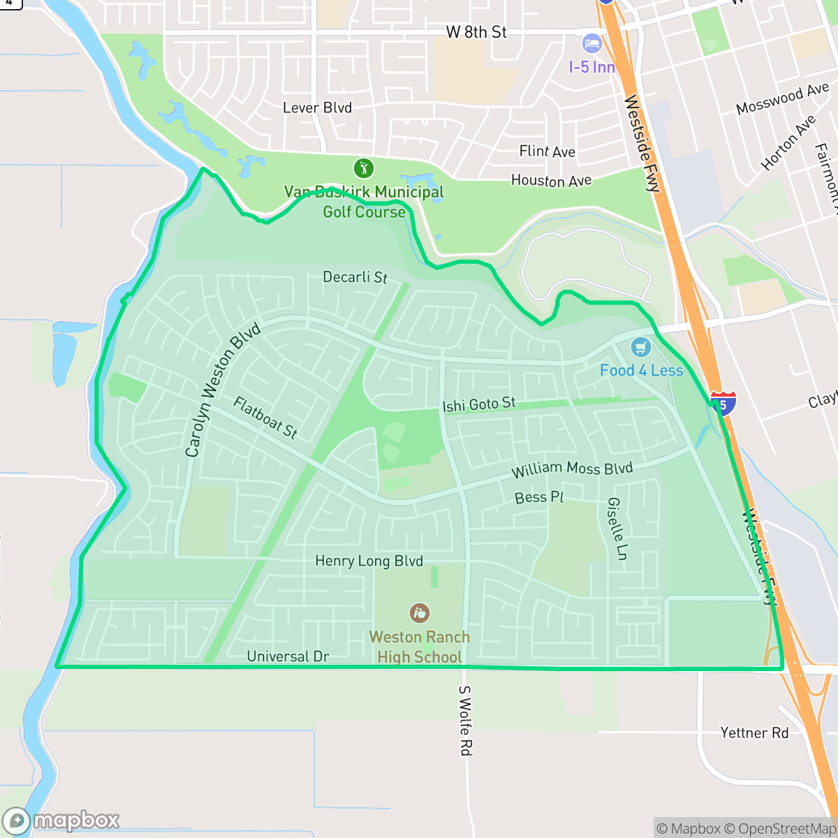
Located in southwestern Stockton along the San Joaquin River and French Camp Slough, Weston Ranch originated as marshlands. In 1877, riverboat captain William S. Moss purchased and drained the wetlands to establish a productive family farm. The land remained agricultural until 1988, when the City of Stockton annexed it for a massive, 1,600-acre master-planned community. Originally envisioned with a marina by developers Lyon Communities and Verner Construction, the project faced financial setbacks in the 1990s, leading to a takeover by Bank of America and SunCal Cos., which shifted the design toward a dense subdivision of tract homes. Completed largely by 2005, the neighborhood later became a focal point of the 2007 foreclosure crisis. Today, Weston Ranch is defined by its extensive levee trail system, including the San Joaquin River Levee path, and its distinct identity as a suburban commuter enclave.
The neighborhood is characterized by its organized, dense suburban layout, featuring uniform housing tracts and a comprehensive network of sidewalks that make it highly walkable for daily exercise or dog walking. Its defining feature is the connection to the San Joaquin River levee system, which provides residents with significant green corridors and open space that stand in contrast to the high-density residential development. The area maintains a consistent aesthetic of affluent suburban architecture, often featuring private pools and manicured lawns, which contributes to its appeal for families seeking a structured living environment. Living here involves specific trade-offs, particularly regarding acoustic comfort and commercial access. While the area is largely residential and free from industrial hazards, it is notably loud due to consistent road traffic. Local business options are sparse, meaning most residents rely on commuting for shopping, dining, and entertainment. Educational opportunities are provided through a mix of districts, including Manteca Unified and Stockton Unified, though families should research specific school performance metrics as they vary significantly. This area is best suited for commuters and families who prioritize outdoor recreation and a quiet, predictable neighborhood structure over proximity to urban nightlife or commercial hubs.
Neighborhood Scores Across 15 Qualities
Residential spacing varies between modern suburban tracts, offering slightly more buffer between neighbors than the Stockton average. While some areas feature closely spaced homes, many lots include private fenced yards and moderate separation.
Extensive sidewalk networks and dedicated paths through green belts make walking easy and safe. This level of accessibility is notably higher than the Stockton average, particularly within low-traffic residential streets.
Manicured lawns, large homes, and a high frequency of private swimming pools contribute to a visual landscape that is more polished than the Stockton average. According to iHuus data, the area is characterized by spacious driveways and well-maintained residential amenities.
Continuous green corridors, large public parks, and interconnected greenbelts provide abundant space for pets. This level of access to open, traffic-free walking areas is notably higher than the Stockton average, according to iHuus data.
Suburban residential tracts transition into large-scale agricultural orchards and open fields, providing a more spacious feel than the Stockton average. Residents experience a mix of planned community infrastructure and vast, undeveloped landscape.
Primarily a serene and low-density environment, this area features significant open space with limited commercial activity. According to iHuus data, the local vibrancy is slightly below the Stockton average due to a reliance on driving for most services and businesses.
Frequent noise from nearby transit corridors and flight paths characterizes the area. This level of acoustic disturbance is slightly higher than the Stockton average, according to iHuus data.
Air quality fluctuates between acceptable and unhealthy levels on certain days. This condition is consistent with the average seen across Stockton, according to iHuus data.
Industrial presence is virtually non-existent here, as the area consists exclusively of residential and agricultural land. This lack of warehouses or heavy industry makes the neighborhood significantly quieter and cleaner than the Stockton average, according to iHuus data.
Health insurance accessibility is strong in this area, with coverage rates trending above the Stockton average according to iHuus data.
Voting patterns and census indicators reflect a strong liberal leaning that is more pronounced than the Stockton average, according to iHuus data.
Residents live alongside a varied demographic of young adults, families, and seniors. This age distribution is slightly more concentrated than the Stockton average, according to iHuus data.
Residual flood risk exists within this area as it sits within a 500-year floodplain, though safety levels are higher than the Stockton average according to iHuus data.
Block-Level Insights for Weston Ranch

iHuus Neighborhood Intelligence Insights
Get block-level neighborhood insights for Weston Ranch
- Street-level scores — see how individual blocks compare, not just neighborhood averages
- Micro-zone boundaries — identify quiet pockets, flood boundaries, and walkable clusters before you visit
- 15 dimensions in full — walkability, noise, air quality, school quality, insurance coverage, population age profile, urban/rural index, and more
- Boundary risk alerts — know if your address sits near a block boundary where scores drop, the kind of detail no listing will ever mention
- School insights — individual school ratings and insights, not just district-level data
- Compare before you commit — side-by-side data across neighborhoods, down to block precision
No credit card required
Compare with Any Neighborhood
| Dimension | Weston Ranch | Anderson |
|---|---|---|
| 🚶 Walkabilityavg 8.33 | ||
| 🔊 Acoustic Comfortavg 3.04 | ||
| 🤫 Privacy Indexavg 5.32 | ||
| 🎨 Visual Appealavg 6.38 | ||
| 🐕 Dog Friendlinessavg 6.44 | ||
| 🗺️ Urban-Rural Indexavg 6.82 | ||
| ✨ Neighborhood Vibeavg 4.6 | ||
| 🏥 Health Insurance Coverageavg 6.72 | ||
| 🌿 Air Qualityavg 6 | ||
| 🏭 Industrial Proximityavg 7.71 | ||
| 🌊 Flood Safetyavg 5.9 | ||
| 🗳️ Ideological Leanavg 8.5 | ||
| 👥 Population Age Profileavg 4.59 | ||
| 🔥 Fire Safety | ||
| 🏫 School Quality |
Weston Ranch Rankings
School Districts Serving Weston Ranch
Manteca Unified School District is a system in transition, characterized by a dual-track profile of robust infrastructure growth and persistent academic challenges. While the district maintains a high 92% graduation rate and is successfully executing a $150 million facility expansion plan, its standardized test scores lag behind state averages, and there is a pronounced performance gap between its top-tier and bottom-tier elementary schools. Positive indicators include strong Career Technical Education (CTE) programs, high community trust in bond measures, and recent state recognition for high school growth, but these are offset by low proficiency rates and salary competitiveness concerns that impact support staff retention.
Schools
Tracy Unified School District is a district in transition, characterized by a sharp dichotomy between its high-performing specialized high school academies and a struggling elementary feeder system where nearly half of the schools are rated 1 or 2. Operationally, the district maintains community trust through successful facility bonds and robust vocational programs (CTE and Agriculture), yet it is besieged by the common pressures of rapid suburban growth: campus overcrowding, teacher retention challenges due to nearby high-wage markets, and a growing achievement gap in mathematics. While the district offers strong 'Blue Chip' pockets like Kimball High, the systemic underperformance at the primary level and reports of inconsistent middle school safety prevent it from achieving a higher stability rating.
Schools
Stockton Unified is currently a Distressed district (Rating: 2) characterized by a severe academic divide and significant historical instability. While the current administration has achieved notable milestones—including exceeding state graduation averages, exiting Department of Justice monitoring, and stabilizing leadership—the district's foundation remains weak, with over 20 schools rated 1/10 and math proficiency at a critical low of 17%. Recent board-level criminal scandals and funding cuts to technical programs counteract the 'Blue Chip' aspirations of its high-performing specialty academies. Despite professional management improvements, the district remains a 'high-risk' entity due to the volume of underperforming schools and persistent governance challenges.
Schools
School Insights for Weston Ranch
Below average outcomes; significant attendance and academic challenges.
School Insights
See what's really behind every school rating near Weston Ranch
- Individual school ratings — each school's own score with outcome context, not just a district average
- Enrollment & class size data — student-to-teacher ratio and how it compares to the state average
- Full demographics breakdown — ethnicity and gender composition for every school in the enrollment zone
- Every school in the district — all schools within the enrollment boundary ranked by rating, not just the closest one
- Grade levels & benchmarks — elementary through high school, with below/above state-average flags
No credit card required