Anderson, Stockton
Updated · 9,203 residents
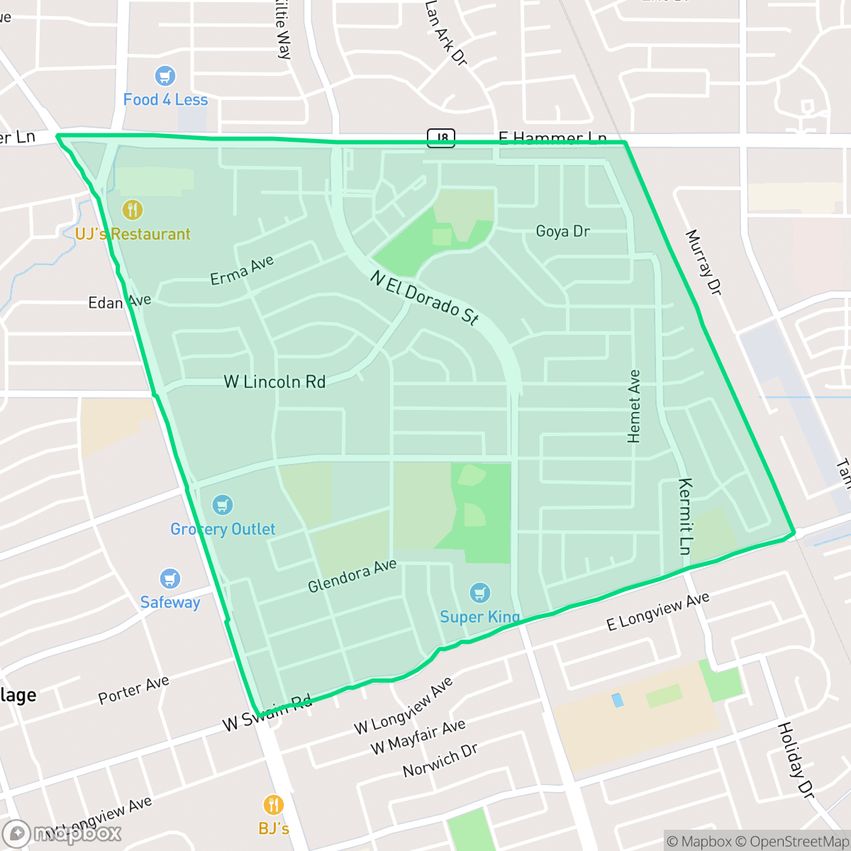
Anderson is a dense suburban neighborhood in Stockton known for its vibrant local dining scene and reliable pedestrian infrastructure. While the area offers high walkability and proximity to community amenities, residents should note the high levels of road traffic noise and the standard density of its residential tracts.
Key Highlights
About Anderson
Anderson is characterized by a dense suburban layout that balances residential streets with a variety of local social and culinary destinations. Residents have access to diverse dining options, including local favorites like Tommy's Cafe and Royal Siam, alongside community hubs like the Carson Oaks Community Church. The area benefits from a comprehensive sidewalk network, making it a highly walkable environment that supports daily errands and neighborhood movement. Prospective residents should consider the trade-offs of living in this established suburban setting. While the neighborhood is free from heavy industrial activity and maintains a high level of flood safety, it experiences significant ambient noise from road traffic. The housing stock consists primarily of standard tract homes with moderate privacy, and families should be aware that school quality varies significantly depending on the district boundaries. It is best suited for those who prioritize neighborhood accessibility and a lively local atmosphere over quiet surroundings.
Neighborhood Scores Across 15 Qualities
Residential spacing varies between closely packed structures and detached homes with consistent side yards. According to iHuus data, the level of privacy buffer is roughly average for the city of Stockton.
Residential streets feature established sidewalk networks and safe crossings, though high traffic arterials and large commercial blocks can create barriers for pedestrians. This level of walkability is slightly below the Stockton city average according to iHuus data.
Uniform rooflines and modest yards characterize this area, which presents a visual profile very similar to the Stockton average. Residents will find a mix of middle-class tract housing and apartment complexes featuring occasional private pools.
Public park access and grassy verges for walking vary significantly by sector, making dog friendliness slightly below the Stockton average according to iHuus data. While some areas feature large parks and baseball fields, other parts of the neighborhood consist mainly of private yards with limited public greenery.
Dense suburban development characterizes this area, featuring a mix of single-family homes, apartment complexes, and commercial strips. This landscape is slightly more developed than the typical surroundings found elsewhere in Stockton.
Local dining and social spots are more concentrated here than in the rest of Stockton. Residents can access a diverse mix of cafes, restaurants, and community landmarks within several suburban blocks.
Frequent noise from a nearby freeway and railroad tracks makes this area significantly louder than the Stockton average, according to iHuus data.
Air quality in this area fluctuates between acceptable and unhealthy levels. This consistency with the Stockton average means residents should monitor local conditions during periods of concern for sensitive groups.
Industrial presence is minimal throughout most of the area, which features predominantly residential and educational land use. While some parts of the central corridor contain warehouses and a rail line, the overall level of industrial proximity is slightly lower than the Stockton average.
Health insurance access among residents is slightly above the Stockton average, according to iHuus data. Most individuals in the area have access to medical coverage.
Political leanings in this area align closely with the broader Stockton average, characterized by a liberal majority and a modest presence of opposing views according to iHuus data.
Residents will find a balanced demographic spread of young adults, families, and older individuals, which is consistent with the Stockton average according to iHuus data.
Flood risk in this area is difficult to precisely assess because FEMA has not yet completed a detailed study for this specific zone. This level of uncertainty is slightly higher than the average seen across Stockton.
Address-Level Insights for Anderson


iHuus Neighborhood Intelligence Insights
Get address-level neighborhood insights for Anderson
- Street-level scores — see how individual blocks compare, not just neighborhood averages
- Micro-zone boundaries — identify quiet pockets, flood boundaries, and walkable clusters before you visit
- 15 dimensions in full — walkability, noise, air quality, school quality, insurance coverage, population age profile, urban/rural index, and more
- Boundary risk alerts — know if your address sits near a block boundary where scores drop, the kind of detail no listing will ever mention
- School insights — individual school ratings and insights, not just district-level data
- Compare before you commit — side-by-side data across neighborhoods, down to block precision
No credit card required
Compare with Any Neighborhood
| Dimension | Anderson | Brookside |
|---|---|---|
| 🚶 Walkabilityavg 8.33 | ||
| 🔊 Acoustic Comfortavg 3.04 | ||
| 🤫 Privacy Indexavg 5.32 | ||
| 🎨 Visual Appealavg 6.38 | ||
| 🐕 Dog Friendlinessavg 6.44 | ||
| 🗺️ Urban-Rural Indexavg 6.82 | ||
| ✨ Neighborhood Vibeavg 4.6 | ||
| 🏥 Health Insurance Coverageavg 6.72 | ||
| 🌿 Air Qualityavg 6 | ||
| 🏭 Industrial Proximityavg 7.71 | ||
| 🌊 Flood Safetyavg 5.9 | ||
| 🗳️ Ideological Leanavg 8.5 | ||
| 👥 Population Age Profileavg 4.59 | ||
| 🔥 Fire Safety | ||
| 🏫 School Quality |
Anderson Rankings
School Districts Serving Anderson
School Insights for Anderson
Below average outcomes; significant attendance and academic challenges.
School Insights
See what's really behind every school rating near Anderson
- Individual school ratings — each school's own score with outcome context, not just a district average
- Enrollment & class size data — student-to-teacher ratio and how it compares to the state average
- Full demographics breakdown — ethnicity and gender composition for every school in the enrollment zone
- Every school in the district — all schools within the enrollment boundary ranked by rating, not just the closest one
- Grade levels & benchmarks — elementary through high school, with below/above state-average flags
No credit card required