West End, San Rafael
Updated June 22, 2026 · 1,555 residents
The West End is a walkable neighborhood featuring a blend of Spanish Mediterranean and California bungalow architecture. It offers clean air and a semi-rural atmosphere while maintaining easy pedestrian access to local dining and community hubs.
Key Highlights
About West End
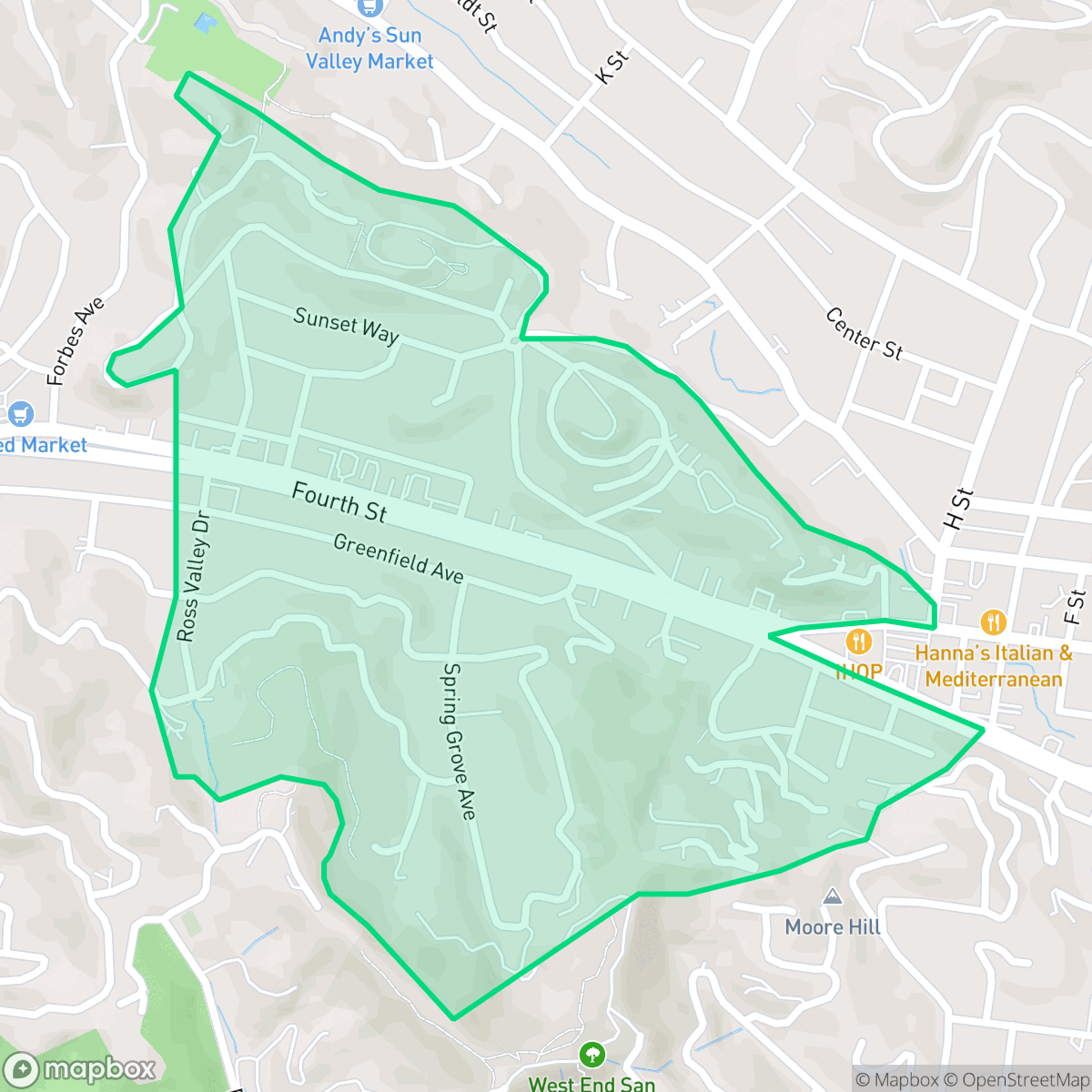
The West End neighborhood of San Rafael is a distinct residential and commercial area anchored by the eclectic West End Village along Fourth Street. Known for its bohemian character, the neighborhood features a diverse architectural blend ranging from Spanish Mediterranean styles to classic California bungalows. The area serves as a vibrant gateway to downtown San Rafael, with its community identity fostered by the West End Neighborhood Association (WENA), which was established in 1977. While the broader city of San Rafael is rooted in the 1817 Mission San Rafael Arcángel, the West End specifically distinguishes itself through its unique local merchant culture and its role as a walkable, vibrant transition between the downtown core and the surrounding residential hillside districts.
The area is characterized by an upscale, scenic aesthetic and a diverse population. Residents enjoy high rates of health insurance coverage and a strong sense of community, with the neighborhood serving as a peaceful residential enclave. The absence of industrial facilities contributes to a clean environment, though the proximity to major transportation corridors results in consistent traffic noise. The landscape balances quiet, low-density streets with vibrant commercial blocks, creating a unique transition between the downtown core and the surrounding hills.
Prospective residents should consider the trade-offs regarding environmental safety and noise. While the neighborhood is highly walkable and pet-friendly, it faces elevated fire and moderate flood risks, necessitating proactive preparedness. The area is served by several school districts, ranging from high-performing institutions like the Ross Elementary and Tamalpais Union High School districts to those currently navigating fiscal and demographic transitions. It is best suited for those who prioritize walkability and a scenic, liberal-leaning community over absolute silence or low-risk hazard zones.
Neighborhood Scores Across 15 Qualities
Residential spacing is moderately varied, ranging from dense downtown apartments to hillside homes with more buffer between neighbors. According to iHuus data, this level of separation is slightly higher than the San Rafael average.
A grid-based sidewalk network provides reliable pedestrian access to downtown amenities, offering slightly better walkability than the San Rafael average. Many daily errands can be completed on foot thanks to safe crossings and consistent infrastructure.
Large hillside estates, private pools, and well-manicured properties contribute to a visual landscape that is more polished than the San Rafael average. According to iHuus data, the presence of premium amenities and spacious lots creates a highly manicured aesthetic throughout the area.
Large parks and wide, grass-lined paths provide ample space for pets. This area offers a similar level of dog friendliness compared to the rest of San Rafael.
Open land and woodland are common throughout the area, providing a sense of space that is slightly more prevalent than in the rest of San Rafael. While some parts of the neighborhood feature a dense suburban downtown, the landscape remains largely characterized by scattered homes and natural surroundings according to iHuus data.
Active dining spots and community hubs create a more vibrant atmosphere than the San Rafael average, though some pockets remain quiet and rural. According to iHuus data, the area balances lively commercial blocks with serene, low-density landscapes.
Frequent noise from the nearby freeway and railroad tracks makes this area noisier than most parts of San Rafael. Residents may experience more consistent auditory disturbances compared to the city average, according to iHuus data.
Air quality remains exceptionally high with minimal health concerns. According to iHuus data, these levels are slightly better than the average found throughout San Rafael.
Residential life here is free from warehouses or heavy industrial facilities, offering a cleaner environment than the San Rafael average. According to iHuus data, the area consists of quiet streets and open green spaces with no detectable industrial hazards.
Health insurance access is widespread among West End residents, significantly outpacing the San Rafael average according to iHuus data.
Voting patterns and census indicators show a highly liberal political leaning, which is slightly more pronounced than the average for San Rafael. According to iHuus data, this reflects a very consistent partisan trend within the neighborhood.
Residents live alongside a balanced mix of young professionals, families, and seniors. This demographic variety is slightly more even than the average found across San Rafael, according to iHuus data.
Flood risk in this area is higher than the San Rafael average, though the specific level of danger remains undetermined due to a lack of detailed FEMA studies. Residents should remain aware of potential vulnerabilities during extreme weather events.
Significant fire hazards exist within this area, which represents a higher risk level than the San Rafael average according to iHuus data. Residents should prioritize enhanced mitigation measures and seasonal preparedness.
Block-Level Insights for West End

iHuus Neighborhood Intelligence Insights
Get block-level neighborhood insights for West End
- Street-level scores — see how individual blocks compare, not just neighborhood averages
- Micro-zone boundaries — identify quiet pockets, flood boundaries, and walkable clusters before you visit
- 15 dimensions in full — walkability, noise, air quality, school quality, insurance coverage, population age profile, urban/rural index, and more
- Boundary risk alerts — know if your address sits near a block boundary where scores drop, the kind of detail no listing will ever mention
- School insights — individual school ratings and insights, not just district-level data
- Compare before you commit — side-by-side data across neighborhoods, down to block precision
No credit card required
Compare with Any Neighborhood
| Dimension | West End | Bay Islands |
|---|---|---|
| 🚶 Walkabilityavg 7.77 | ||
| 🔊 Acoustic Comfortavg 4.28 | ||
| 🤫 Privacy Indexavg 5.75 | ||
| 🎨 Visual Appealavg 7.83 | ||
| 🐕 Dog Friendlinessavg 8.65 | ||
| 🗺️ Urban-Rural Indexavg 7.61 | ||
| ✨ Neighborhood Vibeavg 4 | ||
| 🏥 Health Insurance Coverageavg 7.38 | ||
| 🌿 Air Qualityavg 9.29 | ||
| 🏭 Industrial Proximityavg 9.06 | ||
| 🌊 Flood Safetyavg 3.6 | ||
| 🗳️ Ideological Leanavg 9.8 | ||
| 👥 Population Age Profileavg 5.25 | ||
| 🔥 Fire Safetyavg 1.32 | ||
| 🏫 School Quality |
West End Rankings
School Districts Serving West End
Ross Elementary School District is a premier 'Blue Chip' district demonstrating elite academic performance and exceptional financial stability. As a single-school district, it maintains a 10/10 rating with high proficiency levels (95% in math) and a low 11:1 student-to-teacher ratio. The district benefits from strong community backing via parcel taxes and a dedicated foundation, ensuring robust enrichment programs and modern facilities. With stable leadership, a fully staffed faculty, and a curriculum that successfully integrates STEM and social-emotional learning, the district operates with a level of consistency and resource-richness that mirrors a private institution while maintaining high public accountability.
Schools
Tamalpais Union High School District remains a premier educational entity, ranked 16th in California with an A+ academic standing. While the district is navigating fiscal headwinds—including a $5 million deficit and projected enrollment declines—it maintains high operational stability through strategic staffing adjustments and proactive financial planning via upcoming parcel tax renewals. Its flagship high schools are top-tier destination schools with exceptional STEM and collegiate preparation outcomes. Despite minor community friction regarding technology policies and administrative turnover, the district's 'Blue Chip' status is secured by its dominant academic performance, low chronic absenteeism, and high-performing feeder consistency.
Schools
Ross Valley Elementary School District is a high-performing, stable organization characterized by top-tier academic outcomes and strong community financial backing through its foundation and local tax measures. While the district is currently navigating the regional challenges of declining enrollment and high living costs for staff, its operational health remains robust due to proactive curriculum modernization, successful facility safety initiatives, and high parent satisfaction. The district serves as a premier destination for families in Marin County, maintaining a 'Blue Chip' academic profile with manageable, albeit present, fiscal and demographic headwinds.
Schools
San Rafael City Elementary School District is a solid but bifurcated organization, characterized by a mix of high-achieving 'Blue Chip' campuses and severely underperforming schools serving lower-income areas. The district demonstrates strong operational stability through successful infrastructure bonds, modernized facilities, and a rigorous shift toward evidence-based literacy instruction. While teacher quality and community sentiment remain high, the district's overall health is tempered by a persistent achievement gap, rising cost-of-living challenges for staff retention, and the need for more consistent academic rigor across all neighborhood schools.
Schools
San Rafael City High School District is currently in a state of transition, characterized by a significant performance gap between its high-performing Terra Linda campus and its struggling alternative and secondary sites. While the district is successfully executing large-scale infrastructure improvements through voter-approved bonds and showing strong outcomes in specialized English learner and environmental programs, it faces a looming $5.5 million budget shortfall and declining enrollment. The shift toward a property tax-based funding model and ongoing staff reductions suggest fiscal instability, though strong community support and modernizing facilities provide a buffer against total operational decline.
Schools
School Insights for West End
Below average outcomes; significant attendance and academic challenges.
School Insights
See what's really behind every school rating near West End
- Individual school ratings — each school's own score with outcome context, not just a district average
- Enrollment & class size data — student-to-teacher ratio and how it compares to the state average
- Full demographics breakdown — ethnicity and gender composition for every school in the enrollment zone
- Every school in the district — all schools within the enrollment boundary ranked by rating, not just the closest one
- Grade levels & benchmarks — elementary through high school, with below/above state-average flags
No credit card required