Rafael Meadows/Los Ranchitos, San Rafael
Updated June 22, 2026 · 2,070 residents
Rafael Meadows and Los Ranchitos offer a semi-rural residential atmosphere characterized by visually appealing homes and extensive access to local trails. While the area provides a peaceful, upscale setting with very clean air, residents should be prepared for persistent noise from nearby highway and rail transit corridors.
Key Highlights
About Rafael Meadows/Los Ranchitos
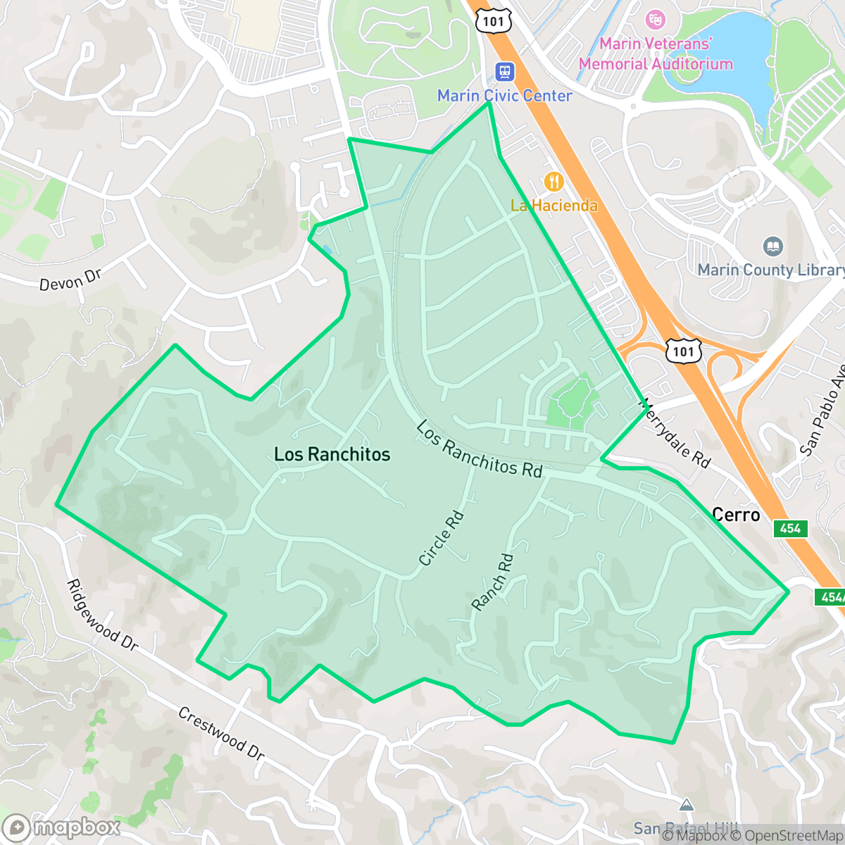
Rafael Meadows and Los Ranchitos are distinct mid-20th-century developments in northern San Rafael. Rafael Meadows, established in the early 1950s, is a residential area located west of Highway 101, characterized by its proximity to the Marin County Civic Center and the SMART train line. In contrast, Los Ranchitos, developed in 1949, maintains a rural identity with larger one-to-two-acre parcels originally zoned for light agricultural use, including stables and small-scale livestock. Historically serving as a community separator between San Rafael and Terra Linda, Los Ranchitos retains a distinct, semi-rural character. Both neighborhoods are represented by long-standing improvement associations that have actively shaped local community life and preserved their respective residential environments since the 1950s.
This area features a steady suburban rhythm that blends quiet residential pockets with a semi-rural aesthetic. The landscape is defined by larger parcels and upscale architecture, creating a visually distinct environment that stands out within the broader region. According to iHuus data, the neighborhood remains purely residential, free from industrial activity, and offers a high degree of privacy for its diverse population of families and professionals. Pet owners will find the location particularly advantageous, as the abundance of nearby trails and open spaces makes it an excellent environment for dog walking and outdoor recreation.
Prospective residents should consider several trade-offs regarding the local environment. While the air quality is exceptionally high, the area faces significant fire safety risks, necessitating proactive emergency preparedness. The neighborhood also experiences elevated noise levels due to its proximity to major transportation arteries. Education options are split between the Dixie and San Rafael City school districts, providing varied academic environments for local families. Despite these considerations, the area maintains high levels of health insurance coverage and a strong sense of community, making it a stable choice for those seeking a balance between natural beauty and suburban convenience.
Neighborhood Scores Across 15 Qualities
Housing density is moderate with varied spacing between structures. Residents will find slightly more separation between neighbors than the typical San Rafael area, according to iHuus data.
Pedestrian access is supported by safe crossings and sidewalks on one side of many streets, though overall walkability is slightly below the San Rafael average.
Large homes and frequent upscale amenities contribute to a landscape that is more visually appealing than the San Rafael average, according to iHuus data.
Extensive access to large parks, trails, and open spaces makes this area ideal for pet owners. This level of accessibility is slightly above the San Rafael average, according to iHuus data.
Open landscapes and scattered greenery provide a sense of space, though the area is slightly less rural than the San Rafael average according to iHuus data.
Local activity levels are slightly higher than the San Rafael average, offering a balanced mix of quiet residential pockets and accessible dining options. Some blocks provide a lively atmosphere near transit corridors, while other areas remain serene and remote with very few commercial amenities.
Persistent noise from nearby highway traffic and railroad lines is a notable feature of this area. According to iHuus data, acoustic levels are significantly higher than the average for San Rafael.
Air quality in this area is exceptionally high with minimal pollutants. According to iHuus data, the atmosphere is even clearer than the San Rafael average.
No warehouses, industrial facilities, or hazard sites are present in this area. According to iHuus data, this neighborhood is more insulated from industrial activity than most of San Rafael.
Health insurance accessibility is notably higher here than the San Rafael average, according to iHuus data. Most residents in this area have access to comprehensive medical coverage.
Voting patterns and census indicators reflect a deeply liberal political orientation that is consistent with the broader San Rafael area.
Residents live alongside a balanced mix of young adults, families, and older individuals. According to iHuus data, this demographic spread is slightly more varied than the San Rafael average.
Flood risk in this area is currently difficult to assess because FEMA has not completed a detailed study for this specific location. According to iHuus data, the potential for flooding is higher than the average for San Rafael.
High levels of fire hazard characterize this area, representing a significant risk that exceeds the average for San Rafael. Residents should prepare for extreme fire safety requirements according to iHuus data.
Block-Level Insights for Rafael Meadows/Los Ranchitos

iHuus Neighborhood Intelligence Insights
Get block-level neighborhood insights for Rafael Meadows/Los Ranchitos
- Street-level scores — see how individual blocks compare, not just neighborhood averages
- Micro-zone boundaries — identify quiet pockets, flood boundaries, and walkable clusters before you visit
- 15 dimensions in full — walkability, noise, air quality, school quality, insurance coverage, population age profile, urban/rural index, and more
- Boundary risk alerts — know if your address sits near a block boundary where scores drop, the kind of detail no listing will ever mention
- School insights — individual school ratings and insights, not just district-level data
- Compare before you commit — side-by-side data across neighborhoods, down to block precision
No credit card required
Compare with Any Neighborhood
| Dimension | Rafael Meadows/Los Ranchitos | Bay Islands |
|---|---|---|
| 🚶 Walkabilityavg 7.77 | ||
| 🔊 Acoustic Comfortavg 4.28 | ||
| 🤫 Privacy Indexavg 5.75 | ||
| 🎨 Visual Appealavg 7.83 | ||
| 🐕 Dog Friendlinessavg 8.65 | ||
| 🗺️ Urban-Rural Indexavg 7.61 | ||
| ✨ Neighborhood Vibeavg 4 | ||
| 🏥 Health Insurance Coverageavg 7.38 | ||
| 🌿 Air Qualityavg 9.29 | ||
| 🏭 Industrial Proximityavg 9.06 | ||
| 🌊 Flood Safetyavg 3.6 | ||
| 🗳️ Ideological Leanavg 9.8 | ||
| 👥 Population Age Profileavg 5.25 | ||
| 🔥 Fire Safetyavg 1.32 | ||
| 🏫 School Quality |
Rafael Meadows/Los Ranchitos Rankings
School Districts Serving Rafael Meadows/Los Ranchitos
Miller Creek Elementary School District (formerly Dixie) is a high-performing, stable organization characterized by top-tier academic outcomes and strong community backing. With three out of four schools performing at the highest levels and a 10/10 middle school serving as a premier feeder, the district remains a primary draw for families in the San Rafael area. Operational health is robust, evidenced by successful facility modernization projects and transparent fiscal management in the face of inflationary pressures. Although there is a notable performance disparity at one elementary site and anecdotal reports of a competitive atmosphere, the district's proactive approach to student wellness and curriculum innovation secures its standing as a solid, high-quality educational provider.
Schools
San Rafael City Elementary School District is a solid but bifurcated organization, characterized by a mix of high-achieving 'Blue Chip' campuses and severely underperforming schools serving lower-income areas. The district demonstrates strong operational stability through successful infrastructure bonds, modernized facilities, and a rigorous shift toward evidence-based literacy instruction. While teacher quality and community sentiment remain high, the district's overall health is tempered by a persistent achievement gap, rising cost-of-living challenges for staff retention, and the need for more consistent academic rigor across all neighborhood schools.
Schools
San Rafael City High School District is currently in a state of transition, characterized by a significant performance gap between its high-performing Terra Linda campus and its struggling alternative and secondary sites. While the district is successfully executing large-scale infrastructure improvements through voter-approved bonds and showing strong outcomes in specialized English learner and environmental programs, it faces a looming $5.5 million budget shortfall and declining enrollment. The shift toward a property tax-based funding model and ongoing staff reductions suggest fiscal instability, though strong community support and modernizing facilities provide a buffer against total operational decline.
Schools
School Insights for Rafael Meadows/Los Ranchitos
Below average outcomes; significant attendance and academic challenges.
School Insights
See what's really behind every school rating near Rafael Meadows/Los Ranchitos
- Individual school ratings — each school's own score with outcome context, not just a district average
- Enrollment & class size data — student-to-teacher ratio and how it compares to the state average
- Full demographics breakdown — ethnicity and gender composition for every school in the enrollment zone
- Every school in the district — all schools within the enrollment boundary ranked by rating, not just the closest one
- Grade levels & benchmarks — elementary through high school, with below/above state-average flags
No credit card required