Picnic Valley, San Rafael
Updated June 22, 2026 · 1,587 residents
Picnic Valley is an exceptionally walkable neighborhood in San Rafael, characterized by a blend of historic cottages and hillside homes. The area maintains high air quality and a lively atmosphere, offering convenient access to local cafes and mixed-use commercial spaces.
Key Highlights
About Picnic Valley
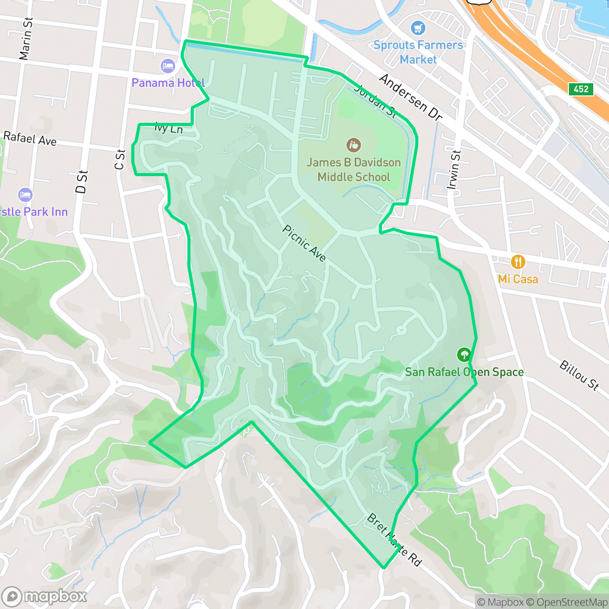
Located south of downtown San Rafael, Picnic Valley is one of the city's earliest suburban neighborhoods, first appearing on an 1889 survey map of the Coleman Tract. The neighborhood takes its name from the historic Laurel Grove Picnic Grounds, which served as a popular hub for civic celebrations and community gatherings during San Rafael's early days. Characterized by steep, wooded hillsides, narrow winding streets, and hidden footpaths, Picnic Valley features a distinct architectural mix. The lower, flatter northern sections showcase century-old cottages and 1920s bungalows along signature streets like Picnic Avenue and Bungalow Avenue. Meanwhile, the upper hillsides transition into mid-century and modern custom homes, preserving the neighborhood's secluded, rustic character.
The area functions as a distinct, high-density pocket within San Rafael, where residential streets transition into active, mixed-use zones. According to iHuus data, the neighborhood achieves a perfect walkability score, allowing residents to easily reach local businesses like Garden Cafe and El Lucerito. The environment is notably quiet regarding aviation noise, though residents should anticipate some daytime traffic associated with nearby industrial proximity.
Prospective residents will find a community that prioritizes accessibility and academic resources, with proximity to high-performing institutions like Laurel Dell Elementary. While the neighborhood offers a unique, central lifestyle, the area faces significant environmental challenges, specifically regarding flood and fire safety. These factors, combined with the dense, mixed-use nature of the surroundings, make it a practical choice for those who value urban convenience and local engagement over secluded, low-density living.
Neighborhood Scores Across 15 Qualities
Residential spacing is mixed, providing some buffer between neighbors. According to iHuus data, this level of privacy is slightly higher than the San Rafael average.
Pedestrian movement is supported by sidewalks on one side of the street and safe crossings. This level of walkability is higher than the average found throughout San Rafael, according to iHuus data.
Large residential properties and frequent upscale amenities characterize this area. According to iHuus data, the visual landscape is slightly more polished than the San Rafael average.
Extensive access to large parks, trails, and open spaces makes this area highly suitable for dog owners. According to iHuus data, the availability of these recreational spaces is slightly above the San Rafael average.
Frequent open land and scattered homes among woodlands characterize this area. According to iHuus data, the landscape is notably more rural than the San Rafael average.
Limited social activity and few local leisure destinations define this area, which offers a much more subdued atmosphere than the San Rafael average. According to iHuus data, the landscape is characterized by low-density housing and essential services that are sparse across the neighborhood.
Acoustic levels are notably lower than the San Rafael average, with noise limited to infrequent distant trains or occasional passing vehicles. According to iHuus data, this area provides a much more tranquil environment than most other parts of the city.
Air quality remains consistently high with minimal health concerns for residents. This level of cleanliness is nearly on par with the San Rafael average, according to iHuus data.
Residential life remains largely undisturbed by heavy industry, though some light commercial activity is present. This area features more industrial proximity than the San Rafael average, particularly in sections where residential streets blend with active daytime commercial use.
Health insurance coverage among residents is slightly below the San Rafael average, according to iHuus data.
Voting patterns and census indicators reflect a highly liberal political leaning, which is slightly more pronounced here than the San Rafael average.
Residents live alongside a balanced mix of young professionals, families, and seniors. According to iHuus data, the age distribution is slightly more varied than the San Rafael average.
Properties in this area are situated within a designated floodplain, which may necessitate flood insurance. According to iHuus data, this level of risk is slightly higher than the San Rafael city average.
Significant fire hazards exist in this area, which represents a higher risk level than the San Rafael average according to iHuus data. Residents should prioritize enhanced mitigation measures and wildfire preparedness.
Block-Level Insights for Picnic Valley

iHuus Neighborhood Intelligence Insights
Get block-level neighborhood insights for Picnic Valley
- Street-level scores — see how individual blocks compare, not just neighborhood averages
- Micro-zone boundaries — identify quiet pockets, flood boundaries, and walkable clusters before you visit
- 15 dimensions in full — walkability, noise, air quality, school quality, insurance coverage, population age profile, urban/rural index, and more
- Boundary risk alerts — know if your address sits near a block boundary where scores drop, the kind of detail no listing will ever mention
- School insights — individual school ratings and insights, not just district-level data
- Compare before you commit — side-by-side data across neighborhoods, down to block precision
No credit card required
Compare with Any Neighborhood
| Dimension | Picnic Valley | Bay Islands |
|---|---|---|
| 🚶 Walkabilityavg 7.77 | ||
| 🔊 Acoustic Comfortavg 4.28 | ||
| 🤫 Privacy Indexavg 5.75 | ||
| 🎨 Visual Appealavg 7.83 | ||
| 🐕 Dog Friendlinessavg 8.65 | ||
| 🗺️ Urban-Rural Indexavg 7.61 | ||
| ✨ Neighborhood Vibeavg 4 | ||
| 🏥 Health Insurance Coverageavg 7.38 | ||
| 🌿 Air Qualityavg 9.29 | ||
| 🏭 Industrial Proximityavg 9.06 | ||
| 🌊 Flood Safetyavg 3.6 | ||
| 🗳️ Ideological Leanavg 9.8 | ||
| 👥 Population Age Profileavg 5.25 | ||
| 🔥 Fire Safetyavg 1.32 | ||
| 🏫 School Quality |
Picnic Valley Rankings
School Districts Serving Picnic Valley
Kentfield Elementary School District is an elite, high-performing organization characterized by 'Green' indicators across academic, financial, and operational categories. With perfect 10/10 school ratings and a robust funding model supported by local parcel taxes and the KIK foundation, the district maintains a luxury standard of public education. Operational health is bolstered by strong community engagement, modern facility investments, and a proactive approach to curriculum development. While the high-pressure academic environment and local cost of living are noted community considerations, they do not detract from the district's status as a stable, premier educational provider with exceptional leadership and fiscal security.
Schools
Tamalpais Union High School District remains a premier educational entity, ranked 16th in California with an A+ academic standing. While the district is navigating fiscal headwinds—including a $5 million deficit and projected enrollment declines—it maintains high operational stability through strategic staffing adjustments and proactive financial planning via upcoming parcel tax renewals. Its flagship high schools are top-tier destination schools with exceptional STEM and collegiate preparation outcomes. Despite minor community friction regarding technology policies and administrative turnover, the district's 'Blue Chip' status is secured by its dominant academic performance, low chronic absenteeism, and high-performing feeder consistency.
Schools
San Rafael City Elementary School District is a solid but bifurcated organization, characterized by a mix of high-achieving 'Blue Chip' campuses and severely underperforming schools serving lower-income areas. The district demonstrates strong operational stability through successful infrastructure bonds, modernized facilities, and a rigorous shift toward evidence-based literacy instruction. While teacher quality and community sentiment remain high, the district's overall health is tempered by a persistent achievement gap, rising cost-of-living challenges for staff retention, and the need for more consistent academic rigor across all neighborhood schools.
Schools
San Rafael City High School District is currently in a state of transition, characterized by a significant performance gap between its high-performing Terra Linda campus and its struggling alternative and secondary sites. While the district is successfully executing large-scale infrastructure improvements through voter-approved bonds and showing strong outcomes in specialized English learner and environmental programs, it faces a looming $5.5 million budget shortfall and declining enrollment. The shift toward a property tax-based funding model and ongoing staff reductions suggest fiscal instability, though strong community support and modernizing facilities provide a buffer against total operational decline.
Schools
School Insights for Picnic Valley
Below average outcomes; significant attendance and academic challenges.
School Insights
See what's really behind every school rating near Picnic Valley
- Individual school ratings — each school's own score with outcome context, not just a district average
- Enrollment & class size data — student-to-teacher ratio and how it compares to the state average
- Full demographics breakdown — ethnicity and gender composition for every school in the enrollment zone
- Every school in the district — all schools within the enrollment boundary ranked by rating, not just the closest one
- Grade levels & benchmarks — elementary through high school, with below/above state-average flags
No credit card required