Mont Marin/San Rafael Park, San Rafael
Updated · 2,014 residents
Mont Marin/San Rafael Park is a quiet, suburban enclave defined by its direct access to extensive ridge-top open space and Jerry Russom Memorial Park. Residents enjoy an exceptionally walkable environment with high air quality and a dog-friendly atmosphere, making it a peaceful retreat in northern San Rafael.
Key Highlights
About Mont Marin/San Rafael Park
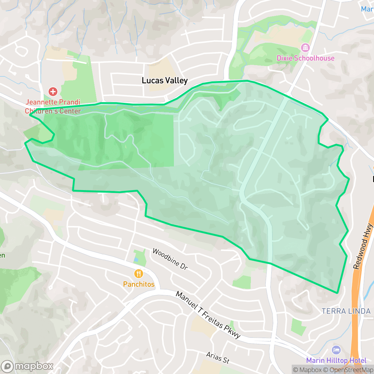
Located in northern San Rafael between Terra Linda and Marinwood, the Mont Marin/San Rafael Park neighborhood is a suburban enclave of approximately 550 homes developed during the mid-1960s and 1970s. The community originated from the city's annexation of the Pimental property in 1963 (Mont Marin) and the Fagundes property in 1965 (San Rafael Park). In April 1974, residents made environmental history in California by establishing a special tax district to fund half of a $412,800 purchase to acquire 197 acres of local open space. This was the first time in the state's history that a tax district was formed specifically to purchase and preserve open space. Today, this protected land forms part of the scenic ridges bordering the neighborhood, which is anchored on its western edge by the Jerry Russom Memorial Park.
The neighborhood is defined by its residential tranquility and strong connection to the natural landscape. With its hilly terrain and abundant greenery, the area maintains a high visual appeal and provides a serene setting for those seeking a slower pace of life. While the community offers limited commercial activity, its high walkability score makes it easy for residents to traverse the local streets on foot, often accompanied by pets, given the area's perfect rating for dog friendliness.
Prospective residents should be aware of the trade-offs inherent in this suburban setting. The area experiences lower levels of social activity compared to more urban parts of San Rafael, and while it benefits from high health insurance coverage and stable air quality, the local fire safety index is a critical consideration for homeowners. Families are served by the Miller Creek Elementary School District, which is known for academic stability, while high school students attend the transitioning San Rafael City High School District.
Neighborhood Scores Across 15 Qualities
Residential spacing offers some buffer between neighbors, though density is slightly higher than the San Rafael average according to iHuus data.
Pedestrian movement is easy due to established sidewalks and safe crossings; this level of connectivity is notably higher than the San Rafael average.
Spacious driveways and large homes characterize the streetscapes here. This area offers a visual quality that is slightly above the San Rafael average according to iHuus data.
Extensive access to large parks, trails, and open spaces makes this area particularly well-suited for pet owners. According to iHuus data, the availability of outdoor space here is higher than the San Rafael average.
Frequent open land and woodland surroundings provide a more semi-rural feel than the San Rafael average. This landscape features scattered homes situated near light industrial parks and office complexes, according to iHuus data.
Residential activity is subdued, featuring low-density housing and limited commercial density compared to the San Rafael average. Most areas rely on a few local hubs and essential services, making the neighborhood feel more tranquil and less active than the city center.
Steady traffic sounds from nearby busy streets are common here; this level of acoustic activity is slightly higher than the average found throughout San Rafael.
Air quality is consistently excellent with minimal health concerns. According to iHuus data, the air quality in this area remains slightly higher than the San Rafael average.
Industrial activity is virtually non-existent here, as the area contains no detected warehouses or hazard sites. This lack of industrial proximity is slightly lower than the San Rafael average, which includes more mixed-use zones.
Health insurance access is exceptionally high among residents, significantly outpacing the San Rafael average according to iHuus data.
Voting patterns and census indicators show a deeply liberal leaning that is slightly more pronounced than the San Rafael average. According to iHuus data, this area maintains a highly consistent progressive political profile.
Residents live alongside a balanced mix of young adults, families, and older populations. According to iHuus data, this demographic spread is slightly more varied than the average found across San Rafael.
Flood risk in this area is slightly higher than the San Rafael average. According to iHuus data, FEMA has not yet completed a detailed flood study for this specific neighborhood.
Wildfire hazards are significant in this area, representing a higher risk level than the San Rafael average according to iHuus data. Residents should prioritize enhanced fire mitigation and preparedness measures.
Address-Level Insights for Mont Marin/San Rafael Park


iHuus Neighborhood Intelligence Insights
Get address-level neighborhood insights for Mont Marin/San Rafael Park
- Street-level scores — see how individual blocks compare, not just neighborhood averages
- Micro-zone boundaries — identify quiet pockets, flood boundaries, and walkable clusters before you visit
- 15 dimensions in full — walkability, noise, air quality, school quality, insurance coverage, population age profile, urban/rural index, and more
- Boundary risk alerts — know if your address sits near a block boundary where scores drop, the kind of detail no listing will ever mention
- School insights — individual school ratings and insights, not just district-level data
- Compare before you commit — side-by-side data across neighborhoods, down to block precision
No credit card required
Compare with Any Neighborhood
| Dimension | Mont Marin/San Rafael Park | Bay Islands |
|---|---|---|
| 🚶 Walkabilityavg 7.77 | ||
| 🔊 Acoustic Comfortavg 4.28 | ||
| 🤫 Privacy Indexavg 5.75 | ||
| 🎨 Visual Appealavg 7.83 | ||
| 🐕 Dog Friendlinessavg 8.65 | ||
| 🗺️ Urban-Rural Indexavg 7.61 | ||
| ✨ Neighborhood Vibeavg 4 | ||
| 🏥 Health Insurance Coverageavg 7.38 | ||
| 🌿 Air Qualityavg 9.29 | ||
| 🏭 Industrial Proximityavg 9.06 | ||
| 🌊 Flood Safetyavg 3.6 | ||
| 🗳️ Ideological Leanavg 9.8 | ||
| 👥 Population Age Profileavg 5.25 | ||
| 🔥 Fire Safetyavg 1.32 | ||
| 🏫 School Quality |
Mont Marin/San Rafael Park Rankings
School Districts Serving Mont Marin/San Rafael Park
School Insights for Mont Marin/San Rafael Park
Below average outcomes; significant attendance and academic challenges.
School Insights
See what's really behind every school rating near Mont Marin/San Rafael Park
- Individual school ratings — each school's own score with outcome context, not just a district average
- Enrollment & class size data — student-to-teacher ratio and how it compares to the state average
- Full demographics breakdown — ethnicity and gender composition for every school in the enrollment zone
- Every school in the district — all schools within the enrollment boundary ranked by rating, not just the closest one
- Grade levels & benchmarks — elementary through high school, with below/above state-average flags
No credit card required