Glenwood, San Rafael
Updated June 22, 2026 · 1,393 residents
Glenwood is a serene, semi-rural enclave in San Rafael characterized by its upscale mid-century ranch-style homes and immediate access to expansive natural trails. While the neighborhood offers exceptionally clean air and a pet-friendly atmosphere, residents should be mindful of elevated wildfire and flood risks.
Key Highlights
About Glenwood
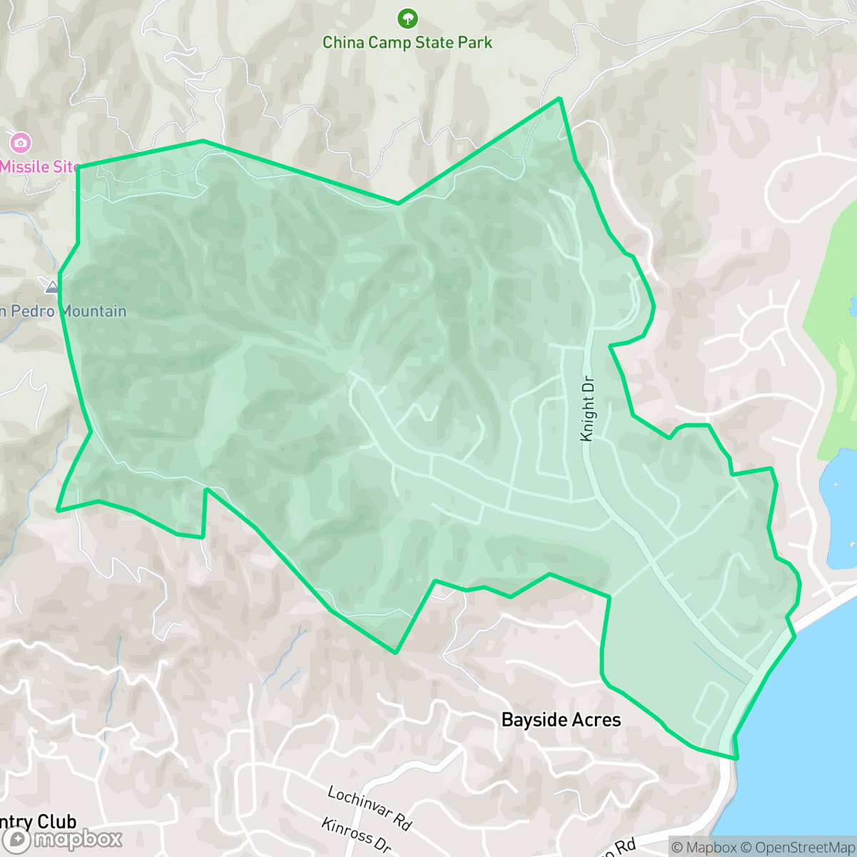
The Glenwood neighborhood in San Rafael occupies land that was once part of the extensive 19th-century holdings of John A. McNear, a prominent figure in Marin County's early development. Originally used for dairying and ranching, the area transitioned to residential use in the mid-1950s following the sale of the McNear estate to the Stegge Development Company. Construction began in 1957, characterized by the development of single-family ranch-style homes along winding streets that notably feature "wood"-themed names such as Cottonwood, Rollingwood, and Robinwood. The neighborhood is anchored by the historic McNear house at 121 Knight Drive, designed by architect Brainerd Jones in 1906, which was preserved during the mid-century expansion. Today, Glenwood is recognized for its proximity to China Camp State Park and its integration into the scenic eastern San Rafael landscape.
Glenwood is a quiet residential pocket that maintains a distinct semi-rural character through its integration with local woodlands and open spaces. The neighborhood features well-maintained properties and spacious lots, creating an upscale aesthetic that stands out within San Rafael. According to iHuus data, the area provides a peaceful retreat from urban density, as it is entirely residential with no industrial activity nearby. Its proximity to China Camp State Park and various trail systems makes it a popular choice for outdoor enthusiasts and pet owners who value immediate access to nature. Prospective residents should consider specific environmental and infrastructure factors when evaluating the area. The neighborhood faces elevated risks regarding both wildfire and flooding, which may require proactive mitigation and specialized insurance coverage. While the streets are generally quiet, some traffic noise is present from nearby thoroughfares. Walkability is moderate, as sidewalks are limited to one side of the street, and the lack of local commercial amenities means most errands require a short drive. Families with school-aged children are served by the San Rafael City school districts, which are currently working through various budgetary and performance-related transitions.
Neighborhood Scores Across 15 Qualities
Residential spacing is mixed with some buffer between neighbors, representing a level of privacy that is slightly higher than the San Rafael average according to iHuus data.
Sidewalks are available on only one side of the street, and walking accessibility is lower than the San Rafael average. Safe crossings are present for pedestrians, but the area is less walkable than many other parts of the city.
Large homes and frequent upscale amenities contribute to a high level of visual appeal that sits above the San Rafael average. According to iHuus data, the area features spacious driveways and well-maintained properties.
Abundant large parks, trails, and open spaces provide ample opportunities for pet owners. According to iHuus data, the access to these recreational areas is higher than the San Rafael average.
Frequent open land and scattered homes amidst woodlands characterize this area. This landscape offers a more rural atmosphere than the typical San Rafael residential setting, according to iHuus data.
Low density and significant open space characterize this serene area. According to iHuus data, the neighborhood lacks distinct commercial character and offers fewer local business options than the San Rafael average.
Steady noise from local traffic along nearby busy streets is present. This level of acoustic activity is slightly higher than the average found throughout San Rafael, according to iHuus data.
Air quality remains consistently high with minimal health concerns. According to iHuus data, the air quality in Glenwood is superior to the San Rafael average.
No warehouses, industrial facilities, or hazard sites are present within the area. This neighborhood maintains a higher level of separation from industrial activity than the San Rafael average.
Health insurance enrollment among Glenwood residents is slightly below the San Rafael average. According to iHuus data, most households in this area maintain active coverage.
Voting patterns and census indicators reflect a deeply liberal political leaning that is very much in line with the broader San Rafael area, according to iHuus data.
A balanced mix of young adults, families, and seniors characterizes this area. According to iHuus data, this demographic distribution is more varied than the average seen across San Rafael.
Located within a designated flood zone, this area faces a significant risk of inundation during major storm events. According to iHuus data, the flood risk in Glenwood is notably higher than the San Rafael average, which may necessitate specialized flood insurance.
Significant fire hazards exist within this area, representing a much higher risk level than the San Rafael average. According to iHuus data, residents should prioritize enhanced wildfire mitigation and preparedness measures.
Block-Level Insights for Glenwood

iHuus Neighborhood Intelligence Insights
Get block-level neighborhood insights for Glenwood
- Street-level scores — see how individual blocks compare, not just neighborhood averages
- Micro-zone boundaries — identify quiet pockets, flood boundaries, and walkable clusters before you visit
- 15 dimensions in full — walkability, noise, air quality, school quality, insurance coverage, population age profile, urban/rural index, and more
- Boundary risk alerts — know if your address sits near a block boundary where scores drop, the kind of detail no listing will ever mention
- School insights — individual school ratings and insights, not just district-level data
- Compare before you commit — side-by-side data across neighborhoods, down to block precision
No credit card required
Compare with Any Neighborhood
| Dimension | Glenwood | Bay Islands |
|---|---|---|
| 🚶 Walkabilityavg 7.77 | ||
| 🔊 Acoustic Comfortavg 4.28 | ||
| 🤫 Privacy Indexavg 5.75 | ||
| 🎨 Visual Appealavg 7.83 | ||
| 🐕 Dog Friendlinessavg 8.65 | ||
| 🗺️ Urban-Rural Indexavg 7.61 | ||
| ✨ Neighborhood Vibeavg 4 | ||
| 🏥 Health Insurance Coverageavg 7.38 | ||
| 🌿 Air Qualityavg 9.29 | ||
| 🏭 Industrial Proximityavg 9.06 | ||
| 🌊 Flood Safetyavg 3.6 | ||
| 🗳️ Ideological Leanavg 9.8 | ||
| 👥 Population Age Profileavg 5.25 | ||
| 🔥 Fire Safetyavg 1.32 | ||
| 🏫 School Quality |
Glenwood Rankings
School Districts Serving Glenwood
San Rafael City Elementary School District is a solid but bifurcated organization, characterized by a mix of high-achieving 'Blue Chip' campuses and severely underperforming schools serving lower-income areas. The district demonstrates strong operational stability through successful infrastructure bonds, modernized facilities, and a rigorous shift toward evidence-based literacy instruction. While teacher quality and community sentiment remain high, the district's overall health is tempered by a persistent achievement gap, rising cost-of-living challenges for staff retention, and the need for more consistent academic rigor across all neighborhood schools.
Schools
San Rafael City High School District is currently in a state of transition, characterized by a significant performance gap between its high-performing Terra Linda campus and its struggling alternative and secondary sites. While the district is successfully executing large-scale infrastructure improvements through voter-approved bonds and showing strong outcomes in specialized English learner and environmental programs, it faces a looming $5.5 million budget shortfall and declining enrollment. The shift toward a property tax-based funding model and ongoing staff reductions suggest fiscal instability, though strong community support and modernizing facilities provide a buffer against total operational decline.
Schools
School Insights for Glenwood
Below average outcomes; significant attendance and academic challenges.
School Insights
See what's really behind every school rating near Glenwood
- Individual school ratings — each school's own score with outcome context, not just a district average
- Enrollment & class size data — student-to-teacher ratio and how it compares to the state average
- Full demographics breakdown — ethnicity and gender composition for every school in the enrollment zone
- Every school in the district — all schools within the enrollment boundary ranked by rating, not just the closest one
- Grade levels & benchmarks — elementary through high school, with below/above state-average flags
No credit card required