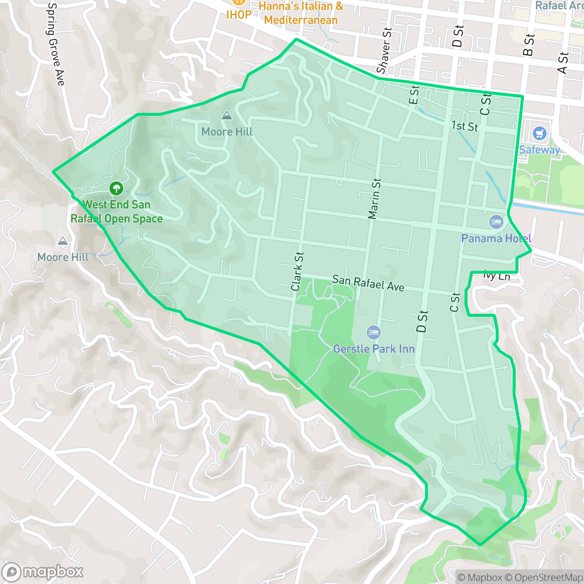
Gerstle Park, San Rafael
Updated June 22, 2026 · 2,662 residents
Gerstle Park is a visually stunning neighborhood in San Rafael known for its quiet, low-density residential streets and significant green space. Residents enjoy a peaceful atmosphere with excellent dog-friendly amenities, though the area generally requires a vehicle for daily errands due to limited walkability.
Key Highlights
About Gerstle Park
Originally subdivided in the 1860s as Short’s Tract, San Rafael’s first subdivision, the Gerstle Park neighborhood began as a collection of summer retreats for wealthy San Francisco families. In 1881, Bavarian immigrant Lewis Gerstle purchased a five-acre estate here, which his family donated to the city in 1930 to establish the neighborhood's namesake park. By the early 20th century, Italian railroad workers settled in the area, building Arts and Crafts cottages and planting vineyards. Today, Gerstle Park is celebrated as one of San Rafael’s oldest historic districts, featuring a rich architectural mix of Italianate and Gothic Revival Victorians, Craftsman homes, and the Gerstle Park Inn, housed in the surviving guesthouse of the adjoining Sloss estate.
The area offers a distinct, calm environment characterized by its high visual appeal and open spaces. According to iHuus data, the neighborhood provides a serene residential rhythm, making it an ideal setting for those who prioritize aesthetic charm and quiet surroundings over high-density urban activity. Its proximity to natural areas and well-maintained properties contributes to a strong sense of community and stability, maintaining a low-density character that stands out within the broader city landscape.
While the neighborhood excels in visual and environmental quality, prospective residents should note the trade-offs regarding accessibility and safety. The area features moderate walkability, meaning most daily tasks are best accomplished by car. Additionally, while health insurance coverage is notably high, the neighborhood faces considerations regarding fire safety. Educational options also vary, as the area is served by districts with mixed performance outcomes, requiring families to research specific school boundaries carefully to understand their local options.
Neighborhood Scores Across 15 Qualities
Residential spacing fluctuates between dense downtown apartments and hillside homes with generous separation. According to iHuus data, the level of seclusion in this area is slightly higher than the San Rafael average.
Pedestrian access to downtown amenities is excellent due to a grid-based sidewalk network and safe crossings. This neighborhood offers greater walkability than the San Rafael average, according to iHuus data.
Hillside properties featuring private pools and well-maintained landscapes contribute to a visual character that is more polished than the San Rafael average. According to iHuus data, the area is characterized by large homes and high-end residential amenities.
Large parks and wide grassy verges provide ample space for pets. According to iHuus data, the level of accessibility to safe, traffic-free walking areas is consistent with the San Rafael average.
A dense suburban downtown provides a mix of retail and low-rise residential structures, closely mirroring the broader city average for open space and built environments.
Local streets offer a mix of quiet residential rhythm and accessible amenities, providing a higher level of activity than the San Rafael average. Residents can find a variety of nearby cafes and dining spots situated alongside calm, low-density housing and green spaces.
Local traffic from nearby busy streets creates a consistent background noise, which is slightly more pronounced than the average for San Rafael.
Air quality in this area is excellent and remains consistent with the San Rafael average. Residents can expect highly clean air with minimal health concerns according to iHuus data.
Residents can expect a purely residential and mixed-use environment with no detected warehouses or heavy industrial hazards. This area maintains a level of industrial separation that is consistent with the rest of San Rafael.
Health insurance access is widespread among residents here, sitting notably higher than the San Rafael average according to iHuus data.
Voting patterns and census indicators in Gerstle Park reflect a deeply liberal political leaning, which is slightly more pronounced than the average seen across San Rafael. According to iHuus data, the area maintains a very consistent ideological profile.
Residents live alongside a balanced mix of young adults, families, and older individuals, reflecting a demographic spread that is very similar to the San Rafael average.
Flood risk in this area is slightly higher than the San Rafael average, though current assessments from iHuus data indicate that a detailed federal study for this specific zone has not yet been completed.
Significant fire hazards are present in this area, representing a higher risk level than the San Rafael average. Residents should prioritize enhanced mitigation measures and remain vigilant regarding local fire safety protocols.
Block-Level Insights for Gerstle Park

iHuus Neighborhood Intelligence Insights
Get block-level neighborhood insights for Gerstle Park
- Street-level scores — see how individual blocks compare, not just neighborhood averages
- Micro-zone boundaries — identify quiet pockets, flood boundaries, and walkable clusters before you visit
- 15 dimensions in full — walkability, noise, air quality, school quality, insurance coverage, population age profile, urban/rural index, and more
- Boundary risk alerts — know if your address sits near a block boundary where scores drop, the kind of detail no listing will ever mention
- School insights — individual school ratings and insights, not just district-level data
- Compare before you commit — side-by-side data across neighborhoods, down to block precision
No credit card required
Compare with Any Neighborhood
| Dimension | Gerstle Park | Bay Islands |
|---|---|---|
| 🚶 Walkabilityavg 7.77 | ||
| 🔊 Acoustic Comfortavg 4.28 | ||
| 🤫 Privacy Indexavg 5.75 | ||
| 🎨 Visual Appealavg 7.83 | ||
| 🐕 Dog Friendlinessavg 8.65 | ||
| 🗺️ Urban-Rural Indexavg 7.61 | ||
| ✨ Neighborhood Vibeavg 4 | ||
| 🏥 Health Insurance Coverageavg 7.38 | ||
| 🌿 Air Qualityavg 9.29 | ||
| 🏭 Industrial Proximityavg 9.06 | ||
| 🌊 Flood Safetyavg 3.6 | ||
| 🗳️ Ideological Leanavg 9.8 | ||
| 👥 Population Age Profileavg 5.25 | ||
| 🔥 Fire Safetyavg 1.32 | ||
| 🏫 School Quality |
Gerstle Park Rankings
School Districts Serving Gerstle Park
Kentfield Elementary School District is an elite, high-performing organization characterized by 'Green' indicators across academic, financial, and operational categories. With perfect 10/10 school ratings and a robust funding model supported by local parcel taxes and the KIK foundation, the district maintains a luxury standard of public education. Operational health is bolstered by strong community engagement, modern facility investments, and a proactive approach to curriculum development. While the high-pressure academic environment and local cost of living are noted community considerations, they do not detract from the district's status as a stable, premier educational provider with exceptional leadership and fiscal security.
Schools
Ross Elementary School District is a premier 'Blue Chip' district demonstrating elite academic performance and exceptional financial stability. As a single-school district, it maintains a 10/10 rating with high proficiency levels (95% in math) and a low 11:1 student-to-teacher ratio. The district benefits from strong community backing via parcel taxes and a dedicated foundation, ensuring robust enrichment programs and modern facilities. With stable leadership, a fully staffed faculty, and a curriculum that successfully integrates STEM and social-emotional learning, the district operates with a level of consistency and resource-richness that mirrors a private institution while maintaining high public accountability.
Schools
Tamalpais Union High School District remains a premier educational entity, ranked 16th in California with an A+ academic standing. While the district is navigating fiscal headwinds—including a $5 million deficit and projected enrollment declines—it maintains high operational stability through strategic staffing adjustments and proactive financial planning via upcoming parcel tax renewals. Its flagship high schools are top-tier destination schools with exceptional STEM and collegiate preparation outcomes. Despite minor community friction regarding technology policies and administrative turnover, the district's 'Blue Chip' status is secured by its dominant academic performance, low chronic absenteeism, and high-performing feeder consistency.
Schools
San Rafael City Elementary School District is a solid but bifurcated organization, characterized by a mix of high-achieving 'Blue Chip' campuses and severely underperforming schools serving lower-income areas. The district demonstrates strong operational stability through successful infrastructure bonds, modernized facilities, and a rigorous shift toward evidence-based literacy instruction. While teacher quality and community sentiment remain high, the district's overall health is tempered by a persistent achievement gap, rising cost-of-living challenges for staff retention, and the need for more consistent academic rigor across all neighborhood schools.
Schools
San Rafael City High School District is currently in a state of transition, characterized by a significant performance gap between its high-performing Terra Linda campus and its struggling alternative and secondary sites. While the district is successfully executing large-scale infrastructure improvements through voter-approved bonds and showing strong outcomes in specialized English learner and environmental programs, it faces a looming $5.5 million budget shortfall and declining enrollment. The shift toward a property tax-based funding model and ongoing staff reductions suggest fiscal instability, though strong community support and modernizing facilities provide a buffer against total operational decline.
Schools
School Insights for Gerstle Park
Below average outcomes; significant attendance and academic challenges.
School Insights
See what's really behind every school rating near Gerstle Park
- Individual school ratings — each school's own score with outcome context, not just a district average
- Enrollment & class size data — student-to-teacher ratio and how it compares to the state average
- Full demographics breakdown — ethnicity and gender composition for every school in the enrollment zone
- Every school in the district — all schools within the enrollment boundary ranked by rating, not just the closest one
- Grade levels & benchmarks — elementary through high school, with below/above state-average flags
No credit card required