Civic Center, San Rafael
Updated June 22, 2026 · 2,350 residents
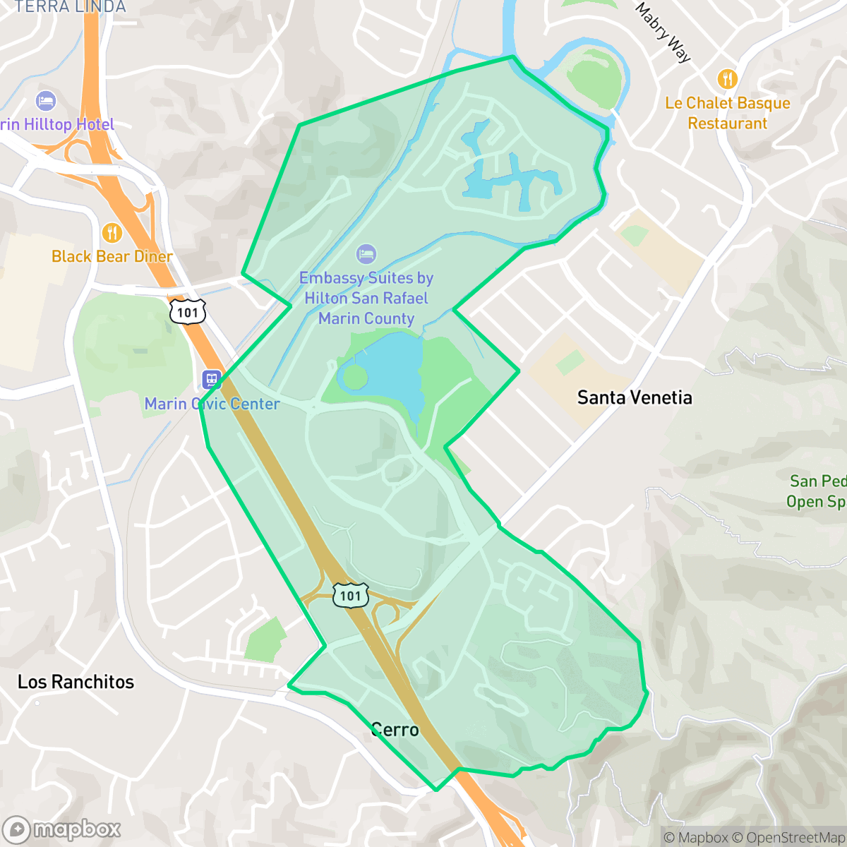
The Civic Center neighborhood is defined by its iconic architecture and open, semi-rural landscape that offers a peaceful, upscale residential environment. Residents enjoy excellent air quality and easy pedestrian access, though the area experiences frequent noise from nearby transportation corridors.
Key Highlights
About Civic Center
The Civic Center in San Rafael is defined by the Marin County Civic Center, a National Historic Landmark designed by Frank Lloyd Wright. Commissioned in the late 1950s and completed posthumously, it is one of Wright's final major projects and a premier example of organic architecture. The complex is world-renowned for its distinctive blue-roofed, arched structures that bridge two hills, seamlessly integrating government facilities into the natural landscape. Serving as the administrative heart of Marin County, the site houses government offices, a library, and a post office. Its unique modernist design has made it a significant cultural icon, frequently featured in film and media, and it remains the defining historical and architectural anchor of the neighborhood, representing a mid-century vision of public space and civic governance.
The area maintains a distinct semi-rural feel, characterized by expansive greenery and a lack of industrial development. It serves as a quiet suburban enclave where residents benefit from high levels of health insurance coverage and a strong sense of community. The streetscapes are upscale, and the layout supports easy pedestrian access, allowing for comfortable movement between residential pockets and local services.
Prospective residents should be aware of the notable acoustic impact caused by proximity to major freeways and transit lines. While the neighborhood is highly suitable for pet owners due to its connected green spaces, it also carries higher risks related to fire and flood events. This location is well-suited for families and individuals who prioritize a blend of natural surroundings and accessible amenities, provided they are comfortable with the environmental and noise-related trade-offs noted by iHuus data.
Neighborhood Scores Across 15 Qualities
Residential spacing offers a balanced amount of buffer between neighbors, sitting slightly above the San Rafael average. This density provides a mix of open space and proximity to adjacent properties, according to iHuus data.
Sidewalks and safe crossings facilitate most local trips on foot, offering a level of walkability that is slightly above the San Rafael average according to iHuus data.
Large residential properties and frequent upscale amenities define the local landscape. This area maintains a level of visual appeal that is very similar to the San Rafael average.
Connected green spaces and wide, traffic-safe paths make this area highly suitable for pet owners. This level of dog friendliness is consistent with the rest of San Rafael.
Open land and scattered greenery provide a more natural landscape than much of the surrounding city. According to iHuus data, this area is less densely developed than the San Rafael average.
Local activity levels are consistent with the city average, characterized by a mix of calm residential blocks and occasional pockets of dining and services. While some areas offer proximity to local amenities like Red Oak Craft Bar, other sections remain primarily quiet and suburban with limited walking access to businesses.
Frequent traffic and transit noise from nearby freeways and rail lines makes this area significantly louder than the San Rafael average. Residents may experience persistent auditory disturbances due to the proximity of major transportation corridors.
Air quality remains consistently high with minimal health concerns, performing even better than the San Rafael average according to iHuus data.
Residential life here is free from warehouses and heavy industrial facilities, offering a cleaner environment than the San Rafael average. According to iHuus data, the area consists of purely residential and light commercial zones with no detected hazard sites.
Health insurance access is widely available among residents, appearing notably higher than the San Rafael city average according to iHuus data.
Voting patterns and census indicators show a highly liberal political orientation that is consistent with the rest of San Rafael.
Residents of all ages are represented here, featuring a balanced spread of young adults, families, and seniors that is slightly more diverse than the San Rafael average according to iHuus data.
Flood risk in this area is higher than the San Rafael average, though a lack of detailed federal studies makes the precise level of danger difficult to determine. Residents should remain aware of potential vulnerabilities during extreme weather events according to iHuus data.
Extreme fire hazards are present in this area, with risk levels notably higher than the San Rafael average according to iHuus data.
Block-Level Insights for Civic Center

iHuus Neighborhood Intelligence Insights
Get block-level neighborhood insights for Civic Center
- Street-level scores — see how individual blocks compare, not just neighborhood averages
- Micro-zone boundaries — identify quiet pockets, flood boundaries, and walkable clusters before you visit
- 15 dimensions in full — walkability, noise, air quality, school quality, insurance coverage, population age profile, urban/rural index, and more
- Boundary risk alerts — know if your address sits near a block boundary where scores drop, the kind of detail no listing will ever mention
- School insights — individual school ratings and insights, not just district-level data
- Compare before you commit — side-by-side data across neighborhoods, down to block precision
No credit card required
Compare with Any Neighborhood
| Dimension | Civic Center | Bay Islands |
|---|---|---|
| 🚶 Walkabilityavg 7.77 | ||
| 🔊 Acoustic Comfortavg 4.28 | ||
| 🤫 Privacy Indexavg 5.75 | ||
| 🎨 Visual Appealavg 7.83 | ||
| 🐕 Dog Friendlinessavg 8.65 | ||
| 🗺️ Urban-Rural Indexavg 7.61 | ||
| ✨ Neighborhood Vibeavg 4 | ||
| 🏥 Health Insurance Coverageavg 7.38 | ||
| 🌿 Air Qualityavg 9.29 | ||
| 🏭 Industrial Proximityavg 9.06 | ||
| 🌊 Flood Safetyavg 3.6 | ||
| 🗳️ Ideological Leanavg 9.8 | ||
| 👥 Population Age Profileavg 5.25 | ||
| 🔥 Fire Safetyavg 1.32 | ||
| 🏫 School Quality |
Civic Center Rankings
School Districts Serving Civic Center
Miller Creek Elementary School District (formerly Dixie) is a high-performing, stable organization characterized by top-tier academic outcomes and strong community backing. With three out of four schools performing at the highest levels and a 10/10 middle school serving as a premier feeder, the district remains a primary draw for families in the San Rafael area. Operational health is robust, evidenced by successful facility modernization projects and transparent fiscal management in the face of inflationary pressures. Although there is a notable performance disparity at one elementary site and anecdotal reports of a competitive atmosphere, the district's proactive approach to student wellness and curriculum innovation secures its standing as a solid, high-quality educational provider.
Schools
San Rafael City Elementary School District is a solid but bifurcated organization, characterized by a mix of high-achieving 'Blue Chip' campuses and severely underperforming schools serving lower-income areas. The district demonstrates strong operational stability through successful infrastructure bonds, modernized facilities, and a rigorous shift toward evidence-based literacy instruction. While teacher quality and community sentiment remain high, the district's overall health is tempered by a persistent achievement gap, rising cost-of-living challenges for staff retention, and the need for more consistent academic rigor across all neighborhood schools.
Schools
San Rafael City High School District is currently in a state of transition, characterized by a significant performance gap between its high-performing Terra Linda campus and its struggling alternative and secondary sites. While the district is successfully executing large-scale infrastructure improvements through voter-approved bonds and showing strong outcomes in specialized English learner and environmental programs, it faces a looming $5.5 million budget shortfall and declining enrollment. The shift toward a property tax-based funding model and ongoing staff reductions suggest fiscal instability, though strong community support and modernizing facilities provide a buffer against total operational decline.
Schools
School Insights for Civic Center
Below average outcomes; significant attendance and academic challenges.
School Insights
See what's really behind every school rating near Civic Center
- Individual school ratings — each school's own score with outcome context, not just a district average
- Enrollment & class size data — student-to-teacher ratio and how it compares to the state average
- Full demographics breakdown — ethnicity and gender composition for every school in the enrollment zone
- Every school in the district — all schools within the enrollment boundary ranked by rating, not just the closest one
- Grade levels & benchmarks — elementary through high school, with below/above state-average flags
No credit card required