Canal, San Rafael
Updated June 22, 2026 · 10,799 residents
The Canal neighborhood is a densely populated and highly walkable area of San Rafael known for its diverse community and proximity to the waterfront. While residents benefit from accessible residential paths, the area is characterized by a mix of light industrial zones and high-density housing that results in limited privacy and consistent road traffic noise.
Key Highlights
About Canal
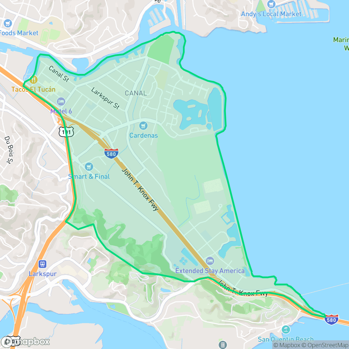
Bounded by the San Francisco Bay and its namesake waterway, the Canal neighborhood of San Rafael has a rich history of demographic and physical transformation. Originally inhabited by the Coast Miwok, the area's canal was dredged in the early 20th century, becoming a popular hub for yacht clubs. Following World War II, the construction of affordable apartment complexes in the 1960s established the neighborhood as a vital immigrant gateway. It welcomed African-American renters in the late 1970s, Vietnamese refugees in the 1980s, and a vibrant, predominantly Latino community by the 1990s. Culturally, the Canal is anchored by Pickleweed Park—home to the Al Boro Community Center—and the "Peoples of the Canal" historical art walk. Additionally, the neighborhood hosted Lucasfilm’s Industrial Light & Magic, which constructed its main special effects stage here in 1997.
The neighborhood functions as a central hub for San Rafael, blending residential clusters with active commercial and industrial infrastructure. The landscape is defined by its high-density layout, featuring closely spaced townhomes and apartment complexes that contribute to a distinct urban feel. According to iHuus data, the area provides a high level of walkability for daily errands, though the presence of major logistics hubs and industrial facilities means that pedestrian access can be challenging near heavy traffic corridors and highway junctions.
Residents navigate a landscape that balances proximity to shoreline trails with the realities of industrial proximity. The area faces specific challenges, including elevated noise levels from road traffic and significant concerns regarding flood and fire safety. While the neighborhood offers unique local dining and social spaces, it is best suited for those prioritizing accessibility and community diversity over quiet, low-density living. Prospective residents should note the limited health insurance coverage and the performance metrics of local schools, such as Bahia Vista Elementary, when evaluating the neighborhood's long-term suitability.
Neighborhood Scores Across 15 Qualities
Shared walls and closely spaced structures result in less personal buffer between neighbors than is typical for San Rafael. Some areas feature high density clusters where buildings are tightly packed with minimal separation.
Extensive sidewalks and pedestrian crossings connect residential areas to commercial zones, making the area slightly more walkable than the San Rafael average. However, navigation can be difficult near high-traffic freeway corridors and industrial blocks where sidewalk consistency decreases.
Visual variety consists mainly of standard commercial structures and high-density residential clusters. This area presents a more utilitarian landscape than the San Rafael average, featuring many shared amenities and parking lots rather than large estate lots.
Access to pet-friendly amenities is lower than the San Rafael average due to heavy industrial areas and freeway interchanges. However, some residents benefit from nearby shoreline trails and green corridors connecting apartment blocks.
A combination of dense commercial warehouses, industrial zones, and nearby undeveloped marshlands creates a landscape that is slightly more urban than the San Rafael average. While some areas feature significant open greenery and shoreline, much of the terrain consists of developed infrastructure and retail centers.
Low-density residential and industrial pockets create a steady but subdued rhythm. While various dining options are available, the layout is largely car-dependent and offers slightly more activity than the San Rafael average.
Steady traffic noise from nearby busy streets is a consistent feature of the area. This level of acoustic activity is typical for the city of San Rafael.
Air quality remains mostly clean with only rare instances of elevated readings. According to iHuus data, air quality in Canal is slightly lower than the San Rafael city average.
Industrial presence is minimal, though a wastewater treatment facility and some light commercial activity are located near the neighborhood edges. This area has fewer heavy industrial features than the San Rafael average.
Health insurance access is notably lower in this area compared to the San Rafael average, according to iHuus data.
Voting patterns and census indicators show a predominantly liberal political leaning that is consistent with the broader San Rafael area, according to iHuus data.
Residents live alongside a varied mix of young adults, families, and older individuals. According to iHuus data, this age distribution is slightly more concentrated in certain age brackets compared to the broader San Rafael area.
Located in a coastal high-hazard zone with wave action, this area faces significantly greater flood danger than most of San Rafael. According to iHuus data, residents should prepare for elevated or potentially prohibitive flood insurance costs.
Extreme fire hazards characterize this area, presenting a significantly higher risk level than the rest of San Rafael. According to iHuus data, residents should prioritize maximum fire protection and emergency preparedness measures.
Block-Level Insights for Canal

iHuus Neighborhood Intelligence Insights
Get block-level neighborhood insights for Canal
- Street-level scores — see how individual blocks compare, not just neighborhood averages
- Micro-zone boundaries — identify quiet pockets, flood boundaries, and walkable clusters before you visit
- 15 dimensions in full — walkability, noise, air quality, school quality, insurance coverage, population age profile, urban/rural index, and more
- Boundary risk alerts — know if your address sits near a block boundary where scores drop, the kind of detail no listing will ever mention
- School insights — individual school ratings and insights, not just district-level data
- Compare before you commit — side-by-side data across neighborhoods, down to block precision
No credit card required
Compare with Any Neighborhood
| Dimension | Canal | Bay Islands |
|---|---|---|
| 🚶 Walkabilityavg 7.77 | ||
| 🔊 Acoustic Comfortavg 4.28 | ||
| 🤫 Privacy Indexavg 5.75 | ||
| 🎨 Visual Appealavg 7.83 | ||
| 🐕 Dog Friendlinessavg 8.65 | ||
| 🗺️ Urban-Rural Indexavg 7.61 | ||
| ✨ Neighborhood Vibeavg 4 | ||
| 🏥 Health Insurance Coverageavg 7.38 | ||
| 🌿 Air Qualityavg 9.29 | ||
| 🏭 Industrial Proximityavg 9.06 | ||
| 🌊 Flood Safetyavg 3.6 | ||
| 🗳️ Ideological Leanavg 9.8 | ||
| 👥 Population Age Profileavg 5.25 | ||
| 🔥 Fire Safetyavg 1.32 | ||
| 🏫 School Quality |
Canal Rankings
School Districts Serving Canal
San Rafael City Elementary School District is a solid but bifurcated organization, characterized by a mix of high-achieving 'Blue Chip' campuses and severely underperforming schools serving lower-income areas. The district demonstrates strong operational stability through successful infrastructure bonds, modernized facilities, and a rigorous shift toward evidence-based literacy instruction. While teacher quality and community sentiment remain high, the district's overall health is tempered by a persistent achievement gap, rising cost-of-living challenges for staff retention, and the need for more consistent academic rigor across all neighborhood schools.
Schools
San Rafael City High School District is currently in a state of transition, characterized by a significant performance gap between its high-performing Terra Linda campus and its struggling alternative and secondary sites. While the district is successfully executing large-scale infrastructure improvements through voter-approved bonds and showing strong outcomes in specialized English learner and environmental programs, it faces a looming $5.5 million budget shortfall and declining enrollment. The shift toward a property tax-based funding model and ongoing staff reductions suggest fiscal instability, though strong community support and modernizing facilities provide a buffer against total operational decline.
Schools
School Insights for Canal
Below average outcomes; significant attendance and academic challenges.
School Insights
See what's really behind every school rating near Canal
- Individual school ratings — each school's own score with outcome context, not just a district average
- Enrollment & class size data — student-to-teacher ratio and how it compares to the state average
- Full demographics breakdown — ethnicity and gender composition for every school in the enrollment zone
- Every school in the district — all schools within the enrollment boundary ranked by rating, not just the closest one
- Grade levels & benchmarks — elementary through high school, with below/above state-average flags
No credit card required