Bret Harte, San Rafael
Updated June 22, 2026 · 1,248 residents
Bret Harte is a quiet, hillside enclave in San Rafael known for its vintage architecture and rural atmosphere. The neighborhood offers high walkability and exceptional dog friendliness, though residents should be aware of its low flood safety rating.
Key Highlights
About Bret Harte
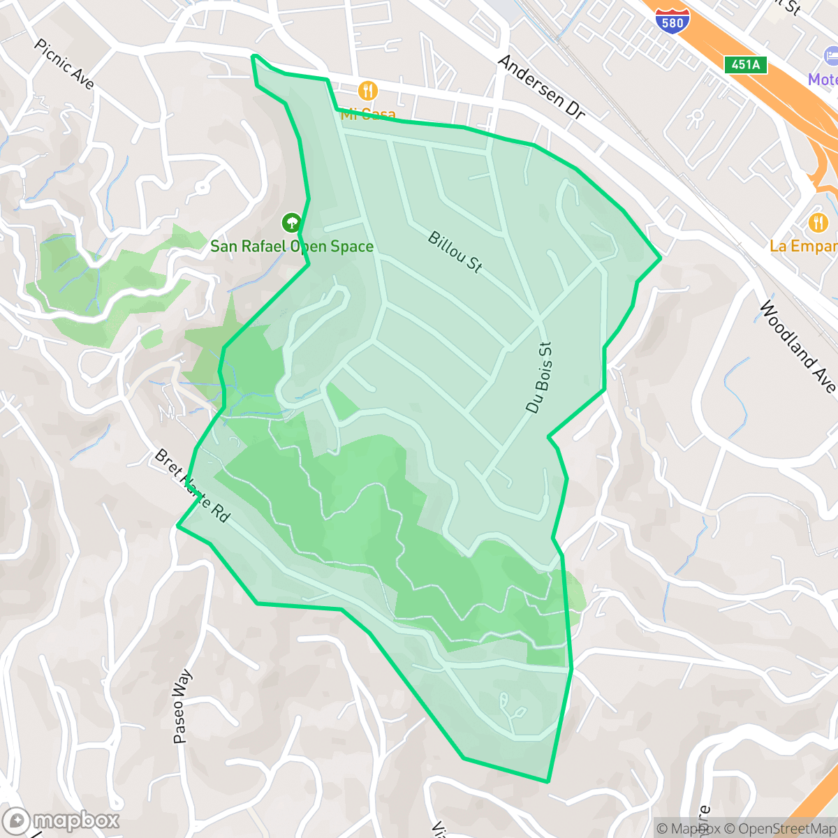
Named after the 19th-century American author Bret Harte—who married in San Rafael in 1862—the Bret Harte neighborhood is a historic, hillside residential enclave situated along the city’s southern border. Developed primarily starting in the late 1930s, the neighborhood is characterized by its vintage architectural appeal, tree-lined streets, and abundant green space. A defining local feature is the "secret bootleg trail," a historic backwoods path snaking up the hillside that is maintained by local volunteers. The social heart of the community is Bret Harte Park, which hosts long-standing neighborhood events organized by the Bret Harte Community Association, a local group that has brought residents together for over 50 years.
The Bret Harte neighborhood is a low-density, visually appealing area that balances suburban residential life with proximity to light industrial zones. While the area is exceptionally quiet, it maintains a high degree of walkability for a hillside community. The environment is notably dog-friendly and retains a strong rural character despite being within city limits, providing a scenic backdrop for the vintage homes that define the local landscape.
Prospective residents should note the mixed-use nature of the surrounding area, which brings occasional daytime traffic. While the neighborhood enjoys decent acoustic comfort, it faces significant challenges regarding flood safety. It is best suited for those who prioritize a peaceful, scenic environment and access to top-tier schools in the nearby Kentfield and Tamalpais Union districts, provided they are comfortable with the specific environmental risks associated with the location.
Neighborhood Scores Across 15 Qualities
Residential and industrial structures feature mixed spacing with some areas presenting tightly packed buildings and minimal buffers. This level of privacy is slightly lower than the San Rafael average according to iHuus data.
Pedestrian navigation can be difficult near industrial blocks and high traffic freeway corridors due to a lack of sidewalks. While quiet streets allow for walking, the overall walkability is below the San Rafael average according to iHuus data.
Residential views consist of a blend of modest housing clusters and standard commercial structures. According to iHuus data, the visual aesthetic is slightly below the San Rafael average.
Industrial lots and a major freeway interchange limit access to green verges or public parks. According to iHuus data, this area offers significantly fewer opportunities for dog walking than the San Rafael average.
Open land and scattered woodland are common throughout the area, though some sections transition into low-density industrial zones with large warehouses. This balance of landscape is consistent with the broader San Rafael average, according to iHuus data.
Limited social destinations and a reliance on vehicles characterize this area, which feels less active than the San Rafael average. Most blocks consist of quiet residential or light industrial spaces where amenities are sparse and scattered.
Persistent sounds from nearby railroad tracks and heavy freeway traffic are common here. According to iHuus data, acoustic comfort in this area is notably lower than the San Rafael average.
Air quality remains consistently good with rare instances of elevated readings; however, levels are slightly lower than the San Rafael city average according to iHuus data.
Light commercial units and warehouses are integrated with residential streets, resulting in a higher concentration of industrial activity than is typically found across San Rafael. According to iHuus data, while much of the area remains quiet, certain pockets experience increased daytime traffic from commercial operations.
Health insurance access is notably lower in this area than the San Rafael average. According to iHuus data, a small portion of the resident population maintains active health coverage.
Voting patterns and census indicators show a strong liberal leaning that is slightly more pronounced than the San Rafael average, according to iHuus data.
Residents live alongside a balanced mix of young adults, families, and seniors. This age distribution is slightly more concentrated in certain age groups compared to the San Rafael average, according to iHuus data.
Properties in this area are located within a designated floodplain, which presents a much higher risk of flooding than most parts of San Rafael. According to iHuus data, residents should anticipate the potential requirement for flood insurance.
Significant fire hazards exist within this area, which presents a higher risk level than the San Rafael average. Residents should prioritize enhanced mitigation strategies and fire preparedness according to iHuus data.
Block-Level Insights for Bret Harte

iHuus Neighborhood Intelligence Insights
Get block-level neighborhood insights for Bret Harte
- Street-level scores — see how individual blocks compare, not just neighborhood averages
- Micro-zone boundaries — identify quiet pockets, flood boundaries, and walkable clusters before you visit
- 15 dimensions in full — walkability, noise, air quality, school quality, insurance coverage, population age profile, urban/rural index, and more
- Boundary risk alerts — know if your address sits near a block boundary where scores drop, the kind of detail no listing will ever mention
- School insights — individual school ratings and insights, not just district-level data
- Compare before you commit — side-by-side data across neighborhoods, down to block precision
No credit card required
Compare with Any Neighborhood
| Dimension | Bret Harte | Bay Islands |
|---|---|---|
| 🚶 Walkabilityavg 7.77 | ||
| 🔊 Acoustic Comfortavg 4.28 | ||
| 🤫 Privacy Indexavg 5.75 | ||
| 🎨 Visual Appealavg 7.83 | ||
| 🐕 Dog Friendlinessavg 8.65 | ||
| 🗺️ Urban-Rural Indexavg 7.61 | ||
| ✨ Neighborhood Vibeavg 4 | ||
| 🏥 Health Insurance Coverageavg 7.38 | ||
| 🌿 Air Qualityavg 9.29 | ||
| 🏭 Industrial Proximityavg 9.06 | ||
| 🌊 Flood Safetyavg 3.6 | ||
| 🗳️ Ideological Leanavg 9.8 | ||
| 👥 Population Age Profileavg 5.25 | ||
| 🔥 Fire Safetyavg 1.32 | ||
| 🏫 School Quality |
Bret Harte Rankings
School Districts Serving Bret Harte
Kentfield Elementary School District is an elite, high-performing organization characterized by 'Green' indicators across academic, financial, and operational categories. With perfect 10/10 school ratings and a robust funding model supported by local parcel taxes and the KIK foundation, the district maintains a luxury standard of public education. Operational health is bolstered by strong community engagement, modern facility investments, and a proactive approach to curriculum development. While the high-pressure academic environment and local cost of living are noted community considerations, they do not detract from the district's status as a stable, premier educational provider with exceptional leadership and fiscal security.
Schools
Tamalpais Union High School District remains a premier educational entity, ranked 16th in California with an A+ academic standing. While the district is navigating fiscal headwinds—including a $5 million deficit and projected enrollment declines—it maintains high operational stability through strategic staffing adjustments and proactive financial planning via upcoming parcel tax renewals. Its flagship high schools are top-tier destination schools with exceptional STEM and collegiate preparation outcomes. Despite minor community friction regarding technology policies and administrative turnover, the district's 'Blue Chip' status is secured by its dominant academic performance, low chronic absenteeism, and high-performing feeder consistency.
Schools
San Rafael City Elementary School District is a solid but bifurcated organization, characterized by a mix of high-achieving 'Blue Chip' campuses and severely underperforming schools serving lower-income areas. The district demonstrates strong operational stability through successful infrastructure bonds, modernized facilities, and a rigorous shift toward evidence-based literacy instruction. While teacher quality and community sentiment remain high, the district's overall health is tempered by a persistent achievement gap, rising cost-of-living challenges for staff retention, and the need for more consistent academic rigor across all neighborhood schools.
Schools
San Rafael City High School District is currently in a state of transition, characterized by a significant performance gap between its high-performing Terra Linda campus and its struggling alternative and secondary sites. While the district is successfully executing large-scale infrastructure improvements through voter-approved bonds and showing strong outcomes in specialized English learner and environmental programs, it faces a looming $5.5 million budget shortfall and declining enrollment. The shift toward a property tax-based funding model and ongoing staff reductions suggest fiscal instability, though strong community support and modernizing facilities provide a buffer against total operational decline.
Schools
School Insights for Bret Harte
Below average outcomes; significant attendance and academic challenges.
School Insights
See what's really behind every school rating near Bret Harte
- Individual school ratings — each school's own score with outcome context, not just a district average
- Enrollment & class size data — student-to-teacher ratio and how it compares to the state average
- Full demographics breakdown — ethnicity and gender composition for every school in the enrollment zone
- Every school in the district — all schools within the enrollment boundary ranked by rating, not just the closest one
- Grade levels & benchmarks — elementary through high school, with below/above state-average flags
No credit card required