Mariners Island, San Mateo
Updated June 22, 2026 · 2,378 residents
Mariners Island is a highly walkable waterfront neighborhood in San Mateo known for its accessible suburban atmosphere and proximity to the Bridgepointe Shopping Center. Residents enjoy a balance of quiet residential streets and open green spaces, though the area presents specific trade-offs regarding residential privacy and flood safety.
Key Highlights
About Mariners Island
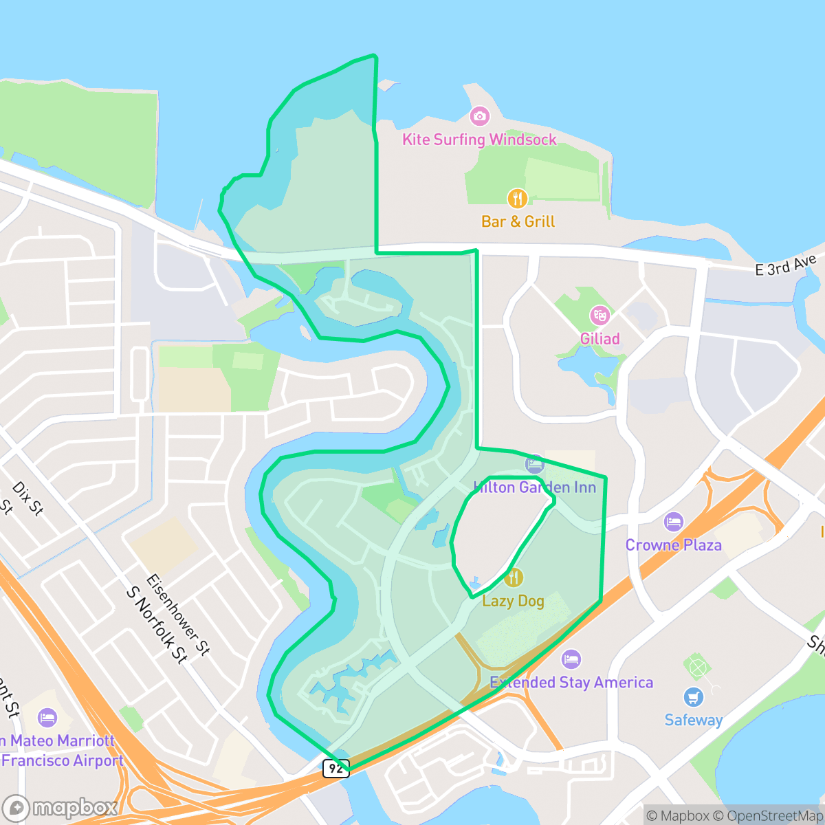
Mariners Island in San Mateo, California, originated from a 300-acre tract of wetlands and grazing land originally owned by dairy farmer Thomas Thurkelson. According to local lore, a minor dispute over an $11 milk bill led Thurkelson to refuse to sell his land to the Foster family (who developed adjacent Foster City), resulting in the parcel becoming part of San Mateo instead. Formerly bordered by Seal Slough, the area transformed in the late 1950s and 1960s when the slough was dredged and diked to form the Marina Lagoon. Residential and commercial development launched in October 1966 with a grand opening hosted by the San Mateo Water Ski Club. Developed heavily through the 1970s and 1980s, the neighborhood features waterfront homes, the woodsy Craftsman-style Harbortown townhomes built in 1979, and major commercial landmarks like the Bridgepointe Shopping Center.
Mariners Island serves as a distinct residential pocket in San Mateo, defined by its relationship with the Marina Lagoon and its immediate access to essential retail hubs like the Bridgepointe Shopping Center. The neighborhood features a mix of waterfront residences and multi-family developments, such as the Harbortown townhomes, which contribute to a visually appealing landscape with significant open green space. According to iHuus data, the area offers exceptional walkability, allowing residents to navigate between local dining options and commercial amenities with ease.
While the neighborhood provides a quiet, suburban environment with moderate noise levels, prospective residents should note specific livability trade-offs. The layout results in lower levels of residential privacy compared to the city average, and the area faces notable flood safety concerns that require consideration. Families are well-served by the highly-rated San Mateo Union High School District, though the local elementary school district manages significant facility modernization needs. This area is best suited for individuals or families who prioritize access to daily conveniences and a walkable, water-adjacent lifestyle over absolute seclusion.
Neighborhood Scores Across 15 Qualities
Residential structures feature tight spacing with some houses positioned very close to one another. This level of density is slightly higher than the San Mateo average, resulting in less separation between neighbors in certain pockets of the area.
Paved sidewalks and safe crossings are available throughout most residential areas, though movement is interrupted by high-traffic freeways. While the neighborhood offers accessible paths, it is slightly less walkable than the San Mateo average.
Residential streetscapes range from dense tract housing with smaller yards to more spacious properties featuring upscale amenities. This variety results in a visual appeal that sits slightly below the San Mateo average.
Private backyards and waterfront greenery provide some space for pets, but the area lacks large public parks or extensive trail networks. According to iHuus data, the availability of dedicated dog walking areas is slightly below the San Mateo average.
Residential pockets feature a mix of single-family homes and office parks with a level of open land that is nearly comparable to the San Mateo average. According to iHuus data, the area maintains a developed suburban character with significant paved surfaces and integrated water features.
Primarily composed of calm residential streets and coastal greenery, this area offers a more subdued pace than the San Mateo average. While some blocks near major highways provide accessible dining and retail, much of the neighborhood remains a quiet, low-density setting with limited walkable commerce.
Frequent noise from nearby transit corridors and flight paths characterizes this area. Acoustic levels are notably higher than the San Mateo average, according to iHuus data.
Air quality in this area is consistent with the San Mateo average, though residents may experience occasional days that are unhealthy for sensitive groups. According to iHuus data, the atmosphere fluctuates between acceptable and concerning levels.
Industrial presence is minimal, consisting only of occasional light commercial activity and utility infrastructure. This area remains slightly more industrial than the San Mateo average due to some nearby wastewater treatment facilities and small warehouses.
Health insurance access is nearly universal among residents, representing a slightly higher rate of coverage than the San Mateo city average according to iHuus data.
Voting patterns and census indicators reflect a deeply liberal political landscape, aligning with the broader trends seen across San Mateo.
Residents live alongside a diverse range of age groups, including young professionals, families, and seniors. This demographic spread is largely consistent with the broader San Mateo area, according to iHuus data.
Residual flood risk exists due to the area's location within a 500-year floodplain; however, according to iHuus data, the safety level remains notably higher than the San Mateo city average.
Block-Level Insights for Mariners Island

iHuus Neighborhood Intelligence Insights
Get block-level neighborhood insights for Mariners Island
- Street-level scores — see how individual blocks compare, not just neighborhood averages
- Micro-zone boundaries — identify quiet pockets, flood boundaries, and walkable clusters before you visit
- 15 dimensions in full — walkability, noise, air quality, school quality, insurance coverage, population age profile, urban/rural index, and more
- Boundary risk alerts — know if your address sits near a block boundary where scores drop, the kind of detail no listing will ever mention
- School insights — individual school ratings and insights, not just district-level data
- Compare before you commit — side-by-side data across neighborhoods, down to block precision
No credit card required
Compare with Any Neighborhood
| Dimension | Mariners Island | Aragon |
|---|---|---|
| 🚶 Walkabilityavg 8.95 | ||
| 🔊 Acoustic Comfortavg 3.72 | ||
| 🤫 Privacy Indexavg 5.13 | ||
| 🎨 Visual Appealavg 7.16 | ||
| 🐕 Dog Friendlinessavg 6.92 | ||
| 🗺️ Urban-Rural Indexavg 6.73 | ||
| ✨ Neighborhood Vibeavg 5.61 | ||
| 🏥 Health Insurance Coverageavg 8.75 | ||
| 🌿 Air Qualityavg 6 | ||
| 🏭 Industrial Proximityavg 9.34 | ||
| 🌊 Flood Safetyavg 5.24 | ||
| 🗳️ Ideological Leanavg 9.68 | ||
| 👥 Population Age Profileavg 4.99 | ||
| 🔥 Fire Safetyavg 0.28 | ||
| 🏫 School Quality |
Mariners Island Rankings
School Districts Serving Mariners Island
San Mateo Union High School District is a 'Blue Chip' educational entity characterized by elite academic performance, robust financial management, and high community confidence. With flagship schools like Aragon and Mills maintaining perfect ratings and a successful $96M bond measure funding modernizations, the district demonstrates organizational excellence. Despite regional trends of declining enrollment, SMUHSD manages localized growth effectively and maintains labor peace through competitive multi-year contracts. The district's ability to balance rigorous college-prep standards with progressive social initiatives and strong fiscal health solidifies its status as a top-tier California system.
Schools
San Mateo-Foster City Elementary School District is a solid and stable organization characterized by strong overall academic achievement and high teacher quality, ranking in the top 20% of California districts. While it faces significant operational challenges—including a $1.1 billion facilities modernization need and a $10 million budget deficit—proactive fiscal management and successful grant acquisition demonstrate institutional resilience. A stark achievement gap exists between its elite Foster City schools and several underperforming sites in San Mateo, but the district's expansion of specialized Montessori and STEM programs, coupled with high community trust as evidenced by planned bond measures, maintains its standing as a high-quality public school system.
Schools
School Insights for Mariners Island
Below average outcomes; significant attendance and academic challenges.
School Insights
See what's really behind every school rating near Mariners Island
- Individual school ratings — each school's own score with outcome context, not just a district average
- Enrollment & class size data — student-to-teacher ratio and how it compares to the state average
- Full demographics breakdown — ethnicity and gender composition for every school in the enrollment zone
- Every school in the district — all schools within the enrollment boundary ranked by rating, not just the closest one
- Grade levels & benchmarks — elementary through high school, with below/above state-average flags
No credit card required