Central, San Mateo
Updated June 22, 2026 · 6,399 residents
Central is defined by its exceptional walkability and its role as a primary transit hub, offering residents immediate access to local dining and community spaces. While the area provides a vibrant, urban-suburban lifestyle, it is characterized by high-density housing and significant noise levels from nearby rail and freeway infrastructure.
Key Highlights
About Central
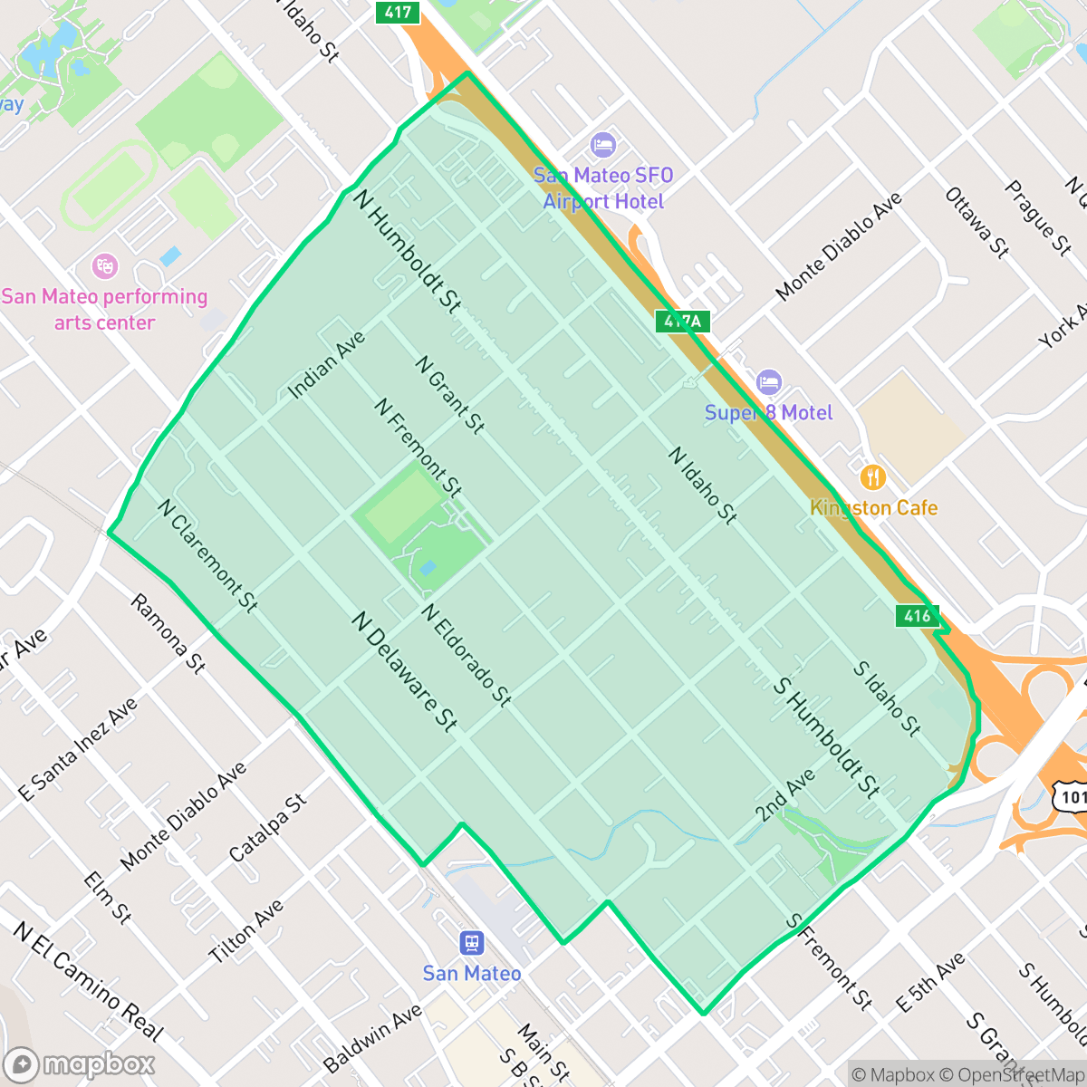
The Central neighborhood of San Mateo, encompassing the city's historic downtown core, traces its origins to 1862 when railroad director Charles Polhemus laid out the first town plat near the San Francisco and San Jose Railroad tracks. The area is anchored by the 16-acre Central Park, which originated as the Polhemus estate and later served as the home of sea captain William Kohl. The park preserves significant historical features, including a 900-foot stone and iron fence and landscape elements designed by John McLaren. Historically influential for its long-standing Japanese-American community, the neighborhood serves as the city's primary commercial and transit hub, characterized by a blend of early 20th-century development and modern urban growth centered around the San Mateo Caltrain station.
The neighborhood serves as a dense, transit-oriented core where pedestrian infrastructure allows for easy navigation between residential blocks and commercial hubs. It maintains a moderately lively atmosphere, blending a variety of housing types with accessible green spaces and local eateries. Residents benefit from a diverse demographic mix and a political environment that aligns with broader citywide trends, making it a central point for community interaction in San Mateo. According to iHuus data, the area offers a unique blend of convenience and accessibility that is difficult to replicate in less developed parts of the city.
Prospective residents should note that the area experiences elevated noise levels due to its proximity to major transportation arteries. The high-density layout results in limited privacy between neighbors, and the location sits within a mapped floodplain, which often requires specific insurance considerations. Despite these factors, the neighborhood remains a highly sought-after destination for those prioritizing connectivity and access to top-tier educational institutions within the San Mateo Union High School District.
Neighborhood Scores Across 15 Qualities
Residential structures are often closely spaced with minimal buffers between neighbors, resulting in a slightly lower privacy level than the San Mateo average. According to iHuus data, many blocks feature high-density layouts where houses or apartment walls are positioned quite near one another.
Pedestrian infrastructure is exceptionally strong here, featuring a dense grid of sidewalks and clear crossings that are even more comprehensive than the San Mateo average. Most residential and commercial areas are easily accessible on foot via well-maintained paths and dedicated pedestrian bridges.
Visual variety ranges from well-maintained affluent properties with manicured lots to standard apartment complexes and uniform tract housing. Overall aesthetic appeal is slightly below the San Mateo average.
Extensive park systems, waterfront paths, and wide sidewalks provide ample space for exercise. This area offers more accessible green space for pets than the typical San Mateo neighborhood.
Suburban layouts characterize this area, featuring a dense blend of single-family homes, apartment complexes, and commercial blocks. This landscape is slightly more developed than the typical semi-rural profile found across San Mateo.
Social activity is slightly higher than the San Mateo average, characterized by a mix of quiet suburban blocks and pockets of active dining and community hubs. According to iHuus data, residents can access various local eateries and green spaces, though some areas remain primarily residential or industrial in nature.
Frequent noise from nearby rail lines and major freeway traffic is common in this area. This level of acoustic disturbance is slightly higher than the average for San Mateo, according to iHuus data.
Air quality levels are consistent with the city average, presenting a mix of acceptable and unhealthy days that may occasionally affect sensitive groups. According to iHuus data, residents can expect periodic fluctuations in air clarity.
Land use in this area is almost entirely residential, commercial, and recreational. While a large electrical substation and nearby highway contribute minor industrial-related noise, the neighborhood lacks heavy manufacturing, warehouses, or visible industrial hazards, making it consistent with the city average.
Health insurance coverage among residents is relatively high, though it remains lower than the average seen across San Mateo. According to iHuus data, a significant portion of the population maintains coverage, but there is a notable gap compared to the citywide rate.
Voting patterns and census indicators show a predominantly liberal political landscape that is very similar to the rest of San Mateo. According to iHuus data, residents will find a community aligned with the broader citywide political trends.
A varied mix of young adults, families, and seniors resides here, reflecting a demographic distribution slightly more concentrated in specific age groups than the San Mateo average. According to iHuus data, this provides a balanced social landscape across different life stages.
Significant flood risk exists in this area due to its location within a mapped floodplain. According to iHuus data, this risk is notably higher than the San Mateo city average and typically necessitates flood insurance.
Block-Level Insights for Central

iHuus Neighborhood Intelligence Insights
Get block-level neighborhood insights for Central
- Street-level scores — see how individual blocks compare, not just neighborhood averages
- Micro-zone boundaries — identify quiet pockets, flood boundaries, and walkable clusters before you visit
- 15 dimensions in full — walkability, noise, air quality, school quality, insurance coverage, population age profile, urban/rural index, and more
- Boundary risk alerts — know if your address sits near a block boundary where scores drop, the kind of detail no listing will ever mention
- School insights — individual school ratings and insights, not just district-level data
- Compare before you commit — side-by-side data across neighborhoods, down to block precision
No credit card required
Compare with Any Neighborhood
| Dimension | Central | Aragon |
|---|---|---|
| 🚶 Walkabilityavg 8.95 | ||
| 🔊 Acoustic Comfortavg 3.72 | ||
| 🤫 Privacy Indexavg 5.13 | ||
| 🎨 Visual Appealavg 7.16 | ||
| 🐕 Dog Friendlinessavg 6.92 | ||
| 🗺️ Urban-Rural Indexavg 6.73 | ||
| ✨ Neighborhood Vibeavg 5.61 | ||
| 🏥 Health Insurance Coverageavg 8.75 | ||
| 🌿 Air Qualityavg 6 | ||
| 🏭 Industrial Proximityavg 9.34 | ||
| 🌊 Flood Safetyavg 5.24 | ||
| 🗳️ Ideological Leanavg 9.68 | ||
| 👥 Population Age Profileavg 4.99 | ||
| 🔥 Fire Safetyavg 0.28 | ||
| 🏫 School Quality |
Central Rankings
School Districts Serving Central
San Mateo Union High School District is a 'Blue Chip' educational entity characterized by elite academic performance, robust financial management, and high community confidence. With flagship schools like Aragon and Mills maintaining perfect ratings and a successful $96M bond measure funding modernizations, the district demonstrates organizational excellence. Despite regional trends of declining enrollment, SMUHSD manages localized growth effectively and maintains labor peace through competitive multi-year contracts. The district's ability to balance rigorous college-prep standards with progressive social initiatives and strong fiscal health solidifies its status as a top-tier California system.
Schools
San Mateo-Foster City Elementary School District is a solid and stable organization characterized by strong overall academic achievement and high teacher quality, ranking in the top 20% of California districts. While it faces significant operational challenges—including a $1.1 billion facilities modernization need and a $10 million budget deficit—proactive fiscal management and successful grant acquisition demonstrate institutional resilience. A stark achievement gap exists between its elite Foster City schools and several underperforming sites in San Mateo, but the district's expansion of specialized Montessori and STEM programs, coupled with high community trust as evidenced by planned bond measures, maintains its standing as a high-quality public school system.
Schools
School Insights for Central
Below average outcomes; significant attendance and academic challenges.
School Insights
See what's really behind every school rating near Central
- Individual school ratings — each school's own score with outcome context, not just a district average
- Enrollment & class size data — student-to-teacher ratio and how it compares to the state average
- Full demographics breakdown — ethnicity and gender composition for every school in the enrollment zone
- Every school in the district — all schools within the enrollment boundary ranked by rating, not just the closest one
- Grade levels & benchmarks — elementary through high school, with below/above state-average flags
No credit card required