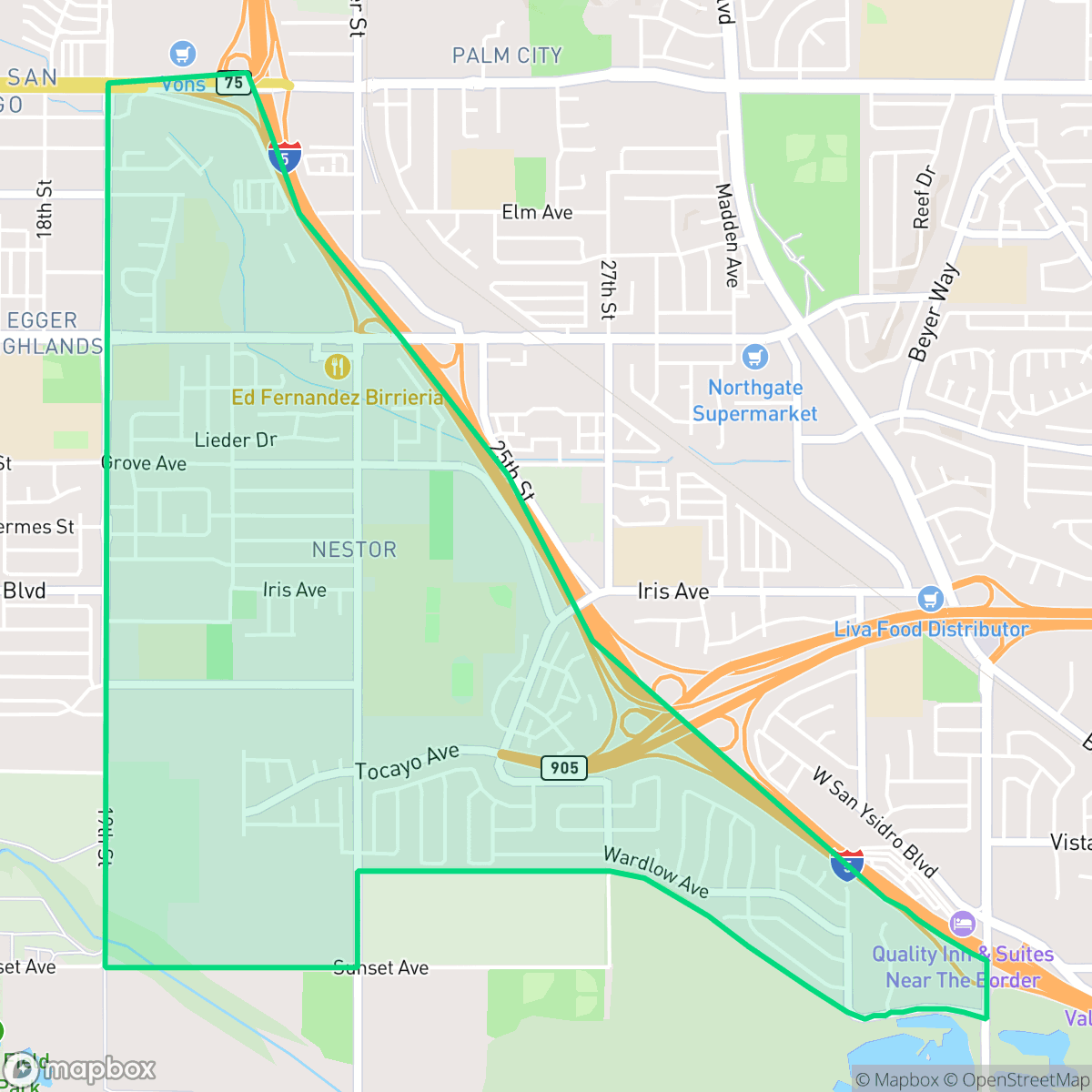
Nestor, San Diego
Updated June 22, 2026 · 16,540 residents
Nestor is a quiet, highly walkable residential community in South San Diego characterized by a dense suburban layout and a lack of industrial activity. The neighborhood offers a serene environment with consistent pedestrian infrastructure, though residents experience limited privacy due to closely spaced housing.
Key Highlights
About Nestor
Located in South San Diego, Nestor originated within the 1833 Rancho Melijo Mexican land grant. Platted in the late 19th century, the neighborhood was named after Nestor A. Young, a California State Assemblyman and San Diego harbormaster. It initially developed as a rural farming community, historically cultivated by Japanese American farmers. Nestor was annexed by the city of San Diego in 1957, transitioning from agricultural lands into a residential suburb. The neighborhood retains several historic landmarks, including the Nestor United Methodist Church, built in 1896 on land donated by Captain John Folks, and the Mount Olivet Cemetery, which opened in 1899. Additionally, the Coronado Avenue corridor features the South Bay Drive-In Theatre, San Diego's last remaining drive-in theater, while the historic South Bay Salt Works operates along its northern boundary.
The neighborhood functions as a dense, residential-focused suburb characterized by a grid of single-family homes and multi-family complexes. It maintains a high level of walkability, with consistent sidewalks throughout its residential streets and cul-de-sacs. While commercial options are sparse, the area benefits from a calm atmosphere and an absence of industrial activity, making it a stable environment for those seeking a quiet lifestyle. According to iHuus data, the area provides a peaceful setting that is largely removed from heavy noise pollution, despite its proximity to major transit corridors. Prospective residents should note the trade-offs regarding privacy and school district performance. Housing density is high, resulting in closely spaced homes and limited yard space. The local educational landscape is served by multiple districts that currently face operational and academic challenges, making the area a better fit for those prioritizing neighborhood accessibility and quietude over proximity to diverse retail or high-scoring educational institutions.
Neighborhood Scores Across 15 Qualities
Residential structures are closely grouped with many homes featuring shared walls or narrow gaps between buildings. This density is slightly higher than the San Diego average, according to iHuus data.
Sidewalks and marked crosswalks are consistent throughout residential blocks, though major highway interchanges and wide arterials can impede continuous pedestrian flow. This level of walkability is slightly below the San Diego average according to iHuus data.
Standard tract housing and apartment complexes define the area, featuring uniform rooflines and relatively small yards. According to iHuus data, the visual variety is below the San Diego average.
Abundant grassy fields and continuous sidewalk verges provide ample space for pet exercise. This area is roughly comparable to the San Diego average for dog friendliness.
Residential layouts consist primarily of dense suburban developments, featuring a mix of single-family homes, apartment blocks, and multi-unit complexes. This landscape is slightly more developed than the typical San Diego average, with fewer open fields or woodland areas present.
Local activity levels are slightly below the San Diego average, characterized by a mix of quiet residential streets and scattered dining options. While some pockets offer accessible social spots, much of the area features a low-density, car-dependent landscape with limited commercial density.
Frequent auditory disturbances from nearby freeway and railroad activity characterize this area. According to iHuus data, acoustic comfort is lower than the San Diego average.
Air quality in Nestor fluctuates between acceptable and unhealthy levels, appearing slightly lower than the San Diego average. Sensitive individuals may experience occasional concerns during certain periods, according to iHuus data.
Heavy industrial facilities and warehouses are absent from most of the area, though some larger commercial rooftops and freeway proximity may contribute to light or noise levels. According to iHuus data, the neighborhood remains very similar to the San Diego average for industrial proximity.
Health insurance accessibility is lower in Nestor than the San Diego average, according to iHuus data. This indicates a higher proportion of uninsured residents compared to most other areas in the city.
Voting patterns and census indicators show a strong liberal leaning that is slightly higher than the San Diego average. According to iHuus data, the area maintains a consistent progressive political profile.
Residents live alongside a balanced mix of young adults, families, and seniors. This demographic distribution is roughly in line with the average seen across San Diego.
Significant flood risk exists due to the area's location within a designated floodplain. According to iHuus data, this risk is much higher than the San Diego average and likely necessitates flood insurance.
Extreme fire hazards are present in this area, with safety levels sitting slightly below the San Diego average according to iHuus data.
Block-Level Insights for Nestor

iHuus Neighborhood Intelligence Insights
Get block-level neighborhood insights for Nestor
- Street-level scores — see how individual blocks compare, not just neighborhood averages
- Micro-zone boundaries — identify quiet pockets, flood boundaries, and walkable clusters before you visit
- 15 dimensions in full — walkability, noise, air quality, school quality, insurance coverage, population age profile, urban/rural index, and more
- Boundary risk alerts — know if your address sits near a block boundary where scores drop, the kind of detail no listing will ever mention
- School insights — individual school ratings and insights, not just district-level data
- Compare before you commit — side-by-side data across neighborhoods, down to block precision
No credit card required
Compare with Any Neighborhood
| Dimension | Nestor | Adams North |
|---|---|---|
| 🚶 Walkabilityavg 8.58 | ||
| 🔊 Acoustic Comfortavg 3.33 | ||
| 🤫 Privacy Indexavg 4.87 | ||
| 🎨 Visual Appealavg 6.85 | ||
| 🐕 Dog Friendlinessavg 6.91 | ||
| 🗺️ Urban-Rural Indexavg 6.6 | ||
| ✨ Neighborhood Vibeavg 5.12 | ||
| 🏥 Health Insurance Coverageavg 7.53 | ||
| 🌿 Air Qualityavg 6.36 | ||
| 🏭 Industrial Proximityavg 9.12 | ||
| 🌊 Flood Safetyavg 4.2 | ||
| 🗳️ Ideological Leanavg 8.51 | ||
| 👥 Population Age Profileavg 4.8 | ||
| 🔥 Fire Safetyavg 0.61 | ||
| 🏫 School Quality |
Nestor Rankings
School Districts Serving Nestor
San Ysidro Elementary School District is currently in a state of transition, moving from historical fiscal distress toward operational stability. While the district celebrates recent improvements in literacy, successful infrastructure bonding, and a move to a healthier financial status, it is characterized by extreme academic disparity where high-performing flagship schools like Ocean View Hills coexist with several campuses rated 1/10. The district serves a high-need border population with dedicated support for English Language Learners and has recently bolstered its security and extracurricular offerings, yet it remains a 'mixed' entity due to the significant achievement gap and systemic math proficiency challenges across its portfolio.
Schools
Sweetwater Union High School District functions as a stable but stratified educational entity, characterized by a significant performance gap between its high-achieving high schools and its struggling middle school feeder patterns. While the district celebrates recent accolades like the 2026 California Distinguished Schools award and maintains strong community trust through facility modernizations and specialized programs like Middle College, its academic core remains mixed with proficiency levels trailing behind state leaders. A legacy of legal settlements and varied facility conditions across its 29 campuses further underscores a 'middle-of-the-road' status, where pockets of excellence are offset by persistent operational and academic challenges in underserved zones.
Schools
South Bay Union School District is currently in a distressed state, characterized by a staggering 40% enrollment drop, chronic structural deficits, and a contentious school consolidation plan involving the closure of multiple campuses through 2032. While the district maintains a few well-regarded programs and utilizes bond funds for facility maintenance at select sites, the overall academic profile is weak, with several schools performing at the 2/10 and 3/10 levels. Severe labor tensions and a potential teacher strike, coupled with the postponement of specialized magnet programs to focus on foundational academic gaps, signal a district struggling to maintain operational and community stability amidst a shrinking tax base.
Schools
School Insights for Nestor
Below average outcomes; significant attendance and academic challenges.
School Insights
See what's really behind every school rating near Nestor
- Individual school ratings — each school's own score with outcome context, not just a district average
- Enrollment & class size data — student-to-teacher ratio and how it compares to the state average
- Full demographics breakdown — ethnicity and gender composition for every school in the enrollment zone
- Every school in the district — all schools within the enrollment boundary ranked by rating, not just the closest one
- Grade levels & benchmarks — elementary through high school, with below/above state-average flags
No credit card required