Swanston Estates, Sacramento
Updated June 22, 2026 · 3,350 residents
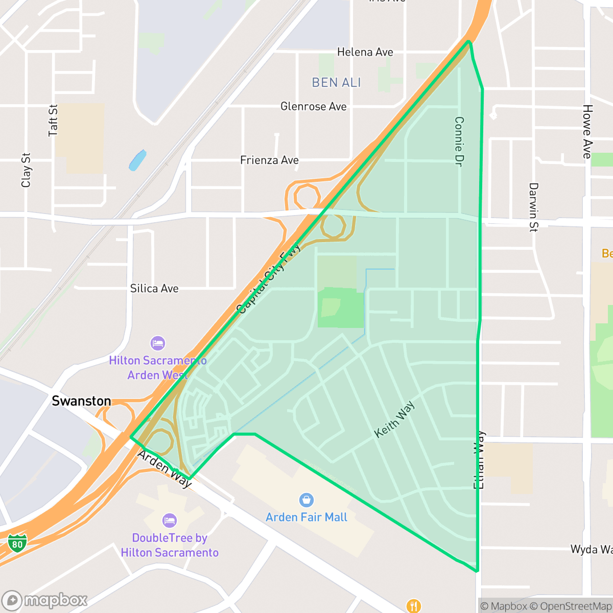
Swanston Estates is a mid-century suburban neighborhood defined by its uniform tract housing and proximity to major commercial and industrial centers. While the area offers a functional grid layout, residents experience significant noise from nearby freeway traffic and a high-density living environment with limited private outdoor space.
Key Highlights
About Swanston Estates
Swanston Estates in North Sacramento is named after the Swanston family, who operated a 2,800-acre cattle ranch and meatpacking plant near the Southern Pacific railroad tracks from 1914 to the 1940s. In the late 1940s, the family sold their land to the State of California for the construction of the Cal Expo fairgrounds. The state eventually sold off unused portions of the land in 1970 for $7.3 million, sparking modern residential and commercial development. Early community anchors were established by founding residents, including Nicholas and Henrietta Gosselink, who founded Hope Community Church, and a local family that donated land for D.W. Babcock Elementary School and Park. Today, Swanston Estates is characterized by its post-WWII mid-century housing stock, built primarily between the 1950s and 1970s.
The neighborhood serves as a dense suburban enclave characterized by post-WWII residential architecture and a mix of single-family homes and multi-family units. Its layout reflects a classic mid-century design, featuring grid-patterned streets that provide consistent pedestrian access, though the presence of large-scale warehouses and light industrial zones creates a distinct industrial-suburban atmosphere. According to iHuus data, the area maintains a practical urban-suburban balance that is well-connected to the broader Sacramento region.
Living here requires a reliance on personal vehicles for most daily errands, as the surrounding freeway infrastructure acts as a significant barrier to broader pedestrian mobility. The environment is notably loud due to consistent road traffic, and the close proximity of neighboring structures results in limited privacy. This neighborhood is best suited for those seeking a practical, central location near major transit corridors who prioritize functional access over quiet, expansive residential settings.
Neighborhood Scores Across 15 Qualities
Residential structures and apartment complexes feature narrow setbacks and close proximity to neighbors. This level of density is notably higher than the Sacramento average, according to iHuus data.
Sidewalk networks and clear crosswalks facilitate pedestrian movement within residential and commercial zones, though the nearby freeway acts as a major barrier to connectivity. Overall walkability levels are lower than the Sacramento average.
Uniform rooflines and modest yards define the local landscape, which appears less visually diverse than the Sacramento average. The area consists primarily of standard tract housing and high-density apartment complexes with shared amenities.
Access to public greenery is below the Sacramento average, as much of the neighborhood's green space is private or fenced. While a central park and a large park in the northeast quadrant offer some walking paths and open lawns, other areas feature narrow sidewalks and limited park access.
The landscape consists of a dense suburban mix of single-family homes, apartments, and large commercial centers. This level of development is roughly in line with the typical urban-rural balance found throughout Sacramento.
Diverse dining options and green spaces provide a more active atmosphere than the Sacramento average; however, the car-dependent layout makes much of the area difficult to navigate without a vehicle.
Frequent sounds from nearby freeway traffic and railroad activity contribute to a louder environment than most other parts of Sacramento. According to iHuus data, residents can expect more significant acoustic disturbances than the city average.
Air quality levels fluctuate between acceptable and unhealthy conditions, appearing largely consistent with the Sacramento average. Sensitive groups should remain aware of occasional days with higher pollution concentrations according to iHuus data.
Nearby logistics hubs and warehouse complexes introduce more truck traffic and commercial activity than is typical for the Sacramento area. While much of the neighborhood remains residential, some residents may experience proximity to large-scale distribution centers and highway-related commerce.
Health insurance enrollment among residents is lower than the Sacramento city average, according to iHuus data.
Voting patterns and census indicators reflect a predominantly liberal political leaning, though this is slightly less pronounced than the average found across Sacramento.
Residents live alongside a balanced mix of young adults, families, and older individuals. This demographic spread is slightly lower than the Sacramento average, according to iHuus data.
Flood risk in this area is notably lower than the Sacramento average, though some residual risk remains due to the location being within a 500-year floodplain. According to iHuus data, the area is generally considered stable despite this minor seasonal vulnerability.
Block-Level Insights for Swanston Estates

iHuus Neighborhood Intelligence Insights
Get block-level neighborhood insights for Swanston Estates
- Street-level scores — see how individual blocks compare, not just neighborhood averages
- Micro-zone boundaries — identify quiet pockets, flood boundaries, and walkable clusters before you visit
- 15 dimensions in full — walkability, noise, air quality, school quality, insurance coverage, population age profile, urban/rural index, and more
- Boundary risk alerts — know if your address sits near a block boundary where scores drop, the kind of detail no listing will ever mention
- School insights — individual school ratings and insights, not just district-level data
- Compare before you commit — side-by-side data across neighborhoods, down to block precision
No credit card required
Compare with Any Neighborhood
| Dimension | Swanston Estates | Airport |
|---|---|---|
| 🚶 Walkabilityavg 8.5 | ||
| 🔊 Acoustic Comfortavg 3.22 | ||
| 🤫 Privacy Indexavg 5.34 | ||
| 🎨 Visual Appealavg 6.3 | ||
| 🐕 Dog Friendlinessavg 6.98 | ||
| 🗺️ Urban-Rural Indexavg 6.57 | ||
| ✨ Neighborhood Vibeavg 4.66 | ||
| 🏥 Health Insurance Coverageavg 7.4 | ||
| 🌿 Air Qualityavg 6.12 | ||
| 🏭 Industrial Proximityavg 8.32 | ||
| 🌊 Flood Safetyavg 6.04 | ||
| 🗳️ Ideological Leanavg 9.49 | ||
| 👥 Population Age Profileavg 4.75 | ||
| 🔥 Fire Safetyavg 0 | ||
| 🏫 School Quality |
Swanston Estates Rankings
School Districts Serving Swanston Estates
San Juan Unified is a large, transitional district characterized by a wide academic performance gap, ranging from elite, high-performing high schools and specialized centers to a significant number of struggling 1/10 rated campuses. While the district maintains strong community financial support through successful modernization bonds and boasts acclaimed programs in IB, STEM, and the arts, it is currently hampered by operational challenges including staffing shortages and campus safety concerns. It remains a viable choice for families accessing its high-performing magnets and neighborhood pillars, but the lack of district-wide consistency and aging infrastructure in specific sub-regions currently limits its standing to a mid-tier, stable but stratified organization.
Schools
Twin Rivers Unified is currently in a distressed state characterized by extreme academic variance, a recently resolved but historic 12-day labor strike, and significant leadership turnover with the impending departure of its long-term Superintendent. While the district maintains stable credit ratings and has successfully leveraged bond refinancing to save taxpayers money, these fiscal wins are overshadowed by a staffing crisis and poor academic proficiency in core subjects like math and reading. The wide gap between high-performing elementary schools and failing secondary schools, combined with high chronic absenteeism and a workforce emerging from a period of high friction, positions the district as an organization in a fragile transition period rather than a stable 'Blue Chip' entity.
Schools
School Insights for Swanston Estates
Below average outcomes; significant attendance and academic challenges.
School Insights
See what's really behind every school rating near Swanston Estates
- Individual school ratings — each school's own score with outcome context, not just a district average
- Enrollment & class size data — student-to-teacher ratio and how it compares to the state average
- Full demographics breakdown — ethnicity and gender composition for every school in the enrollment zone
- Every school in the district — all schools within the enrollment boundary ranked by rating, not just the closest one
- Grade levels & benchmarks — elementary through high school, with below/above state-average flags
No credit card required