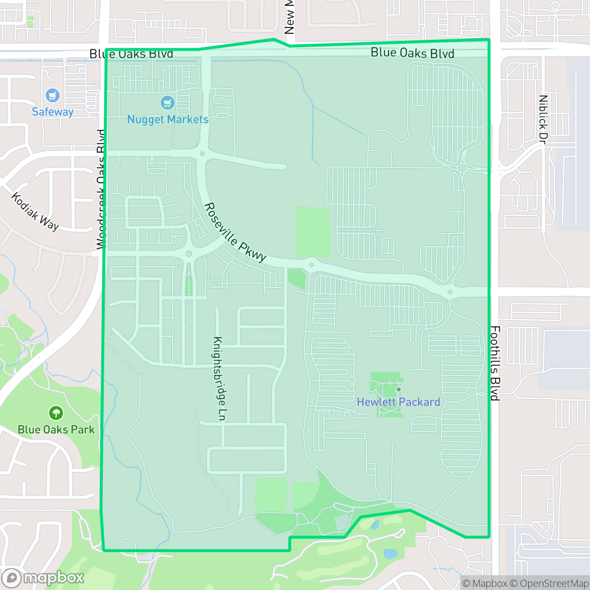
Industrial Area West, Roseville
Updated June 22, 2026 · 1,096 residents
Industrial Area West is a mixed-use district in Roseville that blends logistics hubs and suburban office parks with localized retail and dining options. While the neighborhood is defined by its significant industrial footprint, it offers residents access to high-performing school districts and essential community amenities.
Key Highlights
About Industrial Area West
Industrial Area West is characterized by its significant logistics and commercial infrastructure, serving as a hub for large-scale warehouses and office parks. The landscape is a functional mix of heavy industrial zones and suburban streets that occasionally intersect with community-oriented destinations. While the area is dominated by industrial activity, it maintains a level of utility through proximity to retail centers that host various dining and coffee options. The neighborhood serves as a vital economic node within the region, balancing its commercial focus with pockets of suburban development.
Residents in this area benefit from high health insurance coverage and access to top-tier educational institutions, including the highly rated Roseville Joint Union High School District. However, the neighborhood presents specific trade-offs, such as a reliance on personal vehicles due to its car-dependent layout and the presence of heavy traffic generators. It is best suited for individuals who prioritize regional accessibility and school quality over a traditional, quiet residential atmosphere, as the area balances its industrial roots with modern suburban conveniences.
Neighborhood Scores Across 15 Qualities
Properties feature a mix of spacing with some distance between neighbors, providing slightly more seclusion than the average area in Roseville. According to iHuus data, certain residential plots benefit from additional buffers provided by adjacent private parklands.
Continuous sidewalks on both sides of residential streets and dedicated park trails ensure easy pedestrian movement. According to iHuus data, this area offers superior walkability compared to the Roseville average.
Well-maintained properties and private backyard pools contribute to an aesthetic that is slightly above the Roseville average. According to iHuus data, the area is characterized by large homes and clean, manicured landscapes.
Extensive central parklands with visible walking paths and large sports fields offer superior access to pet-friendly spaces. According to iHuus data, these amenities provide significantly more opportunities for outdoor activity than the Roseville average.
Large-scale warehouses, office parks, and significant grey space characterize this area. According to iHuus data, the level of open land and low-density development is roughly in line with the Roseville average.
A mix of suburban residential pockets and industrial zones creates a level of activity that is slightly higher than the Roseville average. While certain blocks feature local dining and parks, the car-dependent layout and presence of warehouses mean social hubs are scattered throughout the area.
Acoustic levels are notably lower than the Roseville average, with noise limited to infrequent trains or distant vehicle traffic. According to iHuus data, this area maintains a much more tranquil atmosphere than most parts of the city.
Air quality in this area fluctuates between acceptable and unhealthy levels, which may cause occasional concern for sensitive groups. According to iHuus data, these conditions are consistent with the average found across Roseville.
Residential and light commercial uses define this area, with no warehouses or heavy industrial facilities detected. This lack of industrial proximity is slightly better than the Roseville average according to iHuus data.
Health insurance access is nearly universal among residents, which is significantly higher than the Roseville average according to iHuus data.
Political leanings in this area align closely with the overall city average, characterized by a conservative majority and a modest presence of opposing viewpoints according to iHuus data.
Residents of various ages live here, showing a demographic spread that is very similar to the Roseville average. This balanced distribution includes a mix of young adults, families, and older individuals according to iHuus data.
Flood risk in this area is notably lower than the Roseville average, although some residual risk remains due to its location within a 500-year floodplain. According to iHuus data, property owners should remain aware of potential seasonal drainage fluctuations.
Block-Level Insights for Industrial Area West

iHuus Neighborhood Intelligence Insights
Get block-level neighborhood insights for Industrial Area West
- Street-level scores — see how individual blocks compare, not just neighborhood averages
- Micro-zone boundaries — identify quiet pockets, flood boundaries, and walkable clusters before you visit
- 15 dimensions in full — walkability, noise, air quality, school quality, insurance coverage, population age profile, urban/rural index, and more
- Boundary risk alerts — know if your address sits near a block boundary where scores drop, the kind of detail no listing will ever mention
- School insights — individual school ratings and insights, not just district-level data
- Compare before you commit — side-by-side data across neighborhoods, down to block precision
No credit card required
Compare with Any Neighborhood
| Dimension | Industrial Area West | Blue Oaks |
|---|---|---|
| 🚶 Walkabilityavg 8.87 | ||
| 🔊 Acoustic Comfortavg 4.32 | ||
| 🤫 Privacy Indexavg 5.7 | ||
| 🎨 Visual Appealavg 7.58 | ||
| 🐕 Dog Friendlinessavg 7.74 | ||
| 🗺️ Urban-Rural Indexavg 6.82 | ||
| ✨ Neighborhood Vibeavg 4.77 | ||
| 🏥 Health Insurance Coverageavg 8.58 | ||
| 🌿 Air Qualityavg 6 | ||
| 🏭 Industrial Proximityavg 8.8 | ||
| 🌊 Flood Safetyavg 5.72 | ||
| 🗳️ Ideological Leanavg 3.68 | ||
| 👥 Population Age Profileavg 5.05 | ||
| 🔥 Fire Safetyavg 0.15 | ||
| 🏫 School Quality |
Industrial Area West Rankings
School Districts Serving Industrial Area West
Roseville Joint Union High School District is a high-performing 'Blue Chip' organization exhibiting strong academic consistency and operational excellence. The district's portfolio is anchored by elite terminal high schools like Granite Bay and modern facilities like West Park, supported by proactive investments in both Career Technical Education and student mental health infrastructure. While navigating rapid regional growth and the pressures of a high-achievement culture, the district maintains deep community trust, evidenced by successful facility expansions and positive sentiment across diverse educational pathways. Aside from a single continuation school outlier, the district demonstrates the stability, financial health, and academic rigor characteristic of a top-tier educational agency.
Schools
Dry Creek Joint Elementary School District is a solid and stable organization characterized by high academic output and proactive governance. While there is some performance variance between its top-rated elementary schools and its middle schools, the district maintains a strong reputation, particularly in STEM and performing arts. Financial management is disciplined, focusing on special education and resource efficiency amidst state funding adjustments. The transition to by-trustee area elections and the implementation of parent-focused mental health initiatives reflect a district that is evolving with its community's needs while maintaining its status as a top-tier educational provider in Placer County.
Schools
Roseville City Elementary School District is a high-performing, financially stable organization characterized by strong community trust and academic proficiency that significantly exceeds state benchmarks. While the district's portfolio contains a wide performance gap between its top-tier neighborhood schools (rated 8-10) and its struggling campuses (rated 2-3), it maintains a high degree of operational excellence through proactive facility expansion, successful bond management, and robust arts and mental health programming. Current challenges are primarily environmental, driven by rapid population growth in West Roseville leading to student overflows and capacity debates, yet the district remains a top-tier regional choice with a stable leadership outlook.
Schools
School Insights for Industrial Area West
Below average outcomes; significant attendance and academic challenges.
School Insights
See what's really behind every school rating near Industrial Area West
- Individual school ratings — each school's own score with outcome context, not just a district average
- Enrollment & class size data — student-to-teacher ratio and how it compares to the state average
- Full demographics breakdown — ethnicity and gender composition for every school in the enrollment zone
- Every school in the district — all schools within the enrollment boundary ranked by rating, not just the closest one
- Grade levels & benchmarks — elementary through high school, with below/above state-average flags
No credit card required