Palo Alto Orchards, Palo Alto
Updated June 22, 2026 · 876 residents
Palo Alto Orchards is a quiet, highly walkable residential enclave in southern Palo Alto known for its open green spaces and pet-friendly atmosphere. While it offers a peaceful, low-density environment, the area maintains a subdued social pace with minimal commercial activity.
Key Highlights
About Palo Alto Orchards
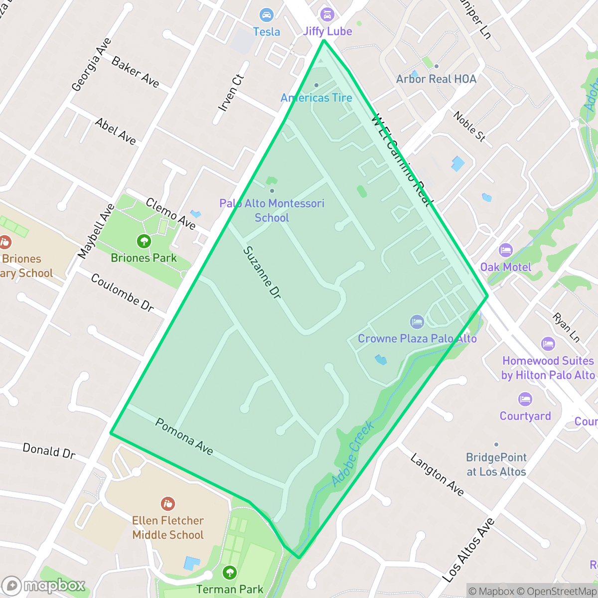
Located in southern Palo Alto and bordered by El Camino Real, Arastradero Road, Los Palos Avenue, and Adobe Creek, the Palo Alto Orchards neighborhood was originally a sprawling agricultural orchard. In the 1950s, developers McKellar and Kelly transformed the land into a residential tract, building modest, single-story cottage homes designed for young military veterans that initially sold for under $10,000. Today, the neighborhood's development history is preserved in local street names like McKellar Lane and Kelly Way. The area has evolved into a quiet, tree-lined suburban enclave featuring a diverse architectural mix of original mid-century cottages, expanded two-story modern residences, and the Plaza International Apartments.
Palo Alto Orchards is primarily a residential area characterized by its proximity to Adobe Creek and a high degree of walkability. According to iHuus data, the neighborhood maintains a strong connection to nature, functioning as a quiet suburban retreat despite its location near major thoroughfares like El Camino Real. The streetscape is defined by a mix of original cottages and newer, expanded residences, all set within a low-density environment that prioritizes privacy and acoustic comfort.
The area is well-suited for those seeking a tranquil, dog-friendly environment with access to top-rated schools, including the Palo Alto Unified School District. Residents should be aware that while the neighborhood excels in walkability and environmental quality, it lacks a vibrant nightlife or extensive retail presence. Prospective buyers should also note the local fire safety profile, which according to iHuus data, requires careful consideration when evaluating property insurance and emergency preparedness.
Neighborhood Scores Across 15 Qualities
Residential spacing is consistent with the Palo Alto average, featuring a mix of detached homes with private backyards and multi-unit complexes. Neighbors are situated at moderate distances, providing a balance of community proximity and personal buffer.
Continuous sidewalks on both sides of residential and arterial roads ensure safe pedestrian movement. According to iHuus data, the connectivity and availability of clear crosswalks in this area are superior to the Palo Alto average.
Landscaped yards and large homes provide an attractive streetscape, though the overall visual variety is slightly below the Palo Alto city average. According to iHuus data, the area features a mix of upscale private estates and standard residential developments.
Accessible public parks and wide green verges provide ample space for walking pets. According to iHuus data, these features make the area slightly more accommodating for dog owners than the Palo Alto average.
Open land and scattered homes provide a more spacious, semi-rural atmosphere than most of Palo Alto. According to iHuus data, the area features a mix of woodland or fields interspersed with residential clusters.
Residential life here follows a steady, subdued pace with occasional access to local dining and cafes. This level of activity is slightly lower than the Palo Alto average, as many social hubs require a short drive.
Frequent disturbances from nearby rail lines and heavy freeway traffic characterize this area. According to iHuus data, acoustic comfort in this neighborhood is significantly lower than the Palo Alto average.
Air quality levels are consistent with the city average, presenting a mix of acceptable and unhealthy days that may occasionally concern sensitive groups.
The area is primarily residential with very little industrial presence, though a nearby EPA Superfund site presents potential risks regarding soil and groundwater contaminants. According to iHuus data, this neighborhood has a higher concentration of industrial proximity compared to the Palo Alto average.
Nearly all residents are covered by health insurance, representing a rate that is notably higher than the Palo Alto average. According to iHuus data, this indicates a high level of access to healthcare services within the community.
Voting patterns and census indicators show a deeply liberal political leaning that is slightly more pronounced than the Palo Alto average, according to iHuus data.
A balanced mix of young adults, families, and seniors defines the local demographic. This distribution is largely consistent with the broader Palo Alto area according to iHuus data.
Flood risk levels remain undetermined in this area due to a lack of detailed federal studies. However, the risk profile is notably higher than the Palo Alto average according to iHuus data.
Block-Level Insights for Palo Alto Orchards

iHuus Neighborhood Intelligence Insights
Get block-level neighborhood insights for Palo Alto Orchards
- Street-level scores — see how individual blocks compare, not just neighborhood averages
- Micro-zone boundaries — identify quiet pockets, flood boundaries, and walkable clusters before you visit
- 15 dimensions in full — walkability, noise, air quality, school quality, insurance coverage, population age profile, urban/rural index, and more
- Boundary risk alerts — know if your address sits near a block boundary where scores drop, the kind of detail no listing will ever mention
- School insights — individual school ratings and insights, not just district-level data
- Compare before you commit — side-by-side data across neighborhoods, down to block precision
No credit card required
Compare with Any Neighborhood
| Dimension | Palo Alto Orchards | Adobe Meadow - Meadow Park |
|---|---|---|
| 🚶 Walkabilityavg 8.94 | ||
| 🔊 Acoustic Comfortavg 3.51 | ||
| 🤫 Privacy Indexavg 5.96 | ||
| 🎨 Visual Appealavg 7.97 | ||
| 🐕 Dog Friendlinessavg 7.6 | ||
| 🗺️ Urban-Rural Indexavg 6.74 | ||
| ✨ Neighborhood Vibeavg 4.82 | ||
| 🏥 Health Insurance Coverageavg 9.05 | ||
| 🌿 Air Qualityavg 6.03 | ||
| 🏭 Industrial Proximityavg 8.67 | ||
| 🌊 Flood Safetyavg 3.52 | ||
| 🗳️ Ideological Leanavg 9.81 | ||
| 👥 Population Age Profileavg 5.03 | ||
| 🔥 Fire Safety | ||
| 🏫 School Quality |
Palo Alto Orchards Rankings
School Districts Serving Palo Alto Orchards
Los Altos Elementary School District is a premier 'Blue Chip' organization characterized by elite academic performance, robust community financial backing, and significant operational stability. With 89% math proficiency and consistent 10/10 school ratings, the district remains a top-tier California performer despite regional cost-of-living pressures and minor enrollment declines. The recent resolution of facility sharing agreements with Bullis Charter School further solidifies its stability, while record-breaking private foundations ensure specialized programs remain better funded than state averages, making it a definitive destination district.
Schools
MVLA is a 'Blue Chip' district characterized by elite academic performance, financial transparency, and modern facility infrastructure. Its terminal high schools are national leaders in STEM and college readiness, supported by a stable tax base and successful local bond measures. While the district faces community debate over curriculum modernization and high-pressure environments, its proactive investment in wellness centers and sustained 'Green' financial audits indicate a highly stable and well-managed organization that remains a primary draw for the region.
Schools
Palo Alto Unified School District is an elite, financially robust 'Blue Chip' district characterized by universal academic excellence across all 19 campuses. Operating as a basic aid district, PAUSD maintains superior infrastructure and extracurricular offerings that rival private institutions, attracting top-tier educators and high-achieving families. While the district faces localized challenges regarding the intense academic culture at its high schools and the high cost of living for staff, its administrative stability, proactive curriculum enhancements, and exceptional college readiness metrics solidify its position as a national leader in public education.
Schools
School Insights for Palo Alto Orchards
Below average outcomes; significant attendance and academic challenges.
School Insights
See what's really behind every school rating near Palo Alto Orchards
- Individual school ratings — each school's own score with outcome context, not just a district average
- Enrollment & class size data — student-to-teacher ratio and how it compares to the state average
- Full demographics breakdown — ethnicity and gender composition for every school in the enrollment zone
- Every school in the district — all schools within the enrollment boundary ranked by rating, not just the closest one
- Grade levels & benchmarks — elementary through high school, with below/above state-average flags
No credit card required