Crescent Park, Palo Alto
Updated June 22, 2026 · 5,070 residents
Crescent Park is a highly walkable, tree-lined residential enclave in Palo Alto known for its quiet streets and architectural diversity. According to iHuus data, the area offers a peaceful environment with excellent access to local green spaces and a strictly residential atmosphere.
Key Highlights
About Crescent Park
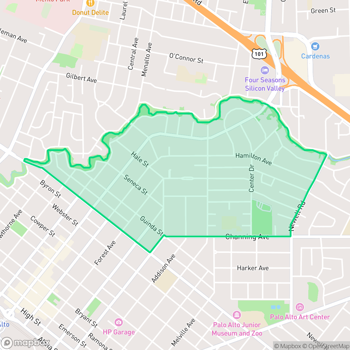
Originally part of Rancho Rinconada del Arroyo de San Francisquito, Crescent Park’s development began in 1864 when pioneer Dr. William Newell purchased land and planted some of the first eucalyptus trees in America. In 1924, realtors Hare, Brewer, and Clark established it as an upscale tract, enforcing strict minimum construction costs and lot sizes to attract architectural merit. The neighborhood's curving streets, which follow the crescent-shaped bend of San Francisquito Creek, showcase prestigious pre-war homes designed by renowned architects like Birge Clark, Julia Morgan, and Gardner Dailey in Spanish Colonial, Craftsman, and Tudor styles. Notable landmarks include the expansive Eleanor Pardee Park, featuring a community garden, and the Edgewood Drive estate purchased by tech executive Mark Zuckerberg.
The neighborhood maintains a distinct suburban character defined by its dense, tree-filled landscape and a complete absence of industrial or commercial hazards. With a perfect walkability score, residents benefit from a continuous network of sidewalks and low-traffic streets that encourage pedestrian activity. The area is notably quiet, with measured noise levels averaging 52 decibels, providing a calm living environment that is well-integrated with local amenities like Eleanor Pardee Park. Residents also enjoy high levels of health insurance coverage and a strong sense of community stability.
While the area is highly desirable for its aesthetic appeal and academic environment, prospective residents should consider specific environmental trade-offs. The neighborhood faces significant challenges regarding flood and fire safety, which are important factors for long-term planning. Families are well-served by the proximity to the Palo Alto Unified School District, which offers top-tier academic performance. It is best suited for those who prioritize a quiet, pedestrian-friendly lifestyle and access to elite educational institutions over proximity to commercial hubs.
Neighborhood Scores Across 15 Qualities
Residential spacing and mature tree canopies provide a moderate level of visual buffering between neighbors. This density level is consistent with the average found throughout Palo Alto.
Pedestrian movement is easy due to continuous sidewalk networks and low-traffic residential streets, which is largely consistent with the Palo Alto average. According to iHuus data, many areas feature high shade cover and clear crosswalks, though a major highway bisects the neighborhood.
Well-maintained properties featuring mature landscaping and private pools create a highly polished aesthetic that is slightly above the Palo Alto average. According to iHuus data, the presence of large homes and premium amenities contributes to a consistently high level of visual quality throughout the area.
Continuous green verges and large public parks with wide lawns provide ample space for exercise. According to iHuus data, the neighborhood offers slightly less dog-friendly infrastructure than the Palo Alto average.
A mix of single-family homes and mature tree canopies defines this area, which maintains a level of openness similar to the Palo Alto average. According to iHuus data, the neighborhood features a dense suburban layout rather than a more rural or unpopulated setting.
A blend of quiet residential streets and accessible amenities provides a more active atmosphere than the Palo Alto average. Residents can find various dining options and local parks, though some areas remain primarily quiet and residential near the highway.
Steady traffic hum from nearby busy streets is a common feature here. This level of acoustic activity is slightly higher than the typical experience in other parts of Palo Alto, according to iHuus data.
Air quality in this area fluctuates between acceptable and unhealthy levels, matching the typical conditions found across Palo Alto. Sensitive groups may encounter occasional periods of concern according to iHuus data.
Industrial activity and heavy warehouses are entirely absent from this area. According to iHuus data, the neighborhood is significantly more free of industrial hazards and manufacturing sites than the Palo Alto average.
Health insurance access is nearly universal among residents, aligning with the broader Palo Alto average according to iHuus data.
Voting patterns and census indicators reflect a predominantly liberal political leaning that is consistent with the broader Palo Alto area.
Residents will find a diverse demographic spread, as the neighborhood age profile is in line with the Palo Alto average. This creates a community composed of a relatively even distribution of young adults, families, and older residents.
Properties in this area are situated within a designated floodplain, which implies a higher risk of inundation during significant weather events. According to iHuus data, the risk level here is notably higher than the Palo Alto city average and may necessitate flood insurance.
Block-Level Insights for Crescent Park

iHuus Neighborhood Intelligence Insights
Get block-level neighborhood insights for Crescent Park
- Street-level scores — see how individual blocks compare, not just neighborhood averages
- Micro-zone boundaries — identify quiet pockets, flood boundaries, and walkable clusters before you visit
- 15 dimensions in full — walkability, noise, air quality, school quality, insurance coverage, population age profile, urban/rural index, and more
- Boundary risk alerts — know if your address sits near a block boundary where scores drop, the kind of detail no listing will ever mention
- School insights — individual school ratings and insights, not just district-level data
- Compare before you commit — side-by-side data across neighborhoods, down to block precision
No credit card required
Compare with Any Neighborhood
| Dimension | Crescent Park | Adobe Meadow - Meadow Park |
|---|---|---|
| 🚶 Walkabilityavg 8.94 | ||
| 🔊 Acoustic Comfortavg 3.51 | ||
| 🤫 Privacy Indexavg 5.96 | ||
| 🎨 Visual Appealavg 7.97 | ||
| 🐕 Dog Friendlinessavg 7.6 | ||
| 🗺️ Urban-Rural Indexavg 6.74 | ||
| ✨ Neighborhood Vibeavg 4.82 | ||
| 🏥 Health Insurance Coverageavg 9.05 | ||
| 🌿 Air Qualityavg 6.03 | ||
| 🏭 Industrial Proximityavg 8.67 | ||
| 🌊 Flood Safetyavg 3.52 | ||
| 🗳️ Ideological Leanavg 9.81 | ||
| 👥 Population Age Profileavg 5.03 | ||
| 🔥 Fire Safety | ||
| 🏫 School Quality |
Crescent Park Rankings
School Districts Serving Crescent Park
Menlo Park City Elementary School District is an elite, operationally robust organization characterized by exceptional academic achievement and deep-rooted community financial support. With all schools in the portfolio performing at the top tier of state metrics, the district maintains 'Blue Chip' status through proactive infrastructure planning, successful innovation grants, and a stable leadership environment. Although the district faces the 'high-stakes' culture typical of Silicon Valley's premier schools and ongoing challenges related to the regional cost of living for staff, its strong fiscal health and consistent 'Green' performance indicators across safety, academics, and facilities make it a model of institutional stability.
Schools
Palo Alto Unified School District is an elite, financially robust 'Blue Chip' district characterized by universal academic excellence across all 19 campuses. Operating as a basic aid district, PAUSD maintains superior infrastructure and extracurricular offerings that rival private institutions, attracting top-tier educators and high-achieving families. While the district faces localized challenges regarding the intense academic culture at its high schools and the high cost of living for staff, its administrative stability, proactive curriculum enhancements, and exceptional college readiness metrics solidify its position as a national leader in public education.
Schools
Sequoia Union High School District remains an academic powerhouse with high-performing flagship schools like Carlmont and Menlo-Atherton consistently outpacing state standards; however, it is currently in a state of operational transition and controversy. The district faces significant community backlash following the decision to close the newly built TIDE Academy to address a $6 million deficit, alongside parent concerns regarding the removal of honors-level 'bridge' courses for younger students. While the core academic portfolio is robust, recent lawsuits involving staff misconduct and ongoing debates over curriculum equity and fiscal management signal internal instability that offsets its high-ranking test scores.
Schools
Ravenswood City Elementary School District is currently in a distressed state, characterized by very low academic performance ratings and a trend of declining enrollment that threatens long-term financial stability. While the district has successfully implemented high-value infrastructure projects, such as modern school facilities and dedicated teacher housing to reduce turnover, these operational wins have yet to translate into significant academic gains or community-wide trust in its terminal outcomes. Despite positive local sentiment toward its dual-language programs and small class sizes, the district's reliance on 'fiscal prudence' to avoid deficits and its low standing on state dashboards indicate a system still struggling to overcome systemic socio-economic and institutional hurdles.
Schools
School Insights for Crescent Park
Below average outcomes; significant attendance and academic challenges.
School Insights
See what's really behind every school rating near Crescent Park
- Individual school ratings — each school's own score with outcome context, not just a district average
- Enrollment & class size data — student-to-teacher ratio and how it compares to the state average
- Full demographics breakdown — ethnicity and gender composition for every school in the enrollment zone
- Every school in the district — all schools within the enrollment boundary ranked by rating, not just the closest one
- Grade levels & benchmarks — elementary through high school, with below/above state-average flags
No credit card required