Santa Fe, Oakland
Updated · 3,523 residents
Santa Fe is a highly walkable North Oakland enclave defined by its dense grid of historic homes and proximity to local eateries. While the area offers excellent air quality and pedestrian access, residents experience limited privacy due to close-set housing and notable noise from nearby road traffic.
Key Highlights
About Santa Fe
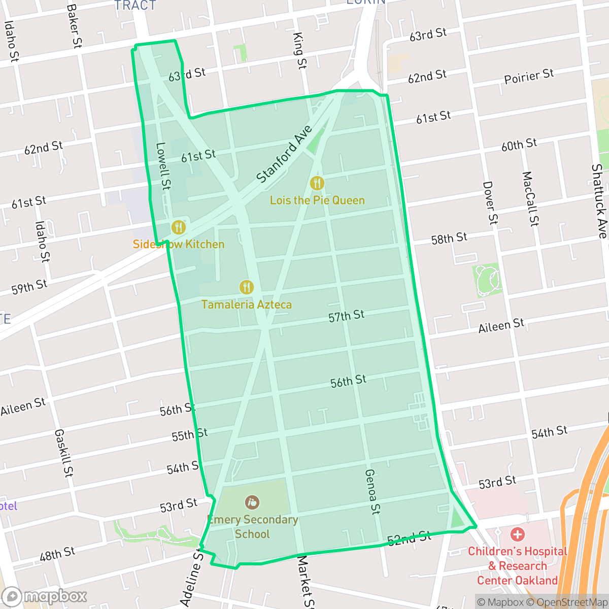
The Santa Fe neighborhood in North Oakland, California, is a historic residential enclave bounded roughly by 52nd Street, Martin Luther King Jr. Way, Lowell Street, and 61st Street. The neighborhood takes its name from the Atchison, Topeka and Santa Fe Railway, which operated along Lowell Street from the early 1900s until 1979. Much of Santa Fe's housing stock consists of historic Queen Anne Victorian, Craftsman, and Tudor Revival homes built between the 1890s and 1920s. The neighborhood holds deep cultural significance for its African American legal history; a former law office at 6014 Market Street served as a hub for early members of the Charles Houston Bar Association, including Lionel Wilson, Oakland’s first Black mayor, and California Supreme Court Justice Allen E. Broussard. A signature local landmark is Lois the Pie Queen, a beloved soul food institution operating since the 1970s.
This neighborhood functions as a dense, urban residential hub where the street layout prioritizes pedestrian movement. With a perfect walkability score, residents enjoy easy access to local staples like Ikaros Greek Kitchen and It's All Good Bakery. The area maintains a balanced urban environment, characterized by light commercial activity and a complete absence of heavy industrial hazards, which contributes to its high air quality ratings according to iHuus data.
Prospective residents should note the trade-offs inherent in this dense, historic setting. Privacy is often limited by the close proximity of row-style housing, and the acoustic environment is influenced by consistent road traffic noise. While the area lacks dedicated public parks, its central location and strong community identity make it a practical choice for those who value transit accessibility and a compact, walkable lifestyle over expansive private outdoor space.
Neighborhood Scores Across 15 Qualities
Buildings in this area are positioned in close quarters with narrow gaps or shared walls, resulting in less privacy than the Oakland average. Residents may experience more proximity to neighbors due to the high density of housing structures.
Continuous sidewalks and clearly marked crosswalks exist on nearly every street corner, making this area even more walkable than the Oakland average. Navigating the neighborhood on foot is easy due to the complete grid of pedestrian-priority crossings and wide paths.
Housing in this area consists of modest, tightly packed single-family homes and apartments with small yards. This level of visual variety is slightly lower than the average for Oakland.
Access to public green space and walking paths is below the Oakland average. While some areas benefit from proximity to San Pablo Park, other parts of the neighborhood feature dense housing with narrow sidewalks and minimal public parks.
Open land and scattered greenery provide a more semi-rural feel than much of the surrounding city. This area features more natural space and woodland elements compared to the Oakland average.
Suburban blocks and green spaces feature pockets of activity around local dining and community hubs, providing a more active atmosphere than the Oakland average. While some amenities are easily accessible on foot, other areas consist of quieter residential streets with limited nearby businesses.
Proximity to major freeways and railroad tracks results in frequent acoustic disturbances. According to iHuus data, noise levels in this area are slightly higher than the Oakland average.
Air quality remains consistently high with minimal health concerns for residents. This level of purity is notably better than the Oakland average, according to iHuus data.
Heavy industrial sites, warehouses, and manufacturing facilities are absent from this area. According to iHuus data, the neighborhood contains only residential and light commercial buildings, making it notably clearer of industrial hazards than the Oakland average.
Health insurance access is widespread among residents, notably higher than the Oakland average according to iHuus data.
Voting patterns and census indicators reflect a deeply liberal political identity that is consistent with the broader Oakland area.
Residents live alongside a balanced variety of young adults, families, and seniors. This demographic spread is largely in line with the broader Oakland area according to iHuus data.
Property sits within a known flood zone, making flood insurance typically necessary for residents. This risk level is higher than the Oakland average according to iHuus data.
Address-Level Insights for Santa Fe


iHuus Neighborhood Intelligence Insights
Get address-level neighborhood insights for Santa Fe
- Street-level scores — see how individual blocks compare, not just neighborhood averages
- Micro-zone boundaries — identify quiet pockets, flood boundaries, and walkable clusters before you visit
- 15 dimensions in full — walkability, noise, air quality, school quality, insurance coverage, population age profile, urban/rural index, and more
- Boundary risk alerts — know if your address sits near a block boundary where scores drop, the kind of detail no listing will ever mention
- School insights — individual school ratings and insights, not just district-level data
- Compare before you commit — side-by-side data across neighborhoods, down to block precision
No credit card required
Compare with Any Neighborhood
| Dimension | Santa Fe | Acorn |
|---|---|---|
| 🚶 Walkabilityavg 8.99 | ||
| 🔊 Acoustic Comfortavg 3.24 | ||
| 🤫 Privacy Indexavg 3.74 | ||
| 🎨 Visual Appealavg 6.28 | ||
| 🐕 Dog Friendlinessavg 5.74 | ||
| 🗺️ Urban-Rural Indexavg 6.02 | ||
| ✨ Neighborhood Vibeavg 5.22 | ||
| 🏥 Health Insurance Coverageavg 7.4 | ||
| 🌿 Air Qualityavg 8.06 | ||
| 🏭 Industrial Proximityavg 8.37 | ||
| 🌊 Flood Safetyavg 2.61 | ||
| 🗳️ Ideological Leanavg 9.95 | ||
| 👥 Population Age Profileavg 4.92 | ||
| 🔥 Fire Safetyavg 0.17 | ||
| 🏫 School Quality |
Santa Fe Rankings
School Districts Serving Santa Fe
School Insights for Santa Fe
Below average outcomes; significant attendance and academic challenges.
School Insights
See what's really behind every school rating near Santa Fe
- Individual school ratings — each school's own score with outcome context, not just a district average
- Enrollment & class size data — student-to-teacher ratio and how it compares to the state average
- Full demographics breakdown — ethnicity and gender composition for every school in the enrollment zone
- Every school in the district — all schools within the enrollment boundary ranked by rating, not just the closest one
- Grade levels & benchmarks — elementary through high school, with below/above state-average flags
No credit card required