Oak Center, Oakland
Updated June 22, 2026 · 3,479 residents
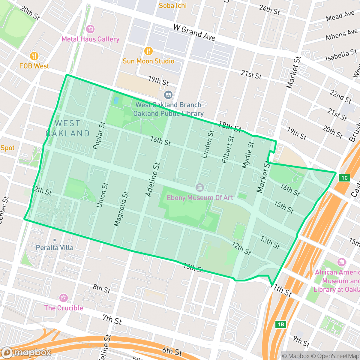
Oak Center is a quiet West Oakland neighborhood defined by its high walkability and dense, historic residential layout. Residents benefit from excellent air quality and a consistent grid of streets, though the area features limited privacy due to closely situated homes and nearby commercial activity.
Key Highlights
About Oak Center
Located in West Oakland, California, Oak Center is a historic neighborhood renowned for its exceptional concentration of Victorian architecture, with hundreds of homes in Italianate, Stick, and Queen Anne styles dating back to the late 19th and early 20th centuries. In the 1960s, the neighborhood was targeted for widespread demolition under the city's urban renewal plans. However, local Black residents, led by activist Lillian Q. Love, founded the Oak Center Neighborhood Association (OCNA) in 1963. Through fierce community organizing, the OCNA successfully forced the Oakland Redevelopment Agency to shift from mass demolition to rehabilitation, preserving the neighborhood's historic character and altering the path of the Grove-Shafter Freeway. In 2003, Oak Center was designated as Oakland's largest Historic Preservation District, cementing its legacy of grassroots preservation.
The neighborhood functions as a highly walkable enclave within the broader West Oakland landscape. Its urban fabric consists of a dense grid of streets where residential properties are situated closely together, resulting in a compact, suburban-like atmosphere despite the proximity to active commercial and light industrial zones. According to iHuus data, the area maintains exceptional air quality, providing a cleaner environment than many other parts of the city. While the streets are quiet and accessible, the layout reflects a high-density mix of multi-unit residential and commercial structures.
The area presents specific considerations for prospective residents regarding privacy and regional infrastructure. Privacy is limited by the high-density housing, and the local school district faces significant financial and structural instability, which may be a factor for families. While the neighborhood offers convenient access to public parks and linear green strips, it is also located in the vicinity of an EPA Superfund site. The environment is characterized by a steady level of road traffic noise, which is typical for this type of functional, mixed-use urban setting.
Neighborhood Scores Across 15 Qualities
Residential structures are closely packed with minimal separation between buildings, resulting in a higher level of density than the Oakland average. Many homes feature narrow side yards or shared walls, creating a tightly clustered urban environment according to iHuus data.
Extensive sidewalk networks and clearly marked crosswalks make navigating this area on foot very efficient. Most streets feature continuous sidewalks on both sides, providing a level of walkability that is higher than the Oakland average.
Housing consists mostly of dense, multi-unit complexes and modest single-family homes with minimal private yard space. According to iHuus data, the visual landscape is slightly less varied than the Oakland average.
Frequent pavement and narrow street verges in the high-density core can make walking pets difficult; however, several public parks and green school fields provide accessible areas for dogs nearby. According to iHuus data, the availability of pet-friendly green space in this area is below the Oakland average.
Street layouts and green spaces are balanced between residential and developed areas, presenting a more suburban character than the more urbanized Oakland average. According to iHuus data, the landscape features a mix of multi-family housing and commercial blocks alongside pockets of single-family homes.
Activity levels are consistent with the city average, ranging from high-energy urban blocks near the highway to quieter, more suburban residential pockets. Residents can find a mix of dining and cultural sites, including the African American Museum and various local eateries, interspersed with more tranquil green spaces.
Frequent acoustic disturbances from nearby railroad tracks and major freeways characterize this area. According to iHuus data, noise levels are notably higher than the Oakland average.
Air quality in this area is consistently excellent, representing a notable improvement over the Oakland average according to iHuus data.
Heavy industrial zones and freight traffic are notably more prevalent here than in the rest of Oakland. Some areas contain large-scale operational facilities and are located near an EPA Superfund site, though other pockets remain primarily residential and commercial.
Health insurance access among residents is lower than the Oakland average, according to iHuus data. This indicates a higher proportion of uninsured individuals living in the area compared to the rest of the city.
Voting patterns and census indicators reflect a deeply liberal political leaning, which is consistent with the broader Oakland area according to iHuus data.
A balanced distribution of young adults, families, and older residents characterizes this area. According to iHuus data, the age profile is largely consistent with the broader Oakland average.
Flood risk in this area is higher than the Oakland average, though official FEMA studies for the neighborhood are currently incomplete.
Block-Level Insights for Oak Center

iHuus Neighborhood Intelligence Insights
Get block-level neighborhood insights for Oak Center
- Street-level scores — see how individual blocks compare, not just neighborhood averages
- Micro-zone boundaries — identify quiet pockets, flood boundaries, and walkable clusters before you visit
- 15 dimensions in full — walkability, noise, air quality, school quality, insurance coverage, population age profile, urban/rural index, and more
- Boundary risk alerts — know if your address sits near a block boundary where scores drop, the kind of detail no listing will ever mention
- School insights — individual school ratings and insights, not just district-level data
- Compare before you commit — side-by-side data across neighborhoods, down to block precision
No credit card required
Compare with Any Neighborhood
| Dimension | Oak Center | Acorn |
|---|---|---|
| 🚶 Walkabilityavg 8.99 | ||
| 🔊 Acoustic Comfortavg 3.24 | ||
| 🤫 Privacy Indexavg 3.74 | ||
| 🎨 Visual Appealavg 6.28 | ||
| 🐕 Dog Friendlinessavg 5.74 | ||
| 🗺️ Urban-Rural Indexavg 6.02 | ||
| ✨ Neighborhood Vibeavg 5.22 | ||
| 🏥 Health Insurance Coverageavg 7.4 | ||
| 🌿 Air Qualityavg 8.06 | ||
| 🏭 Industrial Proximityavg 8.37 | ||
| 🌊 Flood Safetyavg 2.61 | ||
| 🗳️ Ideological Leanavg 9.95 | ||
| 👥 Population Age Profileavg 4.92 | ||
| 🔥 Fire Safetyavg 0.17 | ||
| 🏫 School Quality |
Oak Center Rankings
School Districts Serving Oak Center
Oakland Unified School District is currently in a distressed state, characterized by a massive $100 million budget deficit, high-stakes labor disputes, and a facilities maintenance backlog exceeding $3.5 billion. While the district maintains several high-achieving 'Blue Chip' elementary schools (e.g., Lincoln, Chabot), these are outliers in a portfolio where nearly half of the schools are performing at the lowest state levels. The combination of declining enrollment, 400 recent staff layoffs, and the constant threat of state receivership indicates an organization struggling with long-term stability and equitable academic delivery.
Schools
School Insights for Oak Center
Below average outcomes; significant attendance and academic challenges.
School Insights
See what's really behind every school rating near Oak Center
- Individual school ratings — each school's own score with outcome context, not just a district average
- Enrollment & class size data — student-to-teacher ratio and how it compares to the state average
- Full demographics breakdown — ethnicity and gender composition for every school in the enrollment zone
- Every school in the district — all schools within the enrollment boundary ranked by rating, not just the closest one
- Grade levels & benchmarks — elementary through high school, with below/above state-average flags
No credit card required