Oldtown, National City
Updated June 22, 2026 · 2,853 residents
Oldtown is a historically significant neighborhood in National City characterized by a mix of residential streets and heavy industrial infrastructure. While the area offers convenient access to diverse local dining and essential services, it experiences high levels of ambient noise due to its proximity to major freight corridors and regional highways.
Key Highlights
About Oldtown
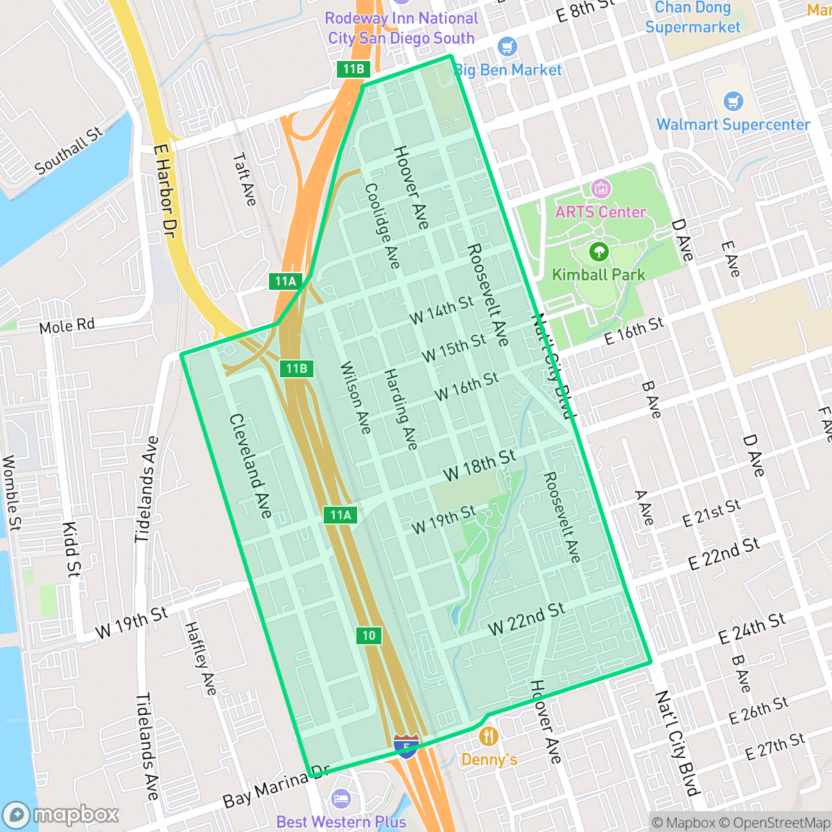
Affectionately known as Old Town, the Westside of National City, California, has a rich Mexican American heritage dating back to the early 20th century. In the 1920s, the neighborhood became a hub for working-class families employed in local meatpacking plants (matanzas). The Casa de Salud at 14th Street and Harding Avenue served as a vital community center during this era. Following World War II, the city permitted heavy industrial operations, such as auto body shops, to mix with residential areas, creating severe environmental challenges. In response, local residents and the Environmental Health Coalition organized to pass a landmark 2006 amortization ordinance to phase out polluting businesses, followed by the 2010 Westside Specific Plan. This community-led effort successfully prioritized green spaces and affordable housing, including the Paradise Creek development.
The neighborhood functions as a dense, industrial-adjacent community where large-scale logistics facilities and warehouses sit alongside suburban blocks. The streetscape is defined by a high grey to green ratio, reflecting its history as a center for meatpacking and manufacturing. Despite the industrial surroundings, residents have access to a variety of local dining options, including spots like Pho Kha and Circus Man Ice Cream, alongside familiar national chains. According to iHuus data, the area maintains a moderate walkability score, allowing for pedestrian access to nearby services and the National City Depot.
Prospective residents should be aware of the significant acoustic profile of the area, which is heavily impacted by road traffic. The neighborhood presents a complex living environment where the benefits of a central location and ongoing urban planning efforts, such as the Paradise Creek development, are balanced against the realities of industrial proximity and low acoustic comfort. While the area is relatively safe from flooding, it faces challenges regarding fire safety and limited health insurance coverage among the local population. It is best suited for individuals who prioritize proximity to transit and industrial employment hubs over a quiet, secluded residential setting.
Neighborhood Scores Across 15 Qualities
Residential structures and industrial buildings are packed closely together with minimal separation between properties. According to iHuus data, this lack of spacing results in much lower privacy levels than the National City average.
Pedestrians can navigate a consistent street grid with sidewalks and safe crossings, though some areas are adjacent to heavy industrial traffic and large parking lots. This level of walkability is slightly below the National City average, according to iHuus data.
Residential areas consist mainly of high-density housing with small lots and minimal private greenery. The landscape features many multi-unit complexes and industrial structures, making the visual environment less diverse than the National City average.
Minimal public greenery and narrow sidewalks make walking dogs difficult. According to iHuus data, the area lacks public parks and is dominated by paved surfaces and private fenced lots, making it less dog friendly than the rest of National City.
High concentrations of industrial and commercial structures create a heavily built environment with limited green space. According to iHuus data, this area is significantly more developed and lacks the vegetation found in the more suburban parts of the city.
A blend of industrial warehouses and suburban blocks creates a steady but subdued rhythm of activity. This level of liveliness is slightly below the city average, as much of the landscape is dominated by freight corridors and light commercial units.
Steady traffic sounds from nearby busy streets are present, though the acoustic environment is notably calmer than the average for National City according to iHuus data.
Air quality in Oldtown fluctuates between acceptable and unhealthy levels, presenting occasional concerns for sensitive groups. This level of-air quality is consistent with the average found throughout National City, according to iHuus data.
Large warehouses and logistics hubs with heavy truck traffic are located near the southern edge of the area. This level of industrial activity is noticeably lower than the city average, as the neighborhood maintains a mix of commercial and residential uses.
Health insurance access is lower than the National City average. According to iHuus data, fewer residents in Oldtown have coverage compared to the rest of the city.
Voting patterns and census indicators show a predominantly liberal community that leans more progressive than the National City average, according to iHuus data.
Residents live alongside a balanced mix of young adults, families, and seniors. This demographic spread is largely consistent with the broader National City area, according to iHuus data.
Located within a designated floodplain, this area faces a greater risk of flooding than much of National City. According to iHuus data, residents may find that flood insurance is a typical requirement for properties in this neighborhood.
Block-Level Insights for Oldtown

iHuus Neighborhood Intelligence Insights
Get block-level neighborhood insights for Oldtown
- Street-level scores — see how individual blocks compare, not just neighborhood averages
- Micro-zone boundaries — identify quiet pockets, flood boundaries, and walkable clusters before you visit
- 15 dimensions in full — walkability, noise, air quality, school quality, insurance coverage, population age profile, urban/rural index, and more
- Boundary risk alerts — know if your address sits near a block boundary where scores drop, the kind of detail no listing will ever mention
- School insights — individual school ratings and insights, not just district-level data
- Compare before you commit — side-by-side data across neighborhoods, down to block precision
No credit card required
Compare with Any Neighborhood
| Dimension | Oldtown | Central |
|---|---|---|
| 🚶 Walkabilityavg 7.96 | ||
| 🔊 Acoustic Comfortavg 4.12 | ||
| 🤫 Privacy Indexavg 3.91 | ||
| 🎨 Visual Appealavg 5.6 | ||
| 🐕 Dog Friendlinessavg 5.13 | ||
| 🗺️ Urban-Rural Indexavg 5.85 | ||
| ✨ Neighborhood Vibeavg 5.31 | ||
| 🏥 Health Insurance Coverageavg 4.68 | ||
| 🌿 Air Qualityavg 6 | ||
| 🏭 Industrial Proximityavg 7.5 | ||
| 🌊 Flood Safetyavg 1.88 | ||
| 🗳️ Ideological Leanavg 8.93 | ||
| 👥 Population Age Profileavg 4.63 | ||
| 🔥 Fire Safety | ||
| 🏫 School Quality |
Oldtown Rankings
School Districts Serving Oldtown
National Elementary School District is a stable but academically average organization currently navigating a leadership transition and high-need demographic challenges. While the district benefits from a supportive internal culture, long-term leadership stability, and avoidence of the fiscal crises affecting its neighbors, it suffers from a sharp divide in school quality and low proficiency rates in core subjects. Community trust remains steady following the historic appointment of a local superintendent, yet the district must bridge the significant gap between its high-performing and low-performing schools to move beyond its current 'Mixed' status.
Schools
Sweetwater Union High School District functions as a stable but stratified educational entity, characterized by a significant performance gap between its high-achieving high schools and its struggling middle school feeder patterns. While the district celebrates recent accolades like the 2026 California Distinguished Schools award and maintains strong community trust through facility modernizations and specialized programs like Middle College, its academic core remains mixed with proficiency levels trailing behind state leaders. A legacy of legal settlements and varied facility conditions across its 29 campuses further underscores a 'middle-of-the-road' status, where pockets of excellence are offset by persistent operational and academic challenges in underserved zones.
Schools
School Insights for Oldtown
Below average outcomes; significant attendance and academic challenges.
School Insights
See what's really behind every school rating near Oldtown
- Individual school ratings — each school's own score with outcome context, not just a district average
- Enrollment & class size data — student-to-teacher ratio and how it compares to the state average
- Full demographics breakdown — ethnicity and gender composition for every school in the enrollment zone
- Every school in the district — all schools within the enrollment boundary ranked by rating, not just the closest one
- Grade levels & benchmarks — elementary through high school, with below/above state-average flags
No credit card required