Yucca Corridor, Los Angeles
Updated · 2,778 residents
The Yucca Corridor is a high-density, intensely walkable urban hub in the heart of Hollywood. It offers residents immediate access to iconic landmarks and diverse dining options, though the area is characterized by significant traffic noise and limited private outdoor space.
Key Highlights
About Yucca Corridor
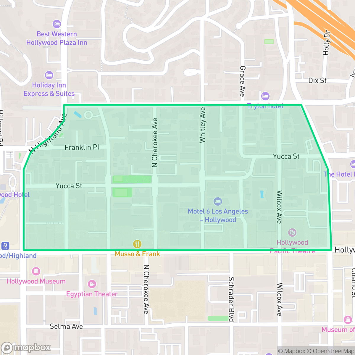
Bounded by Franklin Avenue, Highland Avenue, Vine Street, and Hollywood Boulevard, the Yucca Corridor is a vibrant Hollywood neighborhood with a dramatic history. In 1910, D.W. Griffith’s *In Old California*—the first film shot in Hollywood—was filmed at Vine Street. While the area boasts historic Art Deco landmarks like the Fontenoy (1928) and the notorious Lido Hotel (featured on the *Hotel California* album art), it fell into severe decline by the 1980s and 1990s, nicknamed a "dope supermarket" dominated by gangs. Community-led neighborhood watches, coupled with post-1994 Northridge earthquake redevelopment, sparked a major transformation. Today, the corridor is a walkable hub for young professionals and artists, anchored by the 30-foot-tall "Gateway to Hollywood" glass tower (installed in 2002) and featuring Los Angeles’s first "bike-friendly street" experiment, established on Yucca Street in 2012.
This neighborhood functions as a dense, high-energy core defined by its proximity to major Hollywood attractions and a grid of multi-story apartment buildings. It is a highly accessible environment where daily errands can be completed on foot, supported by an excellent sidewalk network. The local landscape is dominated by commercial and residential blocks, creating a vibrant, non-industrial atmosphere that remains active throughout the day.
Residents should expect an urban environment with minimal private green space and limited pet-friendly amenities. The area experiences high levels of ambient road noise, reflecting its central position within the city. It is best suited for individuals who prioritize walkability and proximity to cultural landmarks over quiet, suburban-style living or extensive private property.
Neighborhood Scores Across 15 Qualities
Buildings are often tightly packed with minimal separation between structures. According to iHuus data, this lack of buffering results in lower privacy levels than the Los Angeles average.
Wide sidewalks and a dense network of crosswalks make most local trips easy to complete on foot. This level of accessibility is higher than the average for Los Angeles, though the nearby highway acts as a notable barrier to movement in certain directions.
The landscape varies from dense apartment blocks and standard urban grids to more upscale hillside properties featuring large homes and private pools. According to iHuus data, the visual variety is slightly above the city average.
Limited access to large public parks and minimal green sidewalk verges make this area less ideal for pet owners compared to the city average. According to iHuus data, greenery is primarily confined to private lots and narrow strips near multi-family housing.
Multi-story apartment buildings and commercial blocks define this area. The neighborhood features a much more concentrated urban environment than the Los Angeles average, with significant presence of high-density structures near major highway interchanges.
Constant movement and a dense concentration of dining and landmarks create an intense urban atmosphere. This area is significantly more lively than the Los Angeles average, according to iHuus data.
Frequent acoustic disturbances from nearby freeway and railroad corridors are common here. According to iHuus data, levels of ambient noise are notably higher than the average for Los Angeles.
Air quality remains consistently high with infrequent instances of poor air. This level of cleanliness is nearly identical to the average found throughout Los Angeles.
Absence of warehouses, heavy industrial plants, or hazardous sites characterizes this area. According to iHuus data, the neighborhood contains significantly fewer industrial facilities and pollution hazards than the Los Angeles average.
Health insurance coverage among residents is below the Los Angeles average, according to iHuus data. This indicates a higher proportion of uninsured individuals compared to most other parts of the city.
Voting patterns and census indicators reflect a very liberal political leaning, which is slightly more pronounced than the Los Angeles average according to iHuus data.
Residents live alongside a balanced variety of young professionals, families, and older adults. According to iHuus data, this demographic spread is slightly more varied than the average seen across Los Angeles.
Flood risk is significantly higher than the Los Angeles average because parts of the area sit within a designated 100-year floodplain. According to iHuus data, residents in this zone may find flood insurance is typically required for properties.
Fire hazards in this area are significantly higher than the Los Angeles average. Residents should remain vigilant and ensure they are prepared for extreme wildfire conditions according to iHuus data.
Address-Level Insights for Yucca Corridor


iHuus Neighborhood Intelligence Insights
Get address-level neighborhood insights for Yucca Corridor
- Street-level scores — see how individual blocks compare, not just neighborhood averages
- Micro-zone boundaries — identify quiet pockets, flood boundaries, and walkable clusters before you visit
- 15 dimensions in full — walkability, noise, air quality, school quality, insurance coverage, population age profile, urban/rural index, and more
- Boundary risk alerts — know if your address sits near a block boundary where scores drop, the kind of detail no listing will ever mention
- School insights — individual school ratings and insights, not just district-level data
- Compare before you commit — side-by-side data across neighborhoods, down to block precision
No credit card required
Compare with Any Neighborhood
| Dimension | Yucca Corridor | Adams-Normandie |
|---|---|---|
| 🚶 Walkabilityavg 8.9 | ||
| 🔊 Acoustic Comfortavg 2.91 | ||
| 🤫 Privacy Indexavg 4.14 | ||
| 🎨 Visual Appealavg 6.58 | ||
| 🐕 Dog Friendlinessavg 5.04 | ||
| 🗺️ Urban-Rural Indexavg 5.96 | ||
| ✨ Neighborhood Vibeavg 5.07 | ||
| 🏥 Health Insurance Coverageavg 6.2 | ||
| 🌿 Air Qualityavg 8.12 | ||
| 🏭 Industrial Proximityavg 8.46 | ||
| 🌊 Flood Safetyavg 2.66 | ||
| 🗳️ Ideological Leanavg 9.56 | ||
| 👥 Population Age Profileavg 4.85 | ||
| 🔥 Fire Safetyavg 0.18 | ||
| 🏫 School Quality |
Yucca Corridor Rankings
School Districts Serving Yucca Corridor
School Insights for Yucca Corridor
Below average outcomes; significant attendance and academic challenges.
School Insights
See what's really behind every school rating near Yucca Corridor
- Individual school ratings — each school's own score with outcome context, not just a district average
- Enrollment & class size data — student-to-teacher ratio and how it compares to the state average
- Full demographics breakdown — ethnicity and gender composition for every school in the enrollment zone
- Every school in the district — all schools within the enrollment boundary ranked by rating, not just the closest one
- Grade levels & benchmarks — elementary through high school, with below/above state-average flags
No credit card required