Terminal Island, Los Angeles
Updated · 1,071 residents
Terminal Island is a heavily industrial maritime hub defined by its massive port infrastructure and proximity to the Vincent Thomas Bridge. While the area offers high walkability and generally clean air, residents face frequent noise from heavy transit and a dense, functional landscape with limited residential privacy.
Key Highlights
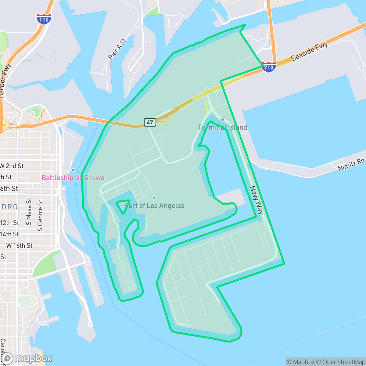
About Terminal Island
Originally known as Rattlesnake Island, Terminal Island was renamed in 1891 to reflect its role as a rail terminus. It once hosted a vibrant Japanese fishing village, known as Furusato, where roughly 3,000 residents established a thriving tuna canning industry. This community was tragically uprooted following the attack on Pearl Harbor, as residents were among the first Japanese Americans forcibly removed and incarcerated. The island underwent significant land reclamation and industrial transformation, evolving into a major maritime hub for shipbuilding and international trade. Today, the landscape is defined by its heavy industrial use, the iconic Vincent Thomas Bridge, and the Federal Correctional Institution. Only two structures on Tuna Street remain as remnants of the former fishing village, serving as poignant reminders of the island’s complex history and the displacement of its original residents.
The neighborhood functions as a critical node in international trade, dominated by container terminals, oil storage, and active logistics corridors. Its visual character is strictly utilitarian, featuring standard tract housing and apartment complexes that prioritize density over expansive greenery. Despite the industrial intensity, the area maintains a grid layout that supports pedestrian movement, providing accessibility to local transit corridors and harbor-side paths.
Living in this environment requires adjusting to high noise levels where industrial activity and rail traffic are constant factors. The neighborhood is best suited for those working in the maritime sector or individuals who prioritize proximity to port operations over traditional suburban quiet. While the area provides access to basic amenities and moderate dog-friendly spaces, the combination of high-density housing and flood risks makes it a specialized choice for residents comfortable with a rugged, working-class maritime setting.
Neighborhood Scores Across 15 Qualities
Residential structures feature very close proximity with minimal separation between homes. This density is notably higher than the average found across Los Angeles, according to iHuus data.
Pedestrians can navigate a dense grid featuring sidewalks and clear crossings, though overall walkability is slightly below the Los Angeles average. According to iHuus data, many streets are well-equipped for foot traffic with accessible infrastructure.
Residential layouts consist of standard tract housing and apartment complexes with minimal greenery. The visual landscape is less varied than the Los Angeles average, featuring primarily boxy rooftops and small, tidy yards.
Continuous green strips along harbor road and access to public parks provide suitable walking areas for pets. This level of accessibility for dog owners is consistent with the average found across Los Angeles.
Dominant maritime and logistics infrastructure creates an environment with very little greenery or residential character. This area is significantly more industrial than the Los Angeles average, consisting mostly of paved terminals, container storage, and heavy port facilities according to iHuus data.
A blend of industrial warehouses and coastal suburban blocks offers occasional dining spots, though the area remains largely car-dependent. The local vibrancy is roughly comparable to the city average, characterized by heavy maritime infrastructure and limited walkable retail.
Frequent noise from nearby railroad tracks and heavy industrial activity makes this area significantly louder than the Los Angeles average. According to iHuus data, residents may experience persistent auditory disturbances from surrounding transit corridors.
Air quality is generally good with only infrequent periods of elevated readings. This level of cleanliness is roughly comparable to the average found throughout Los Angeles.
Extensive maritime infrastructure, including container terminals, oil storage tanks, and heavy truck traffic, defines the area. This level of industrial activity is significantly higher than the average seen across Los Angeles.
Political leanings in this area lean liberal, though the community is slightly less progressive than the broader Los Angeles average according to iHuus data.
A balanced mix of young adults, families, and older residents characterizes the local demographic. According to iHuus data, this age distribution is slightly more varied than the average seen across Los Angeles.
Residual flood risks exist within this area due to its location in a 500-year floodplain. According to iHuus data, the level of flood risk is notably higher than the average for Los Angeles.
Address-Level Insights for Terminal Island


iHuus Neighborhood Intelligence Insights
Get address-level neighborhood insights for Terminal Island
- Street-level scores — see how individual blocks compare, not just neighborhood averages
- Micro-zone boundaries — identify quiet pockets, flood boundaries, and walkable clusters before you visit
- 15 dimensions in full — walkability, noise, air quality, school quality, insurance coverage, population age profile, urban/rural index, and more
- Boundary risk alerts — know if your address sits near a block boundary where scores drop, the kind of detail no listing will ever mention
- School insights — individual school ratings and insights, not just district-level data
- Compare before you commit — side-by-side data across neighborhoods, down to block precision
No credit card required
Compare with Any Neighborhood
| Dimension | Terminal Island | Adams-Normandie |
|---|---|---|
| 🚶 Walkabilityavg 8.9 | ||
| 🔊 Acoustic Comfortavg 2.91 | ||
| 🤫 Privacy Indexavg 4.14 | ||
| 🎨 Visual Appealavg 6.58 | ||
| 🐕 Dog Friendlinessavg 5.04 | ||
| 🗺️ Urban-Rural Indexavg 5.96 | ||
| ✨ Neighborhood Vibeavg 5.07 | ||
| 🏥 Health Insurance Coverageavg 6.2 | ||
| 🌿 Air Qualityavg 8.12 | ||
| 🏭 Industrial Proximityavg 8.46 | ||
| 🌊 Flood Safetyavg 2.66 | ||
| 🗳️ Ideological Leanavg 9.56 | ||
| 👥 Population Age Profileavg 4.85 | ||
| 🔥 Fire Safetyavg 0.18 | ||
| 🏫 School Quality |
Terminal Island Rankings
School Districts Serving Terminal Island
School Insights for Terminal Island
Below average outcomes; significant attendance and academic challenges.
School Insights
See what's really behind every school rating near Terminal Island
- Individual school ratings — each school's own score with outcome context, not just a district average
- Enrollment & class size data — student-to-teacher ratio and how it compares to the state average
- Full demographics breakdown — ethnicity and gender composition for every school in the enrollment zone
- Every school in the district — all schools within the enrollment boundary ranked by rating, not just the closest one
- Grade levels & benchmarks — elementary through high school, with below/above state-average flags
No credit card required