Sawtelle, Los Angeles
Updated · 29,361 residents
Sawtelle is an exceptionally walkable urban district known for its high-energy atmosphere and dense concentration of dining and retail options along Sawtelle Boulevard. Residents benefit from excellent pedestrian infrastructure, though the area is characterized by tightly packed housing and significant road traffic noise.
Key Highlights
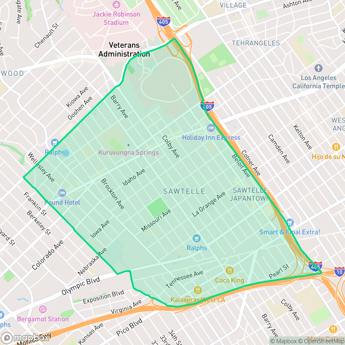
About Sawtelle
Sawtelle emerged in 1899 as an independent city centered around the Pacific Branch of the National Home for Disabled Volunteer Soldiers. Developed by the Pacific Land Company and named for its manager, W. E. Sawtelle, the "Soldier City" was annexed by Los Angeles in 1922. By the early 1900s, Japanese immigrants (Issei) settled in the area, affectionately calling it "so-te-ru". Barred by restrictive covenants from living in adjacent wealthy enclaves like Bel-Air and Brentwood, many Nikkei residents worked as gardeners for those estates. Sawtelle evolved into a thriving agricultural and nursery hub. Today, the neighborhood is officially designated "Sawtelle Japantown". While modern eateries now line Sawtelle Boulevard, historic anchors like the 1929 Japanese Institute of Sawtelle and the pre-WWII Hashimoto Nursery preserve its deep cultural heritage.
The neighborhood functions as a high-density, mid-rise urban corridor defined by its vibrant commercial life and proximity to major Westside transit routes. It features a continuous grid of sidewalks and frequent crosswalks, making it one of the most accessible areas for those who prefer to navigate without a vehicle. The landscape is dominated by multi-family residential structures and commercial blocks, creating a bustling environment that remains active throughout the day.
Prospective residents should anticipate a fast-paced urban lifestyle with limited private outdoor space and noticeable ambient noise from nearby traffic. The area is well-suited for individuals who prioritize walkability and proximity to diverse culinary options over suburban quiet or expansive greenery. While the district lacks large public parks, its dense urban layout and central location provide convenient access to the broader West Los Angeles region.
Neighborhood Scores Across 15 Qualities
Residential structures and multi-family units are notably tightly packed with minimal separation between buildings. This high-density configuration offers less private space between homes than the Los Angeles average, according to iHuus data.
Continuous sidewalks and frequent crosswalks make navigating the dense street grid easy on foot. While the nearby freeway interchange creates a significant barrier, the overall walkability remains notably higher than the Los Angeles average.
Standard multi-family apartment blocks and small-lot bungalows define the skyline, offering a typical urban aesthetic that sits slightly below the city average for visual variety. The landscape is characterized by uniform rooflines and limited private greenery, though some high-end multi-unit complexes feature manicured grounds and rooftop amenities.
Paved surfaces and high building density dominate the area, resulting in fewer grassy verges and public parks for pets compared to the city average. While some residents can access local sports fields, much of the neighborhood lacks accessible green space.
Streetscapes feature a balanced blend of single-family homes, low-rise apartments, and commercial strips. This layout is less densely urbanized than the Los Angeles average, providing a notable amount of green space alongside residential blocks.
Dynamic energy defines this area, which offers a significantly higher density of diverse restaurants and social destinations than the Los Angeles average. Residents can enjoy a wide variety of lively mid-rise districts and walkable eateries, ranging from casual cafes to established dining institutions.
Persistent noise from nearby major freeways and transit corridors makes this area significantly louder than the Los Angeles average. According to iHuus data, residents should expect frequent acoustic disturbances from heavy vehicle traffic.
Air quality remains consistently high with infrequent periods of poor circulation. This level of cleanliness is roughly in line with the broader Los Angeles area according to iHuus data.
Minimal industrial activity is present, as the area is composed primarily of residential and commercial uses without large warehouses or hazardous facilities. This lack of heavy industry makes the neighborhood significantly cleaner than the Los Angeles average regarding industrial proximity.
Health insurance access is notably higher than the Los Angeles average, according to iHuus data. Residents in this area benefit from a greater proportion of insured individuals compared to the rest of the city.
Voting patterns and census indicators reflect a deeply liberal political leaning, slightly more pronounced than the Los Angeles average.
Residents live among a balanced mix of young professionals, families, and older adults. This demographic spread is slightly more diverse than the typical Los Angeles profile, according to iHuus data.
Flood risk levels in Sawtelle are higher than the Los Angeles average, though a definitive risk assessment is currently unavailable due to incomplete federal studies. Residents should remain aware of potential vulnerability during extreme weather events according to iHuus data.
Address-Level Insights for Sawtelle


iHuus Neighborhood Intelligence Insights
Get address-level neighborhood insights for Sawtelle
- Street-level scores — see how individual blocks compare, not just neighborhood averages
- Micro-zone boundaries — identify quiet pockets, flood boundaries, and walkable clusters before you visit
- 15 dimensions in full — walkability, noise, air quality, school quality, insurance coverage, population age profile, urban/rural index, and more
- Boundary risk alerts — know if your address sits near a block boundary where scores drop, the kind of detail no listing will ever mention
- School insights — individual school ratings and insights, not just district-level data
- Compare before you commit — side-by-side data across neighborhoods, down to block precision
No credit card required
Compare with Any Neighborhood
| Dimension | Sawtelle | Adams-Normandie |
|---|---|---|
| 🚶 Walkabilityavg 8.9 | ||
| 🔊 Acoustic Comfortavg 2.91 | ||
| 🤫 Privacy Indexavg 4.14 | ||
| 🎨 Visual Appealavg 6.58 | ||
| 🐕 Dog Friendlinessavg 5.04 | ||
| 🗺️ Urban-Rural Indexavg 5.96 | ||
| ✨ Neighborhood Vibeavg 5.07 | ||
| 🏥 Health Insurance Coverageavg 6.2 | ||
| 🌿 Air Qualityavg 8.12 | ||
| 🏭 Industrial Proximityavg 8.46 | ||
| 🌊 Flood Safetyavg 2.66 | ||
| 🗳️ Ideological Leanavg 9.56 | ||
| 👥 Population Age Profileavg 4.85 | ||
| 🔥 Fire Safetyavg 0.18 | ||
| 🏫 School Quality |
Sawtelle Rankings
School Districts Serving Sawtelle
School Insights for Sawtelle
Below average outcomes; significant attendance and academic challenges.
School Insights
See what's really behind every school rating near Sawtelle
- Individual school ratings — each school's own score with outcome context, not just a district average
- Enrollment & class size data — student-to-teacher ratio and how it compares to the state average
- Full demographics breakdown — ethnicity and gender composition for every school in the enrollment zone
- Every school in the district — all schools within the enrollment boundary ranked by rating, not just the closest one
- Grade levels & benchmarks — elementary through high school, with below/above state-average flags
No credit card required