Palms, Los Angeles
Updated · 40,168 residents
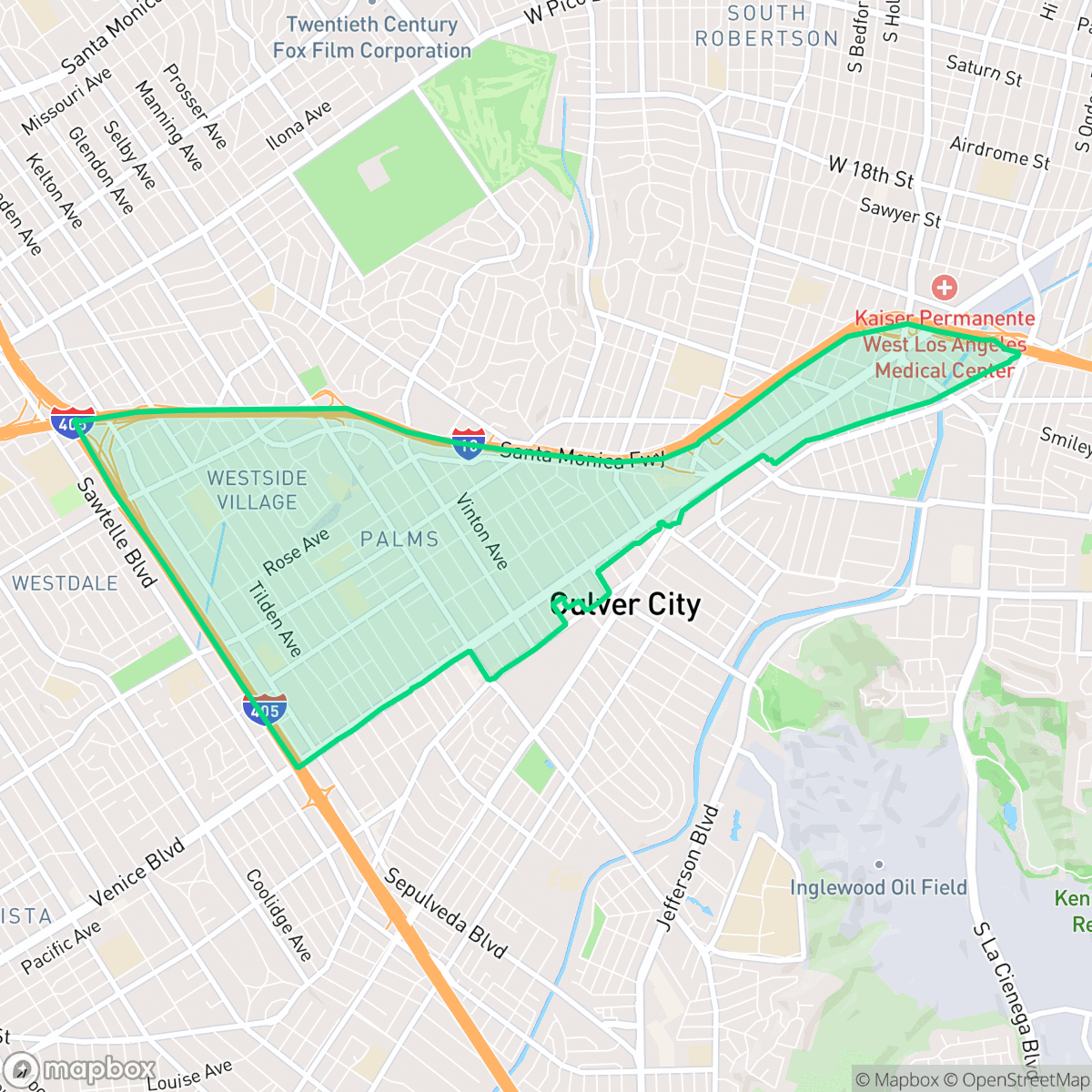
Palms is a densely populated Westside neighborhood known for its high walkability and diverse mix of mid-century apartment buildings and single-family homes. While the area offers convenient access to local commerce and transit, residents should be prepared for a high-density environment with significant road noise and limited private green space.
Key Highlights
About Palms
Established in 1886 on land originally part of Rancho La Ballona, Palms is the oldest neighborhood annexed by the City of Los Angeles, joining in 1915. Originally marketed as an agricultural and vacation suburb called "The Palms," founders Joseph Curtis, Edward H. Sweetser, and C.J. Harrison planted 5,000 palm trees to beautify the area, including near the Eastlake-style Palms-Southern Pacific Railroad Depot. While early residential streets featured Craftsman and Spanish Colonial single-family homes, a post-World War II housing boom prompted widespread redevelopment. From the late 1950s through the 1970s, many older homes were demolished and replaced with mid-century "dingbat" and tiki-themed apartment buildings. Today, bisected by commercial corridors along Motor and Overland avenues, Palms has evolved into one of the most densely populated, renter-heavy residential communities on the Westside.
The area serves as a transit-oriented residential hub, characterized by a dense grid of streets lined with a mix of older Craftsman homes and mid-century apartment complexes. Its central location provides residents with immediate access to a variety of local dining options along Motor and Overland avenues, ranging from casual eateries to established neighborhood cafes. The community maintains a high degree of walkability, allowing for easy navigation between residential blocks and commercial corridors, though the presence of major freeway infrastructure remains a defining feature of the local geography. Prospective residents should weigh the benefits of this central location against the realities of a high-density urban environment. The neighborhood features closely spaced housing with minimal buffers, which contributes to a lower sense of privacy and elevated ambient noise levels from surrounding road traffic. It is best suited for individuals or young professionals who prioritize a walkable lifestyle and proximity to Westside employment centers over expansive private outdoor space or quiet suburban seclusion.
Neighborhood Scores Across 15 Qualities
Residential spacing is consistent with the city average, featuring a mix of detached homes and multi-unit buildings. Some areas, particularly the eastern blocks, feature closely packed structures with shared walls and minimal buffers between neighbors.
Continuous sidewalks and well-defined crosswalks exist on most residential and commercial streets, making the area more walkable than the Los Angeles average. While the major freeway interchange creates a significant barrier for pedestrians, the interior grid remains highly connected.
Varied housing styles ranging from affluent estates with private pools to denser apartment blocks define the landscape. This visual diversity is largely in line with the broader Los Angeles area.
Public parks and wide grassy verges are scarce, as most greenery is contained within private fenced yards. This lack of accessible outdoor space for pets is below the Los Angeles average.
Residential streets and green spaces are found in roughly equal measure to commercial zones. This layout provides a suburban feel that is slightly more developed than the average Los Angeles neighborhood, according to iHuus data.
Lively pockets of mid-rise urban activity and diverse dining options coexist with calmer, suburban blocks. This mix of social hubs and quiet green spaces results in a level of activity that is higher than the Los Angeles average.
Frequent noise from nearby freeways and rail lines makes this area significantly louder than the Los Angeles average, according to iHuus data.
Air quality remains consistently good with only rare instances of elevated readings. This level of air purity is roughly comparable to the average found throughout Los Angeles.
Industrial presence is minimal throughout the area, consisting mostly of residential and light commercial zones. According to iHuus data, the neighborhood remains slightly cleaner of heavy industrial hazards than the Los Angeles average.
Health insurance accessibility is notably higher in Palms than the Los Angeles average, according to iHuus data. Most residents in this area have access to comprehensive medical coverage.
Voting patterns and census indicators show a deeply progressive political leaning that is even more pronounced than the Los Angeles average, according to iHuus data.
Residents live alongside a balanced mix of young professionals, families, and older adults. This demographic spread is consistent with the broader Los Angeles area, according to iHuus data.
Flood risk levels are notably higher than the Los Angeles average. According to iHuus data, the area lacks a detailed FEMA flood study, leaving the exact level of vulnerability undetermined.
Address-Level Insights for Palms


iHuus Neighborhood Intelligence Insights
Get address-level neighborhood insights for Palms
- Street-level scores — see how individual blocks compare, not just neighborhood averages
- Micro-zone boundaries — identify quiet pockets, flood boundaries, and walkable clusters before you visit
- 15 dimensions in full — walkability, noise, air quality, school quality, insurance coverage, population age profile, urban/rural index, and more
- Boundary risk alerts — know if your address sits near a block boundary where scores drop, the kind of detail no listing will ever mention
- School insights — individual school ratings and insights, not just district-level data
- Compare before you commit — side-by-side data across neighborhoods, down to block precision
No credit card required
Compare with Any Neighborhood
| Dimension | Palms | Adams-Normandie |
|---|---|---|
| 🚶 Walkabilityavg 8.9 | ||
| 🔊 Acoustic Comfortavg 2.91 | ||
| 🤫 Privacy Indexavg 4.14 | ||
| 🎨 Visual Appealavg 6.58 | ||
| 🐕 Dog Friendlinessavg 5.04 | ||
| 🗺️ Urban-Rural Indexavg 5.96 | ||
| ✨ Neighborhood Vibeavg 5.07 | ||
| 🏥 Health Insurance Coverageavg 6.2 | ||
| 🌿 Air Qualityavg 8.12 | ||
| 🏭 Industrial Proximityavg 8.46 | ||
| 🌊 Flood Safetyavg 2.66 | ||
| 🗳️ Ideological Leanavg 9.56 | ||
| 👥 Population Age Profileavg 4.85 | ||
| 🔥 Fire Safetyavg 0.18 | ||
| 🏫 School Quality |
Palms Rankings
School Districts Serving Palms
School Insights for Palms
Below average outcomes; significant attendance and academic challenges.
School Insights
See what's really behind every school rating near Palms
- Individual school ratings — each school's own score with outcome context, not just a district average
- Enrollment & class size data — student-to-teacher ratio and how it compares to the state average
- Full demographics breakdown — ethnicity and gender composition for every school in the enrollment zone
- Every school in the district — all schools within the enrollment boundary ranked by rating, not just the closest one
- Grade levels & benchmarks — elementary through high school, with below/above state-average flags
No credit card required