Harvard Heights, Los Angeles
Updated · 31,564 residents
Harvard Heights is a highly walkable urban neighborhood characterized by its dense grid of historic Craftsman architecture and vibrant local energy. Residents enjoy excellent air quality and convenient access to diverse dining options, though the area is marked by tightly packed housing and significant road traffic noise.
Key Highlights
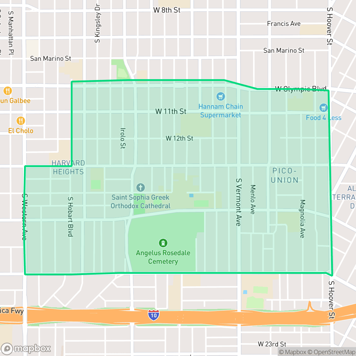
About Harvard Heights
Annexed to Los Angeles in 1896, Harvard Heights developed rapidly between 1902 and 1910 as a premier streetcar suburb. To ensure grander residential designs, early land covenants mandated that homes cost at least $2,500 to build. This requirement resulted in a stately collection of two-story Craftsman and Arts and Crafts-style residences. Today, the neighborhood is a designated Historic Preservation Overlay Zone (HPOZ) and boasts the Lucy E. Wheeler House (1905), the only remaining Greene and Greene-designed home in the city of Los Angeles. Harvard Heights is also home to several Los Angeles Historic-Cultural Monuments, including the historic Angelus-Rosedale Cemetery and the former recording studio and office of legendary musician Ray Charles, which now serves as a private library and archive dedicated to his legacy.
The neighborhood serves as a dense, highly walkable urban enclave where historic architecture meets a lively, multicultural atmosphere. With a perfect walkability score according to iHuus data, residents can easily access a variety of local dining establishments and cultural landmarks on foot. The area maintains a strong sense of community, reflected in its diverse culinary scene and proximity to significant historic sites, while benefiting from excellent air quality and a lack of heavy industrial presence.
Prospective residents should note that the area features high-density housing with limited privacy, as homes are typically built close together with narrow setbacks. While the neighborhood offers a vibrant lifestyle, it presents challenges regarding acoustic comfort due to road traffic and carries risks related to flood and fire safety. The local school landscape is varied, ranging from high-performing elementary options like Magnolia Avenue Elementary to campuses that face significant institutional hurdles. It is best suited for those who prioritize urban accessibility and historic character over suburban seclusion.
Neighborhood Scores Across 15 Qualities
Residential structures are closely packed with minimal separation between buildings, resulting in a lower privacy level than the Los Angeles average. According to iHuus data, many homes feature narrow side yards or shared walls.
Continuous sidewalks and frequent crosswalks throughout the grid provide excellent pedestrian connectivity. This infrastructure is superior to the average for Los Angeles.
Residential views consist primarily of functional tract housing and multi-unit complexes with uniform rooflines. According to iHuus data, the visual variety and private greenery in this area are slightly below the city average.
Paved surfaces and dense urban grids dominate the area, making it harder to find public parks or grass verges compared to the city average. Most greenery is contained within private yards, though some pockets of athletic fields and cemetery grounds offer accessible walking paths.
Sparse development and more open space characterize this area, making it significantly less dense than the Los Angeles average. The landscape consists primarily of low-rise structures and occasional patches of greenery rather than a concentrated urban core.
Dense high-rise pockets and diverse dining options create a highly energetic atmosphere that is significantly more active than the Los Angeles average. While some suburban blocks remain quiet, much of the area serves as a lively hub for local cuisine and social activity according to iHuus data.
Frequent noise from nearby major freeways and rail lines characterizes the area. This level of acoustic disturbance is higher than the average found across Los Angeles.
Air quality remains consistently high with minimal health concerns. This level of air purity is notably better than the Los Angeles city average, according to iHuus data.
Industrial presence is minimal in this area, as the neighborhood consists almost entirely of residential and light commercial zones. According to iHuus data, this district lacks the heavy warehouses or hazardous facilities found more frequently across the city.
Health insurance coverage is significantly lower than the Los Angeles average. According to iHuus data, a small minority of residents in this area possess medical coverage.
Voting patterns and census indicators reflect a deeply liberal political orientation that is slightly more pronounced than the Los Angeles average.
Residents live alongside a balanced distribution of young adults, families, and older individuals. This demographic spread is very similar to the broader Los Angeles area according to iHuus data.
Flood vulnerability in this area is significantly higher than the Los Angeles average. Residents should prepare for heightened seasonal water risks according to iHuus data.
Address-Level Insights for Harvard Heights


iHuus Neighborhood Intelligence Insights
Get address-level neighborhood insights for Harvard Heights
- Street-level scores — see how individual blocks compare, not just neighborhood averages
- Micro-zone boundaries — identify quiet pockets, flood boundaries, and walkable clusters before you visit
- 15 dimensions in full — walkability, noise, air quality, school quality, insurance coverage, population age profile, urban/rural index, and more
- Boundary risk alerts — know if your address sits near a block boundary where scores drop, the kind of detail no listing will ever mention
- School insights — individual school ratings and insights, not just district-level data
- Compare before you commit — side-by-side data across neighborhoods, down to block precision
No credit card required
Compare with Any Neighborhood
| Dimension | Harvard Heights | Adams-Normandie |
|---|---|---|
| 🚶 Walkabilityavg 8.9 | ||
| 🔊 Acoustic Comfortavg 2.91 | ||
| 🤫 Privacy Indexavg 4.14 | ||
| 🎨 Visual Appealavg 6.58 | ||
| 🐕 Dog Friendlinessavg 5.04 | ||
| 🗺️ Urban-Rural Indexavg 5.96 | ||
| ✨ Neighborhood Vibeavg 5.07 | ||
| 🏥 Health Insurance Coverageavg 6.2 | ||
| 🌿 Air Qualityavg 8.12 | ||
| 🏭 Industrial Proximityavg 8.46 | ||
| 🌊 Flood Safetyavg 2.66 | ||
| 🗳️ Ideological Leanavg 9.56 | ||
| 👥 Population Age Profileavg 4.85 | ||
| 🔥 Fire Safetyavg 0.18 | ||
| 🏫 School Quality |
Harvard Heights Rankings
School Districts Serving Harvard Heights
School Insights for Harvard Heights
Below average outcomes; significant attendance and academic challenges.
School Insights
See what's really behind every school rating near Harvard Heights
- Individual school ratings — each school's own score with outcome context, not just a district average
- Enrollment & class size data — student-to-teacher ratio and how it compares to the state average
- Full demographics breakdown — ethnicity and gender composition for every school in the enrollment zone
- Every school in the district — all schools within the enrollment boundary ranked by rating, not just the closest one
- Grade levels & benchmarks — elementary through high school, with below/above state-average flags
No credit card required