Crenshaw, Los Angeles
Updated · 24,912 residents
Crenshaw is a highly walkable neighborhood defined by its dense suburban layout and strong community identity. Residents benefit from a robust network of sidewalks and proximity to green spaces, though the area remains relatively quiet with limited local commercial activity.
Key Highlights
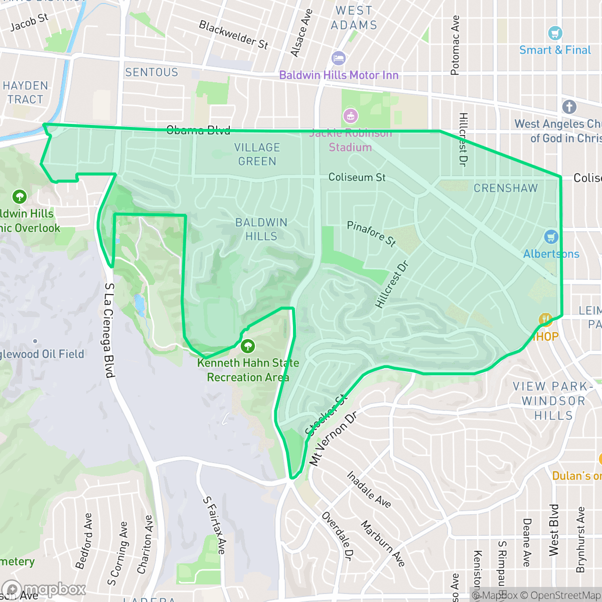
About Crenshaw
Named in 1904 after developer George Lafayette Crenshaw, the Crenshaw neighborhood of Los Angeles was originally part of the 19th-century Rancho La Cienega o Paso de la Tijera. Following the 1948 Supreme Court ruling outlawing racially restrictive covenants, the once-segregated area underwent a dramatic demographic shift. It initially welcomed a massive Japanese American community—becoming one of the largest in California—alongside a growing African American population. By the 1970s, Crenshaw had evolved into the historic commercial and cultural heart of Black Los Angeles. This rich, multiethnic history is anchored by local landmarks like the Baldwin Hills Crenshaw Plaza (opened in 1947 as one of the nation's first regional shopping centers) and the Googie-style Holiday Bowl, a historic bowling alley and café that famously united the neighborhood’s diverse communities.
The area functions as a dense suburban enclave characterized by a mix of single-family homes and multi-unit apartment complexes. Its layout is highly pedestrian-friendly, featuring a comprehensive grid of sidewalks that makes navigating the residential blocks straightforward. While the neighborhood is largely residential and light commercial, it maintains a serene atmosphere with minimal industrial interference, contributing to a generally high quality of air for its residents.
Prospective residents should consider the trade-off between the neighborhood's excellent walkability and its relatively low commercial density, which results in a quieter, less active street life compared to more central urban hubs. While the area offers good access to green spaces and parks, the housing density is high, often resulting in limited privacy due to the close proximity of structures. The neighborhood is served by a mix of school districts, including the Culver City Unified and Los Angeles Unified systems, and remains a stable, residential-focused environment.
Neighborhood Scores Across 15 Qualities
Residential spacing varies between dense apartment clusters and detached homes with moderate yard separation. According to iHuus data, this neighborhood offers more separation between neighbors than the Los Angeles average.
Continuous sidewalks and marked crosswalks are present throughout the residential grid, making the area more pedestrian friendly than the Los Angeles average. According to iHuus data, the network of sidewalks and dedicated pedestrian zones remains comprehensive across most major thoroughfares.
Large custom homes with manicured landscapes and private pools are common here, offering a visual appeal that is slightly above the Los Angeles average. According to iHuus data, the area features a mix of high-end suburban living and denser residential pockets.
Access to large public parks and connected green belts provides significantly more space for pet walking than the Los Angeles average. While some residential pockets feature narrow sidewalks, many areas offer wide paths and continuous green buffers for dogs.
Residential pockets feature a blend of single-family homes and multi-unit apartments interspersed with commercial corridors. This landscape offers slightly more open space and lower density than the typical Los Angeles urban environment, according to iHuus data.
Residential pockets here offer a serene and low-density atmosphere, though the area lacks the concentrated commercial energy found in much of Los Angeles. Most of the neighborhood consists of quiet streets and green spaces where access to local dining and services is limited and often requires a vehicle.
Frequent noise from nearby freeway corridors and transit routes is common here; according to iHuus data, acoustic conditions are slightly more disruptive than the Los Angeles average.
Air quality in this area is mostly clean with only rare instances of elevated readings. This level of air purity is nearly identical to the average found across Los Angeles.
Industrial activity is minimal throughout the area, as the neighborhood consists mostly of residential and light commercial zones. According to iHuus data, the presence of heavy warehouses or hazardous sites is lower than the city average.
Health insurance coverage among residents is notably higher than the Los Angeles city average, according to iHuus data.
Voting patterns and census indicators reflect a predominantly liberal community, slightly more so than the broader Los Angeles area according to iHuus data.
Residents live alongside a balanced distribution of young adults, families, and older community members. This demographic spread is slightly more varied than the average seen across Los Angeles, according to iHuus data.
Properties in this area are located within a known floodplain, which implies a higher risk of flooding than the Los Angeles average. According to iHuus data, residents should anticipate a likely requirement for flood insurance.
Fire hazards in this area are significantly higher than the Los Angeles average. Residents should be aware of the extreme fire risk and the necessity for maximum protection measures, according to iHuus data.
Address-Level Insights for Crenshaw


iHuus Neighborhood Intelligence Insights
Get address-level neighborhood insights for Crenshaw
- Street-level scores — see how individual blocks compare, not just neighborhood averages
- Micro-zone boundaries — identify quiet pockets, flood boundaries, and walkable clusters before you visit
- 15 dimensions in full — walkability, noise, air quality, school quality, insurance coverage, population age profile, urban/rural index, and more
- Boundary risk alerts — know if your address sits near a block boundary where scores drop, the kind of detail no listing will ever mention
- School insights — individual school ratings and insights, not just district-level data
- Compare before you commit — side-by-side data across neighborhoods, down to block precision
No credit card required
Compare with Any Neighborhood
| Dimension | Crenshaw | Adams-Normandie |
|---|---|---|
| 🚶 Walkabilityavg 8.9 | ||
| 🔊 Acoustic Comfortavg 2.91 | ||
| 🤫 Privacy Indexavg 4.14 | ||
| 🎨 Visual Appealavg 6.58 | ||
| 🐕 Dog Friendlinessavg 5.04 | ||
| 🗺️ Urban-Rural Indexavg 5.96 | ||
| ✨ Neighborhood Vibeavg 5.07 | ||
| 🏥 Health Insurance Coverageavg 6.2 | ||
| 🌿 Air Qualityavg 8.12 | ||
| 🏭 Industrial Proximityavg 8.46 | ||
| 🌊 Flood Safetyavg 2.66 | ||
| 🗳️ Ideological Leanavg 9.56 | ||
| 👥 Population Age Profileavg 4.85 | ||
| 🔥 Fire Safetyavg 0.18 | ||
| 🏫 School Quality |
Crenshaw Rankings
School Districts Serving Crenshaw
School Insights for Crenshaw
Below average outcomes; significant attendance and academic challenges.
School Insights
See what's really behind every school rating near Crenshaw
- Individual school ratings — each school's own score with outcome context, not just a district average
- Enrollment & class size data — student-to-teacher ratio and how it compares to the state average
- Full demographics breakdown — ethnicity and gender composition for every school in the enrollment zone
- Every school in the district — all schools within the enrollment boundary ranked by rating, not just the closest one
- Grade levels & benchmarks — elementary through high school, with below/above state-average flags
No credit card required