Chatsworth, Los Angeles
Updated · 36,992 residents
Chatsworth is a distinct community in the northwest San Fernando Valley characterized by a blend of suburban residential tracts and significant industrial logistics hubs. While it offers a quiet environment with high air quality, the area remains largely car-dependent and features varying levels of noise from local road traffic.
Key Highlights
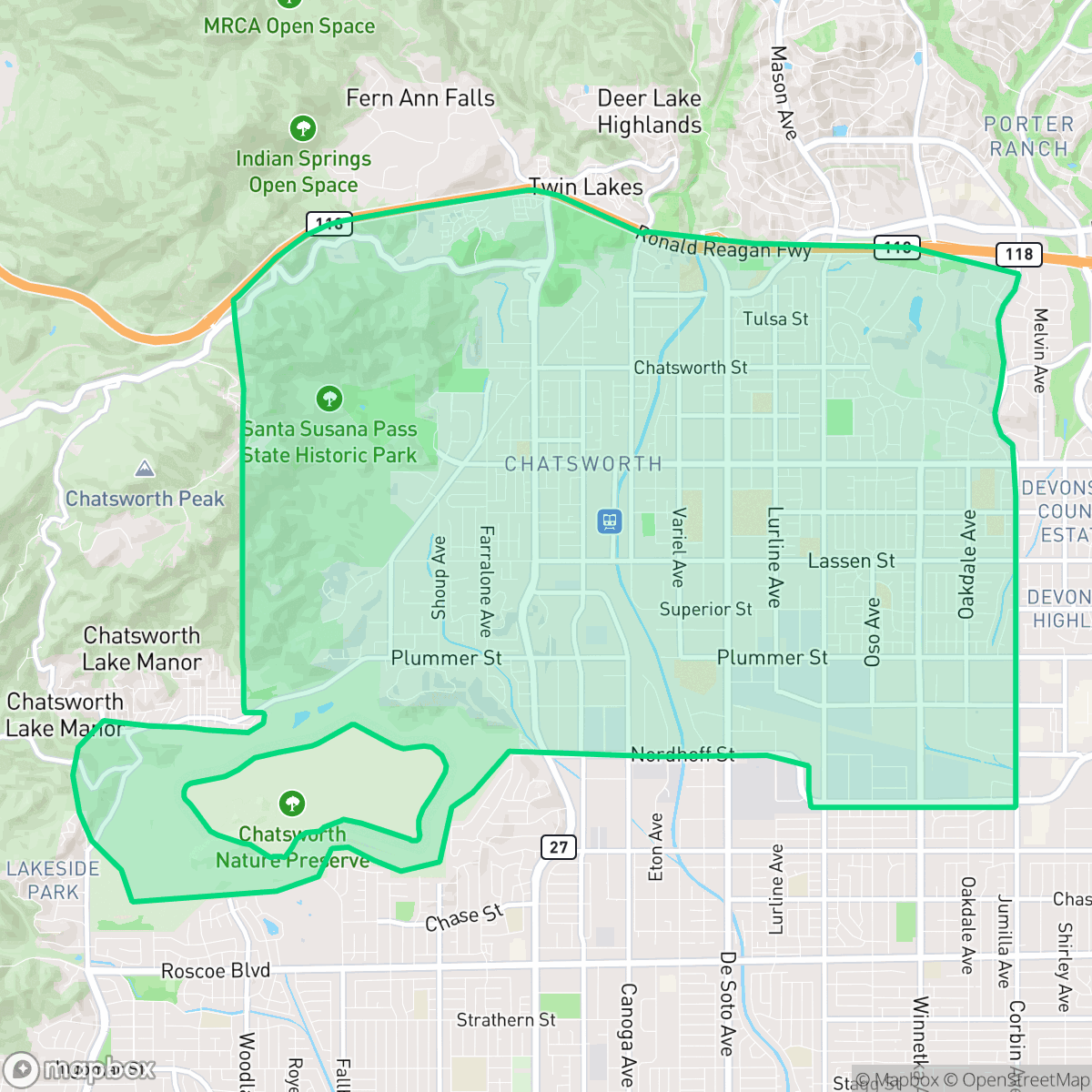
About Chatsworth
Nestled in the northwest San Fernando Valley, Chatsworth has a rich history beginning with the Chumash, Tongva, and Tataviam peoples, who left ancient rock art in the Santa Susana Pass. Established as a townsite in 1888, the area was a vital transit hub along the 1860s Old Santa Susana Stage Road, famously known as the "Devil's Slide". Its dramatic sandstone landscapes, including the Stoney Point rock outcroppings, made Chatsworth a prime location for Hollywood's golden era. The 500-acre Iverson Movie Ranch hosted over 2,000 film and television productions, cementing the neighborhood's identity in Western film history. Today, Chatsworth preserves its agrarian and pioneering roots through local landmarks like the 1903 Pioneer Church and the 1912 Minnie Hill Palmer Cottage at Homestead Acre.
The neighborhood presents a complex landscape where affluent residential pockets, featuring large homes and private swimming pools, sit in close proximity to active logistics and commercial zones. This industrial-suburban mix creates a functional, albeit car-oriented, environment where residents rely on major arterials for daily needs. According to iHuus data, the area maintains a consistent sidewalk network, though the overall livability is balanced by the presence of large-scale warehouses and freight corridors that define much of the local character. The visual appeal remains high due to well-manicured lots and suburban landscaping, providing a sense of stability for those seeking a quiet residential setting in the Valley.
Prospective residents should consider several trade-offs when evaluating the area. While health insurance coverage is high, the neighborhood faces significant environmental challenges, including a notably low fire safety rating. The educational landscape is also varied, with high-performing schools like Superior Street Elementary existing alongside institutions that face structural and academic challenges within the Los Angeles Unified School District. The area is best suited for those who prioritize suburban space and quietude over walkability, provided they are comfortable navigating a car-centric lifestyle and remain mindful of local environmental risks.
Neighborhood Scores Across 15 Qualities
Residential spacing varies between detached suburban homes and shared-wall complexes, offering more separation between neighbors than the Los Angeles average. According to iHuus data, some areas feature close-set housing, while other sections maintain typical suburban yard buffers.
Sidewalks and visible crosswalks are consistently present along both residential and arterial streets. While the area remains largely car dependent, the sidewalk network is more comprehensive than the average for Los Angeles.
Large lots, manicured yards, and a high density of private swimming pools contribute to a visual landscape that is more upscale than the Los Angeles average. According to iHuus data, the area features a notable presence of well-maintained estates alongside more standard suburban housing and apartment complexes.
Abundant sports fields and wide suburban street layouts provide more accessible walking space for pets than the Los Angeles average. However, some residential pockets feature narrow sidewalk verges and limited public park access.
Frequent open land and scattered homes amid fields or woodland provide a more semi-rural atmosphere than most of Los Angeles. This characteristic landscape offers more greenery and space compared to the city average.
Suburban landscapes and industrial corridors dominate the area, creating a serene but low-density environment. Most residents will find the local energy lower than the city average, as the lack of concentrated commercial hubs makes a vehicle necessary for most dining and errands.
Frequent noise from nearby freeways and railroad tracks characterizes the area, though levels are slightly more stable than the city average. According to iHuus data, residents may experience intermittent disruptions from heavy transit corridors.
Air quality remains mostly clean with rare instances of elevated readings, performing nearly in line with the Los Angeles average according to iHuus data.
Residential streets remain largely free from heavy industrial hazards or large-scale warehouse operations. This area is slightly below the city average for industrial proximity, as it features mostly residential and light commercial zoning with minimal truck traffic.
Health insurance accessibility is notably higher than the Los Angeles average, according to iHuus data. Most residents in the area have access to medical coverage through employer-sponsored or private plans.
Political leanings in this area are largely liberal, though the community is slightly less progressive than the broader Los Angeles average according to iHuus data.
A diverse range of age groups inhabits the area, providing a more balanced demographic spread than the typical Los Angeles profile. According to iHuus data, the population includes a steady distribution of young adults, families, and older residents.
Flood risk is elevated in this area due to its location within a 100-year floodplain. According to iHuus data, this level of risk is slightly higher than the average found across Los Angeles.
High vulnerability to wildfires characterizes this area, presenting a greater danger than most other parts of Los Angeles. Residents should prioritize maximum fire protection measures and remain vigilant regarding seasonal fire threats according to iHuus data.
Address-Level Insights for Chatsworth


iHuus Neighborhood Intelligence Insights
Get address-level neighborhood insights for Chatsworth
- Street-level scores — see how individual blocks compare, not just neighborhood averages
- Micro-zone boundaries — identify quiet pockets, flood boundaries, and walkable clusters before you visit
- 15 dimensions in full — walkability, noise, air quality, school quality, insurance coverage, population age profile, urban/rural index, and more
- Boundary risk alerts — know if your address sits near a block boundary where scores drop, the kind of detail no listing will ever mention
- School insights — individual school ratings and insights, not just district-level data
- Compare before you commit — side-by-side data across neighborhoods, down to block precision
No credit card required
Compare with Any Neighborhood
| Dimension | Chatsworth | Adams-Normandie |
|---|---|---|
| 🚶 Walkabilityavg 8.9 | ||
| 🔊 Acoustic Comfortavg 2.91 | ||
| 🤫 Privacy Indexavg 4.14 | ||
| 🎨 Visual Appealavg 6.58 | ||
| 🐕 Dog Friendlinessavg 5.04 | ||
| 🗺️ Urban-Rural Indexavg 5.96 | ||
| ✨ Neighborhood Vibeavg 5.07 | ||
| 🏥 Health Insurance Coverageavg 6.2 | ||
| 🌿 Air Qualityavg 8.12 | ||
| 🏭 Industrial Proximityavg 8.46 | ||
| 🌊 Flood Safetyavg 2.66 | ||
| 🗳️ Ideological Leanavg 9.56 | ||
| 👥 Population Age Profileavg 4.85 | ||
| 🔥 Fire Safetyavg 0.18 | ||
| 🏫 School Quality |
Chatsworth Rankings
School Districts Serving Chatsworth
School Insights for Chatsworth
Below average outcomes; significant attendance and academic challenges.
School Insights
See what's really behind every school rating near Chatsworth
- Individual school ratings — each school's own score with outcome context, not just a district average
- Enrollment & class size data — student-to-teacher ratio and how it compares to the state average
- Full demographics breakdown — ethnicity and gender composition for every school in the enrollment zone
- Every school in the district — all schools within the enrollment boundary ranked by rating, not just the closest one
- Grade levels & benchmarks — elementary through high school, with below/above state-average flags
No credit card required