Atwater Village, Los Angeles
Updated · 12,464 residents
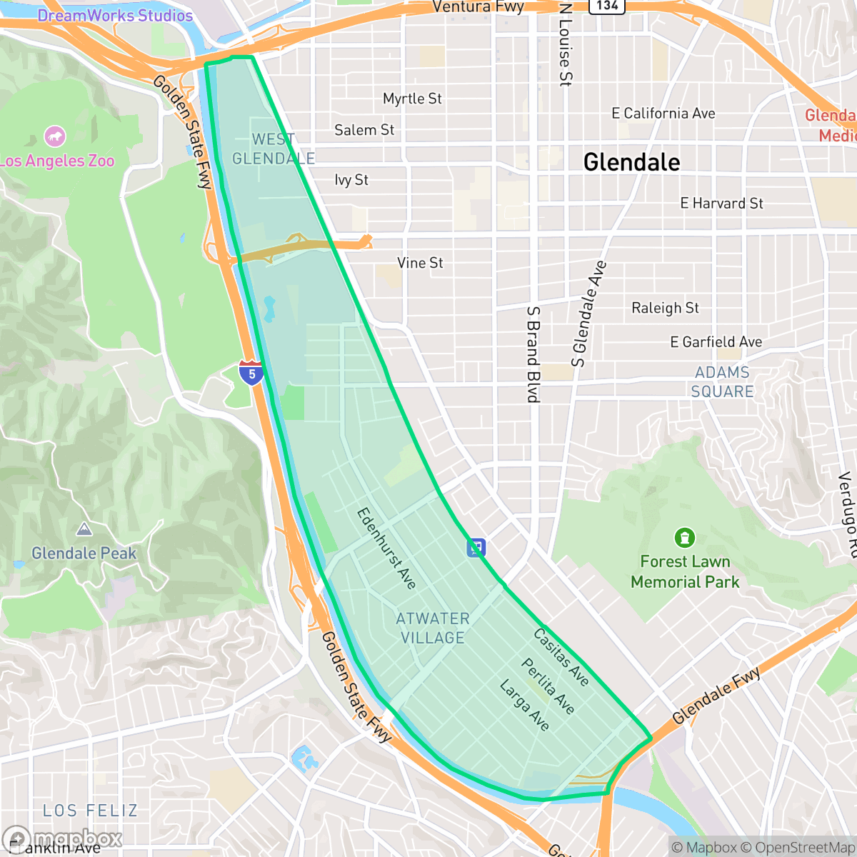
Atwater Village is a dense, historic enclave defined by its collection of pre-1939 Craftsman bungalows and Spanish-style architecture. While the area offers a walkable grid with access to local dining and parks, residents should expect significant noise from nearby freeways and industrial corridors.
Key Highlights
About Atwater Village
Originally part of Rancho San Rafael, the neighborhood was subdivided in 1902 as the "Atwater Tract," named for its proximity to the Los Angeles River. "Village" was officially added to its name in 1986. Growth accelerated in the 1920s with the arrival of the Pacific Electric "Red Car" line along Glendale Boulevard, attracting working-class residents and employees of the nearby DWP substation. Today, Atwater Village preserves one of Los Angeles County's highest concentrations of pre-1939 structures, characterized by historic Spanish-style homes and Craftsman bungalows. Local landmarks include the 1927 Glendale-Hyperion Bridge and the Tam O'Shanter Inn, a themed restaurant established in 1922 that was famously frequented by Walt Disney and his animators. The neighborhood was also historically home to the Franciscan Pottery factory.
The neighborhood maintains a dense urban fabric where single-family homes sit on small lots with minimal setbacks. It serves as a calm, suburban-style retreat that balances residential life with proximity to major transit corridors and light industrial zones. The area is home to diverse local dining options and benefits from a strong school district, particularly with highly-rated elementary schools like Glenfeliz Boulevard.
Living here requires balancing the charm of historic architecture against the realities of a high-density environment. The area faces notable noise levels from road traffic and proximity to logistics centers, which may impact acoustic comfort. It is best suited for those who prioritize neighborhood walkability and access to established community schools over the privacy and quiet typically found in more expansive suburban settings.
Neighborhood Scores Across 15 Qualities
Residential structures are tightly packed with minimal setbacks and shared property lines, resulting in a lower privacy level than the Los Angeles average. According to iHuus data, many homes are situated less than ten feet apart.
Residential streets and main thoroughfares feature consistent sidewalk networks and marked crosswalks. While most errands can be completed on foot, major freeways and industrial zones create some barriers to seamless pedestrian transit, making the area slightly less walkable than the city average.
Residential views consist mostly of standard tract housing and mid-century apartments with small yards. While some affluent pockets feature manicured landscaping and private pools, the overall visual character is slightly below the Los Angeles average.
Publicly accessible areas for pet exercise are relatively sparse, as much of the greenery is contained within private residential yards. While some residents benefit from nearby riverside green belts, overall access to public parks is slightly below the city average according to iHuus data.
Residential streets and green spaces exist in roughly equal measure to commercial and light industrial zones. This density is slightly higher than the city average, offering a suburban feel that integrates community parks with low-rise urban infrastructure.
A steady rhythm of residential life and light industrial use defines this area, which offers a more subdued atmosphere than the Los Angeles average. While local dining and green spaces like North Atwater Park provide pockets of activity, many parts of the neighborhood remain car-oriented with limited walking access to services.
Frequent acoustic disturbances from nearby railroad tracks and freeway proximity characterize this area. According to iHuus data, the level of noise is significantly higher than the Los Angeles average.
Air quality is generally good with rare instances of elevated readings, staying largely in line with the Los Angeles average according to iHuus data.
Light commercial and warehouse activity exists alongside residential areas, though this level of industrial proximity is notably lower than the Los Angeles average. While the neighborhood lacks heavy industrial zones, some areas feature logistics centers and rail infrastructure near the eastern edge.
Health insurance access among residents is higher than the Los Angeles average, according to iHuus data.
Voting patterns and census indicators show a very strong liberal leaning, which is slightly more pronounced than the Los Angeles average according to iHuus data.
Residents live alongside a balanced mix of young professionals, families, and older adults. According to iHuus data, this demographic distribution is slightly more varied than the average seen across Los Angeles.
Property sits within a designated floodplain, which is more prone to flooding than many other parts of Los Angeles. According to iHuus data, residents should anticipate a higher likelihood of needing flood insurance for their homes.
High fire hazards are present in this area, representing a significantly greater risk than most other parts of Los Angeles. Residents should prioritize maximum protection measures and remain vigilant regarding local fire safety protocols.
Address-Level Insights for Atwater Village


iHuus Neighborhood Intelligence Insights
Get address-level neighborhood insights for Atwater Village
- Street-level scores — see how individual blocks compare, not just neighborhood averages
- Micro-zone boundaries — identify quiet pockets, flood boundaries, and walkable clusters before you visit
- 15 dimensions in full — walkability, noise, air quality, school quality, insurance coverage, population age profile, urban/rural index, and more
- Boundary risk alerts — know if your address sits near a block boundary where scores drop, the kind of detail no listing will ever mention
- School insights — individual school ratings and insights, not just district-level data
- Compare before you commit — side-by-side data across neighborhoods, down to block precision
No credit card required
Compare with Any Neighborhood
| Dimension | Atwater Village | Adams-Normandie |
|---|---|---|
| 🚶 Walkabilityavg 8.9 | ||
| 🔊 Acoustic Comfortavg 2.91 | ||
| 🤫 Privacy Indexavg 4.14 | ||
| 🎨 Visual Appealavg 6.58 | ||
| 🐕 Dog Friendlinessavg 5.04 | ||
| 🗺️ Urban-Rural Indexavg 5.96 | ||
| ✨ Neighborhood Vibeavg 5.07 | ||
| 🏥 Health Insurance Coverageavg 6.2 | ||
| 🌿 Air Qualityavg 8.12 | ||
| 🏭 Industrial Proximityavg 8.46 | ||
| 🌊 Flood Safetyavg 2.66 | ||
| 🗳️ Ideological Leanavg 9.56 | ||
| 👥 Population Age Profileavg 4.85 | ||
| 🔥 Fire Safetyavg 0.18 | ||
| 🏫 School Quality |
Atwater Village Rankings
School Districts Serving Atwater Village
School Insights for Atwater Village
Below average outcomes; significant attendance and academic challenges.
School Insights
See what's really behind every school rating near Atwater Village
- Individual school ratings — each school's own score with outcome context, not just a district average
- Enrollment & class size data — student-to-teacher ratio and how it compares to the state average
- Full demographics breakdown — ethnicity and gender composition for every school in the enrollment zone
- Every school in the district — all schools within the enrollment boundary ranked by rating, not just the closest one
- Grade levels & benchmarks — elementary through high school, with below/above state-average flags
No credit card required