Traffic Circle, Long Beach
Updated June 22, 2026 · 14,339 residents
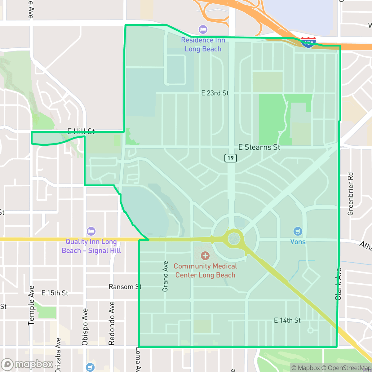
The Traffic Circle neighborhood serves as a highly walkable suburban hub in Long Beach, characterized by its dense grid and convenient access to diverse local dining and recreational spaces like Stearns Champions Park. While the area offers excellent pedestrian connectivity and high air quality, residents often experience elevated noise levels due to its proximity to major transit routes and the iconic central roundabout.
Key Highlights
About Traffic Circle
Centering on the historic Los Alamitos Traffic Circle, the Traffic Circle neighborhood of Long Beach developed around one of the nation's first major roundabouts. Designed by German engineer Werner Ruchti in 1930, the circle was built to accommodate traffic for the 1932 Los Angeles Summer Olympics, which hosted rowing events at the nearby Marine Stadium. Originally the terminus for US Route 6 and US Route 91, the intersection was converted by Caltrans in 1993 into the first modern roundabout in the United States. The surrounding residential neighborhood grew rapidly in the mid-20th century, with most housing built between 1940 and 1969. During the 1950s and 1960s, the area became a landmark of Southern California’s cruising culture, defined by popular local hangouts like the Clock Drive-In and the Cinamon Cinder teen nightclub.
This neighborhood functions as a lively suburban district that blends residential living with active commercial corridors. Residents benefit from a robust sidewalk network that makes daily errands and dining at local establishments highly accessible on foot. According to iHuus data, the area maintains high marks for air quality and walkability, providing a convenient lifestyle for those who prioritize proximity to services and community green spaces. The presence of diverse dining options and community parks creates a dynamic, high-energy environment for its residents.
Prospective residents should consider the trade-offs regarding acoustic comfort and privacy, as the neighborhood features tightly packed housing and frequent road traffic noise. While the density creates a vibrant, urban-suburban atmosphere, it may not suit those seeking quiet seclusion. The area is well-suited for commuters and individuals who value an active, accessible environment over expansive private yards or total silence.
Neighborhood Scores Across 15 Qualities
Residential structures feature a mix of shared apartment walls and closely spaced homes. According to iHuus data, this density is higher than the Long Beach average, providing less separation between neighbors than typical city layouts.
Extensive sidewalk networks and clearly marked crosswalks facilitate easy movement throughout residential and commercial zones. While the area is very accessible, walkability is slightly below the Long Beach average.
Large homes and frequent upscale amenities provide a more polished landscape than the Long Beach average. Many properties feature manicured driveways and private backyard pools, according to iHuus data.
Ample public parkland and wide grassy verges offer more space for pets than the Long Beach average. Residents can benefit from significant green space and accessible trails throughout much of the area.
Characterized by a mix of residential and industrial zones, this area offers more open land than the typical Long Beach urban landscape. According to iHuus data, the neighborhood features a dense low-rise fabric with scattered pockets of development.
Vibrant dining hubs and social pockets provide more activity than the Long Beach average. Residents will find a mix of high-energy streets and quieter, suburban blocks characterized by a variety of local eateries and essential services.
Frequent auditory disturbances arise from the proximity to nearby railroad tracks and major freeway corridors. According to iHuus data, acoustic comfort in this area is slightly below the Long Beach average.
Air quality is consistently excellent with minimal health concerns, performing significantly better than the Long Beach average according to iHuus data.
Industrial presence is minimal and mostly limited to light commercial uses, though the area is slightly more exposed to utility infrastructure and large-scale storage tanks than the Long Beach average. Residential life remains the primary focus, despite the proximity to major highway systems and an active airport runway.
Health insurance accessibility is notably higher than the Long Beach average, according to iHuus data. Most residents in this area have access to comprehensive medical coverage.
Voting patterns and census indicators reflect a deeply liberal political leaning that is slightly more pronounced than the Long Beach average.
A balanced mix of young adults, families, and older residents characterizes the area, closely mirroring the broader Long Beach population profile.
Residual flood risk exists within this area as it sits within a 500-year floodplain. According to iHuus data, this level of safety is notably higher than the average for the city of Long Beach.
Block-Level Insights for Traffic Circle

iHuus Neighborhood Intelligence Insights
Get block-level neighborhood insights for Traffic Circle
- Street-level scores — see how individual blocks compare, not just neighborhood averages
- Micro-zone boundaries — identify quiet pockets, flood boundaries, and walkable clusters before you visit
- 15 dimensions in full — walkability, noise, air quality, school quality, insurance coverage, population age profile, urban/rural index, and more
- Boundary risk alerts — know if your address sits near a block boundary where scores drop, the kind of detail no listing will ever mention
- School insights — individual school ratings and insights, not just district-level data
- Compare before you commit — side-by-side data across neighborhoods, down to block precision
No credit card required
Compare with Any Neighborhood
| Dimension | Traffic Circle | Airport Area |
|---|---|---|
| 🚶 Walkabilityavg 9.37 | ||
| 🔊 Acoustic Comfortavg 3.04 | ||
| 🤫 Privacy Indexavg 3.63 | ||
| 🎨 Visual Appealavg 6.3 | ||
| 🐕 Dog Friendlinessavg 5.35 | ||
| 🗺️ Urban-Rural Indexavg 6 | ||
| ✨ Neighborhood Vibeavg 5.01 | ||
| 🏥 Health Insurance Coverageavg 6.4 | ||
| 🌿 Air Qualityavg 8.69 | ||
| 🏭 Industrial Proximityavg 8.14 | ||
| 🌊 Flood Safetyavg 3.75 | ||
| 🗳️ Ideological Leanavg 9.2 | ||
| 👥 Population Age Profileavg 4.81 | ||
| 🔥 Fire Safety | ||
| 🏫 School Quality |
Traffic Circle Rankings
School Districts Serving Traffic Circle
LBUSD is currently a district in transition, characterized by a 'Mixed/Transition' status where high academic accolades for its specialty programs and elite high schools are overshadowed by a severe $70 million budget deficit and declining enrollment. While the district maintains strong feeder patterns into prestigious pathways, the pending layoff of over 500 staff members, significant equity gaps across its 82 campuses, and the impending retirement of its Superintendent create a volatile operational environment. Community trust is currently strained by fiscal austerity measures and a lack of parity between neighborhood schools, though the district's core academic results remain stable and slightly improving.
Schools
School Insights for Traffic Circle
Below average outcomes; significant attendance and academic challenges.
School Insights
See what's really behind every school rating near Traffic Circle
- Individual school ratings — each school's own score with outcome context, not just a district average
- Enrollment & class size data — student-to-teacher ratio and how it compares to the state average
- Full demographics breakdown — ethnicity and gender composition for every school in the enrollment zone
- Every school in the district — all schools within the enrollment boundary ranked by rating, not just the closest one
- Grade levels & benchmarks — elementary through high school, with below/above state-average flags
No credit card required