North Long Beach, Long Beach
Updated · 90,674 residents
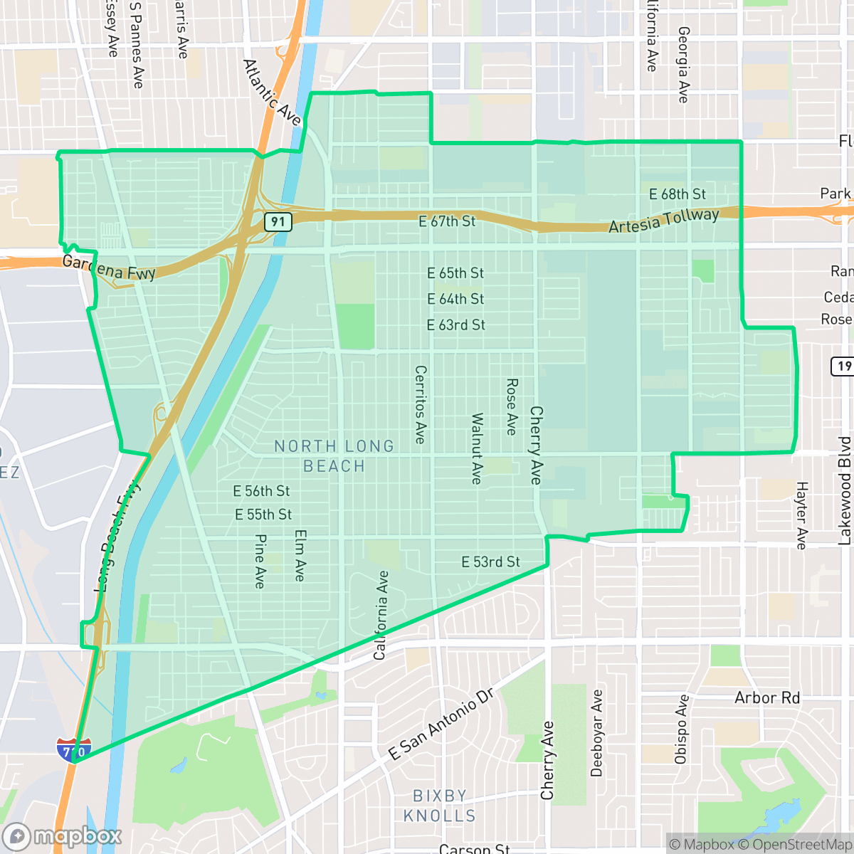
North Long Beach is a dense, highly walkable residential community characterized by its gridded street layout and proximity to major industrial and freeway corridors. While it offers a consistent urban environment with established landmarks like Houghton Park, residents experience significant noise from surrounding transit infrastructure and limited private outdoor space.
Key Highlights
About North Long Beach
Originally known as "Fertile Farms" for its sugar beet and dairy pastures, and later called "Virginia City," North Long Beach was annexed by Long Beach in 1924. The 1920s oil boom rapidly transformed the agricultural landscape into a working-class residential hub for oil and defense workers. In 2019, the neighborhood established its first historic district along the 6000 block of Walnut Avenue, featuring late 1920s Spanish Colonial Revival homes. Originally the Grant Neighborhood, residents renamed it the Nehyam Historic District—using the Tongva word for "friend"—to honor the area's indigenous heritage. Today, North Long Beach is a culturally diverse community anchored by landmarks like Houghton Park and Jordan High School, which opened in 1934.
The neighborhood functions as a dense urban grid that balances residential life with nearby industrial and utility zones. Its architectural landscape consists primarily of modest tract housing and multi-unit developments, often situated on small lots with minimal setbacks. While the area benefits from a comprehensive sidewalk network that supports pedestrian movement, the presence of major logistics hubs and freeway interchanges contributes to higher ambient noise levels and air quality challenges.
This area is best suited for those who prioritize proximity to transit routes and a traditional urban grid over expansive private green space. Prospective residents should be aware of the trade-offs between the neighborhood's high walkability and its industrial-adjacent environment, which impacts both acoustic comfort and overall air quality. Educational options vary significantly, as local schools currently navigate broader district-wide transitions and budget constraints.
Neighborhood Scores Across 15 Qualities
Residential structures are densely packed with minimal separation between homes, often featuring shared walls or narrow gaps. This level of density is typical of the broader Long Beach area, where houses and multi-family units are frequently positioned less than ten feet apart.
Continuous sidewalks and well-marked crosswalks line most residential and arterial streets, providing a highly connected environment for pedestrians. While the sidewalk network is very strong and comparable to the rest of Long Beach, major freeway interchanges and industrial blocks can act as significant barriers to movement.
Uniform tract housing and high-density apartment complexes define the landscape, featuring small yards and consistent roof geometries. This visual character is slightly below the Long Beach average due to a lack of luxury amenities and widespread private greenery.
Dog walking options are somewhat restricted due to narrow sidewalk verges and many fenced private yards. While some areas benefit from proximity to large sports parks and trails, the overall accessibility to open green space is below the Long Beach average according to iHuus data.
Residential street grids blend with large-scale industrial warehouses and major highway infrastructure. This layout offers a slightly more suburban character than the Long Beach average, though significant portions of the area feature high building coverage and limited open green space.
Primarily a car-oriented landscape, this area features a calm, industrial-suburban rhythm with limited local retail. While some dining and services are reachable on foot, the neighborhood lacks the social density found in other parts of Long Beach.
Frequent noise from nearby railroad tracks and heavy freeway traffic is common in this area. According to iHuus data, acoustic comfort in North Long Beach is lower than the Long Beach average.
Air quality in this area is generally good, though it tends to be lower than the Long Beach average. According to iHuus data, residents may occasionally encounter elevated readings compared to other parts of the city.
Large logistics hubs, warehouses, and nearby freeway interchanges introduce noticeable traffic and noise to certain parts of the neighborhood. While many areas remain primarily residential, some residents may experience higher levels of industrial activity and heavy vehicle movement than the city average.
Health insurance accessibility is lower in North Long Beach than in the rest of the city, according to iHuus data. This indicates a higher proportion of uninsured residents compared to the Long Beach average.
Voting patterns and census indicators reflect a highly liberal political leaning that is even more pronounced than the Long Beach average.
Residents experience a varied demographic landscape consisting of young adults, families, and seniors. This age distribution is largely consistent with the broader Long Beach area, according to iHuus data.
Flood vulnerability is significant in this area as parts of the neighborhood fall within a designated floodplain. According to iHuus data, the risk level here is notably higher than the Long Beach city average.
Address-Level Insights for North Long Beach


iHuus Neighborhood Intelligence Insights
Get address-level neighborhood insights for North Long Beach
- Street-level scores — see how individual blocks compare, not just neighborhood averages
- Micro-zone boundaries — identify quiet pockets, flood boundaries, and walkable clusters before you visit
- 15 dimensions in full — walkability, noise, air quality, school quality, insurance coverage, population age profile, urban/rural index, and more
- Boundary risk alerts — know if your address sits near a block boundary where scores drop, the kind of detail no listing will ever mention
- School insights — individual school ratings and insights, not just district-level data
- Compare before you commit — side-by-side data across neighborhoods, down to block precision
No credit card required
Compare with Any Neighborhood
| Dimension | North Long Beach | Airport Area |
|---|---|---|
| 🚶 Walkabilityavg 9.37 | ||
| 🔊 Acoustic Comfortavg 3.04 | ||
| 🤫 Privacy Indexavg 3.63 | ||
| 🎨 Visual Appealavg 6.3 | ||
| 🐕 Dog Friendlinessavg 5.35 | ||
| 🗺️ Urban-Rural Indexavg 6 | ||
| ✨ Neighborhood Vibeavg 5.01 | ||
| 🏥 Health Insurance Coverageavg 6.4 | ||
| 🌿 Air Qualityavg 8.69 | ||
| 🏭 Industrial Proximityavg 8.14 | ||
| 🌊 Flood Safetyavg 3.75 | ||
| 🗳️ Ideological Leanavg 9.2 | ||
| 👥 Population Age Profileavg 4.81 | ||
| 🔥 Fire Safety | ||
| 🏫 School Quality |
North Long Beach Rankings
School Districts Serving North Long Beach
School Insights for North Long Beach
Below average outcomes; significant attendance and academic challenges.
School Insights
See what's really behind every school rating near North Long Beach
- Individual school ratings — each school's own score with outcome context, not just a district average
- Enrollment & class size data — student-to-teacher ratio and how it compares to the state average
- Full demographics breakdown — ethnicity and gender composition for every school in the enrollment zone
- Every school in the district — all schools within the enrollment boundary ranked by rating, not just the closest one
- Grade levels & benchmarks — elementary through high school, with below/above state-average flags
No credit card required