65 Block, Isla Vista
Updated June 22, 2026 · 2,579 residents
The 65 Block serves as the central commercial and pedestrian hub of Isla Vista, characterized by its immediate proximity to the UCSB campus and a dense, highly walkable street grid. While the area offers exceptional access to local dining and green spaces, residents experience a high-density living environment with limited privacy between neighboring structures.
Key Highlights
About 65 Block
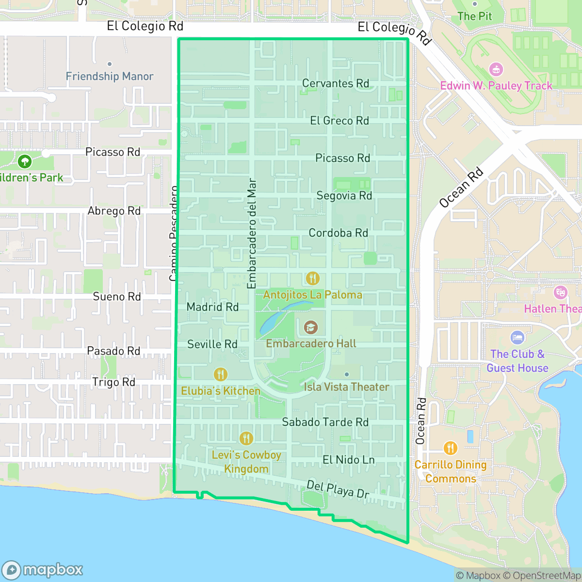
The 65 Block of Isla Vista, California, is the community’s easternmost section directly adjacent to the University of California, Santa Barbara (UCSB) campus. Serving as the neighborhood's core pedestrian and commercial hub, it contains the vibrant business district known as "The Loop". Signature streets like Pardall Road form the heart of student life, lined with long-standing local eateries and retail shops. The block is also defined by its public art and community memorials; notably, the 65 block of Sabado Tarde Road features the famous "Turtle Mural". Originally painted in 2014 by a UCSB urban art class, the mural was updated with six angel fish to honor the victims of the tragic 2014 Isla Vista killings, making it a deeply significant cultural landmark for residents.
The area functions as the primary gateway between the university and the broader community, maintaining a lively atmosphere driven by its dense concentration of student housing and institutional facilities. With a perfect walkability score according to iHuus data, the neighborhood is designed for foot traffic, featuring a consistent flow of residents between local eateries, coffee shops, and campus grounds. The urban environment is functional and compact, prioritizing utility and accessibility over luxury amenities or expansive private outdoor spaces.
Prospective residents should note that the neighborhood is characterized by high-density living, where apartment complexes are situated in close proximity, leading to minimal personal privacy. The area benefits from excellent air quality and a lack of industrial hazards, making it a clean, if bustling, environment. It is particularly well-suited for students and university-affiliated individuals who prioritize convenience and proximity to campus over quiet, low-density suburban living.
Neighborhood Scores Across 15 Qualities
Buildings are situated in very close proximity with minimal separation between structures. This area features much higher density and closer quarters than the typical Santa Barbara County neighborhood, according to iHuus data.
Extensive sidewalk networks and pedestrian-priority zones allow for easy movement throughout the area. According to iHuus data, the connectivity of these paths is even more robust than the typical Isla Vista standard.
Dense apartment complexes and institutional buildings define the landscape, providing functional architecture and shared amenities like communal pools. The visual environment is largely consistent with the surrounding city average.
Extensive sports fields, public parks, and wide grassy verges provide ample exercise space for pets. This area is slightly below the city average for dog friendliness due to the specific density of the block, though proximity to the beach and campus greenery remains a significant benefit.
A blend of multi-story residential buildings and athletic greenery creates a landscape similar to the broader city average. This environment features a mix of dense institutional structures alongside significant open spaces.
Frequent social destinations and diverse dining options create a lively atmosphere that is more active than the typical city average. Residents have access to a mix of wellness services, parks, and local eateries within a high-energy coastal setting.
Frequent noise from nearby transit routes and traffic patterns makes this area noisier than the average for the city. According to iHuus data, residents may experience regular disruptions from surrounding transportation infrastructure.
Air quality is consistently excellent with minimal health concerns. This level of cleanliness is on par with the city average, according to iHuus data.
Residential and academic structures comprise the entire area, with no warehouses or industrial hazards detected. This lack of heavy industry makes the neighborhood even more purely residential than the nearby city average, according to iHuus data.
Health insurance access is very high among residents in this area, significantly surpassing the local city average according to iHuus data.
Voting patterns and census indicators show a highly progressive political leaning that is slightly more pronounced than the city average, according to iHuus data.
Young adults make up the vast majority of the local population, matching the typical age profile found across the rest of the city.
Block-Level Insights for 65 Block

iHuus Neighborhood Intelligence Insights
Get block-level neighborhood insights for 65 Block
- Street-level scores — see how individual blocks compare, not just neighborhood averages
- Micro-zone boundaries — identify quiet pockets, flood boundaries, and walkable clusters before you visit
- 15 dimensions in full — walkability, noise, air quality, school quality, insurance coverage, population age profile, urban/rural index, and more
- Boundary risk alerts — know if your address sits near a block boundary where scores drop, the kind of detail no listing will ever mention
- School insights — individual school ratings and insights, not just district-level data
- Compare before you commit — side-by-side data across neighborhoods, down to block precision
No credit card required
Compare with Any Neighborhood
| Dimension | 65 Block | 66 Block |
|---|---|---|
| 🚶 Walkabilityavg 9.81 | ||
| 🔊 Acoustic Comfortavg 3.79 | ||
| 🤫 Privacy Indexavg 3.35 | ||
| 🎨 Visual Appealavg 6.25 | ||
| 🐕 Dog Friendlinessavg 8.58 | ||
| 🗺️ Urban-Rural Indexavg 6.65 | ||
| ✨ Neighborhood Vibeavg 6.84 | ||
| 🏥 Health Insurance Coverageavg 7.9 | ||
| 🌿 Air Qualityavg 10 | ||
| 🏭 Industrial Proximityavg 9.41 | ||
| 🌊 Flood Safetyavg 1.26 | ||
| 🗳️ Ideological Leanavg 9.93 | ||
| 👥 Population Age Profileavg 3.03 | ||
| 🔥 Fire Safety | ||
| 🏫 School Quality |
65 Block Rankings
School Districts Serving 65 Block
Goleta Union Elementary School District is a high-performing and financially stable district characterized by strong academic results and successful long-term capital planning. With proficiency scores significantly outperforming California state averages and a successful $80 million Measure M bond program underway for infrastructure modernization, the district maintains high community trust and operational transparency. Although it faces common regional challenges such as moderate enrollment decline and achievement gaps in a few specific schools, its robust financial reserves, active parent engagement, and 'A-' rated academic standing solidify its position as a top-tier educational provider in the Santa Barbara area.
Schools
School Insights for 65 Block
Below average outcomes; significant attendance and academic challenges.
School Insights
See what's really behind every school rating near 65 Block
- Individual school ratings — each school's own score with outcome context, not just a district average
- Enrollment & class size data — student-to-teacher ratio and how it compares to the state average
- Full demographics breakdown — ethnicity and gender composition for every school in the enrollment zone
- Every school in the district — all schools within the enrollment boundary ranked by rating, not just the closest one
- Grade levels & benchmarks — elementary through high school, with below/above state-average flags
No credit card required