Tropico, Glendale
Updated · 4,682 residents
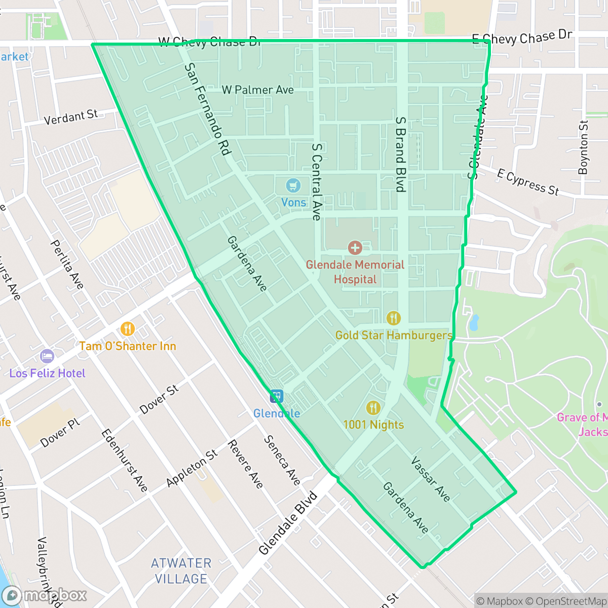
Tropico is a highly walkable urban enclave in Glendale that balances residential blocks with light industrial activity. While the area offers convenient access to local dining and services, residents should be prepared for significant noise levels from road traffic and limited privacy.
Key Highlights
About Tropico
Established in 1887 on W.C.B. Richardson’s Rancho Santa Eulalia, Tropico began as a fertile agricultural settlement at the southern edge of Glendale. Known for its "Tropico Beauties" strawberries—cultivated largely by Japanese immigrant farmers—and served by the first Southern Pacific Railroad depot north of Los Angeles, the area quickly grew. After a brief period as an independent incorporated city from 1911 to 1918, Tropico consolidated with Glendale, transitioning into a bustling industrial district. Before annexation, the community attracted notable figures, including famed photographer Edward Weston, who established his studio here. It was also home to the Tropico Art Tile Works and the original Tropico Cemetery, which Hubert Eaton later transformed into the world-famous Forest Lawn Memorial Park. Today, the historic name survives primarily through the local Tropico Post Office.
The neighborhood functions as a dense, mixed-use district where residential life intersects with active commercial zones. Its character is defined by a blend of housing and light industrial units, reflecting its evolution into an integrated part of Glendale. Residents benefit from high walkability, which allows for easy access to local staples like El Pavo Bakery and Dinah's Chicken without relying on a vehicle.
Living in this area involves navigating specific environmental trade-offs, particularly regarding acoustic comfort, as road traffic contributes to a consistently busy soundscape. The neighborhood also presents challenges regarding flood and fire safety, which prospective residents should consider. It is best suited for individuals who prioritize proximity to transit and local amenities over quiet, secluded living, and who appreciate an urban atmosphere.
Neighborhood Scores Across 15 Qualities
Residential structures are positioned closely together with minimal setbacks between homes. This lack of separation is more pronounced than in the rest of Glendale, according to iHuus data.
Extensive sidewalk networks and frequent crosswalks make much of the area accessible on foot, slightly exceeding the Glendale average. While a major rail corridor and industrial blocks create some separation, most residential and commercial streets feature continuous pedestrian infrastructure.
Uniform tract housing and dense apartment blocks characterize the area. This visual landscape is less varied than the Glendale average, featuring small yards and modest rooflines without many large estate properties.
Walking paths feature narrow sidewalk verges and predominantly concrete surfaces, making it less ideal for pets than the Glendale average. While large cemetery and park areas provide significant nearby green space, most neighborhood greenery is contained within private residential yards.
Frequent open land and scattered homes amid woodland create a setting slightly more rural than the Glendale average. According to iHuus data, the area features a mix of low-rise urban fabric and larger commercial or industrial structures.
A mix of quiet residential blocks and pockets of activity defines this area, which offers a slightly higher level of energy and dining variety than the Glendale average. While certain streets feature accessible amenities and restaurants, many parts of the neighborhood remain low-density and suburban in character.
Frequent noise from nearby freeways and railroad tracks defines the local acoustic environment. This level of disruption is higher than the Glendale average, according to iHuus data.
Air quality remains consistently good with only rare instances of elevated readings. This level of air purity is consistent with the average found throughout Glendale.
Residential life remains largely undisturbed by heavy industry, as the area lacks the large warehouses and logistics centers found in other parts of the city. According to iHuus data, the neighborhood consists primarily of residential, commercial, and park land with no visible hazardous industrial activity.
Health insurance accessibility in this area is slightly lower than the Glendale average, according to iHuus data.
Voting patterns and census indicators show a distinctly liberal leaning that is more pronounced than the Glendale average. Residents will find a community with deeply established progressive political values according to iHuus data.
Residents live among a balanced variety of young professionals, families, and seniors. This demographic spread is largely in line with the broader Glendale area.
Significant flood risk exists in this area due to its designation as a coastal high-hazard zone with potential wave action. According to iHuus data, this risk level is much higher than the Glendale average and may lead to elevated or prohibitive insurance costs.
Severe fire hazards are present in this area, matching the high level of risk found across Glendale. Residents should be aware that according to iHuus data, maximum protection measures and heightened safety precautions are necessary.
Address-Level Insights for Tropico


iHuus Neighborhood Intelligence Insights
Get address-level neighborhood insights for Tropico
- Street-level scores — see how individual blocks compare, not just neighborhood averages
- Micro-zone boundaries — identify quiet pockets, flood boundaries, and walkable clusters before you visit
- 15 dimensions in full — walkability, noise, air quality, school quality, insurance coverage, population age profile, urban/rural index, and more
- Boundary risk alerts — know if your address sits near a block boundary where scores drop, the kind of detail no listing will ever mention
- School insights — individual school ratings and insights, not just district-level data
- Compare before you commit — side-by-side data across neighborhoods, down to block precision
No credit card required
Compare with Any Neighborhood
| Dimension | Tropico | Adams Hill |
|---|---|---|
| 🚶 Walkabilityavg 8.69 | ||
| 🔊 Acoustic Comfortavg 3.71 | ||
| 🤫 Privacy Indexavg 4.65 | ||
| 🎨 Visual Appealavg 6.99 | ||
| 🐕 Dog Friendlinessavg 5.3 | ||
| 🗺️ Urban-Rural Indexavg 6.32 | ||
| ✨ Neighborhood Vibeavg 5.1 | ||
| 🏥 Health Insurance Coverageavg 7.89 | ||
| 🌿 Air Qualityavg 8.01 | ||
| 🏭 Industrial Proximityavg 8.92 | ||
| 🌊 Flood Safetyavg 2.96 | ||
| 🗳️ Ideological Leanavg 8.52 | ||
| 👥 Population Age Profileavg 5.28 | ||
| 🔥 Fire Safetyavg 0.5 | ||
| 🏫 School Quality |
Tropico Rankings
School Districts Serving Tropico
School Insights for Tropico
Below average outcomes; significant attendance and academic challenges.
School Insights
See what's really behind every school rating near Tropico
- Individual school ratings — each school's own score with outcome context, not just a district average
- Enrollment & class size data — student-to-teacher ratio and how it compares to the state average
- Full demographics breakdown — ethnicity and gender composition for every school in the enrollment zone
- Every school in the district — all schools within the enrollment boundary ranked by rating, not just the closest one
- Grade levels & benchmarks — elementary through high school, with below/above state-average flags
No credit card required